hudsonvalley21
-
Posts
4,265 -
Joined
-
Last visited
Content Type
Profiles
Blogs
Forums
American Weather
Media Demo
Store
Gallery
Everything posted by hudsonvalley21
-
1.82” in the bucket here since midnight.
-
I could only imagine how crowded the local apple orchards are today. Low of 49 here overnight.
-
The cell fell apart here to your east. 0.16
-
Sorry, had to do it.

-
Had some gusts 40-50 here. Not much rain or thunder.
-
Same here now. Gusts to 40-50. Not much rain or thunder. Nice shelf cloud rolled thru.
-
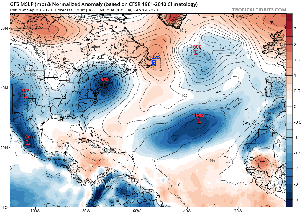
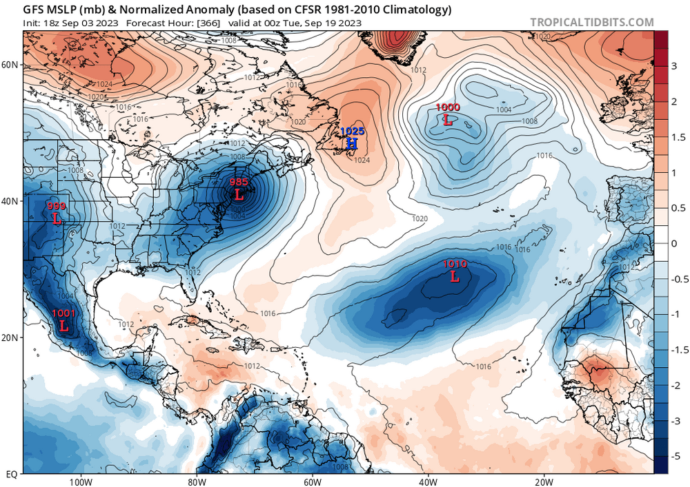
Subject to change of course
-
DCA: +2.8 NYC: +2.4 BOS: +2.7 ORD: +2.4 ATL: +2.5 IAH: +2.4 DEN: +2.1 PHX: +2.3 SEA: +0.7
-

-
You can definitely tell we have moisture back. The mosquitoes have been numerous and annoying lately, even in the daytime hours. 0.54” here in the last 24 hours for QPF.
-
Had 0.75” here this afternoon. 2.32” since midnight Tuesday morning.
-
1.57” is the total here.
-
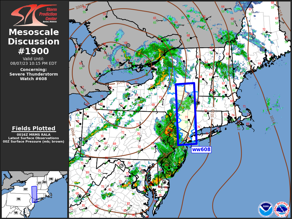
Mesoscale Discussion 1900 NWS Storm Prediction Center Norman OK 0718 PM CDT Mon Aug 07 2023 Areas affected...Hudson Valley to western Long Island Concerning...Severe Thunderstorm Watch 608... Valid 080018Z - 080215Z The severe weather threat for Severe Thunderstorm Watch 608 continues. SUMMARY...Damaging winds are possible with thunderstorms this evening. DISCUSSION...MCS that evolved over southeast PA continues its eastward surge early this evening. Latest radar data suggests an MCV is located along the PA/NJ line over eastern Monroe County PA. This feature is lifting northeast and will likely track across Orange County NY in the next 1-1.5 hours. Primary bowing segment south of the MCV is now surging off the NJ Coast, so the most organized portion of the MCS should focus across the lower Hudson Valley over the next few hours. Damaging winds are the primary concern.
-
Had 0.71” this morning. We’ll see what this line has left when is moves east towards us.
-
August 2023 temperature forecast contest
hudsonvalley21 replied to Roger Smith's topic in Weather Forecasting and Discussion
DCA +0.4 NYC +0.1 BOS +0.3 ORD +0.1 ATL +1.6 IAH +1.8 DEN +0.4 PHX +1.5 SEA +1.7 -
0.15” here
-
And for us folks up near KSWF

-
It’s going to be a rough week for the vegetation.
-
1.88” here since midnight. We’ll see if any more dumps on us. East sections, Long Island and CT. have had some 3-4” totals so far today.
-
78/73
-
1.37” since midnight with the multiple rounds of thunderstorms.
-
From a buddy of mine that lives in fort Montgomery https://www.facebook.com/1273894455/videos/pcb.10230104318533338/286241400576747?__cft__[0]=AZWkp4jkmvKY2NDZF0OAlT4iIX1fubSUxt68ADOb9MCnHURIo0RO66ulhWg7MDHEGRsVp9gW3CaIxtOt0ITwfXaRrIlpIKqgPWN98y9a6tMjZ1vS37MbqZOlRQ3tMMlqLTSC-rYAnpA33lU4AWsda5Q_-pfbEMsFkmFVbk2x0U2LJA&__tn__=*bH-R
-
4.38” here with the event.
-
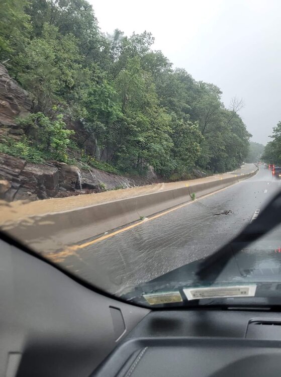
There were a couple of spots that the water did spill over the barrier. 4.09” in the Davis for today.
-
A photo of route 9w near highland falls/West Point