

hudsonvalley21
-
Posts
3,893 -
Joined
-
Last visited
Content Type
Profiles
Blogs
Forums
American Weather
Media Demo
Store
Gallery
Posts posted by hudsonvalley21
-
-
3 hours ago, forkyfork said:
thanks for backing up this statement with reasons
-
DCA _ NYC _ BOS __ ORD _ ATL _ IAH ___ DEN _ PHX _ SEA
2.1 2.4 2.0 1.8 1.8. 1.1 0.2 -1.4 -0.8
-
 1
1
-
-
1 hour ago, MJO812 said:
Just took my winter mats out of my car.
That should do it. Now we will get some snow this winter.

-
49 minutes ago, psv88 said:
Point and click shows 0 for Friday night now
-3 here Friday night with a high of 13 Saturday.

-
 2
2
-
-
1 hour ago, 8611Blizz said:
Wipe out cold? Do we all die?
Yup even Ant in Manhattan.
-
 6
6
-
-
1 hour ago, IrishRob17 said:
.93 in the Stratus which exactly the same as Monday.
0.86 here.
-
41/39 with light rain currently at 9:45 pm. 0.36 in the Davis for today so far.
-
57 minutes ago, gravitylover said:
I think most of this is going to stay south and east, I don't expect to get the 1"+ NWS has for me here. That's quite alright, it's soggy out there already. 33/33/drizzle and mist
Radar is filling in to our southwest somewhat. Everything here on will be in the form of liquid for most. 34/34
-
Current radar is showing most of the activity to our south and east. Not much coming from the eastern Pa area. Wondering if the forecast is going to be a bust.
-
Had a period of light snow about an hour ago. Gave a quick dusting. All melted now.
-
1
-
-
34/32 a few ice pellets mixed in currently.
-
3 minutes ago, wdrag said:
I think NAM correct: It's a mess in SC of nw NJ because in very light precept it might DZ- or FZDZ in northern SC elevations but there almost has to be a 1 1-2 hours period of 3/4S- or 1/2S between roughly 8A-10A. Melting on pavement during the afternoon and possibly on all surfaces during the afternoon depending on intensity and sfc temp.
Right now, I think there are going to be some folks possibly falling this evening around here (unsuspecting slippery stepping on untreated surfaces) as untreated pavement gets slick. The snow is so wet you can't really know it (small flake mix with IP-). Temp down to 32.5. I have my first tenth of sleet/snow...mostly IP-. Also noting temps down to spotty 32 down into northern Hunterdon County on NJ CLIMAT site and 31 HP at the tipping stop ion NJ. Also mPing has snow in northern Warren County NJ and rain mixed with sleet down to the s of ABE. Going to get a little slick up here. And the 32F air sits just north of us in the morning ready to drift south at daybreak.
I like the idea off seeing some KBUF whitening of the ground here by 9AM tomorrow. Was a fun to see the snow falling there (AGAIN!)
We’ll see what the 00z NAM will show. The 18z ticked up from the 12z run. Good too see some frozen precipitation again!
-
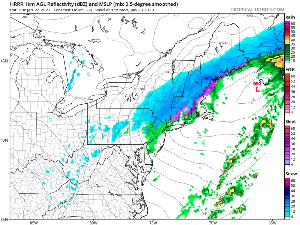
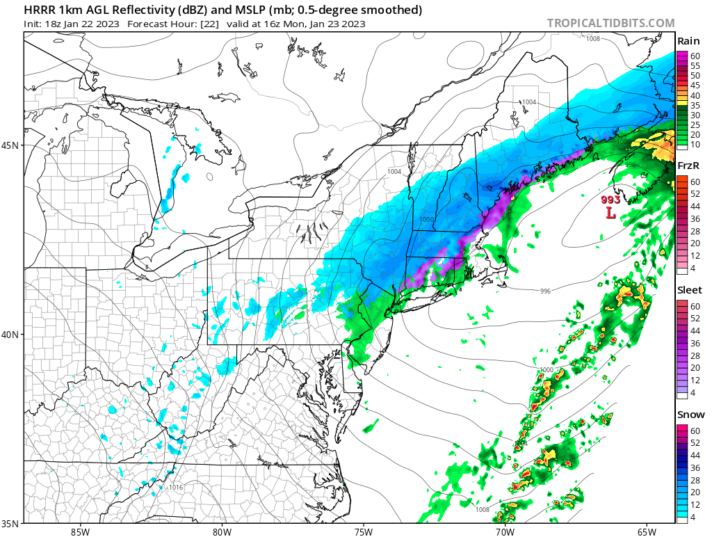
18z HRRR map
-
4 minutes ago, wdrag said:
Wantage NJ started as IPW- around 5P, then RW-/IPW- mix but now down to 33 with TD 31 and a wet snow/sleet mix. Getting slippery on many surfaces here at 640PM including pavers/ concrete/wood step, even at 33F. I'm expecting less than 1/2" snow-sleet mix here in Wantage this eve before ZR- everywhere northern 1/2 county around 9P then prob warms to 33-34F overnight before snow drops it back to 31-32F at 7-8A and accumulates widespread 1-3" in Sussex County 8A-2P with less on pavement and especially elevations BELOW 600 feet including Sussex Airport.
What’s your thinking on tomorrow afternoon after the low moves up to the northeast of us for precipitation type Walt?
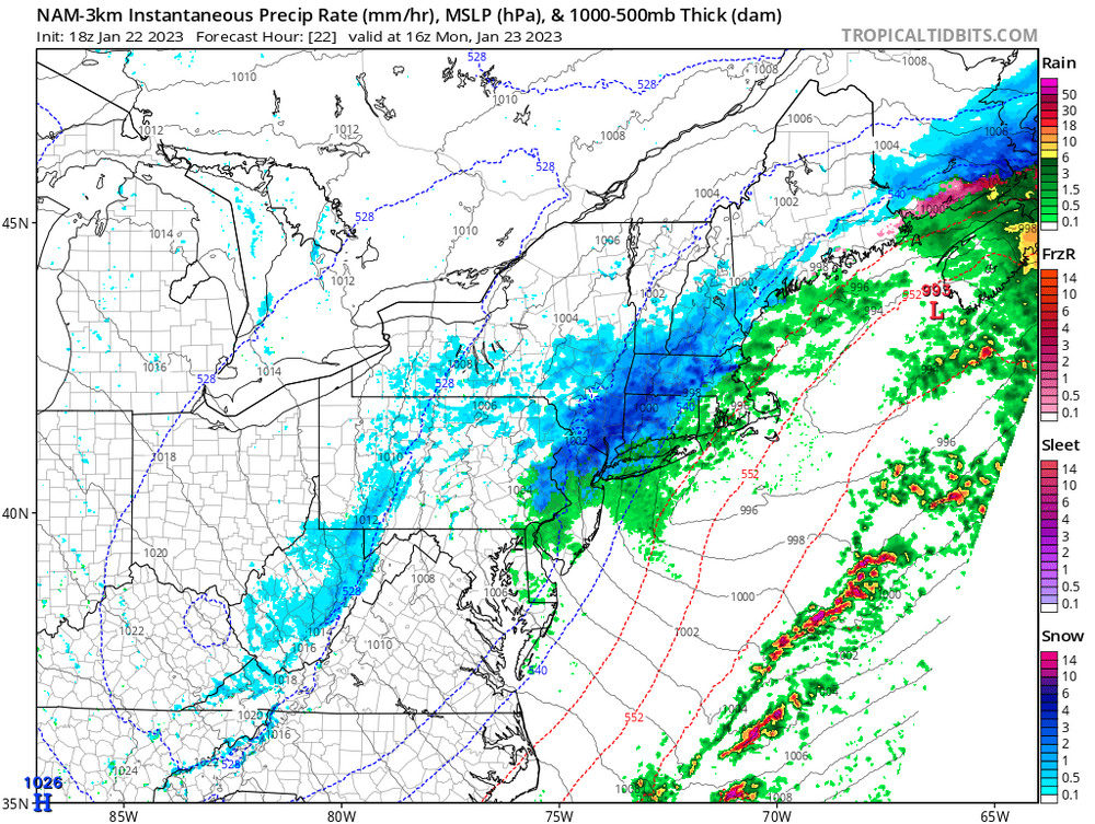
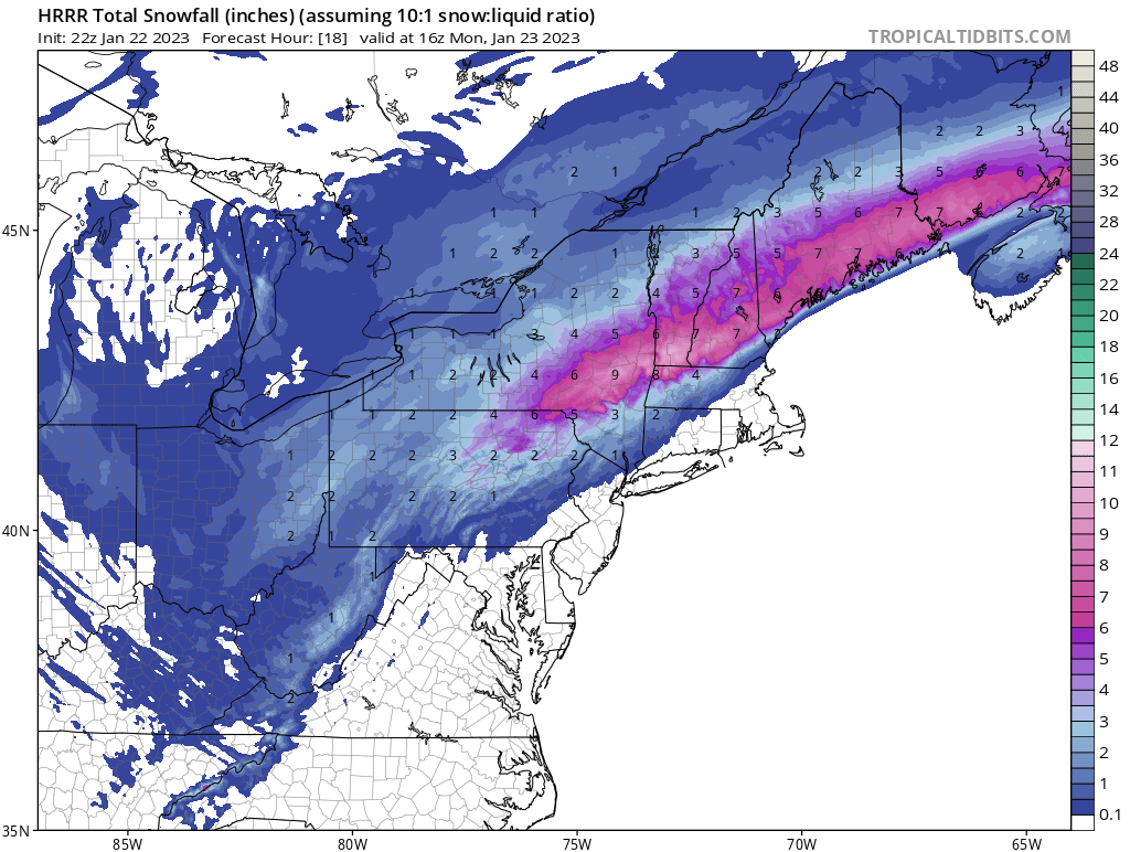
18z 3K NAM map
-
1
-
-
-
29 minutes ago, gravitylover said:
33/32/SSE4 Pingping
35/29 sleet.
-
6 minutes ago, Will - Rutgers said:
more like the new york giant failures
Eagles defense looks like the Giants defense back in the 80’s
-
2 hours ago, LibertyBell said:
You guys can't stand the Eagles....I'm meh on them, because I don't really care about the NFC East as long as the Cowboys lose.
The team I really hate right now are the Chiefs. Mahomes is a bit of a clown in the way he plays I wish there was someone like LT in the league right now to just level him.
-
1
-
-
3 hours ago, snywx said:
Probably? Monticello is without a doubt snowier but other than the 3 people who live there, there is really nothing to do or see
A much longer commute for MJO812. I believe he works in Manhattan.
-
4 minutes ago, MJO812 said:
One of these storms coming up will hit us. Models are really stormy moving forward
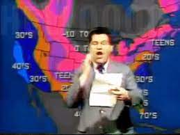
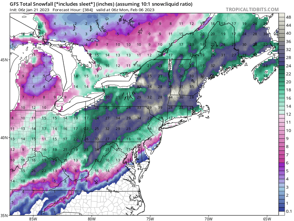
Hopefully we get at least one event. Well anyway, here’s our daily porn shot to fantasize about
-
37 minutes ago, snywx said:
Lol.. where in the world did you hear that craziness. Stay far away
Totally agree
-
1
-
1
-
 1
1
-
-
45 minutes ago, Hitman said:
38f and raining. Is there anything worse?
35 and raining.
-
1
-
-
3 minutes ago, MJO812 said:
My wife and I are looking at houses in orange county
Any specific area that's good ?
Goshen, New Hampton.
-
6 minutes ago, CIK62 said:
YOU SEXY THING: "Snow is in the Eye of the Needle" But the Ensemble still struggles to give us 100% chance for even an inch.

You never know. Even a broken clock is right twice a day.
")

February 2023
in New York City Metro
Posted
GFS fantasy maps have some color again