Wxoutlooksblog
Meteorologist-
Posts
1,194 -
Joined
-
Last visited
Content Type
Profiles
Blogs
Forums
American Weather
Media Demo
Store
Gallery
Everything posted by Wxoutlooksblog
-
Looks like a good hit, 1.00-2.50" rain tomorrow into Monday with winds 20-30mph gusts up to 50mph+ at times. Some coastal flooding & beach erosion then storm moves away quickly Monday night into Tuesday. I'm driving from Douglaston to Kingston tomorrow and will return on Tuesday. There should be slightly lower rain amounts up in Kingston points north and west. WX/PT
- 731 replies
-
- heavy rain
- damaging wind
-
(and 2 more)
Tagged with:
-
It certainly doesn't look like the big wound up powerful nor'easter we saw on the maps yesterday though a few of the models still drench us and kick up the winds. My gut feeling is the dry air works down from the north and that the low center at some point makes a righthand turn before the heavier rainfall is able to win out. I'm sure we'll get some rainfall and some wind gusts but to me at this point it looks manageable. WX/PT
- 731 replies
-
- 1
-

-
- heavy rain
- damaging wind
-
(and 2 more)
Tagged with:
-
The EPS had been hinting of a more southern/offshore track on most of its runs. Some of the operational models now picking up on that idea. And the push of cool dry air down from the north with high pressure ahead of the storm argues it. Maybe the nw quadrant around the storm's center is depleted of moisture. Maybe there are two distinct areas of precip one associated with the northern stream the other separate one way down south. 24 hours from yesterday's clarity nothing is now clear. We watch and wait for further guidance. WX/PT
- 731 replies
-
- 1
-

-
- heavy rain
- damaging wind
-
(and 2 more)
Tagged with:
-
It's not only closer, more than likely it is a pattern changing storm and *could* ultimately take us into a below normal temperature pattern. WX/PT
-
-
Each AI run has been significantly south and east of the one before it. Although it still gets us wet I think it ends up looking like the other models now do. WX/PT
-
I think snowfall will probably be a bit above normal. I think temperatures will be below normal for 2 months. WX/PT
-
I think it will be a moderately snowy winter. WX/PT
-
I think this one meanders down south and then moves e-ne out to sea. Even AI has trended further east. I think the trend OTS has begun. WX/PT
-
We had them throughout 2010-11 and often enough in 2014-15, 2015-16, 2020-21. It doesn't have to be single digits. Teens or 20s is sometimes good enough. WX/PT
-
You'd need a very cold air mass to get locked in to our n/nw and those kinds of air masses have been rare in recent years. WX/PT
-
They're not uncommon but notice how much further south the storm is as it's wrapped around kind of a double barreled upper low over Ohio and North Carolina. That's what's drawing it in towards the coast. I think the hope here for me (traveling up the Hudson Valley on Sunday) is that this storm does a bit of a loop di loop and gets trapped under the pool of cool air down there maybe never making it all the way up the coast before it finally either fills in or turns east. And that's pretty much what happened at 192 hours. To bed I go. WX/PT
-
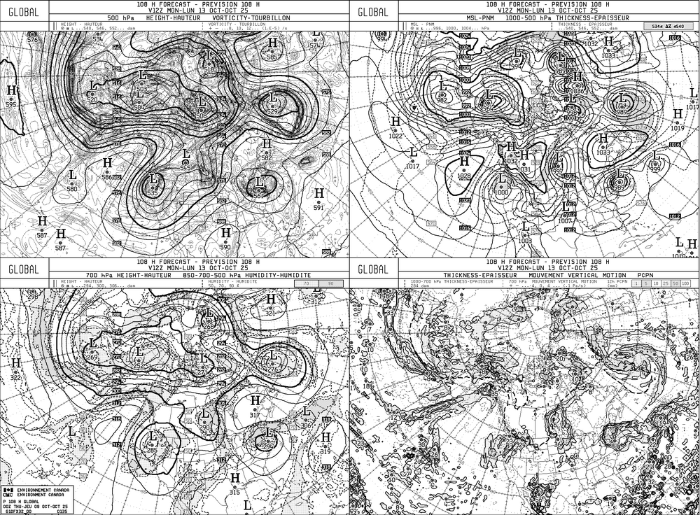
With regards to this next weekend's storm, sure the 00Z 10/6 operational model runs seem to have come to a consensus of hooking the storm n-nw or north up the east coast. There is considerable blocking to the east of the storm making it hard for it to exit out to the east. And while the trough over the Northern Rockies may not be quite as amped as earlier, it still seems that it's a tight squeeze for the coast hugger being depicted. I need to see at least a couple of more days of consistency with this solution to be totally convinced. I'm still just a tiny bit skeptical. WX/PT
-
The cool snaps seem to have been overdone this last few weeks. We'll see if a little bit of high latitude blocking changes that. Also, there's good reason to question the ultimate track of low pressure off the east coast next weekend. WX/PT
-
September 2025 OBS-Discussion centered NYC subforum
Wxoutlooksblog replied to wdrag's topic in New York City Metro
Probably but we do not yet know that for sure as a fact. WX/PT -
September 2025 OBS-Discussion centered NYC subforum
Wxoutlooksblog replied to wdrag's topic in New York City Metro
I think there are a couple more. WX/PT -
Perhaps you missed my many subsequent posts in which my outlook on summer changed a bit. So far it has been a seasonably warm summer overall though overnight low temperatures have tainted averages upwards. But there has been no relentless heat only 3-4 day spurts of it. It is the high overnight low temperatures that help this summer to average out hot. Nevertheless you have back tracked to post in April or May which is quite a long time ago in the weather-world. And this weekend's weather was relatively cool at the coast (60s at night) but warmer inland. And such will be the case this week though temperatures should be about normal or slightly above overall for the first week of August. The second week looks above normal right now. But this is not relentless heat like the very hot summers. WX/PT
-
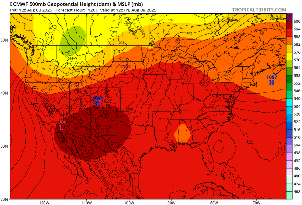
I'm going to partially disagree with a some things that have been said. Firstly, I think the onshore flow around the relatively cool HP is mostly this week. Then from what I'm looking at there is a fairly brief spell of warmer/hotter weather later in week #2 pending no significant tropical activity up our way. GFS thinks there will be some. Then it appears a fresh Canadian air mass drops southeast bringing possibly a spell of well below normal temperatures by sometime during week #3. After that I speculate purely based on the pattern that we may see one last or the second to last spell of heat as the ridge builds around on the return flow of that air mass probably not long duration but we'll see. All in all, it looks like an average to slightly above average August temperature-wise. WX/PT
-
July 2025 Discussion-OBS - seasonable summer variability
Wxoutlooksblog replied to wdrag's topic in New York City Metro
Totally agree with this. The heat just keeps on building back possibly into early September. In addition, I do not think the "cool down" is going to be quite as cool as it earlier appeared to be. WX/PT


