SouthCoastMA
-
Posts
8,571 -
Joined
-
Last visited
Content Type
Profiles
Blogs
Forums
American Weather
Media Demo
Store
Gallery
Everything posted by SouthCoastMA
-

It was a Flop... February 2024 Disco. Thread
SouthCoastMA replied to Prismshine Productions's topic in New England
0 chance it would keep going. -
It was a Flop... February 2024 Disco. Thread
SouthCoastMA replied to Prismshine Productions's topic in New England
was actually driving through "interior" Upper Cape today and you can tell the differences in depth. Areas like Forestdale/ South Sandwich/Marston Mills have a few more inches of depth than where I live, closer to the ocean. Those 8"+ reports were legit in those areas. Had about 6" here, but depth is down to 2-3" in shaded areas, and some bare spots where the sun hits -
Excellent, let's spice this thread up some. Now I'm invested in the outcome
-
Although likely snowless, doesn't look that great to me over next couple weeks. If it's not 50s and 60s, I don't want out. I see a couple days of muted warmth at the end of February..meh
-
GEPS actually looked good to me. Several sub 980s near BM
-
Saturday February 16th - Another CT/ Cape special?
SouthCoastMA replied to Sey-Mour Snow's topic in New England
this forum is full of chicken soup for your soul -
Saturday February 16th - Another CT/ Cape special?
SouthCoastMA replied to Sey-Mour Snow's topic in New England
Any reports out of ACK? -
It was a Flop... February 2024 Disco. Thread
SouthCoastMA replied to Prismshine Productions's topic in New England
2022 summer drought was pretty horrific in these parts -
Saturday February 16th - Another CT/ Cape special?
SouthCoastMA replied to Sey-Mour Snow's topic in New England
light snow and a dusting so far. if I'm lucky maybe I'll be treated to a quarter inch -
Saturday February 16th - Another CT/ Cape special?
SouthCoastMA replied to Sey-Mour Snow's topic in New England
Might be fighting some dry air further east, so could use another tick N. best is south coast of CT, block island, ACK -
It was a Flop... February 2024 Disco. Thread
SouthCoastMA replied to Prismshine Productions's topic in New England
let e24 verify and then we can move on to spring -
It was a Flop... February 2024 Disco. Thread
SouthCoastMA replied to Prismshine Productions's topic in New England
Saturday looks like shite so far at 12z..NAM and that crappy hires FV3 model.vLets see if REGGIE comes back to earth or doubles down -
It was a Flop... February 2024 Disco. Thread
SouthCoastMA replied to Prismshine Productions's topic in New England
VDay was tough for some, i get it. no need to lash out -
It was a Flop... February 2024 Disco. Thread
SouthCoastMA replied to Prismshine Productions's topic in New England
It could mostly torch for all I care, but hoping we can thread the needle for a HECS. And no one is capable of predicting it will/won't happen. -
It was a Flop... February 2024 Disco. Thread
SouthCoastMA replied to Prismshine Productions's topic in New England
Maybe compared to what was modeled several days ago. last few runs of the euro and RGEM have ticked back north a bit. I get it though, this won't affect most in the area. -
It was a Flop... February 2024 Disco. Thread
SouthCoastMA replied to Prismshine Productions's topic in New England
If it trends a bit north, possibly -
It was a Flop... February 2024 Disco. Thread
SouthCoastMA replied to Prismshine Productions's topic in New England
For southern sections of SNE, Saturday still on the table for a couple inches per the RGEM/Euro/EPS. Let's see if it can keep trending north at 12z -
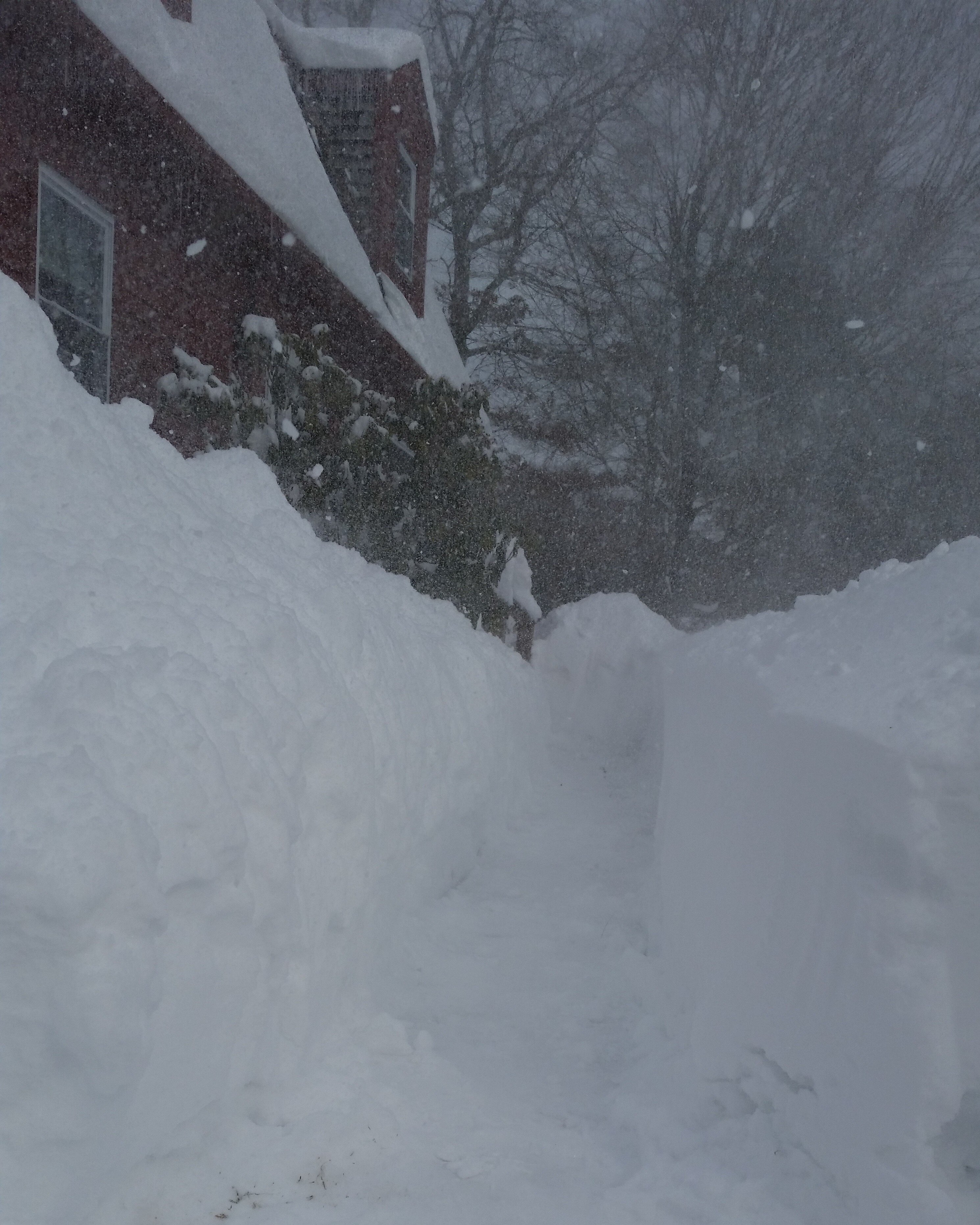
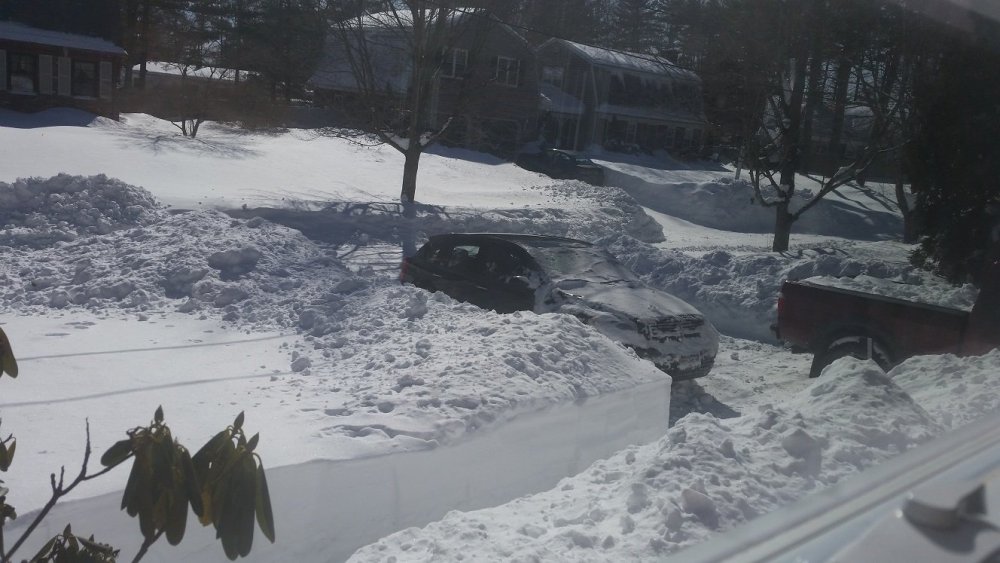
Morning of 2/15/15 then 2nd pic is the next day

-
It was a Flop... February 2024 Disco. Thread
SouthCoastMA replied to Prismshine Productions's topic in New England
then he will have died in an honorable fashion, and it would all be worth it -
It was a Flop... February 2024 Disco. Thread
SouthCoastMA replied to Prismshine Productions's topic in New England
I don't think the 26 yo version of myself would've handled the past several years very well. I would be an expert in drywall repair -
It was a Flop... February 2024 Disco. Thread
SouthCoastMA replied to Prismshine Productions's topic in New England
Saturday morning still worth watching for a couple inches, per a few models. May have already been mentioned -
7:1 sounds about right here
-
12.1" YTD, passing last years 11"
-
Someone from S Sandwich wally pipped my 6 on the PNS with an 8 spot 30.7"
-
A little front yard Phil for Kevin @Damage In Tolland