wegoweather
-
Posts
136 -
Joined
-
Last visited
Content Type
Profiles
Blogs
Forums
American Weather
Media Demo
Store
Gallery
Everything posted by wegoweather
-

Winter 2023/24 Medium/Long Range Discussion
wegoweather replied to Chicago Storm's topic in Lakes/Ohio Valley
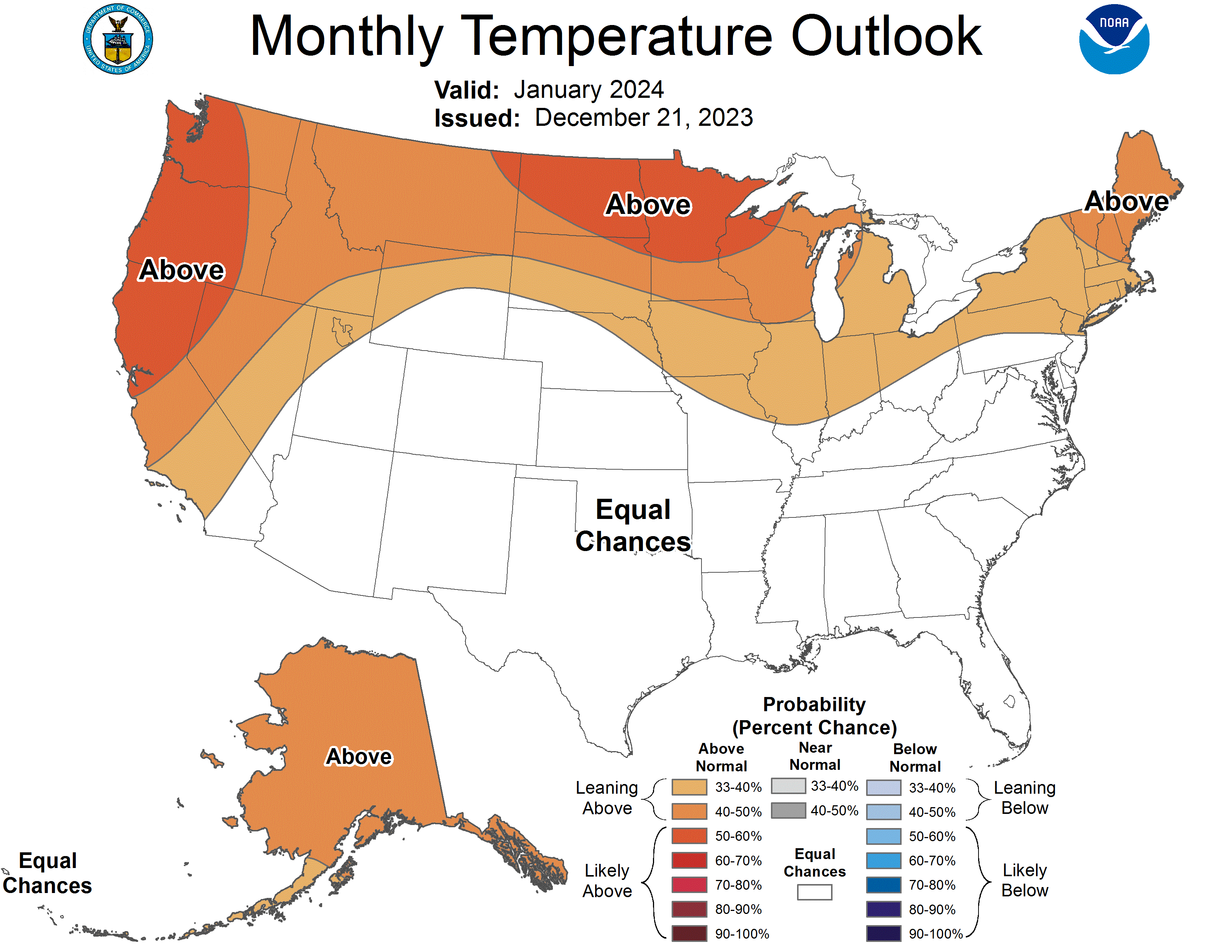
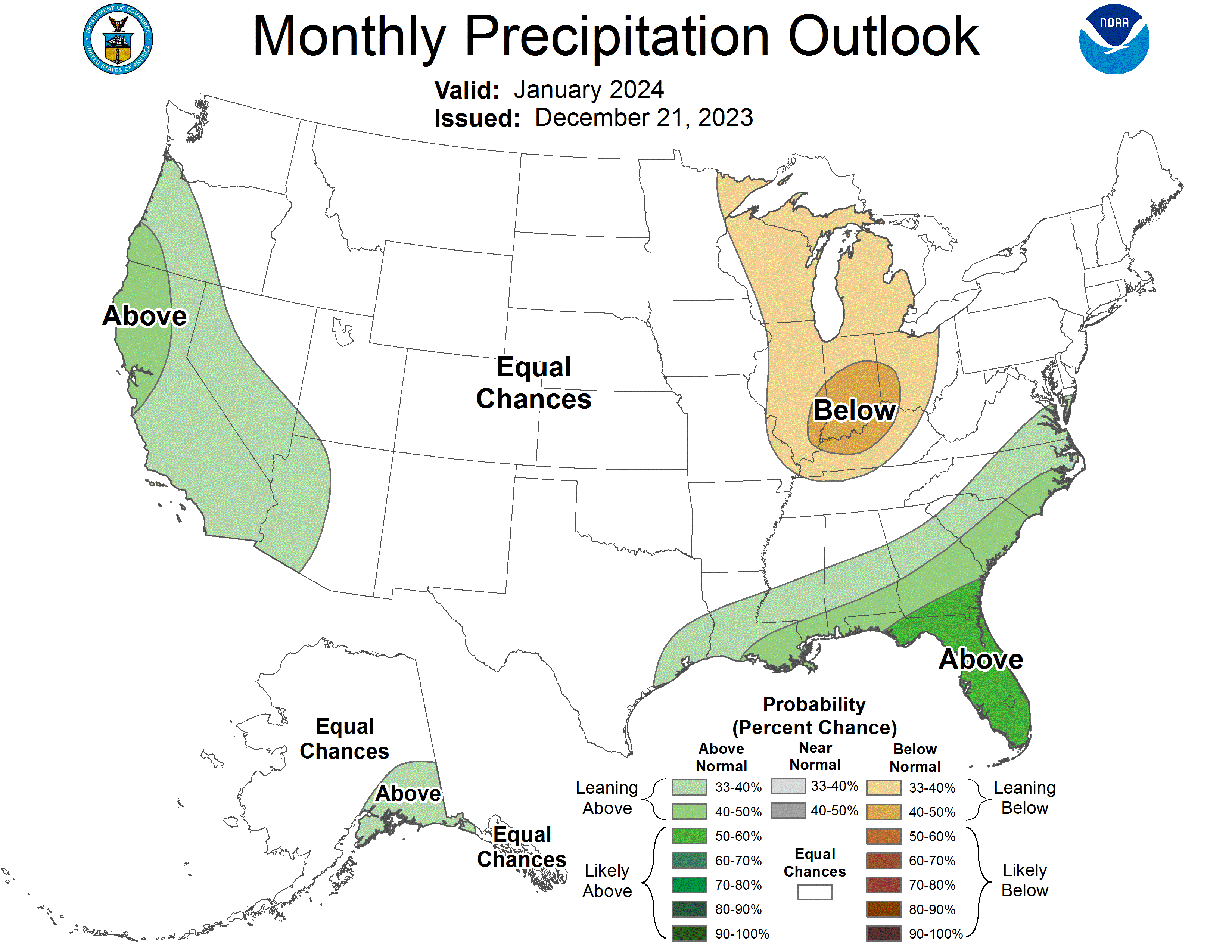
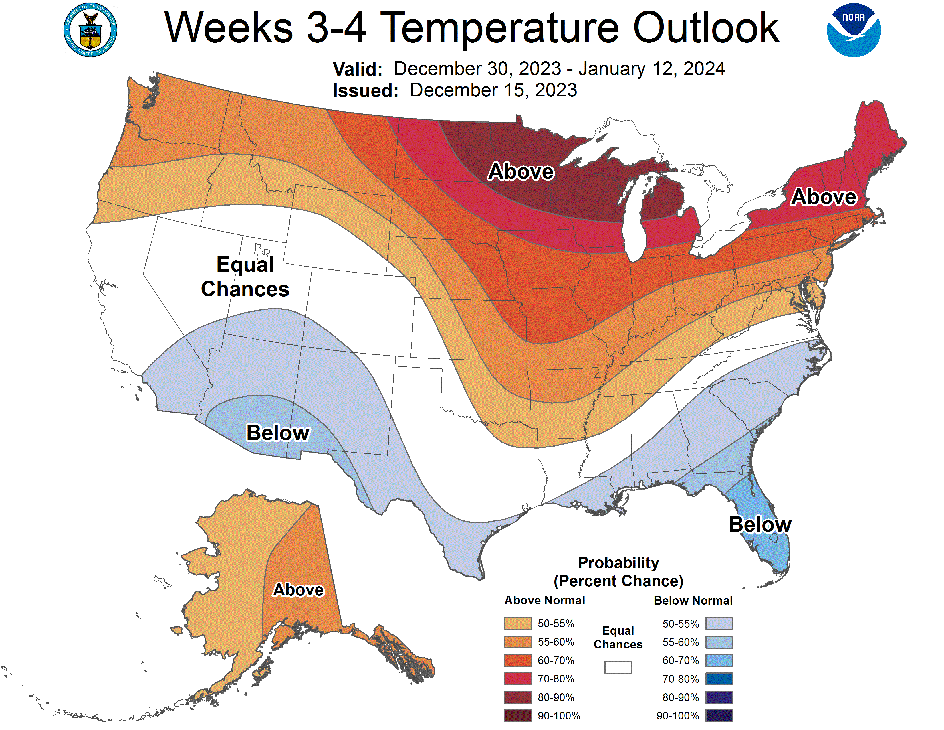
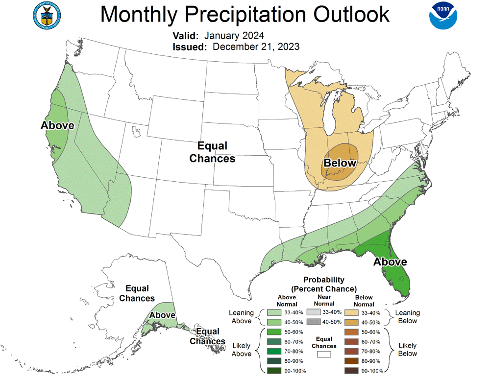
WAD. Updated 3 month outlooks are warmer and drier.
-
Winter 2023/24 Medium/Long Range Discussion
wegoweather replied to Chicago Storm's topic in Lakes/Ohio Valley

-
Anyone who "wants" severe weather makes no sense, but I can respect those who want it in their own backyards as opposed to somewhere else.
-
If insurance finds out how it happened, they may not cover it at all. A chaser that was purposely driving into hail was laughing about driving a rental car on their stream. Good chance they will have to pay the damage completely out of pocket if it's discovered what they were doing.
-
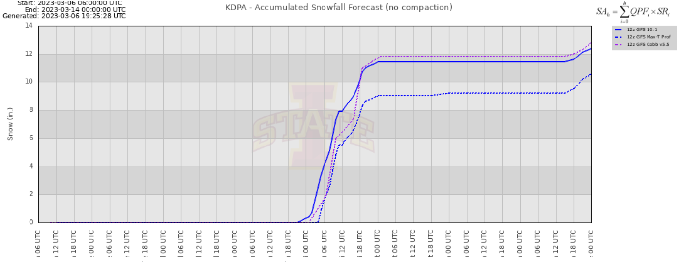
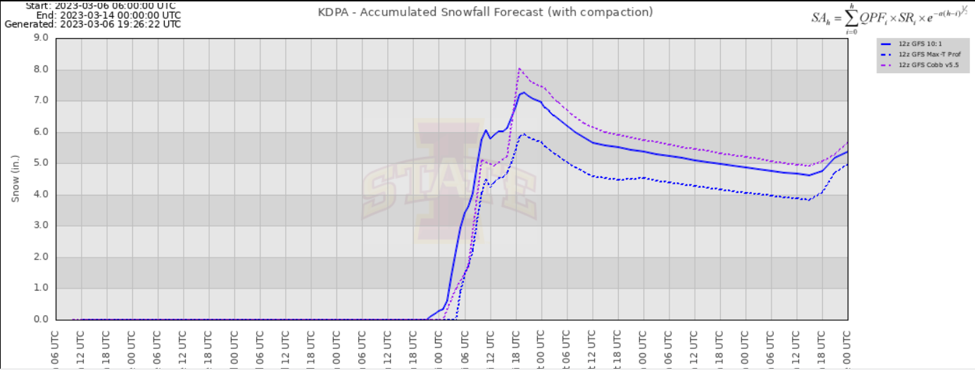
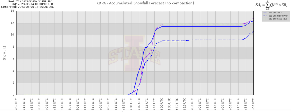
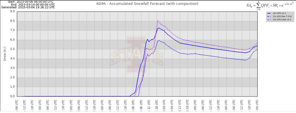
Non-event at KDPA.
-
Virga-fest at KDPA.
-
Response on NWS MKE Facebook post upgrading to a warning. I'm missing the laughing part.
-
Pick the algorithm.
-
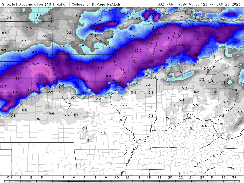
HRRR ptype and highest totals look very dependent on precip rates/evaporative cooling overcoming low ratios and surface temps.
-
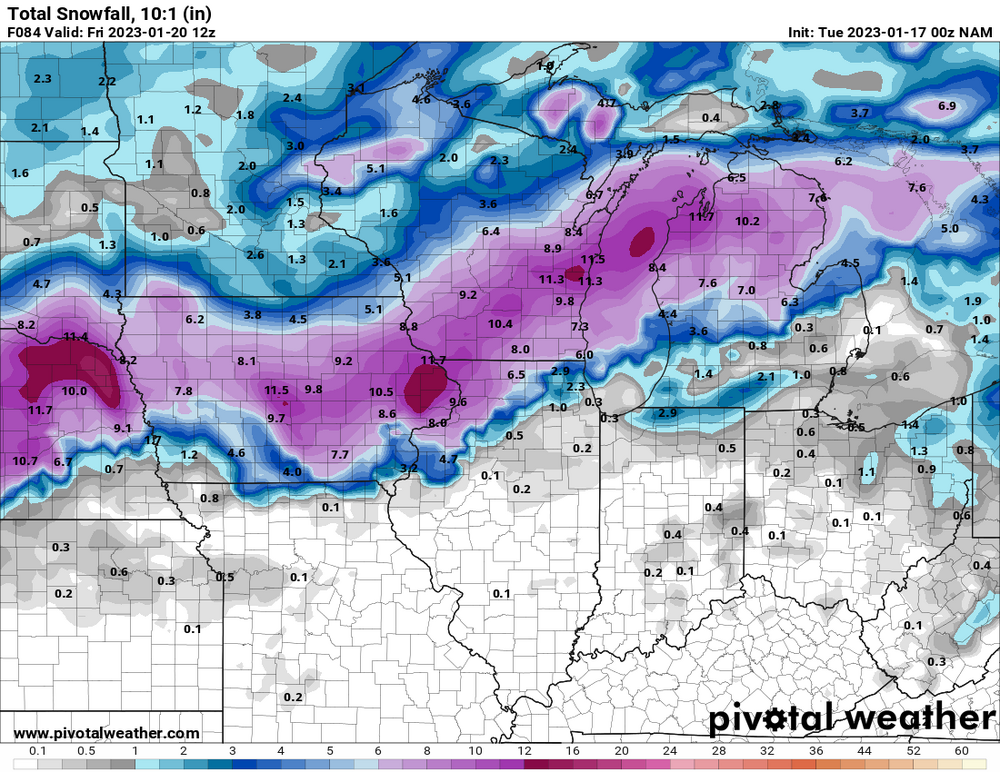
20" Big Dog plume for ORD
-
Jan 19-20: Hoosier is not allowed to start this thread
wegoweather replied to mimillman's topic in Lakes/Ohio Valley
Pingers at DPA. -
Jan 19-20: Hoosier is not allowed to start this thread
wegoweather replied to mimillman's topic in Lakes/Ohio Valley
Looks more like an issue on how Tropical is handling the data. Pivotal and COD are showing a different outcome on the SE extent of the snow.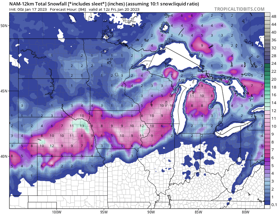
-
Pre-Christmas (Dec 21-23rd) Winter Storm
wegoweather replied to Chicago Storm's topic in Lakes/Ohio Valley
Snow totals decrease and heaviest totals move north and east. -
Pre-Christmas (Dec 21-23rd) Winter Storm
wegoweather replied to Chicago Storm's topic in Lakes/Ohio Valley
Already has .50" to .75" in this run. -
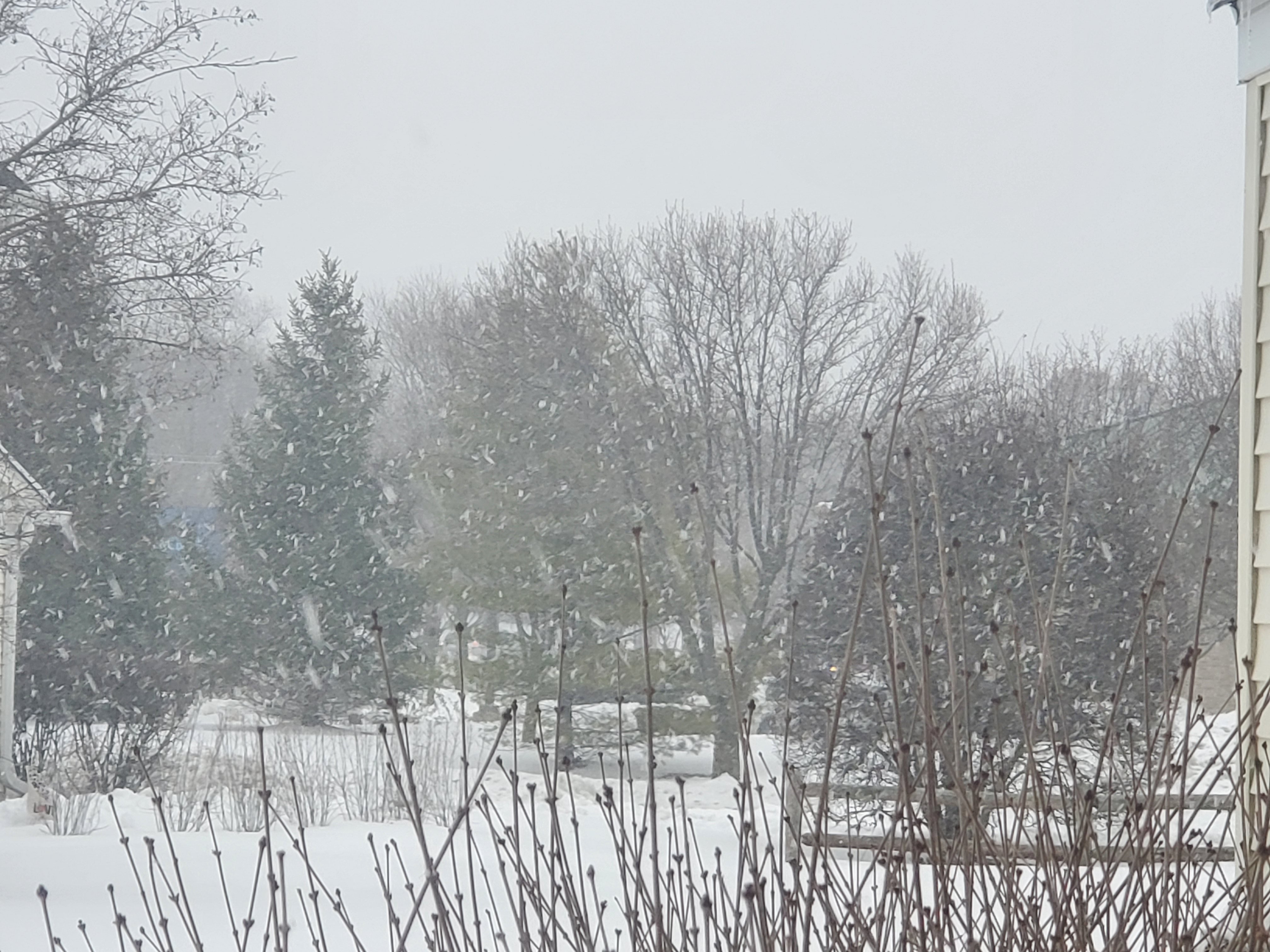
Parachutes dusted the ground at KDPA in a few minutes before transitioning to a mix.
-
NAM

-
MSPaint is hard.
-
Battle for which is messier, the storm or creating 3 threads for the storm.
-
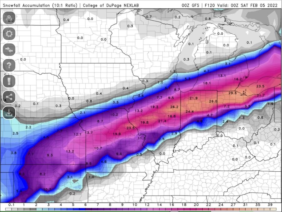
Heck, how about 24"+ on straight 10:1.
-
Message: NOAA-NWS-ALERTS-IL1261CB32631C.WinterStormWatch.1263DC011240IL.LOTWSWLOT.103c7bc075e65d55d974b3b26277e43b from [email protected] Sent: 14:47 CST on 12-30-2021 Effective: 09:00 CST on 01-01-2021 Expires: 06:00 CST on 01-02-2022 Event: Winter Storm Watch Alert: ...WINTER STORM WATCH IN EFFECT FROM SATURDAY MORNING THROUGH LATE SATURDAY NIGHT... * WHAT...Steady, blowing snow and dangerous travel possible. Total snow accumulations greater than 6 inches and northeasterly wind gusts in excess of 40 mph are possible. * WHERE...Lake IL, DuPage, Northern Cook, Central Cook and Southern Cook Counties. * WHEN...From Saturday morning through late Saturday night. * IMPACTS...Travel could be very difficult. Widespread blowing snow could significantly reduce visibility, especially along the Lake Michigan shoreline. * ADDITIONAL DETAILS...The steadiest snow rates appear most likely between noon Saturday and midnight Sunday. Instructions: Monitor the latest forecasts for updates on this situation. Target Area: Central Cook DuPage Lake Northern Cook Southern Cook Event: Winter Storm Watch Alert: ...WINTER STORM WATCH IN EFFECT FROM SATURDAY MORNING THROUGH SATURDAY EVENING... * WHAT...Steady, blowing snow and dangerous travel possible. Total snow accumulations greater than 6 inches and northeasterly wind gusts in excess of 35 mph are possible. * WHERE...Portions of north central and northeast Illinois. * WHEN...From Saturday morning through Saturday evening. * IMPACTS...Travel could be very difficult. Widespread blowing snow could significantly reduce visibility, especially in open areas. * ADDITIONAL DETAILS...The steadiest snow rates appear most likely between noon Saturday and midnight Sunday. Instructions: Monitor the latest forecasts for updates on this situation. Target Area: Boone De Kalb Eastern Will Grundy Kane Kendall La Salle Lee McHenry Northern Will Ogle Southern Will Winnebago
-
That's great. I got a snow removal job back in high school off the scroll on the bottom.
-
Band never making it to ORD means * is likely not an *, or much less than some want to think.
-
-
Feb 3rd - 5th Potential strong stm threat
wegoweather replied to Brian D's topic in Lakes/Ohio Valley
Just east of KDPA
-
Feb 3rd - 5th Potential strong stm threat
wegoweather replied to Brian D's topic in Lakes/Ohio Valley
Very light mix of pingers and the occassional flake at KDPA.