-
Posts
3,054 -
Joined
-
Last visited
Content Type
Profiles
Blogs
Forums
American Weather
Media Demo
Store
Gallery
Posts posted by olafminesaw
-
-
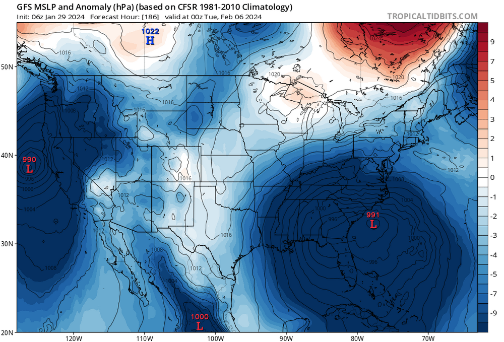
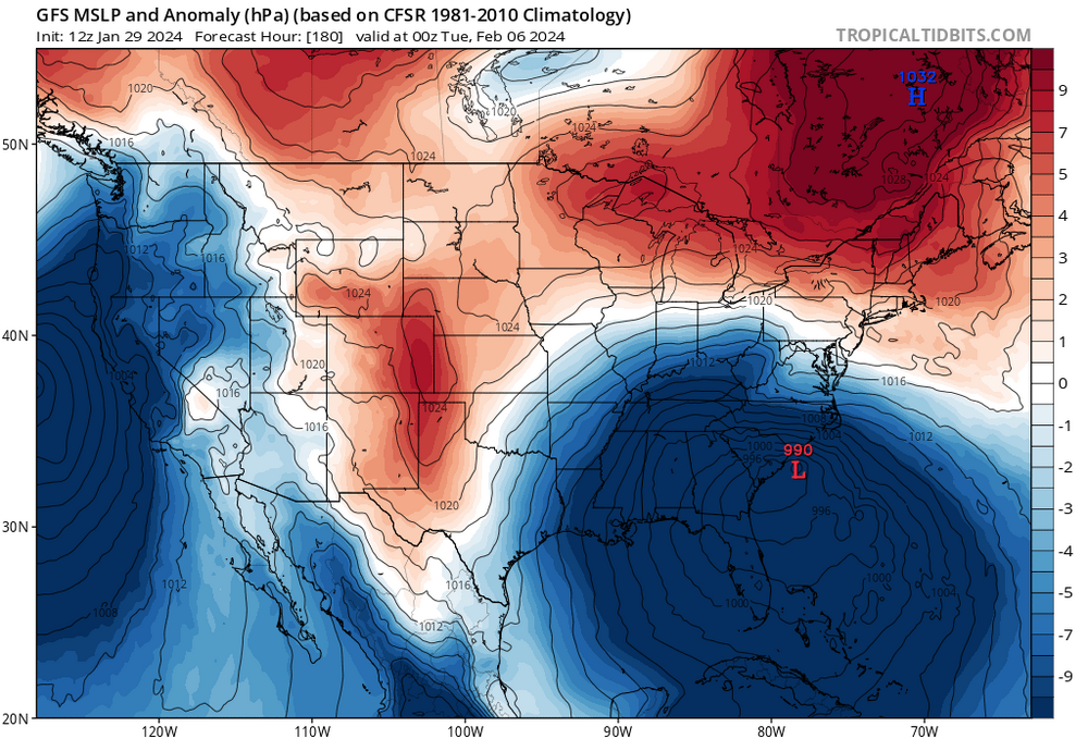
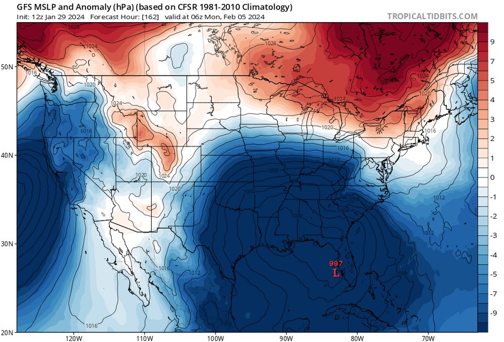
The GEFS members that have snow transfer and develope a new low near the coast which gets pulled inland by the interaction with the original low. A messy setup that could work in theory, but can't think of an analog where this worked out. The OP kinda has this evolution, it's just that the system gets pulled OTS to quickly, which would be the more plausible solution.
-
-
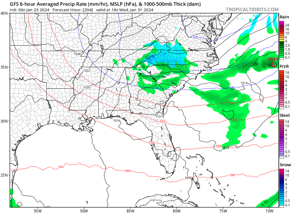
The biggest reason to be pessimistic is lack of cold air. Even with a perfect track we would likely be all cold rain. The only path to snow at this point is for the storm to stall just off shore and wrap cold air around. A tall order for sure.
-
 3
3
-
-
7 minutes ago, WxUSAF said:
Although that statement doesn’t say it, I would expect the new “control” will be at the resolution of the current op? And maybe all ensemble members will be at higher resolution?
Doesn't raising the resolution just make it exactly the same as the current OP? Because the control is just a low resolution version of the OP currently?
-
The southern stream energy comes ashore Thursday evening so the weenie playbook says we can't write this one off until then.
-
 1
1
-
-
-
1 minute ago, wncsnow said:
Higher elevations get crushed with that slow moving low. Soo close to a big snow for foothills too..
Wackiest run of the year. Easily.snowing in the piedmont at 189. Maybe the only way we can win is something like this where it gets delayed so much the cold can work back in.
-
-
A weaker/further north HP and the storm track is ideal but too warm at the surface. A stronger HP and it's cold enough but too far south. We kinda gotta hope that modeling is just not putting all the possible scenarios on the table right now.
FWIW the GEFS mean is showing a bit of CAD. That may be our only path to frozen. Which would depend on a relatively weak HP, but the low in Atlantic Canada needs to be strong enough and in an ideal spot
-
-
1 minute ago, NJsnow89 said:
Still very suppressed
For sure. More or less the same. Not good trends today but we still have time. it's actually quite common to have storms disappear due to suppression squashing them into the Gulf. Probably just as common as the NW trend leading to rain rather than snow. Kinda makes sense with all the big rex block, and positive tilt
-
GFS looking juiced so far down in Texas. Let's see if we can get a little step in the right direction
-
-
-
-
-
-
29 minutes ago, eyewall said:
Some good news on the 12z GFS. The little disturbance dropping down from the lakes right at the start of Feb tries spark off a coastal low. The disturbance has been consistently modeled but the coastal re-development hasn't been as much. This run brings some precip into the Piedmont. As far as snow, it is borderline but not impossible.
Yeah it's definitely quite warm at the surface right now but if the coastal can get going it's got a shot. Problem is these late blooming coastals have been slow to develop and supressed all winter.
-
 1
1
-
-
12 minutes ago, ncjoaquin said:
Take it with a grain of NaCl, but the 6z GFS op brings a series of snow chances. These show up and disappear run to run. Hopefully, they start getting in a 5 day window. GSP not very excited by the upcoming upslope. It looks better to me than what they think, but they have forgotten more than I know.
Absolutely good storm tracks and the 540 line nearby they whole run. Of course 0Z was much less enthusiastic, so as you say we really need this to get inside 5 days to take seriously
-
 1
1
-
-
Even including the Dec 2018 snowstorm in the data, the last 5 years have been abysmal, with 38% lower than normal snow over that span. Mor than half of the snowfall in the last 5 years came from the 2018 storm
-
-
11 minutes ago, BooneWX said:
The torch in December also wasn’t as torchy as we thought it’d be. A couple well above average days but mostly muted by endless rainstorms - which, looks exactly like the upcoming pattern.
True. 40 degrees drizzle wedge is what we do best!
-
 1
1
-
 1
1
-
-
28 minutes ago, GaWx said:
When I click on the link, it won’t let me see the actual tweet. It instead goes to a page asking me to sign-in. But I don’t have an account. I don’t get it because I normally can view a linked tweet despite not having an account.
Are you able to embed this tweet in your post?
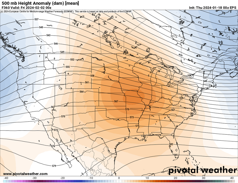
The extended 1/18 GEFS fwiw agrees with the average of the last 12 CFS ensemble runs in having a pattern change to significantly colder that first occurs ~2/12-15 and extends through late Feb due to a combo of a solid +PNA/Aleutian low (SE 500 mb hts go BN) and -AO. SE precip anomalies hint at a mid or late Feb GOM low, with a nice ST jet/split flow likely helped by El Niño. Yesterday’s Euro Weeklies also agree. But before mid-Feb, all 3 agree on mild to warm dominating late Jan through early Feb. Thus the end of the two week models might continue to look ugly for another 7-10 days. So, I’m hoping for and leaning toward an abrupt pattern change near mid-Feb that is similar to some other Nino winters that I showed yesterday (1914, 1919, 1924, 1952). We’ll whether or not 2024 ends up to be similar.
-
 1
1
-
 1
1
-
-


.thumb.png.a778337e8d4f6f20aae107f3bf854820.png)


.thumb.png.ef9a2f7ebb8f124f43e701b3ca806772.png)
.thumb.png.d5c32be91f92387c8d93b1e537a4eda1.png)


.thumb.png.177c42a3906eb1e1876f52637cd92e20.png)

.thumb.png.67d599488fd7bf48f1c289052fb22fb2.png)

Mid to Long Range Discussion ~ 2024
in Southeastern States
Posted
Sometimes I feel like long range tracking is a bit like surfing. You're waiting for that perfect wave to come along, big enough, breaks at the right angle and where you're at. Sometimes you look off in the distance and see what looks like the perfect wave. It's all coming together. But at the last minute you realize it's just a swell that doesn't really break, or it peters out. Some days you're out there and wave after wave just doesn't break the way you need it too. You think you're unlucky at first, but after a while you realize, without a shift of the wind, or moving to a different location, all the waves are going to break that way.
We need that proverbial wind shift and if it never comes, we all need to move to buffalo.