

olafminesaw
-
Posts
3,051 -
Joined
-
Last visited
Content Type
Profiles
Blogs
Forums
American Weather
Media Demo
Store
Gallery
Posts posted by olafminesaw
-
-
What in tarnation is under these returns?

-
 3
3
-
-
3 hours ago, eyewall said:
Dallas, Texas now has a higher season total on snowfall than Raleigh for this year. The GFS is still trying for the 19th.
Yeah I'm really getting deja vu on this one so that's not a good feeling. But I do think the orientation and Eastward progression of the cold air is better this time.

-
2
-
-
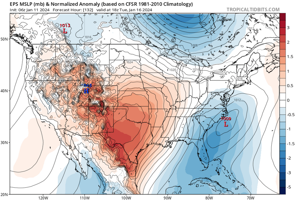
Looking rather toasty around day 10-14. But signs of another pattern change after. We need a hard reset for early February anyway. Anything after the first week of February is normally drippy slop, which I'm not really about
-
21 minutes ago, WinstonSalemArlington said:
You just couldn't help getting premium so you could see how much we suck in fine detail

-
 2
2
-
-
The first system is more of a threat up close to the VA border. No matter where the band of snow falls it's going to be relatively light and unlikely to accumulate outside the mountains. The second threat looks actually somewhat promising for the coast where they may end up with a surprise inch or two due to better moisture/dynamics.. unless we can trend towards a stronger system, the triad may be left high and dry on this one
-
Meanwhile Portland is getting a major snowstorm for the second year in a row.
-
32 minutes ago, BooneWX said:
Not fun but let’s see what the ensemble’s say
Dry as a bone

-
1
-
-
So far it looks to me like the GFS is caving to the Euro

-
 1
1
-
-
7 minutes ago, Joe Clark said:
Until the Euro gets on board with the Tuesday system I'm skeptical. I've seen plenty of times where the Euro lost a storm and was on its own and then watched as everything else caved...
While I don't think a cave from the rest of the models is likely, especially with the Euro ensembles being a bit more amped than the OP, my worry is if you average it out with the rest of guidance you end up with late development that crushed the NE, but leaves us with poor dynamics/warm surface temps. The counter to this fear though is, it's good to see the GFS generate decent moisture on the backside even after the low passes well to our NE. We want the LP to stay weak and ride the boundary.
-
3 minutes ago, wncsnow said:
I still think this is our best shot to date for at least an inch of snow for much of NC. The EPS has increased slightly each run the past few days.
Yep, always a good sign when the Mid-Atlantic forum is starting to get nervous about suppression

-
3
-
 1
1
-
-
3 minutes ago, buckeyefan1 said:
OMG the 12z euro is looking like this mornings control

Get's squashed, but pretty close to something good.
-
The UKMET is quite amped and warm, good to see the GEFS cold and suppressed
-
Not a ton of snow, but streets would be a skating rink in that scenario for the Triad.
-
1
-
-
This looks decent I think
-
3
-
-
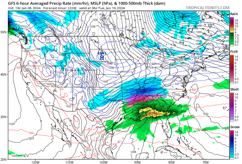
The 18z GFS is much more Euro-like in it's evolution. It's just a little too strung out/suppressed to get the job done.
-
2
-
-
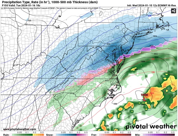
Verbatim the Euro would be pretty nasty in the Triad. Freezing rain turning to snow and temps dropping into the teens overnight. Now it has support from the ensembles. This is right around the time frame where we tend to see models start to put the pieces together, so it's all about watching the trend. Still it's a delicate set-up, even with the advantage of some legit arctic air on the backside of the system. We need this to become a southern stream dominant system and slow down as much as possible.
-
5
-
-
10 minutes ago, Tullioz said:
The 12z Euro is getting close to being something.
Yeah we just need the energy to consolidate to the south with less NS involvement. Nice not to see an overly amped up system.
-
1
-
-
It would certainly be disappointing to not get anything out of this period

-
12 z GFS is looking much improved for our 15th threat. The trend has been to bring the cutter further south and East which in turn has pulled the cold air further South and East
-
1
-
-
Single day precip records for January are 3.06 at GSO and 2.96 at Charlotte. It seems likely one or both records will fall
-
1
-
-
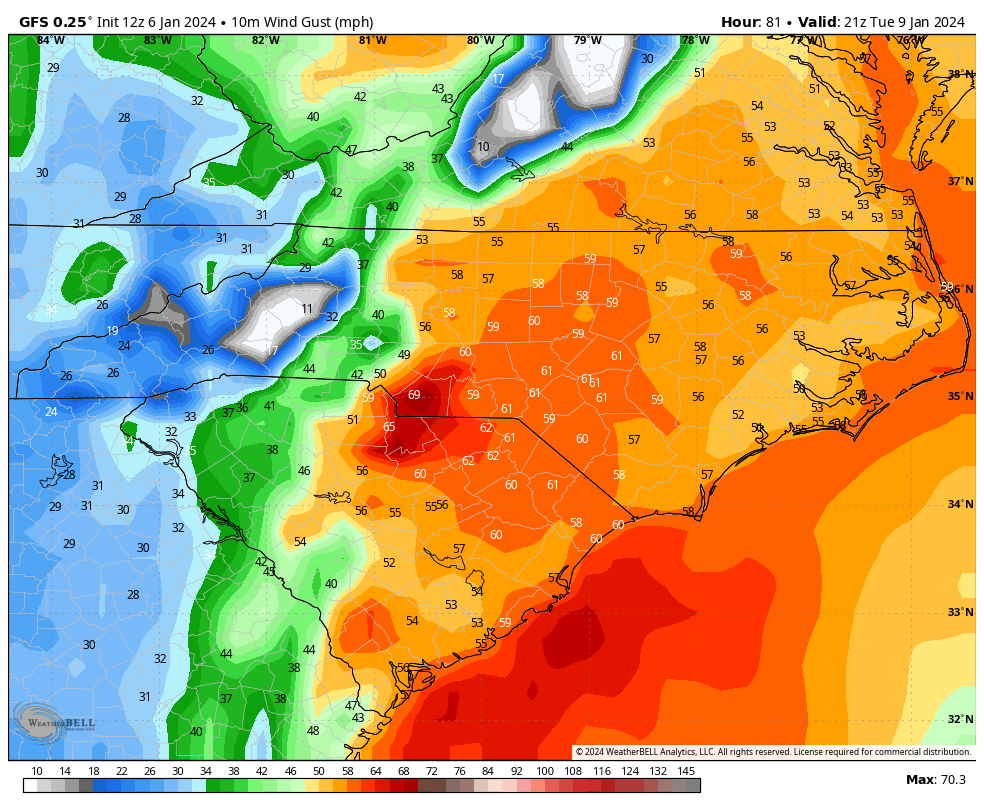
Consensus for 925mb winds to be 50-75kts across all of the eastern half of NC. The 6z HRRR leads me to believe that perhaps gusts over about 45 mph will have trouble making it to the surface without convection, which is probably why RAH is a little conservative. The globals are still gungho on 50 mph+ gusts.
-
1
-
-
2 hours ago, SnowDawg said:
Considering how much he's enjoyed destroying all our hope the last few years, this is one person I'm glad to see on board lol
https://x.com/webberweather/status/1743727117710368793?s=46&t=BVabKZBl0JP2qfoqs7LgyQ
On cue, the GFS serves up a day 9 overrunning event
-
5
-
-
3 minutes ago, eyewall said:

Note: this is likely overdone but gusts to 40 outside thunderstorms are likely. NWS Raleigh also mentions the possibility of a gravity wave event which could locally enhance winds for a short time.
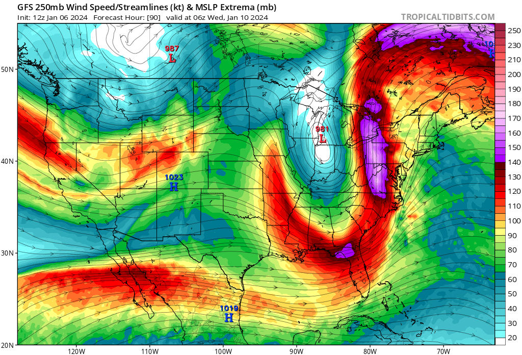
Is a gravity wave event going to occur in the rear exit of the jet streak? It's looking pretty potent.

-
7 minutes ago, eyewall said:
These are often overdone but 30-40 mph seems reasonable. RAH is thinking a potential gravity wave event may occur which would briefly induce higher winds.
Right now the highest winds are timed with the slug of moisture. This would elevate the threat beyond what we normally would get from baraclonic winds, along with a small amount of instability. 925mb sustained winds are 65-75 mph around that same frame so some of that would be brought down by any convection. Maybe it could gust to 50 especially East of the Triad.


Mid to Long Range Discussion ~ 2024
in Southeastern States
Posted
Welp. Seems about right.