

olafminesaw
-
Posts
3,051 -
Joined
-
Last visited
Content Type
Profiles
Blogs
Forums
American Weather
Media Demo
Store
Gallery
Posts posted by olafminesaw
-
-
1 hour ago, wncsnow said:
Activate rain shields
.thumb.png.3107566103df34ee743d96a2a5ccde77.png)
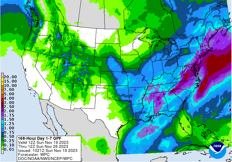
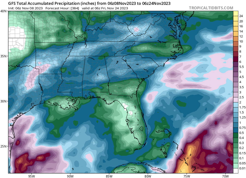
It's a bit of an outlier, but it does seem we will only have opportunities on 2-3 quick moving systems over the next 10 days. Some are promising however and it seems that rainfall is most likely to fall in the .75-1.75" range in that timeframe based on ensemble consensus.
-
Just for kicks and giggles, I present last night's Euro control

-
 1
1
-
 4
4
-
 3
3
-
-
I love days like this every once in a while, a chilly all day rain. The 12z HRRR indicates we should receive 2-3" across the triad
-
2
-
-
Starting to finally look like a wet period upcoming
.thumb.png.c56ab5bbf5abdc4bfa4159b10546534d.png)
-
6
-
-
2 hours ago, PackGrad05 said:
A long way out but the EPS has had something the last 3 model runs around the 29/30 time period... snow perhaps.
An Interesting look at the end of the 12z Euro run

-
3
-
-
2 hours ago, NorthHillsWx said:
Latest GFS has trended the way of every other front this fall and it really dries up east of the mountains. Rainfall amounts of <1/2” pretty much for everyone in drought area and much of NC and upstate SC <1/4”. Canadian and EURO still look wet but definitely do not like the GFS splitting the energy over the area. I’ve seen that story play out at this range a time or 5 since September
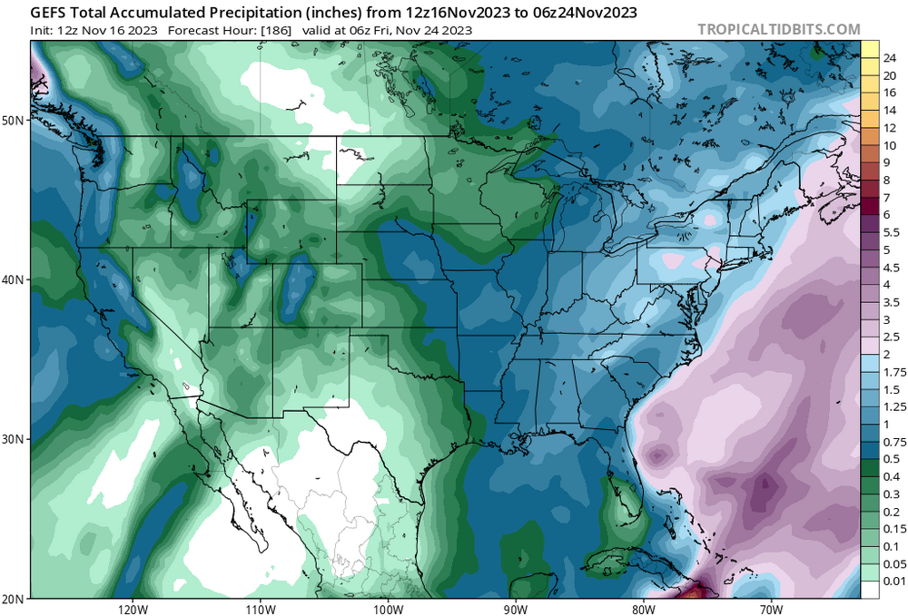
Models have trended drier for sure. But the Euro ensembles have good agreement on .5-1.5" of rain. The GEFS is more all over the place and opens the door for the front to dry out entirely as you allude to. But there's a strong cluster in the .75-1" range. I think we can feel pretty confident in .5"+, which is not enough but a win relative to what we've gotten the past 6 weeks or so
.thumb.png.db0cf263ec3169d5d936932dec660f8b.png)
-
The first extreme drought since 2017 has been issued for some of NC's SW counties. Next Tuesday's system is looking promising for rainfall, especially for the mountains. it looks like a long duration rainfall which will help prevent runoff as well
-
5
-
-
No meaningful rain on the GFS in the next 10 days. The Euro brings through a frontal system next Wednesday that drops .5-1". Unfortunately we've seen how these fronts have dried out as they've approached. Hopefully we get a pattern change around or just after Thanksgiving. I am glad we are stuck in this pattern now and not in mid January!
-
2
-
-
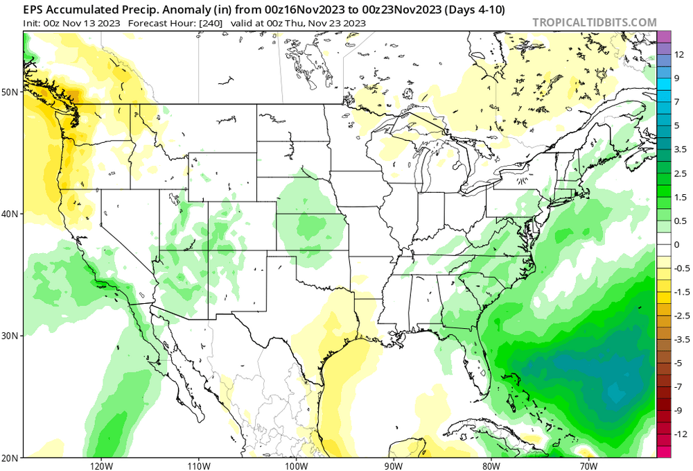
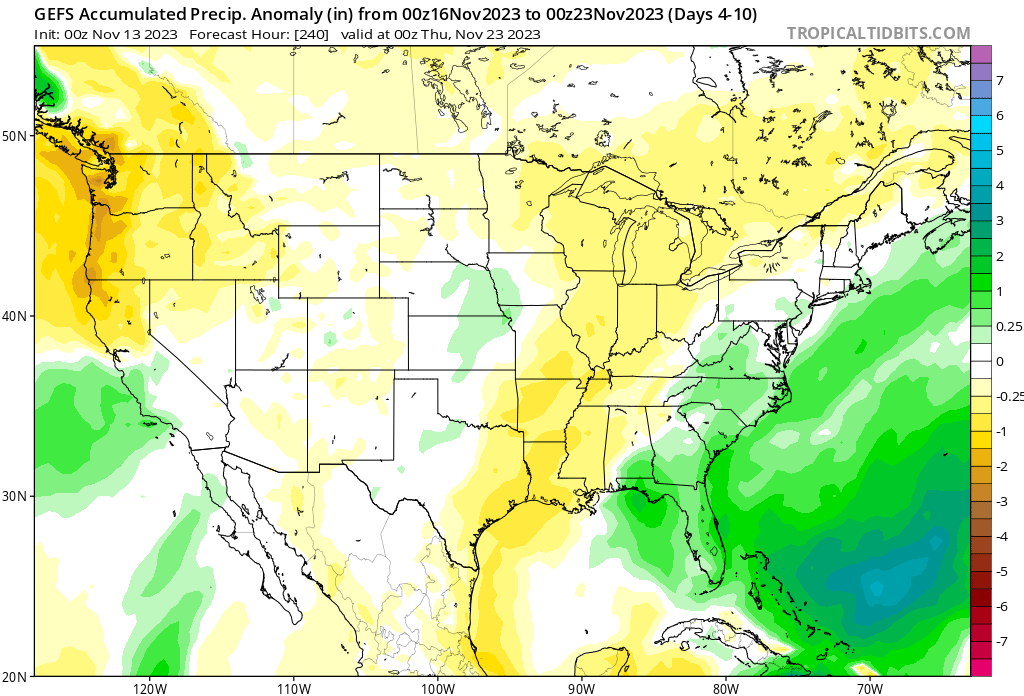
Some signs of moisture in the 4-10 day period
-
2
-
-
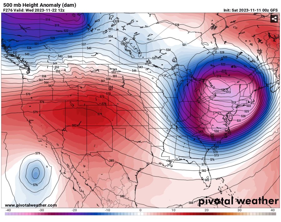
On the other hand...
.thumb.png.5d26aeda2064bf5a4e0d89660d7f0086.png)
-
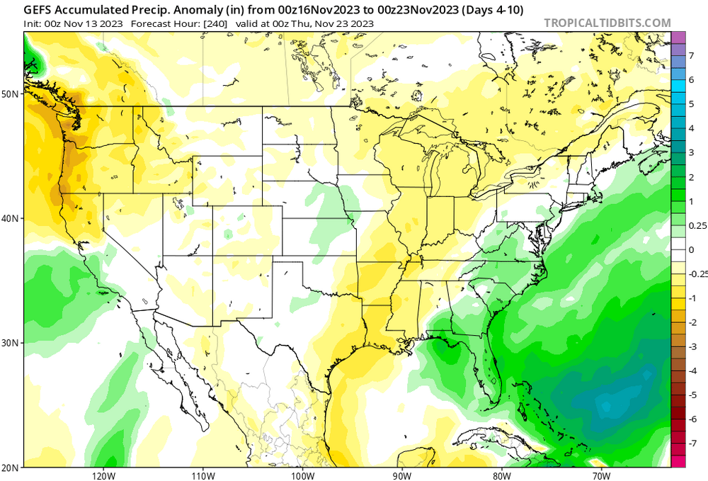
More rain to come after the run ends. This would certainly be a drought buster

-
4
-
-
58 minutes ago, WinstonSalemArlington said:
Still interesting
Flashbacks to last December
-
GSO reporting light rain and 33% humidity
-
Moisture moving in on radar but dry air bleeding down from VA is going to win out. 60/39 with dew point dropping and temp remaining stable. I don't see us getting more than a few raindrops
-
BWI: 27.3"
DCA: 22.1"
IAD: 30.9"
RIC: 11.3"
SBY: 9.7"
-
1
-
-
Weathergami! Pretty fun concept
-
Rain shield activated
-
1
-
-
2 hours ago, NorthHillsWx said:
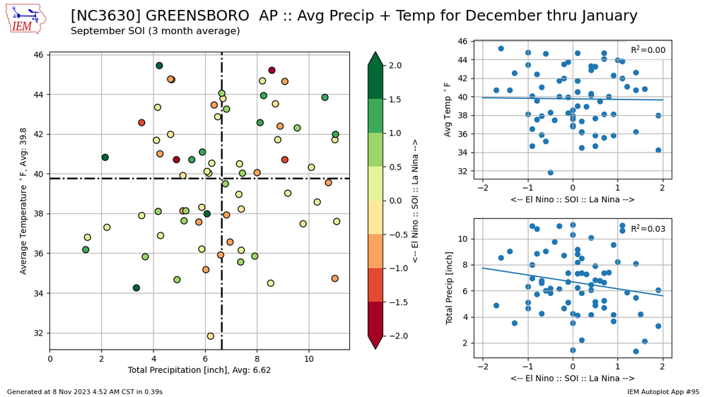
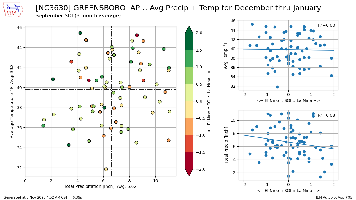
When is this above average El Niño rainfall supposed to start? It is bone dry. We have received a total of 0.18” the last 4 weeks from one rainfall
Here is a comparison of temp/precip departures depending on enso state. It seems that El Nino skus more wet in the winter months vs in the fall months. Although El Nino years have reasonable odds of being dry as well

-
2
-
-
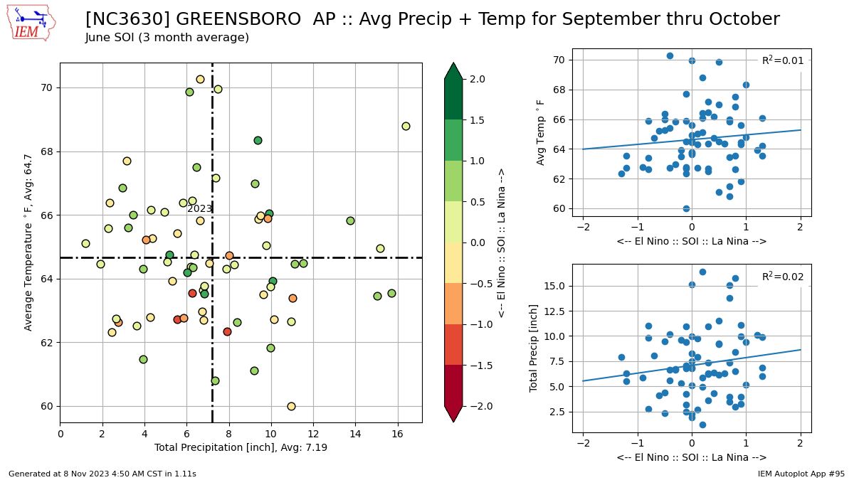
I love this new graphic from IEM. Great way to visualize an entire month.

-
63/16 at GSO, a RH of 16%. This is right around the average lowest RH for the entire year.
-
Maybe something for the mountains to watch

-
2
-
-
5 minutes ago, GaWx said:
Crestview, a perennial cold spot in N FL, had a low of 27, which ties with 1993 the coldest low for the date on record and misses just by one day for coldest so early in the season as 1993 also had a 27 on Nov 1st.
Wow. That beats nearly every coastal city on the East Coast, including Boston for lowest temp so far this fall. It ties the YTD coldest low at Portland ME, set this morning also.
-
 1
1
-
-
With an average first freeze date of Oct 30th one would think this morning's low at GSO of 27 is not particularly unusual. However every degree becomes more difficult to attain this time of year. The average first date at or below 27 is Nov 13 and we have not reached this threshold this early since 1976
-
1
-
-
Incredible photographs (hopefully not paywalled)
https://www.theatlantic.com/photo/2023/10/photos-acapulco-aftermath-hurricane-otis/675835/
-
1
-
.png.4b4610520130f75bf93172815912cf69.png)
.png.3249778a0110c56838aa5d38a4c89388.png)

.png.8d4361c568ef3fe0b48ea823a4cabff2.png)


.png.a5e04f3ac42f9b6dabae23f6161cbad6.png)


November 2023 Obs
in Southeastern States
Posted
GSO dropped into the teens for the first time since the day after Christmas 2022. The average first date for the low to drop below twenty is Dec 14th