HIPPYVALLEY
-
Posts
32,932 -
Joined
-
Last visited
Content Type
Profiles
Blogs
Forums
American Weather
Media Demo
Store
Gallery
Everything posted by HIPPYVALLEY
-
It has not even been sunny here the past two days. Gray and chilly.
-
OMFG!
-
Where is that? Not out of the ordinary for inland areas in the NW areas of Japan.
-
A lot of weird January's in the mix too.
-
It has definitely been warm. Sure, there is ice skating and fishing to finally be had in WNE but we are at peak cold climo, so that should come as no surprise. We AN until we not.
-
Yeah, pond skating is on this week. People were fishing out on Barton Cove today!
-
Step away from the edge bruh', it's all going to be alright.
-
I love snow but I also like nice weather and it's been nice weather this week. My Brother and Sister-in-law did the 2 hour drive from Exeter NH for an outdoor visit and fire this afternoon. A few double IPA's and nothing to complain about. Still an inch of glacier in the yard so still looks/feels like winter.
-
Truth!
-
Sure, it’s after noon!
-
There’s the snow!

-
The ferns by the stream behind our house never went dormant.
-
Almost time to start worrying about South Shore reservoir levels?
-
Every time
-
Wow. Maybe after last night smaller ponds might be OK but seems risky. I won’t go out unless there is at least 3” of black ice.
-
Sometimes you forget to pay your electric bill, I’ve been there.
-
I’m thinking a hugger is more likely than a cutter but let’s see how the next few days trend on the models.
-
The AN and dry has been nice for the kids to have extended outdoor play dates at least.
-
Yeah, I wasn’t really concerned about you, everybody’s metabolism is different. In a past professional incarnation, among other classes, I taught holistic nutrition at the acupuncture college (NESA/MCPHS) One of my tenets, was that whenever patients were having digestive issues, first look at diet and then food combining habits.
-
Sure, be nice to soften up the ground to get some bulbs in for the spring.
-
I loved it!
-
Coffee after spirulina sounds like a recipe for the runs. Powdered greens are best when taken alone and on an empty stomach.
-
We usually can’t buy dry stretches like this in the summer.
-
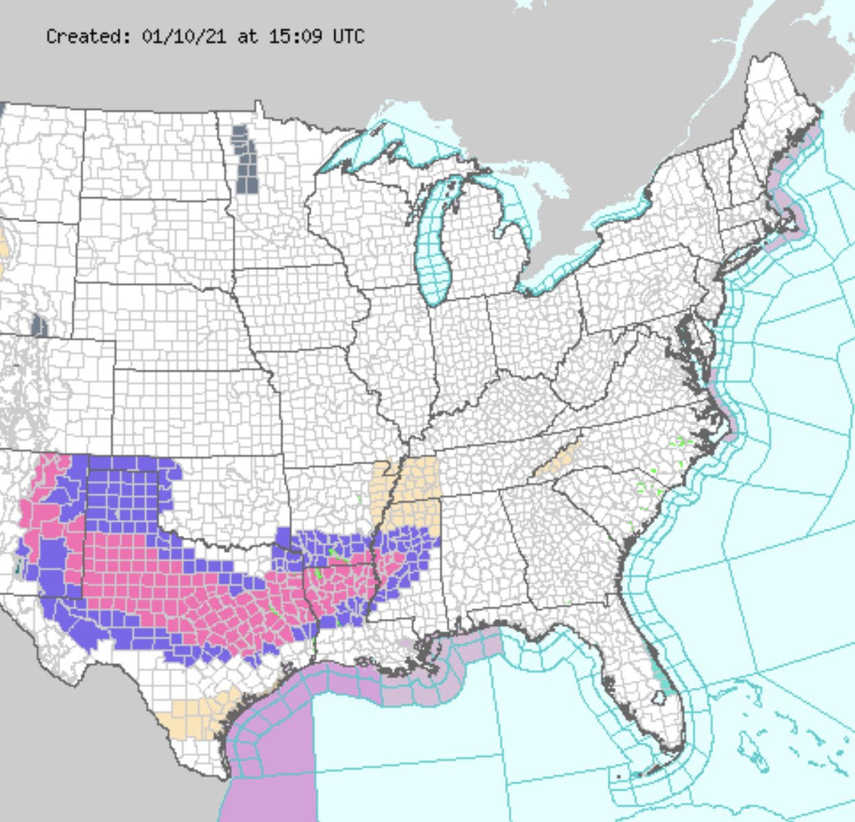
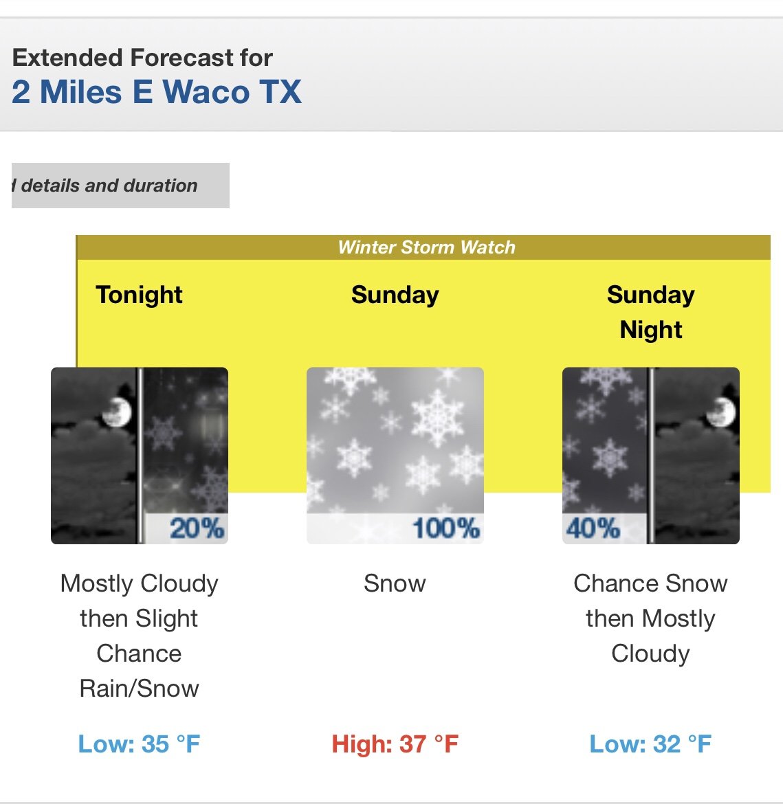
At least somebody’s getting snow.