HIPPYVALLEY
-
Posts
32,951 -
Joined
-
Last visited
Content Type
Profiles
Blogs
Forums
American Weather
Media Demo
Store
Gallery
Everything posted by HIPPYVALLEY
-
According to several folks, it was meh’.
-
I mentioned the other day, the ice buildup on the rivers is already impressive. Another week of this, and it will be insane. Bye-bye Vermont, again?
-
Groundhog says six more weeks of this and then 10 weeks of April!
-
Yeah, this part of the valley (Greenfield to Brattleboro) is where wind goes to die.
-
I'm right around my seasonal average but that will trail off quickly if the next few weeks are futile. I have had snow in my yard since Dec 2nd so there's that. I like the deep cold, I've just been a little lazy with the wood stove so our heating bill is higher than normal.
-
If it wasn’t for last week’s storm, most of us would be looking at a pretty piss poor winter. Nothing I can do about it, but it’s really irritating to be wasting peak Climo with cold dry days.
-
 Yeah, I think a snow pack reduces ice formation rate by 50%
 -
What? People literally been ice fishing here for close to eight weeks.
-
You hate to see it, but I’m still praying for a dry spring and summer.
-
-4F there have been at least 12 mornings below zero in Greenfield.
-
Wrong
-
I said six weeks because I know if I said eight people would jump down my throat about how March is barely a winter month and we rarely get March snow anymore, etc.
-
We’re going to need at least two more warning events and some smaller events to get to normal. We have about six weeks to do it, but I haven’t really looked at the long range. I have to go back and calculate my totals but I think I need at least another 20” to hit my average.
-
This winter seems much colder than last, right?
-
They were reporting flurries there this morning. My friend in Clearwater said the water temperature in the golf is below 60° now. I’ll have to check because that seems low, but definitely cold down there.
-
Possible coastal storm centered on Feb 1 2026.
HIPPYVALLEY replied to Typhoon Tip's topic in New England
That’s not actually true. Sometimes it’s over your area. -
Oh how we pray. Something, anything!
-
Plus, even if the snow looks fresh and white, there are always dirt and dust particles settling on it, reducing its reflective ability, allowing for more melting!
-
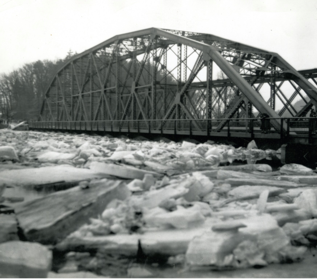
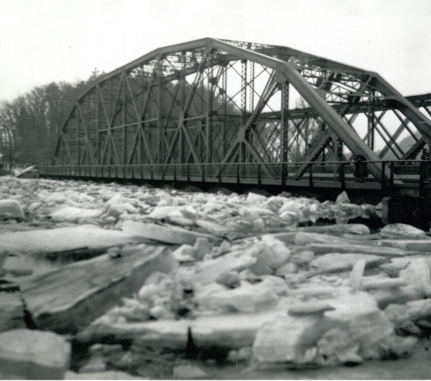
I used to think it was a mistake when I would see 1936 listed as peak water height on a lot of the rivers around here. I just assumed they meant 1938 hurricane. Then I started looking into it and found a banged up copy of that same book that you posted. There are some actual film archives of the ice flows taking out bridges on the CT River and tributaries. I think the Montague historical society has the one I saw.
-
Got down to -9° at my house and there were lot’s of -5 to -10’s on local Wunder sites. Your elevation probably kept you from going lower.
-
This cold has already and will continue to set up some impressive river ice. Maybe come March we can get some jamming and flooding on the Connecticut to rival 1936. Not that I really want that. It’s just a fascinating phenomena. 1936 took out dozens of bridges and I believe it was worse flooding than the 1938 hurricane.
-
oh, there was plenty of blowing snow today. The section of my road with the cornfields was completely coated with snow this afternoon.
-
This is the way.
-
Geez, need to get out to mid February before there’s any real break from the cold. That would be torture if we couldn’t pop a storm or two.
-
Yes, autocorrect is crap.