

wasnow215
-
Posts
875 -
Joined
-
Last visited
Content Type
Profiles
Blogs
Forums
American Weather
Media Demo
Store
Gallery
Posts posted by wasnow215
-
-
But it is a convective model so I get it. Love this stuff man!
-
2 minutes ago, wasnow215 said:
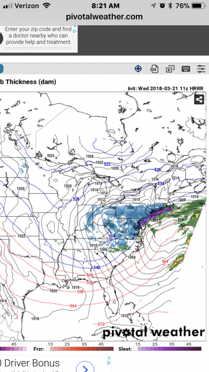
Here’s my point about the HRRR at least with snow outside of four hours. Here is HRRR 7z five hours out for surface precip.

And here is same hour (hour one for this shot) on 11z
-
Here’s my point about the HRRR at least with snow outside of four hours. Here is HRRR 7z five hours out for surface precip.
-
2 minutes ago, dswx said:
Yep. I did not see your post until this morning so did not post the 12z Euro.
HRRR is actually good beyond 4 hours. More so in warm season for t-storms.
Yes I like it for severe you’re correct.
-
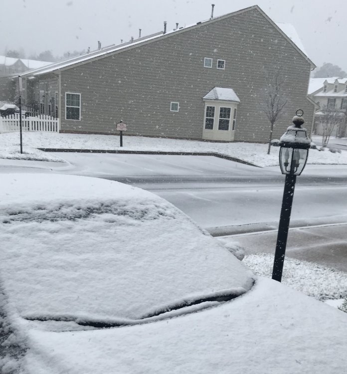
Light to moderate snow here in Glen Allen. Love it! Maybe not better rates than last time, but started earlier this time which will help.

-
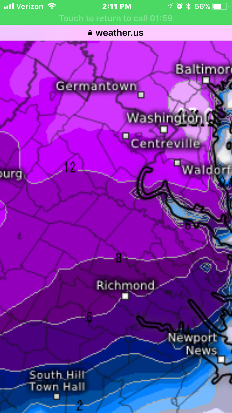
1 hour ago, dswx said:
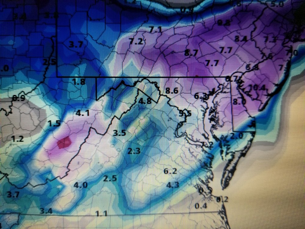
8z HRRR Kuchera (posted) has 1 inch for RIC. 6z NAM Kuchera has 3.5 (not posted) while IBM's Deep Thunder model has 3.9 (can't post; Deep Thunder is not Kuchera).

It’s ok -but we were talking about Euro yesterday and I posted “snow depth”. I was asking what Euro Kuchera was showing for snow totals at 12z specifically. IMO HRRR is NOT a reliable model outside of four hours btw.
-
4 hours ago, eaglesin2011 said:
Could easily over preform here if we get the banding to set up right.. Then again dry air/mix could kill us.. . If we can get some good precip in here around the 3am timeframe that could make a big difference..Really won't know till the precip is just about over the area ...I'm at 35 degrees out here in Glen Allen at the moment so this def could go either way...
Was 33 here when I pulled car in garage (only do that when there are PENDING snow events lol). NAM dry but GFS nice again at 0z
-
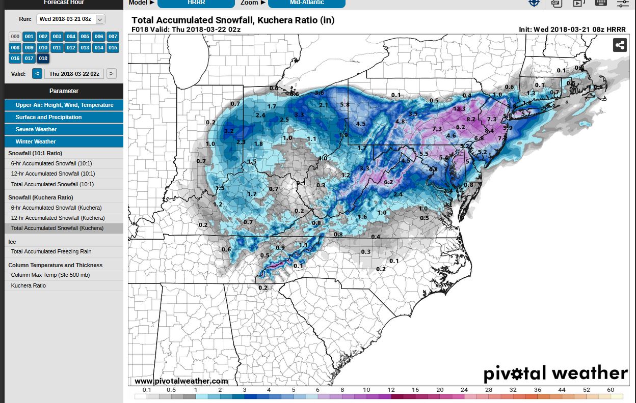
18z GFS Kuchera
-
1 hour ago, dswx said:
That is a 10:1 ratio.
It’s the only one I have from the European model… But each run it has trended more snow here since two days ago. I got that from the snow depth model on Weather US. What is Kuchera from 12Z?
-
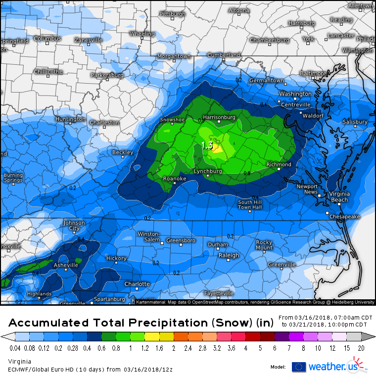
I don’t know how much of this is snow compared to sleet etc. but the euro model keeps trending south.
-
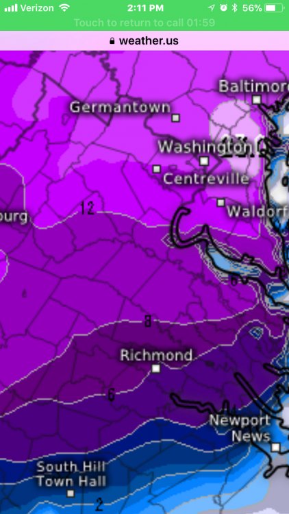
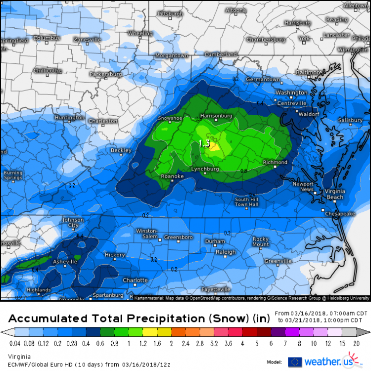
RVA snow predictions for tomorrow based on latest data (first time I’m doing this on here so go easy lol)
Accumulation probabilities-
1/2” to 1” -95% chance
1-2”-75% chance
2-3”-65% chance
3-4-35% chance
4” or more 20% chancePlaces like Glen Allen, Goochland, Ashland, maybe even Mechanicsville best chances for the higher amounts. We shall see.
-
6 hours ago, eaglesin2011 said:
Yep 2nd wave we have a shot .. I'd expect pretty much the same result as last storm as of now... For our area.. Maybe a little more on the main roads if we can get it in here at night ..
Pretty much scenario I was thinking
-
18z gfs..ummmmm some more
-
2 hours ago, SteveVa said:
Umm...
Like I said last night...piece of the action!!
-
Not too far away from getting the piece of the action for the loss SECS/HECS both of us in DC etc. Let’s do this!
-
 1
1
-
-
5 minutes ago, JB Fins said:
Wasnow215, guessing you live off Hunton Park Boulevard by those pics. I used to live back there in the Ridge at Hunton Park, used to run through that area...miss it.
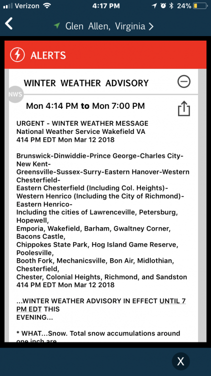
A little late on the WWA I think, I thought we would have had one around 2:30PM. This is certainly more than enough to impact the evening commute.
Yes Hunton Park. They waited too long but I was trying to be kind. I know models aren’t supposed to be worth much when we are in “nowcasting time” but The NAM, NAM 3k, GFS, and then even the EURO (all 12z) brought the snow “back” and this was at 10 am and then so on. So yeah-once those radar returns clearly showed this was happening WWA should have been issued.
-
And here is our advisory.
-
Agreed for sure but does it end at 4:15 or 6:15 here and then subsequently places in RVA and Hampton roads etc? 2 hours could mean two extra inches and more problems on the road. My buddy called me and said 64 was slushy near Mechanicsville.
-
31 minutes ago, eaglesin2011 said:
starting to accucm on back roads/shaddy areas.. may make and inch... Starting to end nw to south tho.. Don't think we will catch the wrap around out here...
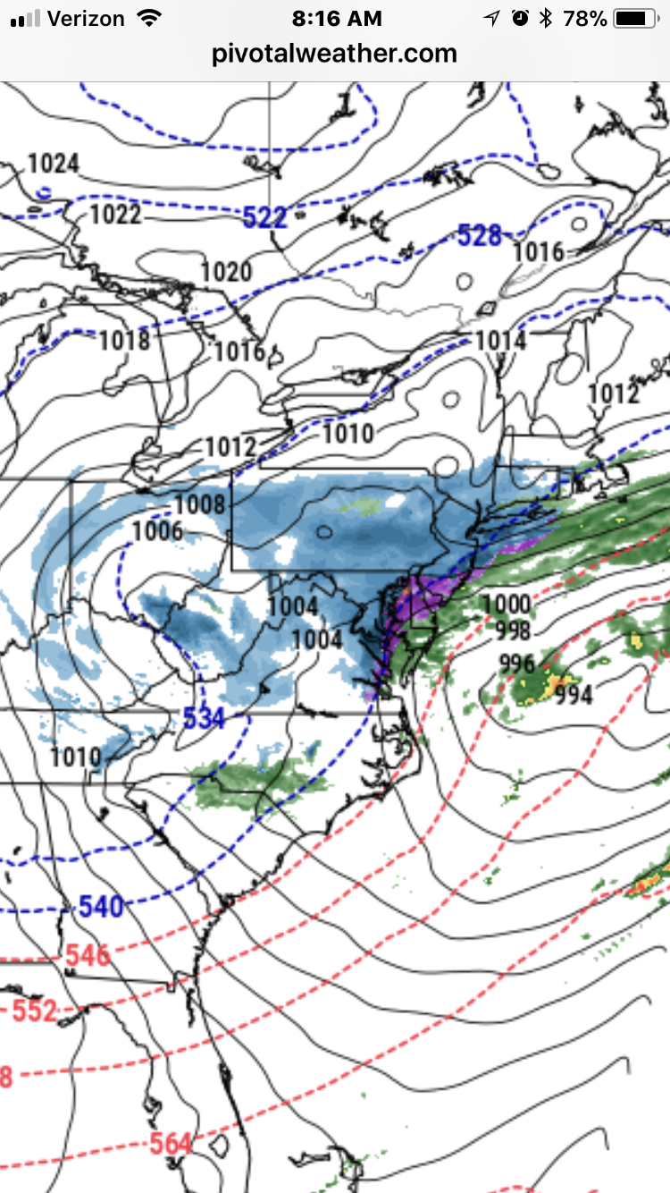
Interesting that the radar returns on weather bug are expanding somewhat to the north and west of Glen Allen. Not sure if that’s just something that lasts a very sort time or brings a couple more hours of moderate snow. Still snowing moderately here though.
-
16 minutes ago, eaglesin2011 said:
starting to accucm on back roads/shaddy areas.. may make and inch... Starting to end nw to south tho.. Don't think we will catch the wrap around out here...
Agreed!
-
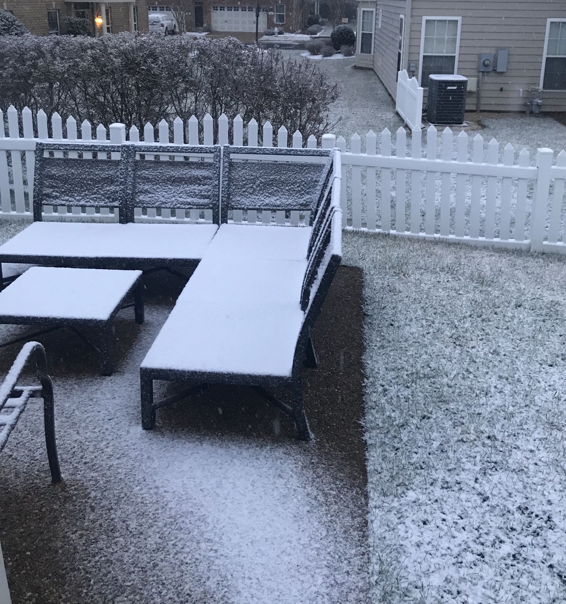
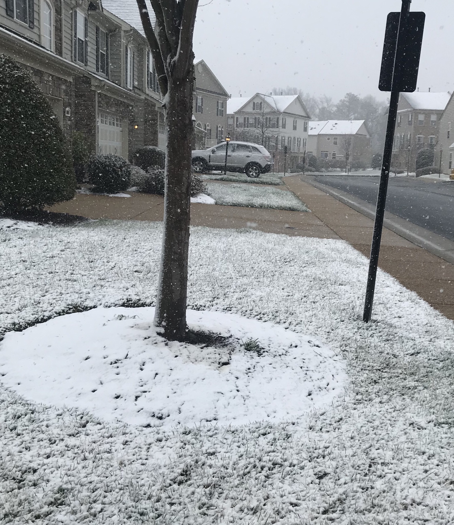
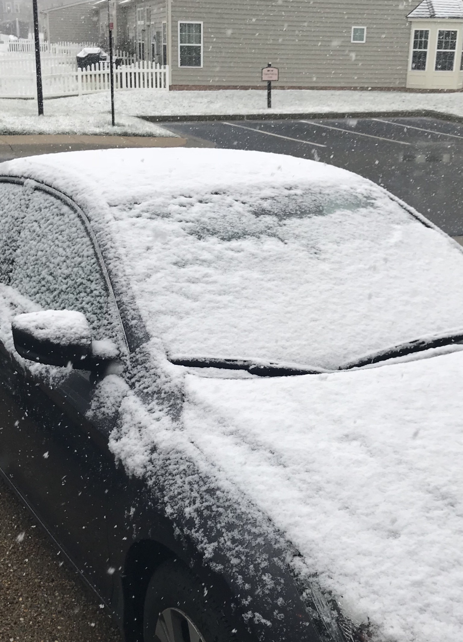
An inch on the car now.
-
1
-
-
Sticking to side streets now. Looks like on back edge unless it fills in from the southwest.
-
-


Richmond Metro/Hampton Roads Discussion
in Mid Atlantic
Posted
An inch here now. 31°- continued ligot to moderate snow.