metagraphica
-
Posts
2,213 -
Joined
-
Last visited
Content Type
Profiles
Blogs
Forums
American Weather
Media Demo
Store
Gallery
Everything posted by metagraphica
-
65/63 small droplet sheet rain nonstop since 11pm last night. Far cry from the 20% chance of showers that the NWS forecast was showing as late as 5pm yesterday.
-
Saturday, June 14th. 57/54 @ 4:30pm.
-
Give him the heater, Ricky!

-
COC. That is all.
-
Clearing and sunshine just in time for sunset. Again.
-
67/66 It's gonna rain.
-
I got the TP ready.
-
Still not installed. Probably tonight or tomorrow morning. Tomorrow and Friday gonna be heaters.
-
77/56 under hazey/smoky sky.
-
Black flies are the worst. Nothing deters them. At least with deer flies you can wear a hat with tanglefoot on it that catches them and there other ways to catch them in the yard.
-
Not too often to see a 24 hours like this. Miserable weather.
-
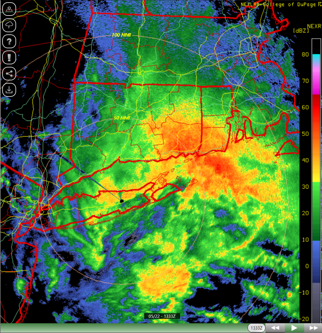
I think Stonington, Pawcatuck, Westerly area is going to be the jackpot. Just a firehose down there.
-
Absolutely pouring again down here.
-
It's f00king raining cats and dogs.

-
50/42 This is no way to run a Summah.
-
60/45 Summeh.
-
Turned into a fantastic afternoon. 74/64 Summah.
-
Nice to feel some dews today instead of windy and dry.
-
Just getting pummeled with rain. The "dryslot" lasted all of about 45 minutes.
-
Rain and fog. Wet.
-
Couple of nice rumbles as that came through. .23" in 10 minutes or so. Sump pump kicked in, so I know the ground is saturated.
-
Wet.
-
Anti-Stein here: Hazardous Weather Outlook National Weather Service New York NY 744 PM EDT Mon May 5 2025 CTZ005>012-062345- Northern Fairfield-Northern New Haven-Northern Middlesex- Northern New London-Southern Fairfield-Southern New Haven- Southern Middlesex-Southern New London- 744 PM EDT Mon May 5 2025 This Hazardous Weather Outlook is for southern Connecticut. .DAY ONE...Tonight. 2 to 4 inches of rainfall are likely across southern CT overnight, particularly the higher elevations. Isolated instances of flash flooding are possible.
-
Mother Nature took notice of your lawn OCD this year and decided to fuck with you.
-
67 and very light drizzle/mist. Late afternoon fail. Was pretty nice for most of the day.