-
Posts
593 -
Joined
-
Last visited
Content Type
Profiles
Blogs
Forums
American Weather
Media Demo
Store
Gallery
Everything posted by cstrunk
-
I-10 special today from San Antonio through Houston later mostly for wind/very large hail. Ended up with 1.49" yesterday.
-
1.26" so far today in Longview and it's not quite done yet. Nice soaking rain. I think tomorrow's severe threat is going to get pushed farther south/east again. Models not looking impressive (IMO) due to lingering precip tonight/tomorrow morning across areas of eastern Texas.
-
I agree. Looks like SPC disagreed with the Enhanced delineation in the area I mentioned... and even nudged it slightly more north. I wonder what they are seeing.
-
The DFW area still looks to be ground zero for the supercell/hail threat this afternoon. I think the Enhanced Risk is delineated too far to the north, once you get east of there. I wouldn't be surprised if it gets trimmed back south closer to I-20 in NE TX and N LA, as opposed to extending along I-30 in NE TX to Texarkana and southern Arkansas.
-
-
Lots of supercells out there this afternoon across a wide area! Several tornado warnings as well.
-
Friendly reminder - don't feed the trolls... just ignore them.
-
-
Maybe I need to convince my boss to let me take my birthday off from work...
-
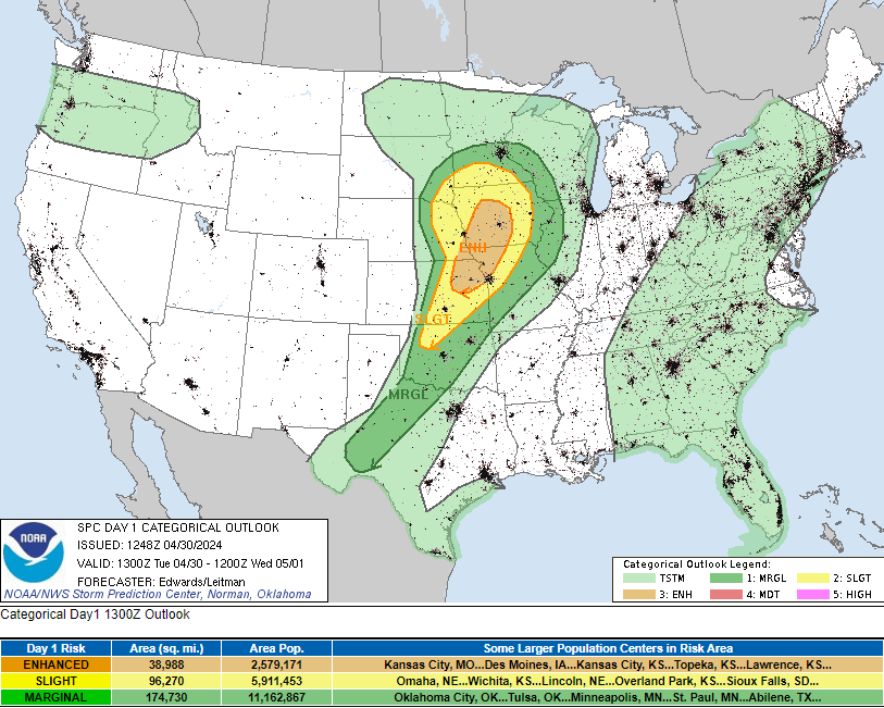
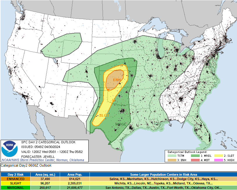
SPC Day One Outlook (4-30-24): SPC Day Two Outlook (4-31-24): Severe storms in chaseable terrain return today and tomorrow (possibly Thursday too?). Today's threat covers areas hit hard by Friday's storms in E NE and W IA.
-
It seems to me like the SPC is highlighting risk areas in Days 4-8 more than in the past. That used to be more of a big deal, as it seems like they would only do that for days with a much higher certainty of some kind of severe weather outbreak, and those would end up being more like true "Moderate" risk type days (which are much more infrequent). Now they are highlighting those areas and they don't end up being huge outbreaks, just standard "Slight" or "Enhanced" risk type days. But not significant, like you mention. I think social media is making it worse. There's so many variables and failure modes, that confidence can't be that high at those ranges to start highlighting "Super Outbreaks" headlines that we've seen from some.
-
5.93" total IMBY on the north side of Longview.
-
Man, the last few runs of the HRRR look pretty nasty for a pretty big area of NE TX, E OK, and NW AR. Lots of individual cells/supercells this afternoon/evening.
-
Tomorrow evening certainly looks interesting in the extreme NE Kansas area.
-
Southern Tyler had up to 2 inch hail about 30 mins ago. It's headed towards Longview now but should focus on the central/southern part of town and the worst should miss me.
-
Less than a half inch of freezing drizzle, sleet, and snow in Longview. Ground mostly white but not completely. Roads are iced over and will get worse as traffic drives on it. Not forecast to get above freezing until Wednesday. Should see some melting tomorrow with a high of 30 degrees and some sun. Roads will be hazardous through Wednesday.
-
PDS tornado warning north of Clarksville, TN.
-
This looks like it's not going to get too crazy (at least for the western part of the risk area), but the HRRR is sure intent on rolling an supercell through the De Queen, AR area late this evening.
-
Texas/Oklahoma 2023 Obs and Discussion
cstrunk replied to Ed, snow and hurricane fan's topic in Central/Western States
GFS is very consistent in showing solid to heavy rain for much of central/N/NW TX next week and beyond. Euro keeps any decent rainfall farther west with much lighter amounts. -

Texas/Oklahoma 2023 Obs and Discussion
cstrunk replied to Ed, snow and hurricane fan's topic in Central/Western States
2.7" storm event total since yesterday morning. -

Texas/Oklahoma 2023 Obs and Discussion
cstrunk replied to Ed, snow and hurricane fan's topic in Central/Western States
Getting more interesting now, including a tornado warned storm near Commerce, TX. -

Texas/Oklahoma 2023 Obs and Discussion
cstrunk replied to Ed, snow and hurricane fan's topic in Central/Western States
https://www.spc.noaa.gov/products/md/md2163.html Mesoscale Discussion 2163 NWS Storm Prediction Center Norman OK 0520 PM CDT Tue Sep 19 2023 Areas affected...north-central Texas. Concerning...Severe Thunderstorm Watch 686... Valid 192220Z - 192345Z The severe weather threat for Severe Thunderstorm Watch 686 continues. SUMMARY...A supercell across north-central Texas could pose a large hail threat this evening. DISCUSSION...A supercell formed on the western periphery of mid-day elevated convection which moved east across north-central Texas. Given only weak CINH near this storm and its radar depiction over the last hour, this storm has likely rooted and is surface based in a region with around 1000 J/kg MLCAPE. 40+ knots of mid-level northwesterly flow (per FWD VWP) has yielded near 50 knots of effective shear. This environment will support supercells capable of large hail (potentially 2+ inches). If this storm continues to turn right, which it has started to do over the last 15 to 30 minutes, portions of at least the northern DFW metro area may be impacted by large to very large hail this evening. If this storm continues to maintain its current intensity or strengthen, an expansion of watch 686 may be needed. ..Bentley/Bunting.. 09/19/2023 -

Texas/Oklahoma 2023 Obs and Discussion
cstrunk replied to Ed, snow and hurricane fan's topic in Central/Western States
It finally rained in Longview. I got 2.42". Hope y'all got something too. -

Texas/Oklahoma 2023 Obs and Discussion
cstrunk replied to Ed, snow and hurricane fan's topic in Central/Western States
It's been hot but it's July 20th and Longview has only hit 100F once (officially, although my weather station did record 100F yesterday making it the second instance). We might do it again today, but even the forecast through next Wednesday doesn't have 100F temperatures. In fact, this weekend is forecast to be in the low-mid 90's. The humidity has been high, but overall, this summer could be worse. -

Texas/Oklahoma 2023 Obs and Discussion
cstrunk replied to Ed, snow and hurricane fan's topic in Central/Western States
Made it to 101F in Longview yesterday. My weather station shows a 77F dewpoint also and a 118F heat index. The airport south of town recorded 101F but a slightly lower dewpoint at that time (72F) which corresponds to a 112F heat index. SHV didn't pull the trigger on an excessive heat warning yesterday, but did for today and tomorrow. The dewpoints just aren't mixing out as much as expected.


