blizzardof96
-
Posts
1,565 -
Joined
-
Last visited
Content Type
Profiles
Blogs
Forums
American Weather
Media Demo
Store
Gallery
Everything posted by blizzardof96
-
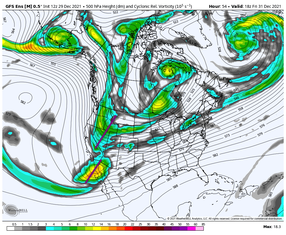
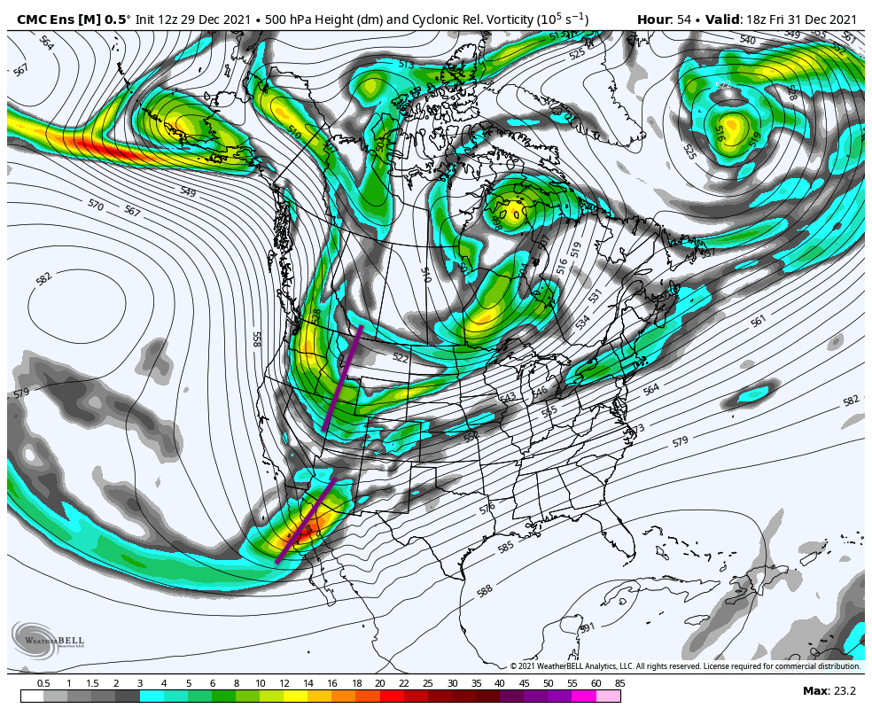
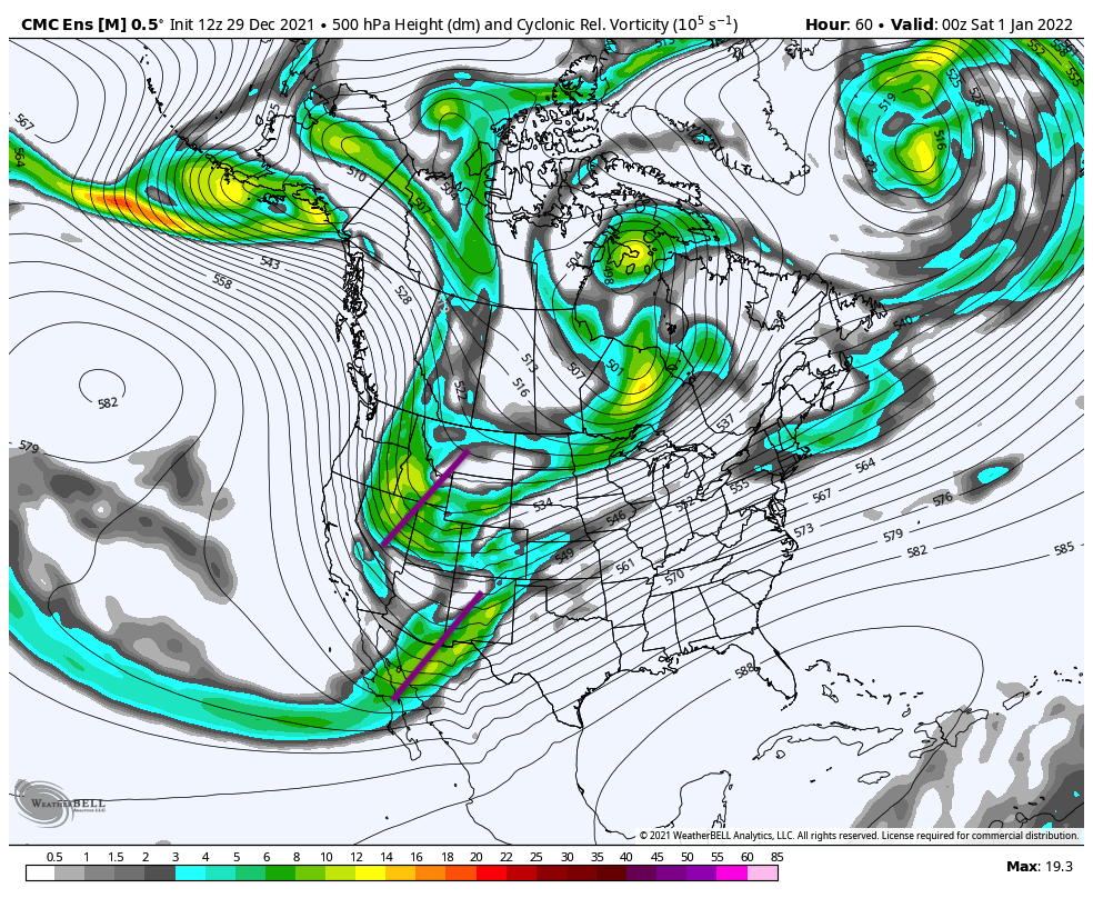
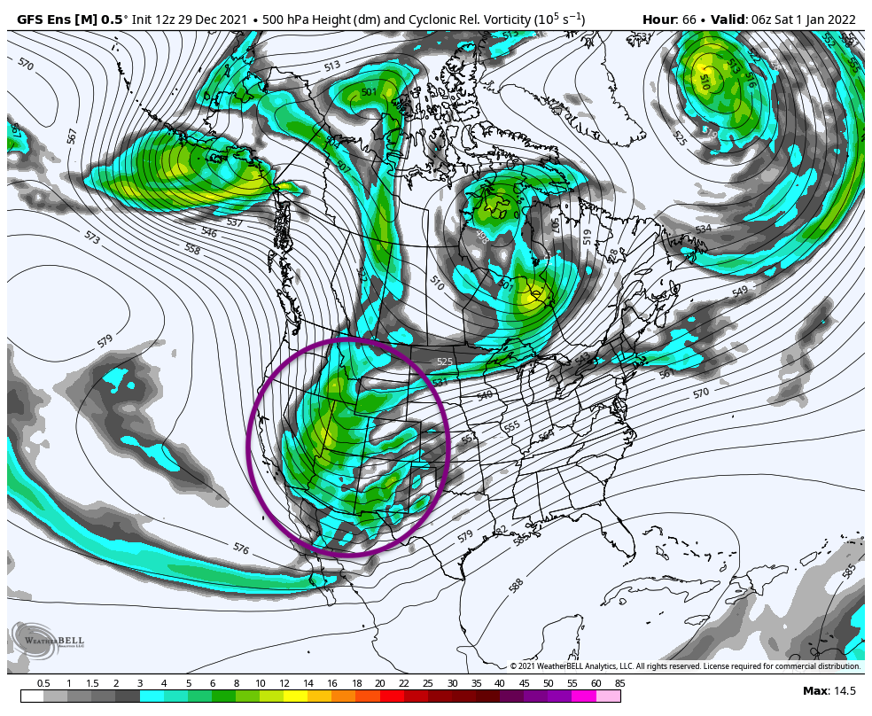
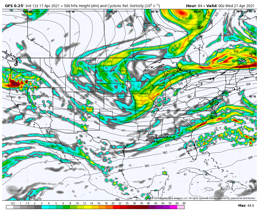
Can really see the differences in phasing between the GEFS and GEPS as soon as hour 54-60. The GEFS has the northern wave digging further south which allows for more interaction with the southern energy. The GEPS has less digging and more separation between the two pieces of energy.


-
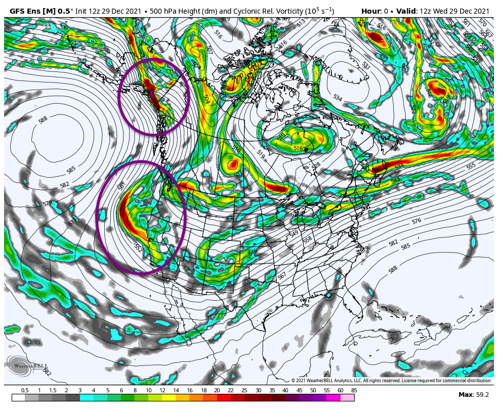
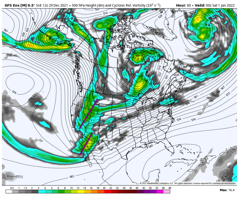
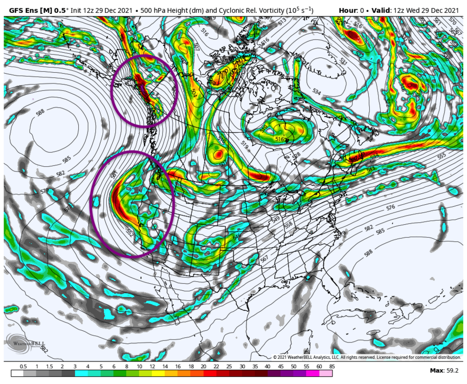
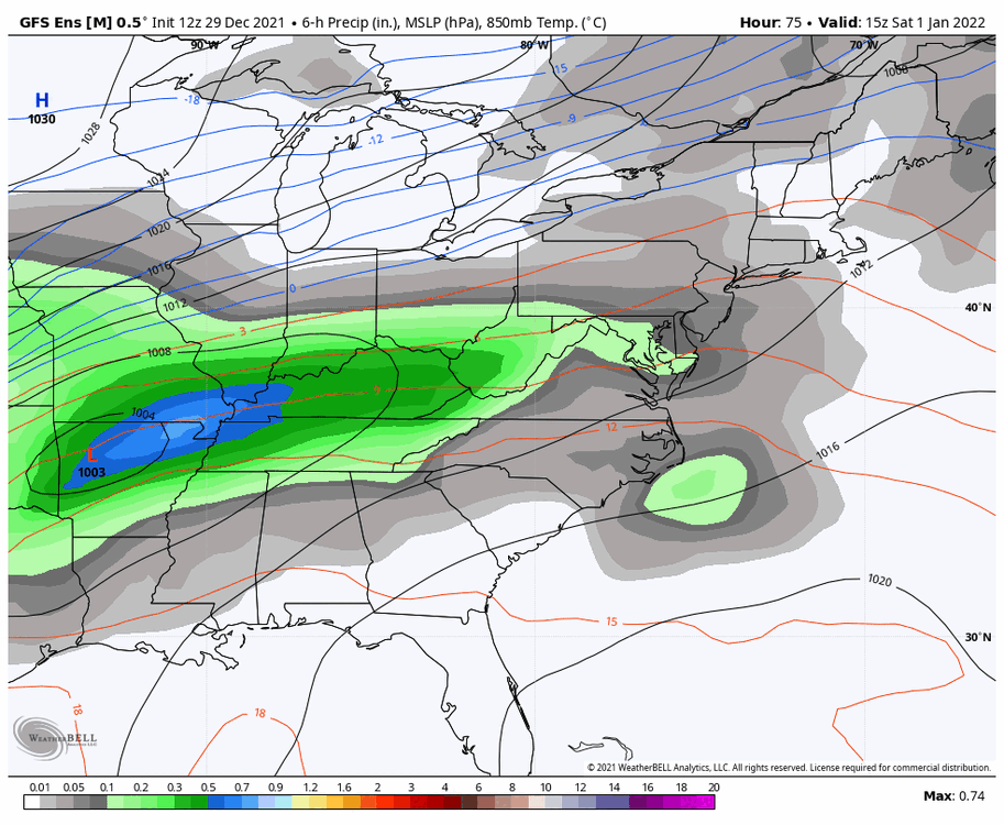
Looking at the initialization from the 12z GEFS, we can see the two pieces of energy that quasi-phase by new years eve along with lee cyclogenesis (Colorado low formation). Exact details still murky.

-
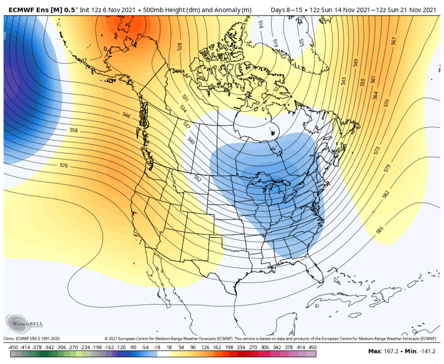
Looks solid indeed. Hopefully the signal holds.
-
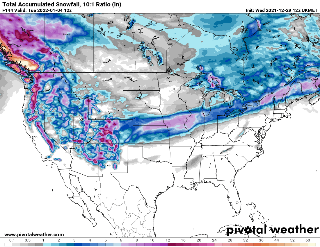
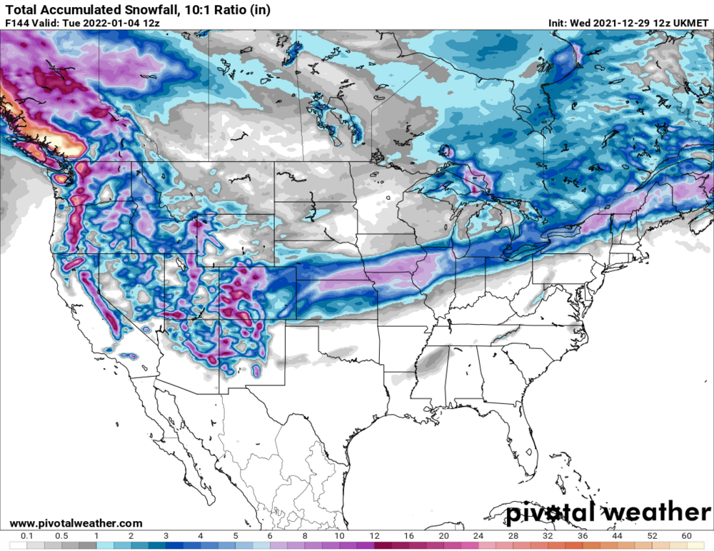
Here's a look at total snowfall from the 12z UKMET
-
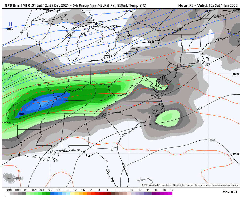
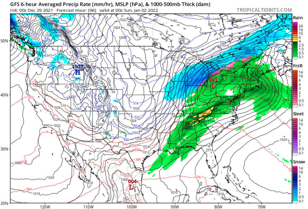
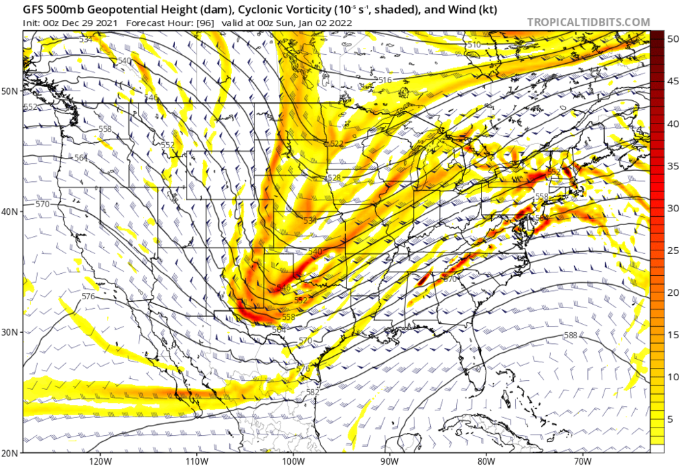
I’m a bit skeptical that given this upper level configuration: We end up with a surface low this far north and well developed: To me, a sfc low track further south would fit the UL pattern better. Whether the UL setup on the 0z GFS is correct is another question entirely. Lots of moving parts for the models to put together — will probably take some time to iron out.
-
Pretty textbook look to the 12z EPS
-
What are your thoughts on GTA?
-
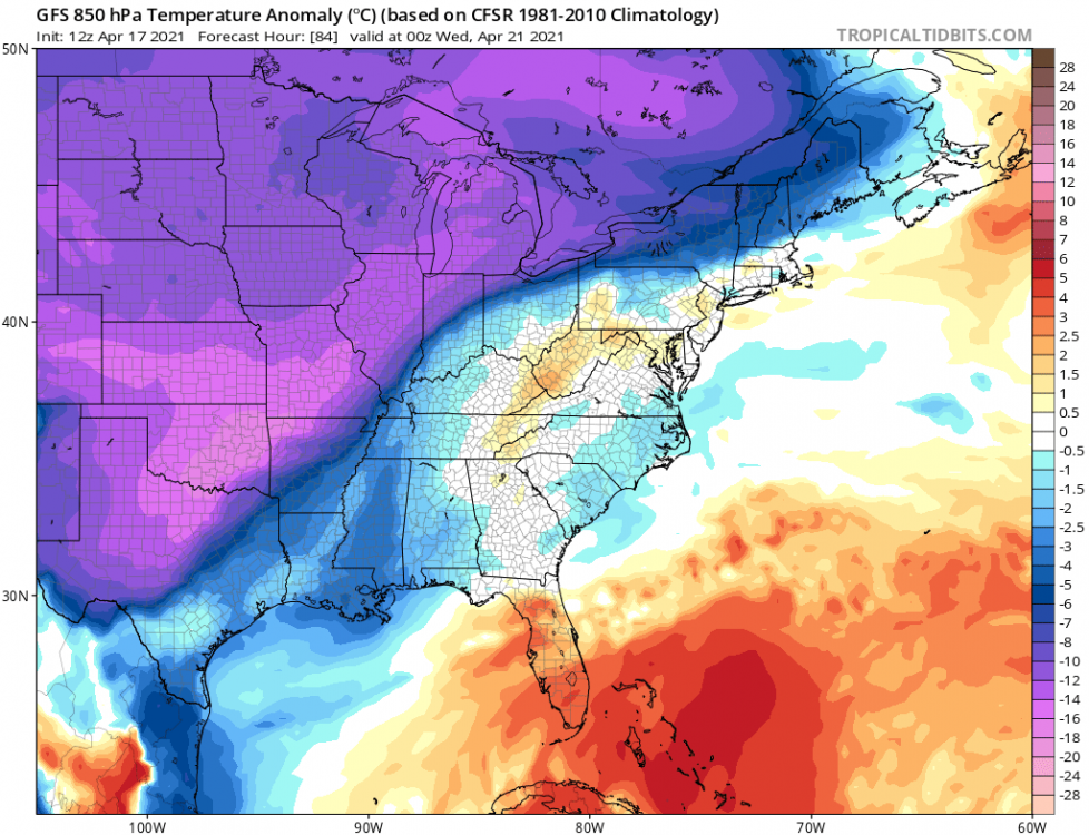
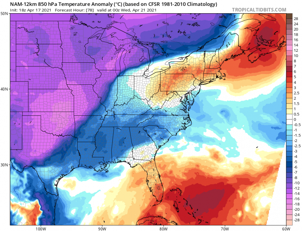
Check out the differences in the mid-level warm sector: GFS NAM
-
A key piece looks to be the leading Quebec vortex which really helps determine where the thermal boundary sets up behind. If the vortex digs further south, the confluence zone also ends up further south and you get more of a GFS like track. If the opposite occurs, there's more room for the great lakes energy to amplify further NW.

-
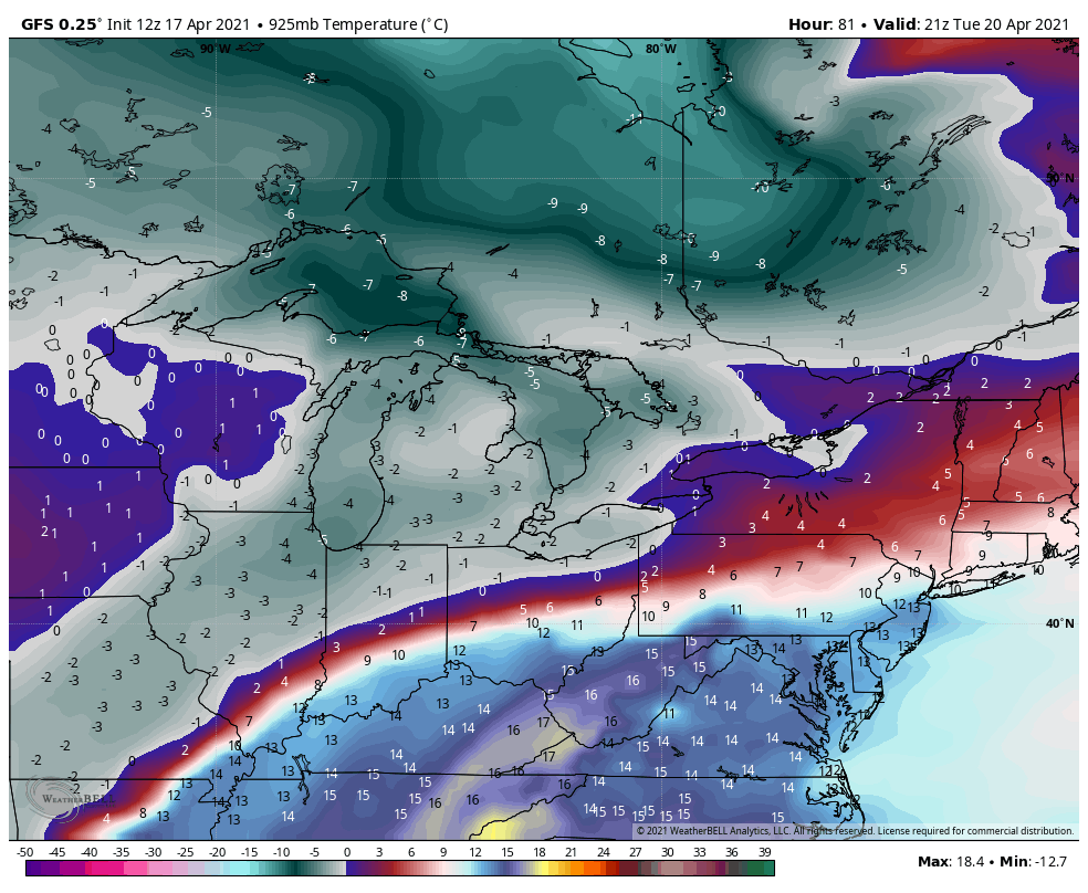
We can get a good idea of where the snow swath & dynamic cooling set up on the model by looking at 925mb temps. Notice the razor sharp temperature gradient along the south side of the band.

-
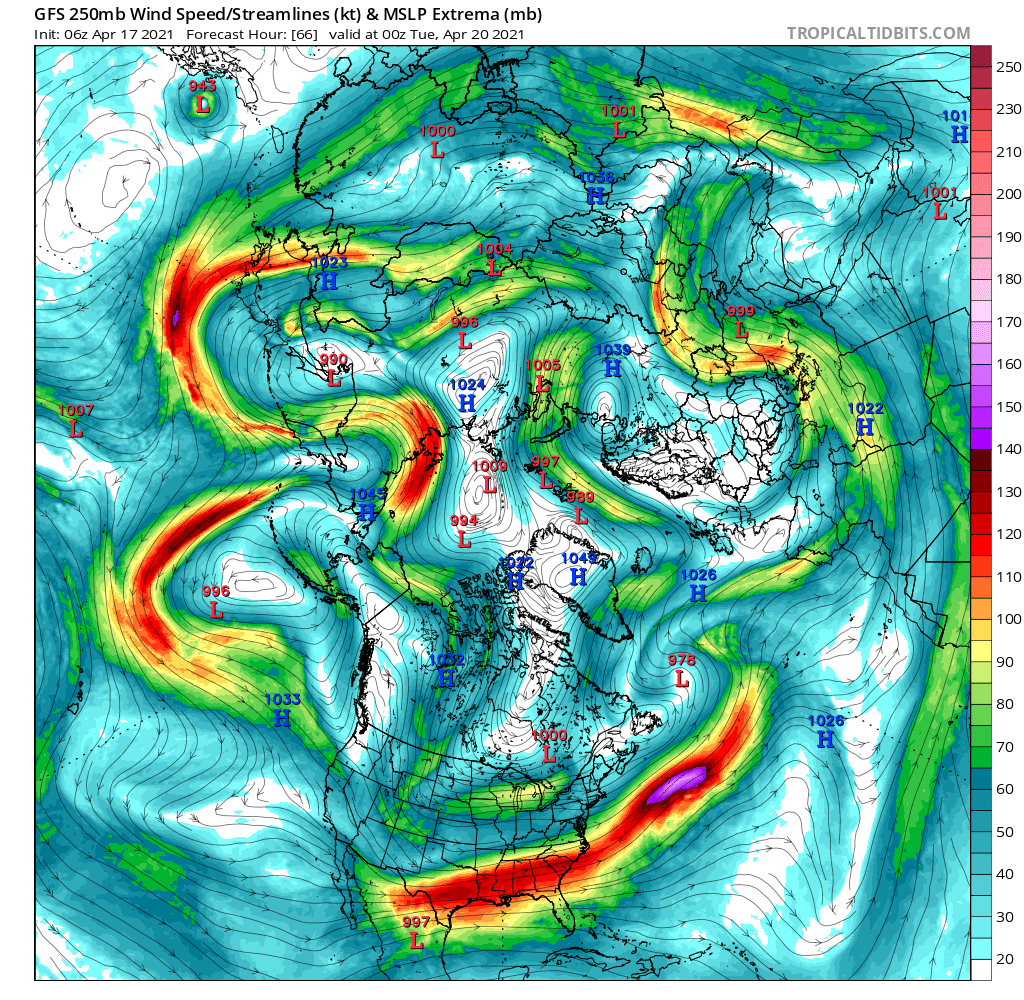
For late April...the upper level cold pool looks very impressive with this event. The source region of the air mass comes from the Siberian side of the pole with 250mb flow vectors pointing due south from Nunavut. A wave then develops along the thermal boundary which is how we get our snow swath.

-
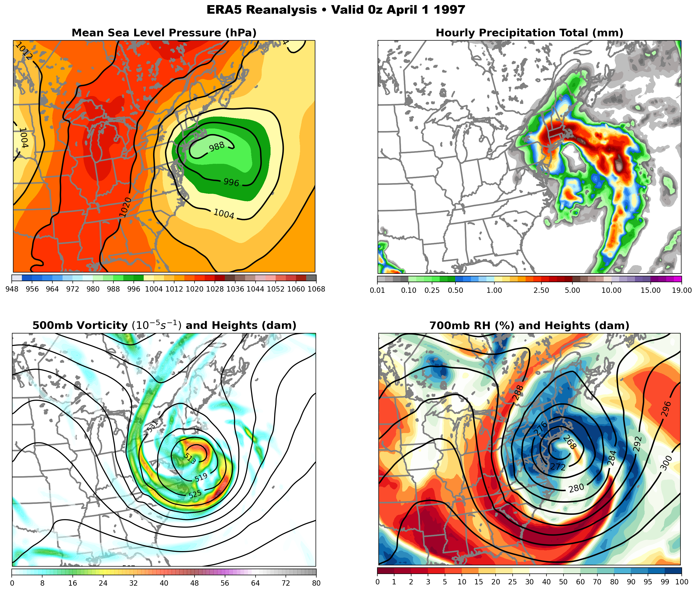
Four-panel map of the 1997 blizzard...

-
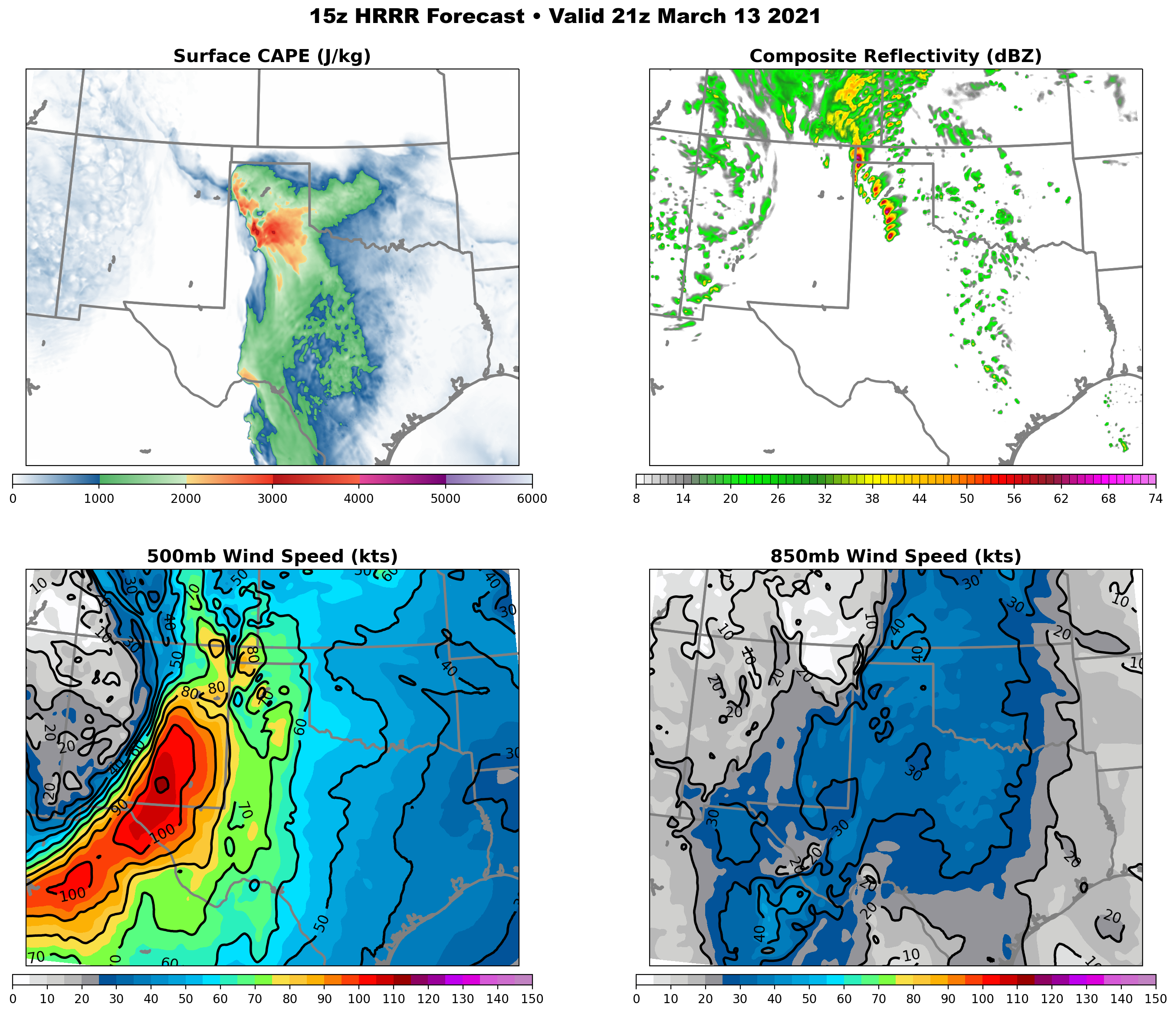
Impressive parameter space in place for today! I hope everyone stays safe.

-
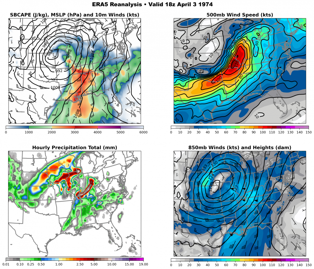
I had a bit of fun yesterday and plotted out a four panel map of the 1974 "Super Outbreak". I thought I would share the data here for those interested.
-
Today marks the 50th anniversary of Quebec's "Storm of the Century" which set an all time 24hr snowfall record in the city of Montreal. 43cm was recorded during that time period with wind gusts >110km/hr creating two storey snow drifts.
-
Feb 17-19th Potential Of Potential
blizzardof96 replied to Chicago Storm's topic in Lakes/Ohio Valley
Good points. Delta-Ts and lake convergence were stronger with that event...leading to higher totals. The stationary nature of that band also helped. I find that NE flow tends to lock in more often while E flow tends to be more of a windshield wiper. -
Feb 17-19th Potential Of Potential
blizzardof96 replied to Chicago Storm's topic in Lakes/Ohio Valley
Nice wintry feel. I'm glad the forecast worked out well. -
Feb 17-19th Potential Of Potential
blizzardof96 replied to Chicago Storm's topic in Lakes/Ohio Valley
Nice. I just measured 4" of fresh snow on my driveway (24 hour total). -
Feb 17-19th Potential Of Potential
blizzardof96 replied to Chicago Storm's topic in Lakes/Ohio Valley
Measured 2" here in North Toronto at 6PM. -
Feb 17-19th Potential Of Potential
blizzardof96 replied to Chicago Storm's topic in Lakes/Ohio Valley
0z RGEM remains adamant on a big hit for city of Toronto -
Feb 17-19th Potential Of Potential
blizzardof96 replied to Chicago Storm's topic in Lakes/Ohio Valley
Some of the issues with that mid-December event: 1) Dry profiles 2) Lower delta-Ts (850s were closer to -8C) and shallower arctic air 3) Significant veering between sfc-850mb 4) Weaker model support in terms of intensity/duration I think we have a more favourable setup this time, but we'll see what happens tomorrow. RADAR won't be too helpful given the shallow nature of the banding. With lower beam heights, KBUF will likely pick up on it better than WKR. -
Feb 17-19th Potential Of Potential
blizzardof96 replied to Chicago Storm's topic in Lakes/Ohio Valley
Agreed wholeheartedly. That looks similar to what the 12z Euro was showing and is a plausible scenario. Climo argues for the band hugging the lakeshore a bit more but it'll likely come down to nowcasting as the models simply aren't good enough to resolve this event with perfect accuracy. -
Feb 17-19th Potential Of Potential
blizzardof96 replied to Chicago Storm's topic in Lakes/Ohio Valley
Here's an RGEM sounding valid 6z Friday. It's using the 850mb flow as the steering flow... note the easterly wind at that level. Surface flow northeasterly. The banding is shallow... below ~850mb, which is typical of these easterly flow events. 850s are about -10C which gives about ~16C deltaT with the Lake temp. This is supportive of something popping up.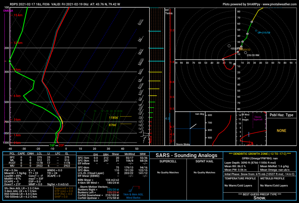
-
Feb 17-19th Potential Of Potential
blizzardof96 replied to Chicago Storm's topic in Lakes/Ohio Valley
This is a tough forecast due to the localized nature of the LE banding. I think many communities within the GTHA (besides northern areas near the 407) will see 5-10cm. The >10cm amounts will directly align with the narrow streamer expected to come in off Lake Ontario. Location of this band varies depending on which model you trust. NAM/3kNAM have the bullseye near Oakville/Burlington while RGEM/HRDPS have a downtown TO -- Mississauga bullseye. The GFS & ECMWF look similar in positioning to the RGEM suite...so something to keep in mind. I definitely think Downtown TO -- Southern Mississauga -- Oakville have the potential to exceed 10cm but small differences in wind direction will make all the difference. Hardest hit areas (localized) will probably approach 20cm. -
Feb 17-19th Potential Of Potential
blizzardof96 replied to Chicago Storm's topic in Lakes/Ohio Valley
Exactly. The band steering flow is likely coming from the ~925-850mb layer where winds are stronger and have an ESE component to them.