blizzardof96
-
Posts
1,565 -
Joined
-
Last visited
Content Type
Profiles
Blogs
Forums
American Weather
Media Demo
Store
Gallery
Everything posted by blizzardof96
-
Feb 17-19th Potential Of Potential
blizzardof96 replied to Chicago Storm's topic in Lakes/Ohio Valley
Keeping a close eye on the easterly flow LE setup. Lake effect snow band forms tomorrow afternoon and continues through Friday AM. Impacts expected across Toronto to Hamilton corridor with highest amounts near Oakville, ON or Mississauga lakeshore. I'm thinking that the impacted areas will likely see 5-15cm of snow. Narrow bullseye may exceed 20cm.
-
RADAR looks good... I think we can probably pull off 8"+ assuming the dry slot remains south of us. Time will tell.
-
Snow has started in Toronto as winds are picking up. Let the fun begin!
-
Agreed completely. Several indicators pointing towards more of a 401/407 jackpot zone, in my opinion.
-
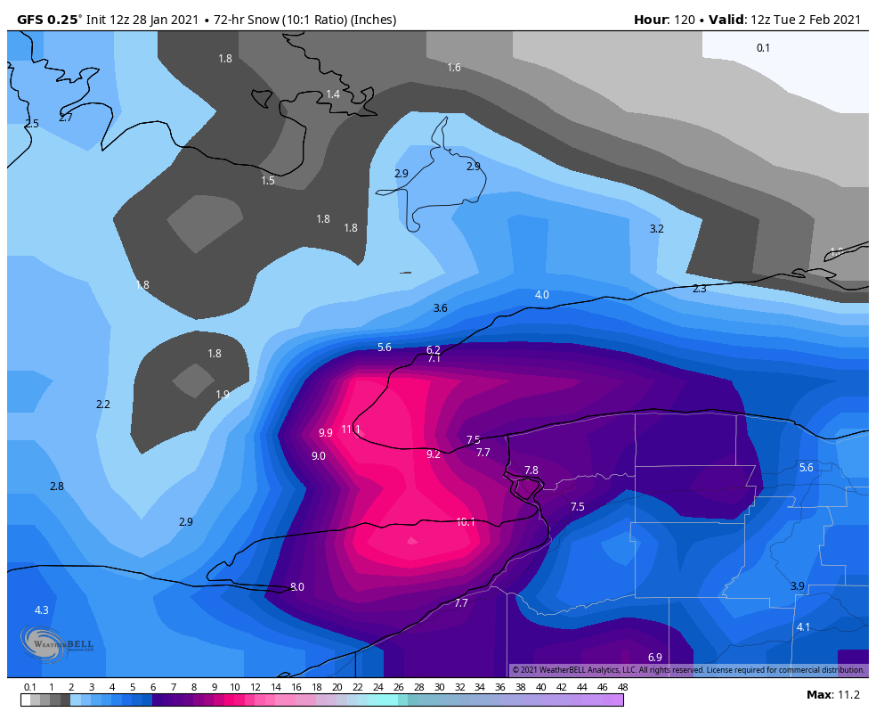
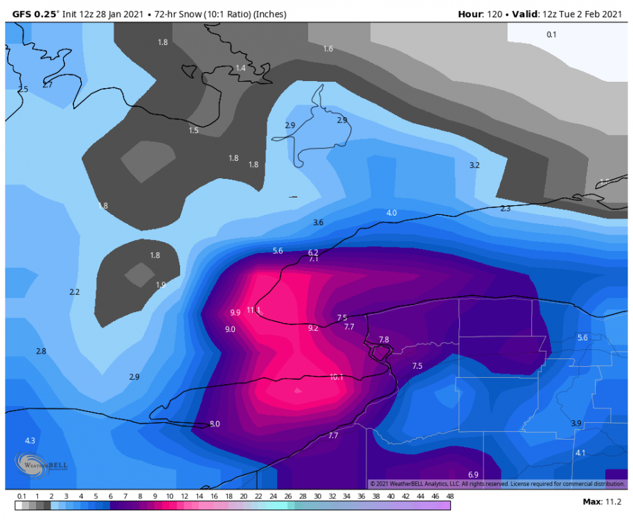
My current thinking is a widespread 6-10” across most of S ON, including the Windsor-London-KW-GTA corridor. Local amounts up to 12”. Hamilton-Niagara area is 8-12” with local amounts up to 15” given lake enhancement and upslope flow. Wind gusts ~40-60km/hr will create blizzard like conditions tomorrow night. Peak snowfall rates >1”/hr likely for several hours tomorrow night.
-
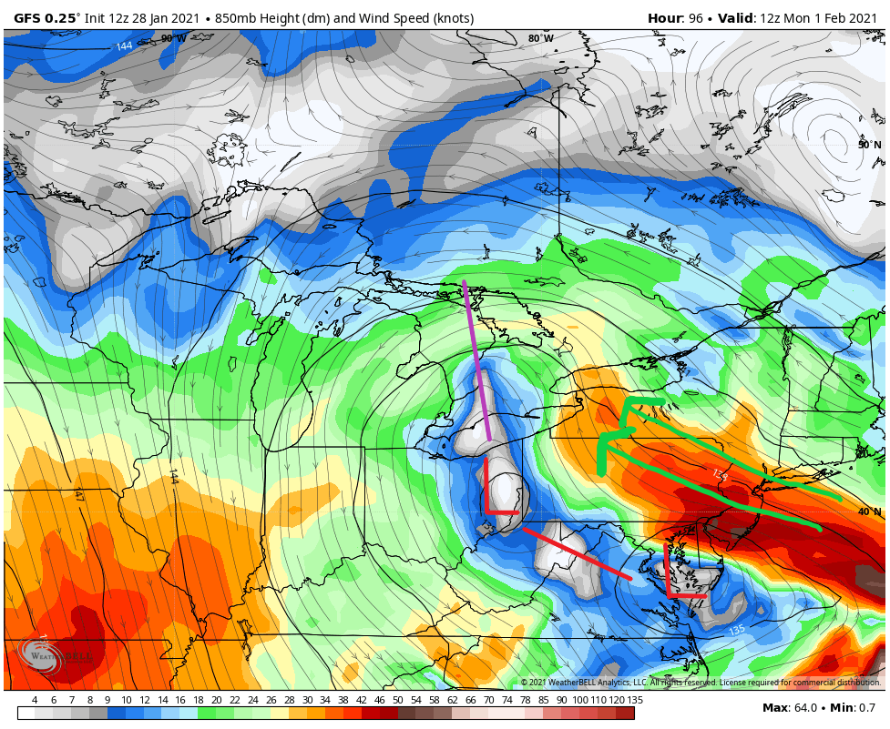
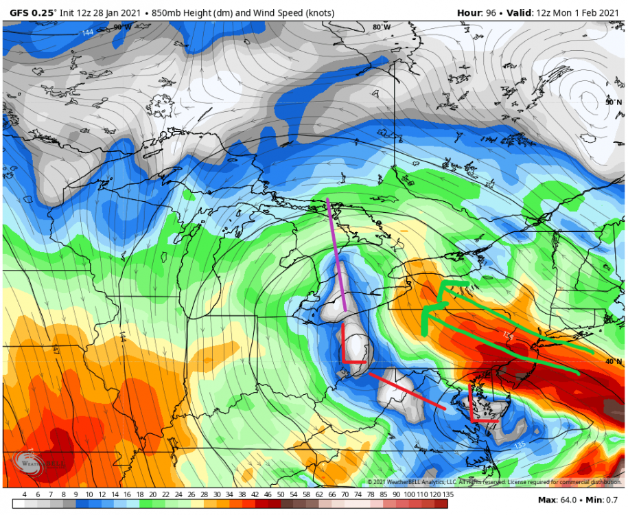
Resulting in significant changes at the surface
-
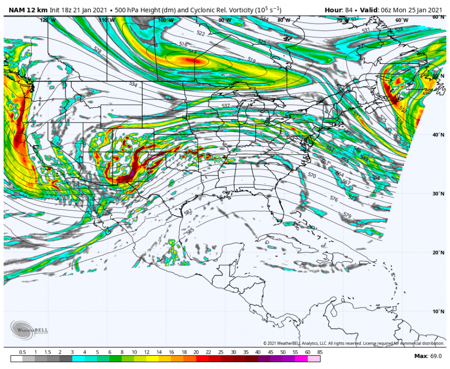
Negative tilt is becoming more pronounced across the Southern Plains before ejection:
-
What's interesting about this inverted trough setup for S ON is the mid-level convergence axis and moisture transport advecting in from both the GOMEX and ATL sectors
-
Check out that gradient! Burlington pier at 11.1" with Buttonville at 3.6".
-
Jan 25-26th Potential Something Part 3
blizzardof96 replied to Chicago Storm's topic in Lakes/Ohio Valley
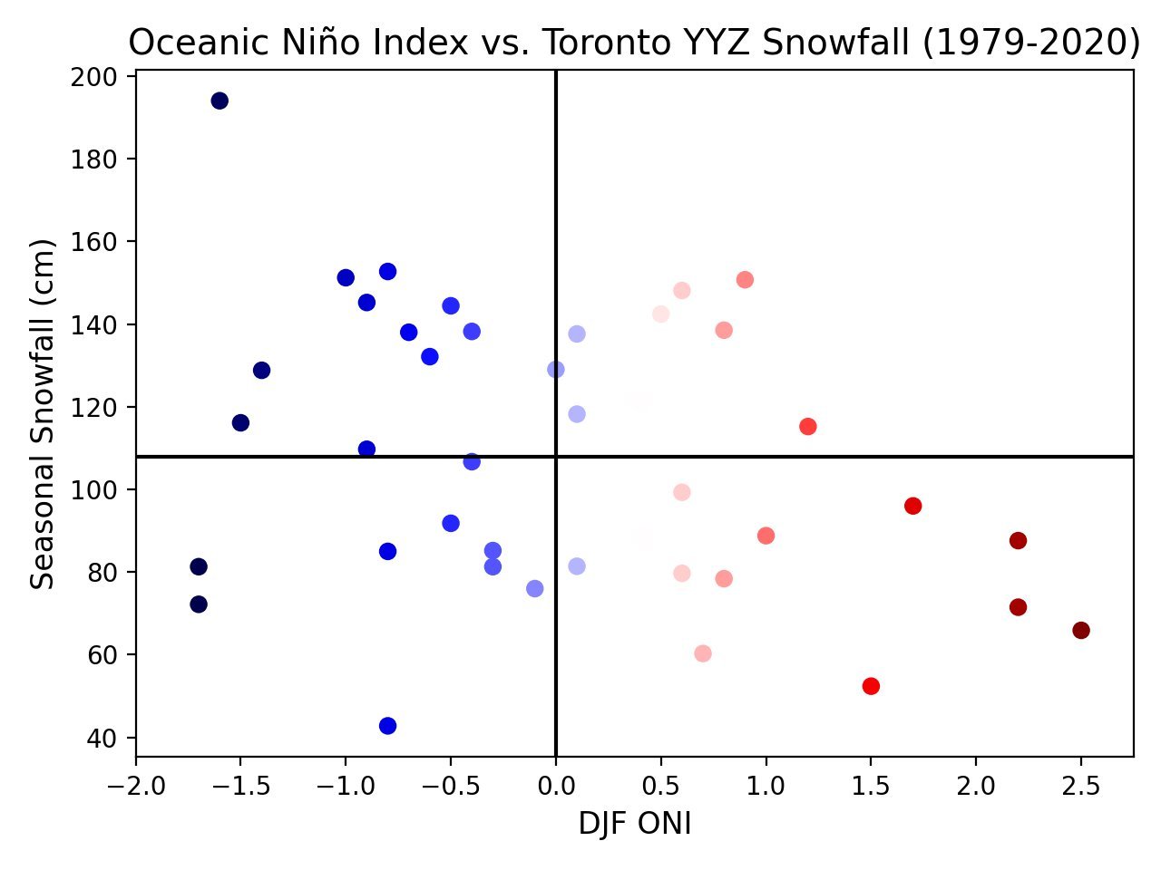
I also did some recent analysis -- with emphasis on the Oceanic Nino Index (ONI) relationship. Here's what I found out: 1) Toronto YYZ had an average annual snowfall (1979-2020 climatology) of ~108cm with a standard deviation of ~33cm. 2) When DJF ONI > 0.5 (El Nino), 5 years had above normal snowfall and 10 were below normal (1979 - 2020) 3) When DJF ONI < -0.5 (La Nina), 10 years were above normal and 5 years below normal (1979 - 2020) Average seasonal snowfall by decade: 1970s: 139.2cm 1980s: 101.3cm 1990s: 103.0cm 2000s: 121.1cm 2010s: ~115.2cm 50 year average (1970 - 2020): ~116cm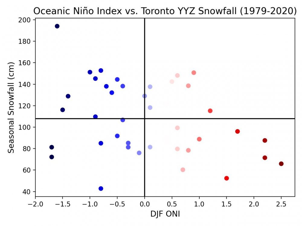
-
Jan 25-26th Potential Something Part 3
blizzardof96 replied to Chicago Storm's topic in Lakes/Ohio Valley
I'll take the 3" and run. Happy with it. Throw in some blowing/drifting with those strong easterly gusts off the Lake. -
Jan 25-26th Potential Something Part 3
blizzardof96 replied to Chicago Storm's topic in Lakes/Ohio Valley
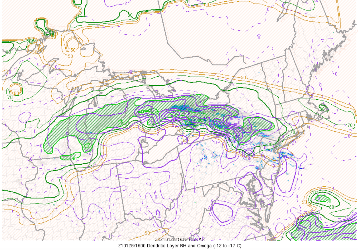
Looks like main snowfall axis is going to push well north of modelled position, which is a pretty remarkable north trend of the 700mb RH zone. Will see how much activity can build into GTA off the lake with the low level easterlies. -
Jan 25-26th Potential Something Part 3
blizzardof96 replied to Chicago Storm's topic in Lakes/Ohio Valley
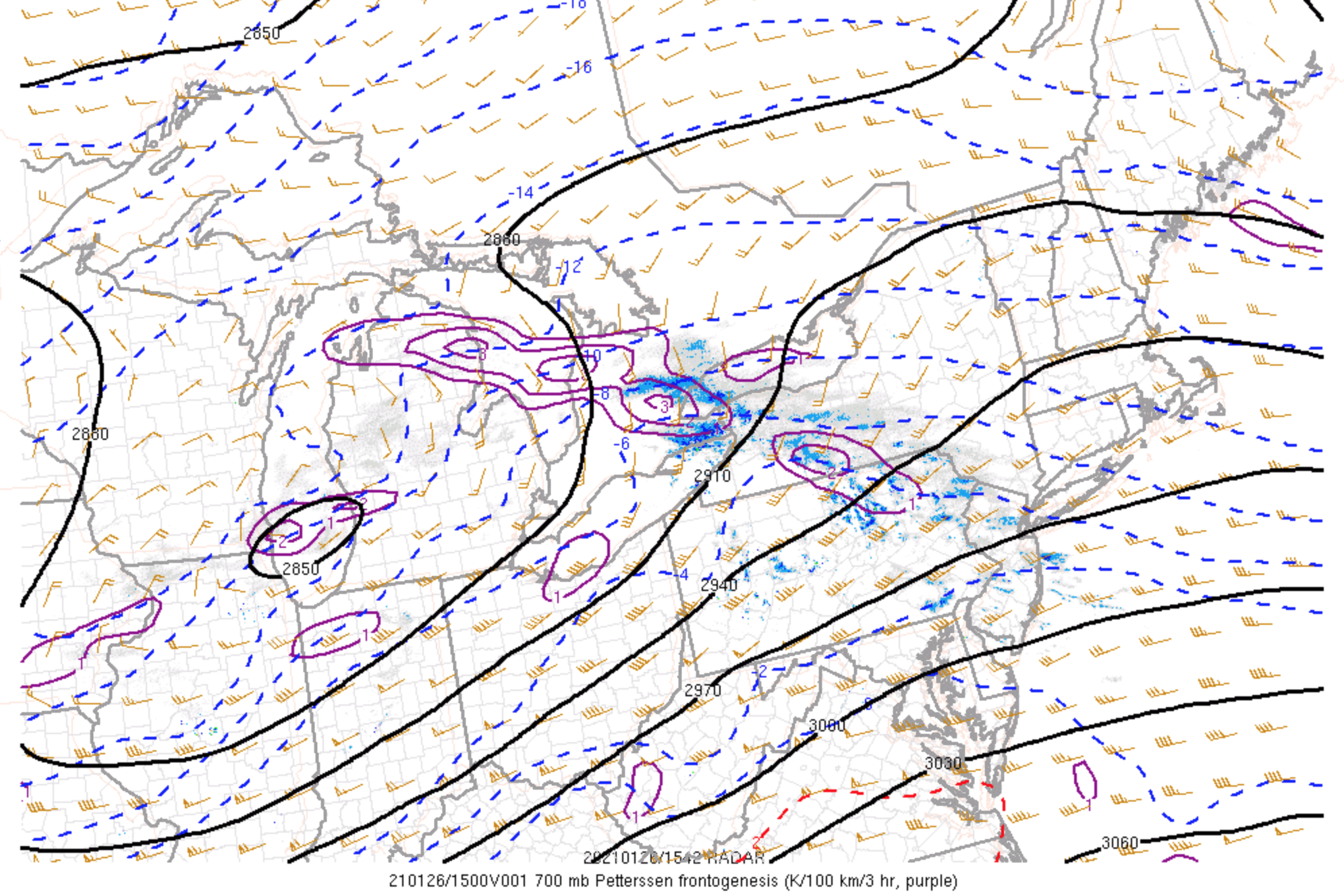
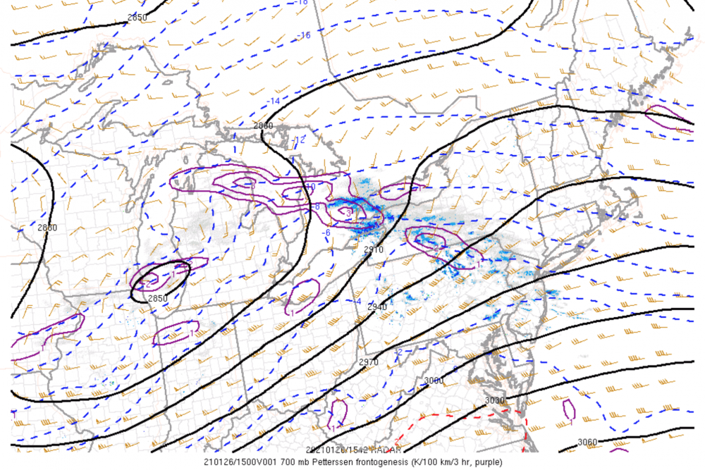
Textbook leading 700mb FGEN band. Note the strong intersection between DGZ relative humidity, omega and mid-level frontogenesis.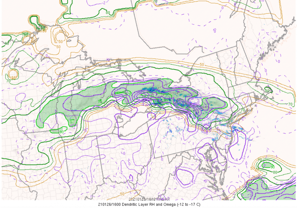
-
Jan 24-26th Potential Something Part 2
blizzardof96 replied to Chicago Storm's topic in Lakes/Ohio Valley
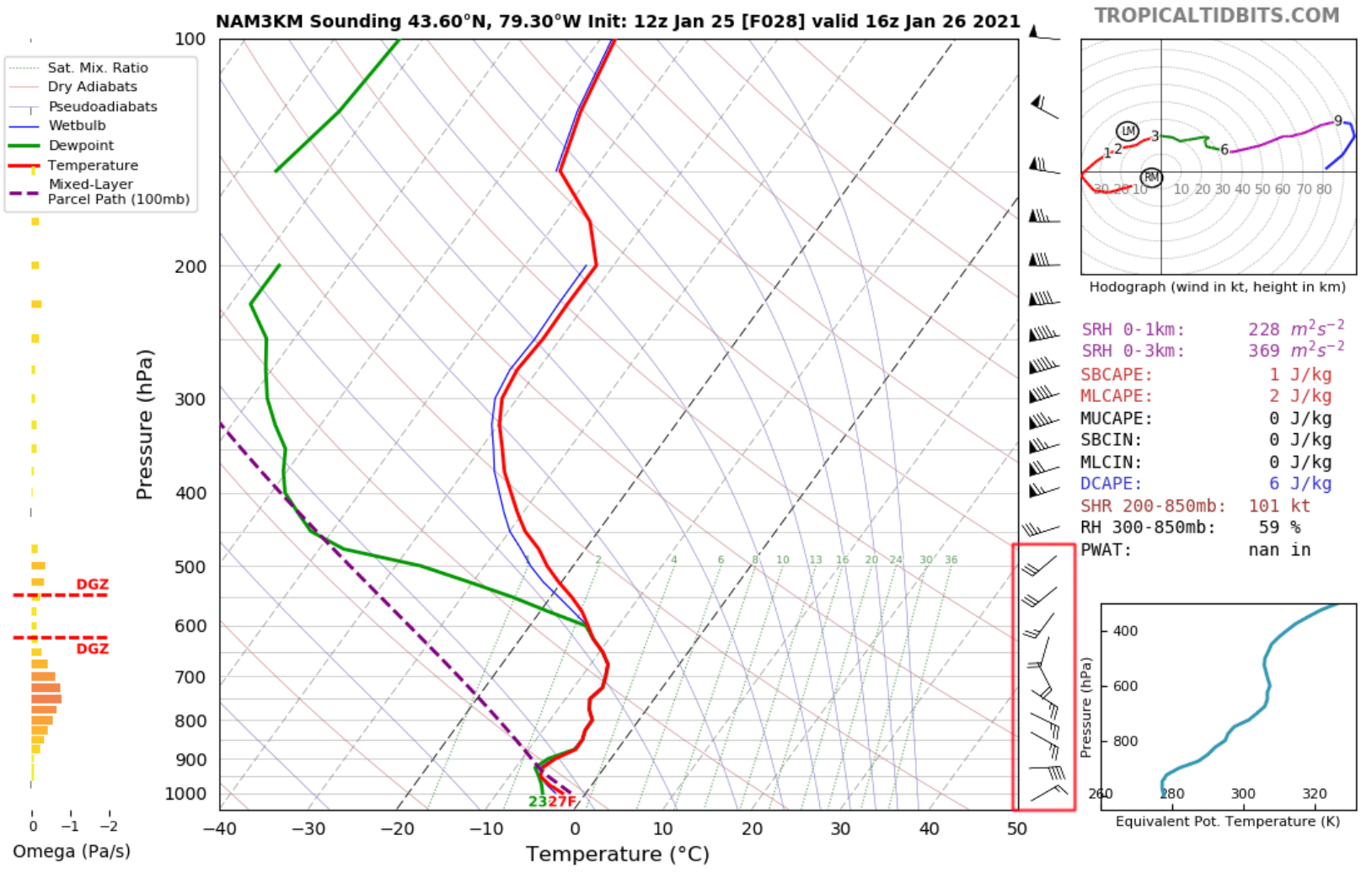
With regards to lake enhancement, I don't see that being a major component of this system for GTA. Sounding data indicates surface winds are ENE with winds veering with height (i.e 850mb winds ESE and 700mb SW). This amount of directional shear doesn't support organized enhancement. Sfc-700mb temps are in the range of -9C to 0C which is also a bit warm for organized enhancement. We would typically want inversion heights to be more elevated & mid-level temps a bit cooler given lake temps about 5-6C.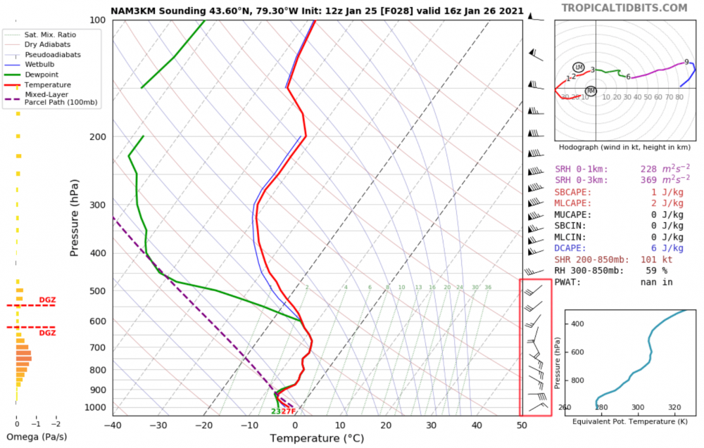
-
Jan 24-26th Potential Something Part 2
blizzardof96 replied to Chicago Storm's topic in Lakes/Ohio Valley
The FGEN banding does look like it will thump for a little while tomorrow morning into early afternoon. I'm expecting 2-4" across most of S ON, with local amounts of 4-6" across parts of GTHA that cash in on banding features. Easterly wind gusts 40-60km/hr.
-
Jan 24-26th Potential Something Part 2
blizzardof96 replied to Chicago Storm's topic in Lakes/Ohio Valley
Nice to hear from you! -
Jan 24-26th Potential Something Part 2
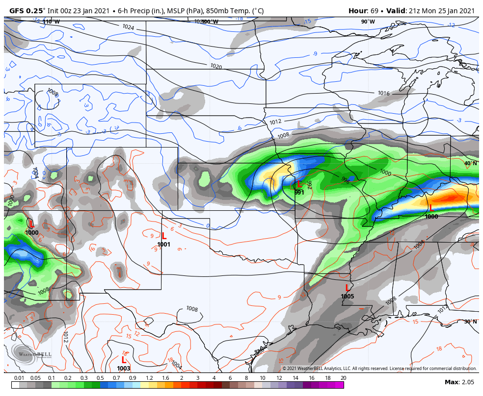
blizzardof96 replied to Chicago Storm's topic in Lakes/Ohio Valley
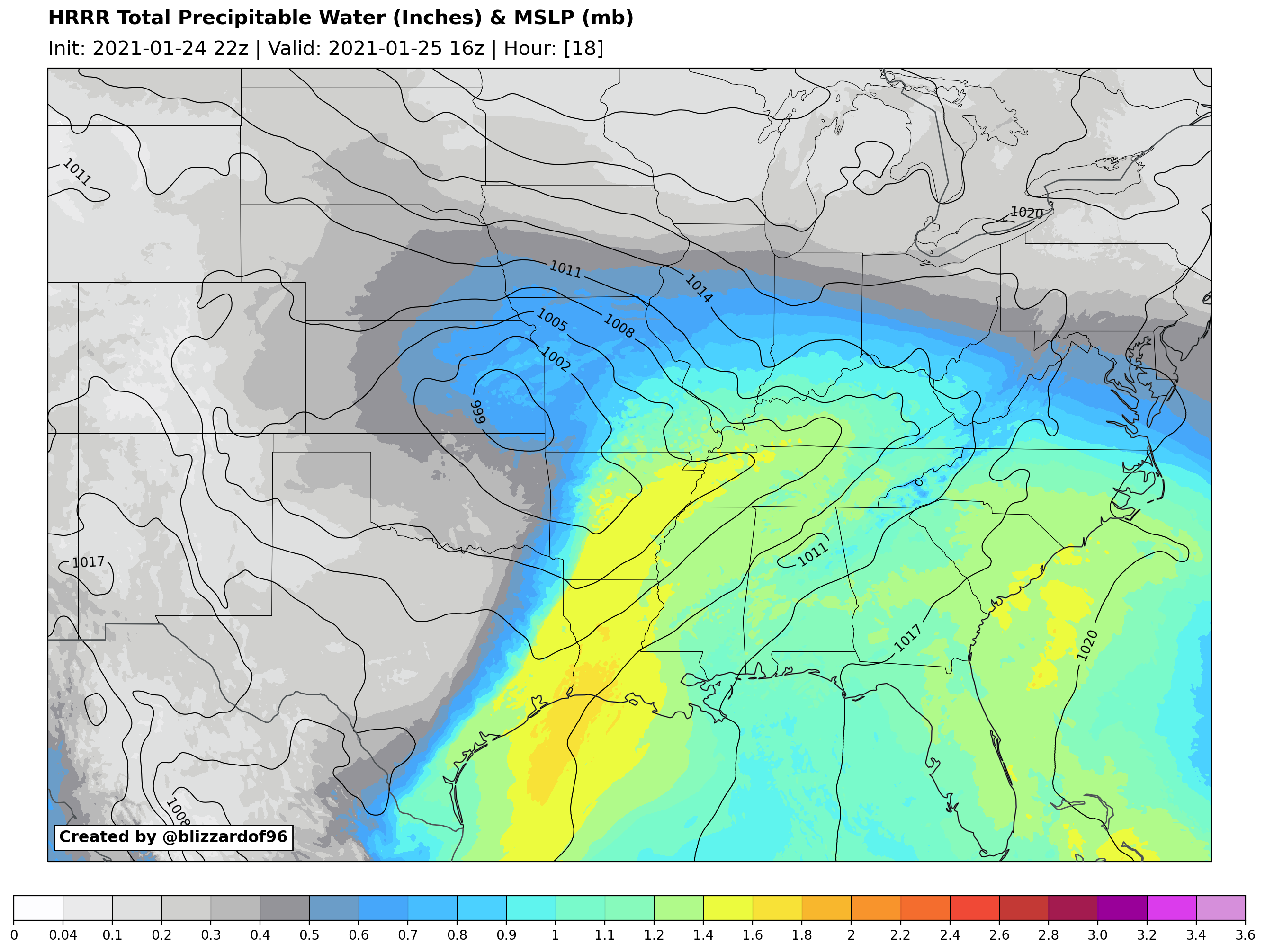
Our Texas low begins to develop tonight. Moisture trajectories look good out of the Gulf of Mexico.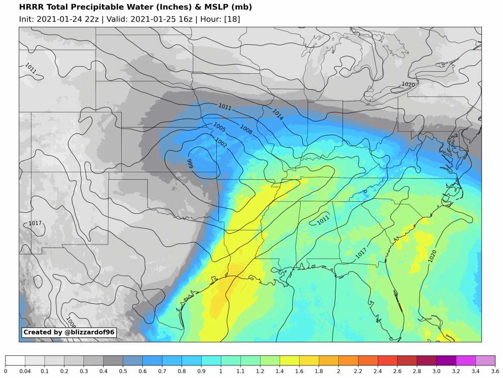
-
Jan 24-26th Potential Something Part 2
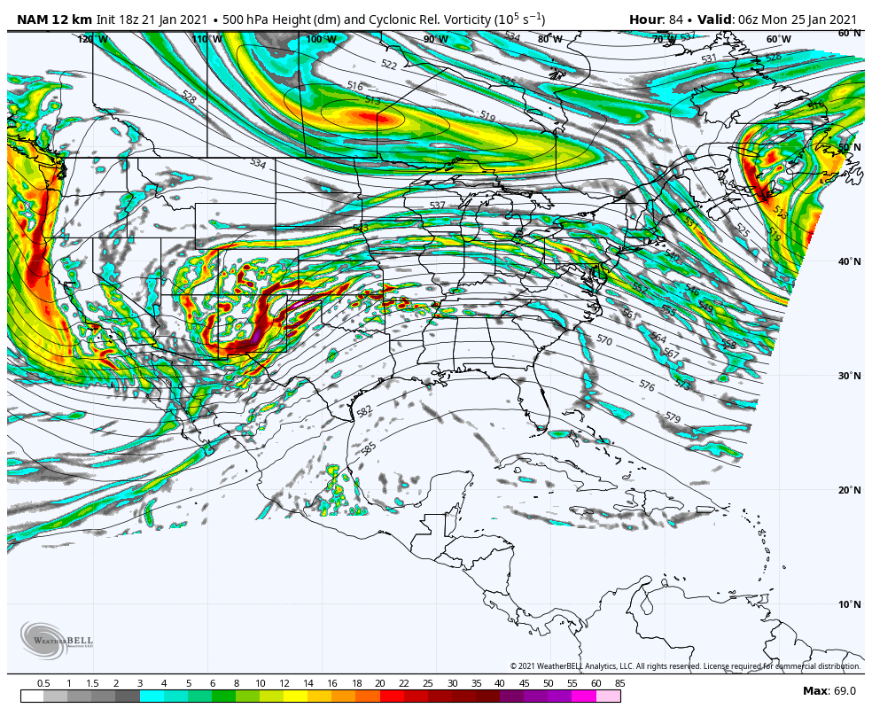
blizzardof96 replied to Chicago Storm's topic in Lakes/Ohio Valley
6z NAM with a significant jump north relative to 0z -
Good points being made. I agree.
-
Two main reasons why the sfc low begins to weaken as it moves east, in my opinion: 1) H5 vort max peaks in strength over the S Plains states 2) Vort max begins to elongate/stretch/weaken as it becomes under the influence of the Quebec confluence zone
-
Could be some convective feedback on this run pulling the low a little bit too far NW into the heavy banding on the NW quadrant. Also might just be representative of the low becoming vertically stacked as the cyclone approaches the occlusion phase.

-
The NAM low track remains south of the Ohio River whereas the majority of 18z EPS & GEFS tracks are north of the ohio river
-
18z EPS

-
It would probably have a low track fairly similar to the 12z GFS. My opinion is that the GFS/NAM shift towards a ECM/GEM/UKMET/EPS look as we move forward.
-
Final frame of the 18z NAM. Taken with a grain of salt but it seems to be further south with the northern stream vortex.