Jump to content

blizzardof96

Professional Forecaster
  • Posts

    1,565
  • Joined

  • Last visited

Everything posted by blizzardof96

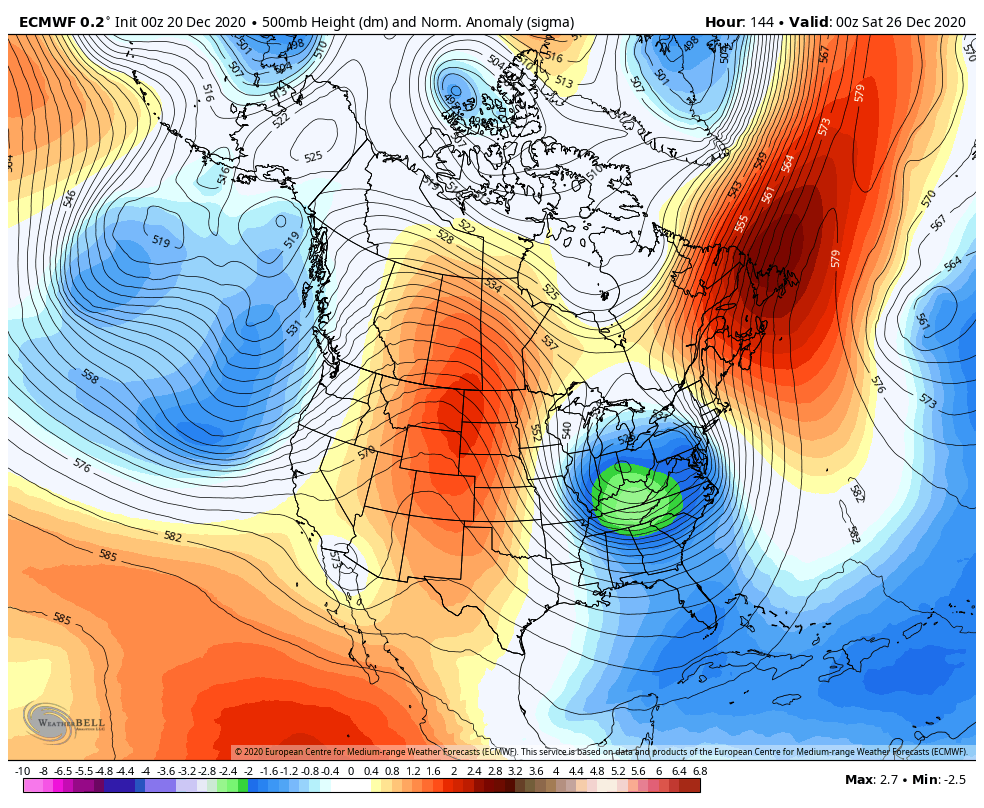
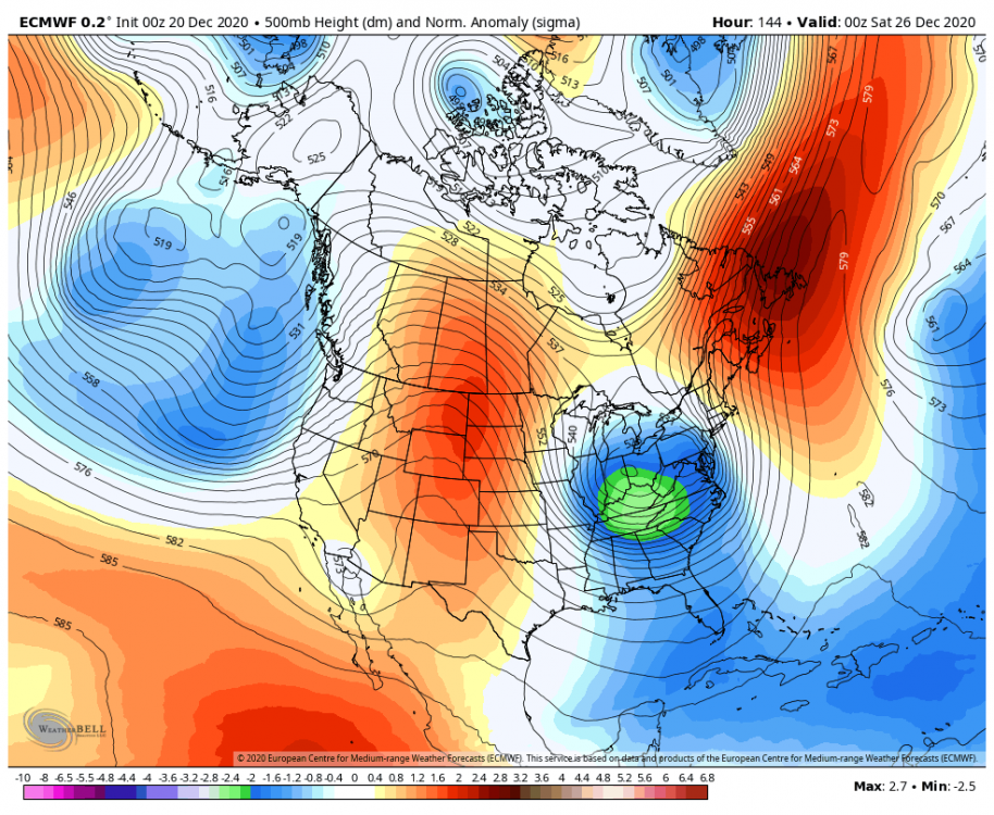
  1. I think we're gonna see accumulating snow from this...possibly significant if things can align correctly. This upper level pattern is generally favourable for our area, especially with the ridge bridge to the north of the upper low. Would like to see more consistency on guidance. A wave is expected to develop as a secondary low along the front, so models will probably struggle with the sfc low track. If track is up the spine of the apps it becomes slightly more challenging as well.
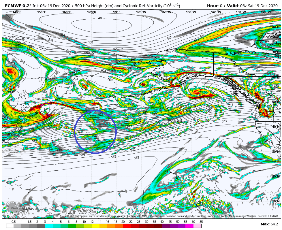
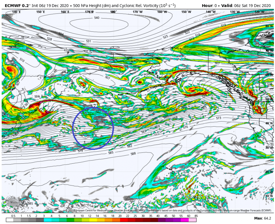
  2. Here's a look at the location of the energy from the time of 6z ECMWF initialization. I suspect model guidance will continue to struggle as the energy is embedded within a broad/complex jet streak out over the North Pacific. The energy is incident on the west coast by ~0z Tuesday.
  3. Interesting to note that the GFS OP is within the Northwest quadrant of the ensemble envelope
  4. Thank you. Nice to be back... hope to chime in from time to time this winter.
  5. For those curious, these are the >3” probs from the other two ensemble suites. 12z GEFS 12z GEPS
  6. NAM has the 12" line sneak through east end of the city (Toronto). I'll eat crow if this verifies.
  7. The weekend system is confusing for a few reasons: 1) Very slow movement of the upper low 2) Highly variable precipitation rates + banding 3) Marginal thermals, causing snowfall accumulations to be dependant on precip rates. Areas with stronger upward motion may win out.
  8. 6z EPS looks pretty favourable for Toronto. It has 60-70% probability of >3".
  9. 12z GEFS mean 700mb RH looks pretty decent from DTX--->YYZ
  10. Video I created which discusses the differences between the CMC and GFS:
  11. Lake enhancement/banding has been really common this season especially compared to recent years. A nice cherry on what’s been a snowy winter for the GTA.
  12. Both NAM and RGEM are developing a LES band through the city of Toronto tomorrow morning into the afternoon hours under an ESE flow. Should be very interesting.
  13. I agree. If the HRRR is correct, the deformation band will start to come together around 5z as the atmosphere moistens, low strengthens and thermal gradient increases.
  14. Nice DGZ depth and omega values are intersecting this layer. This is forecast sounding from HRRR:
  15. As a Toronto snow lover, a low position near Erie, PA is what you want to see. A solid look here.
  16. Environment Canada adds a SWS for the Golden Horseshoe. They're thinking a general 2-4" with up to 6" possible for YHM--Grimbsy--Oakville. This is a tough event to forecast. On the one hand you have good ratios and models like HRRR/RGEM bringing a solid band through between 6z--12z. The NAM however has been further south with dry air dominating.
  17. I’m definitely enjoying UWO, thanks for asking! I’ll be finishing up my BSc in Physics next year. From there I’ll likely be persuing Medicine or Research.
  18. I agree. The 12z NAM setup would be interesting if it pans out with easterly flow and favourable ratios. Will be curious to see what the HRRR shows once it gets into normal 18 hour range.
  19. Definitely some lake enhancement occurring. Bands aiming at the city of Toronto. University is cancelled here in London.
  20. Seeing those lake enhanced bands showing up on KC radar with the strong east wind. Looking at Detroit radar, the dry slot is also pretty aggressive. Don’t think HRRR will even come close to reality with what it’s showing(multiple hours of rain).
  21. YYZ reporting visibility <0.5mi at the 1PM update. Nice look on radar with convergence/upslope flow.
×
×
  • Create New...