

cbmclean
-
Posts
3,062 -
Joined
-
Last visited
Content Type
Profiles
Blogs
Forums
American Weather
Media Demo
Store
Gallery
Posts posted by cbmclean
-
-
Storms seem to be swirling around me in every direction, but none headed my way.
-
A workman-like 1.19" today; 1.63" for the week, 2.69" for the month.
-
Only 0.42" in the bucket today. Hoping fr more tonight.
-
Finally got a decent hit: squeezed out 0.67 for 0.87 for the three-day. If I had just been a few miles east would have been pounded twice today.
-
 1
1
-
-
It's not gonna happen for me today; there's an invisible wall over I-40 that shreds every cell as it goes north. Better luck this week I guess.
-
1 minute ago, cbmclean said:
The I-95 corridor has been shafted so far. I have 0.19" today, only 0.01 yesterday.
Edit. Some nice cells starting to wander in from the south but as of now it looks like they're going to be juuuuust to the east.
-
The I-95 corridor has been shafted so far. I have 0.19" today, only 0.01 yesterday.
-
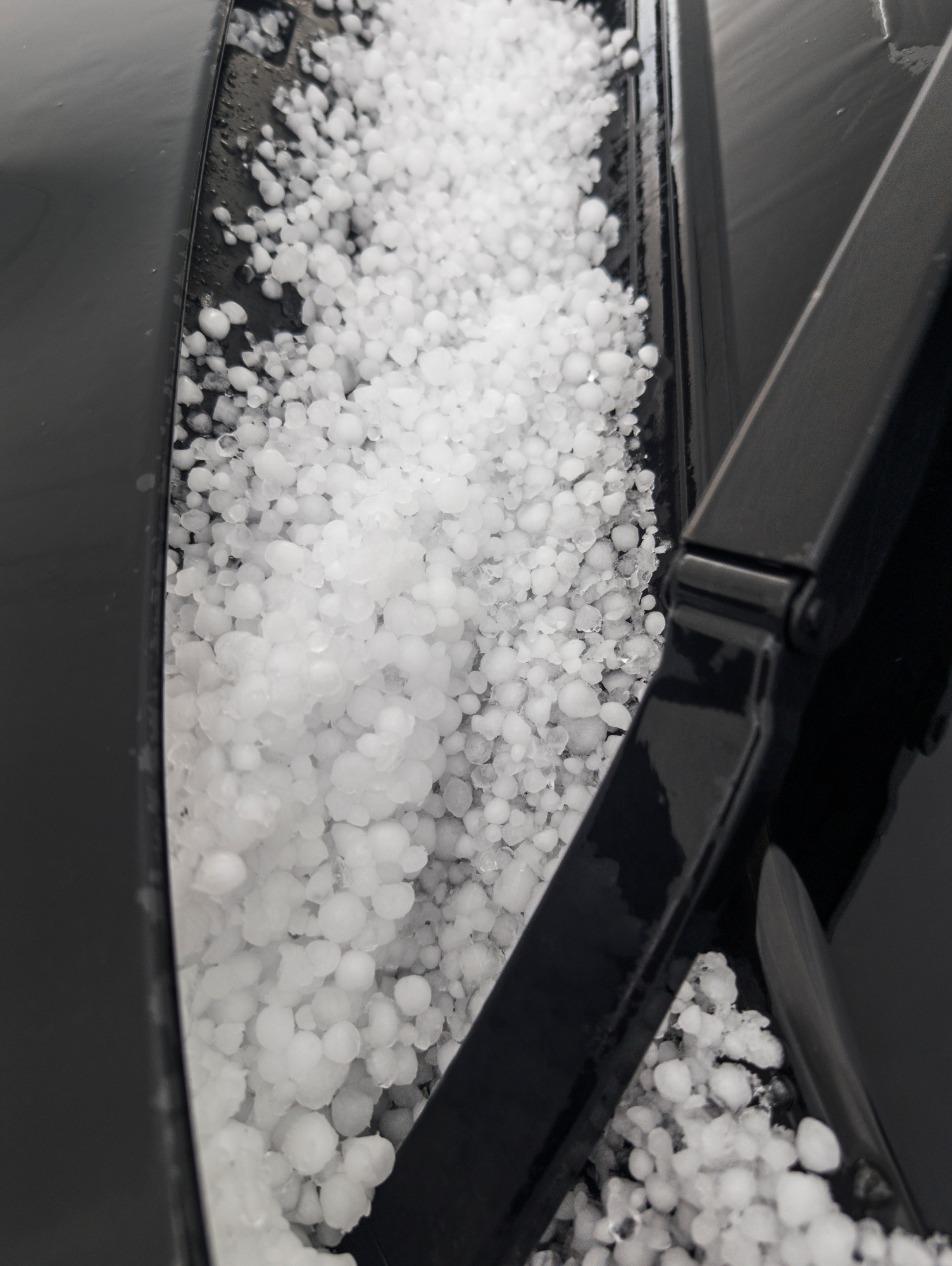
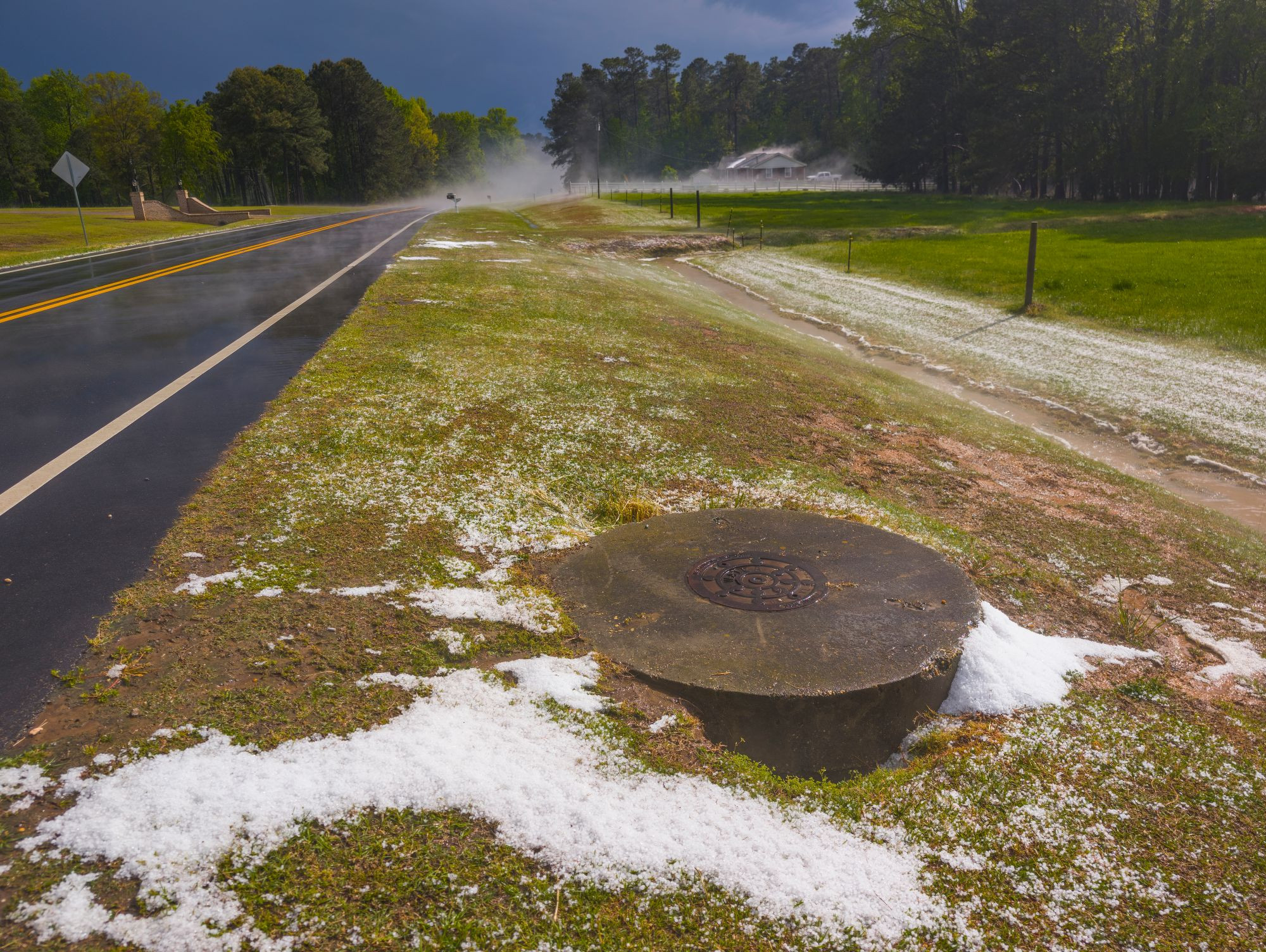
1 hour ago, eyewall said:
Yesterday's storm chase near Spivey's Corner and south of Benson yesterday:
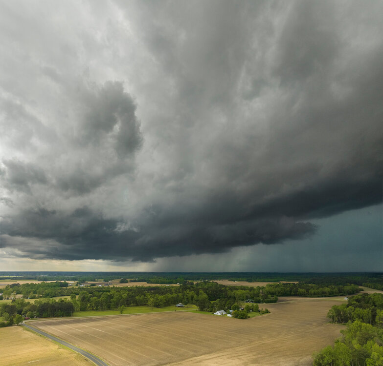
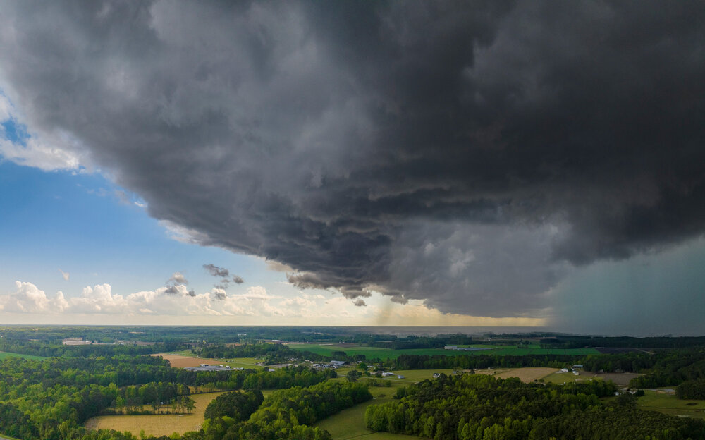
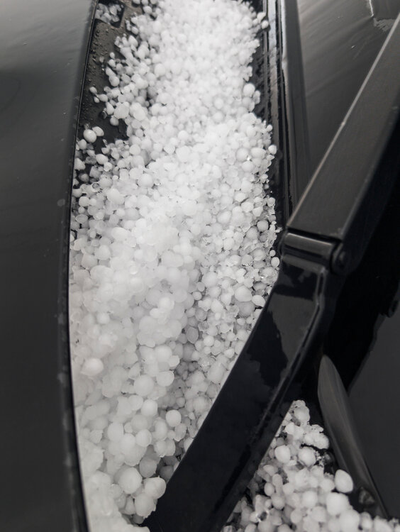
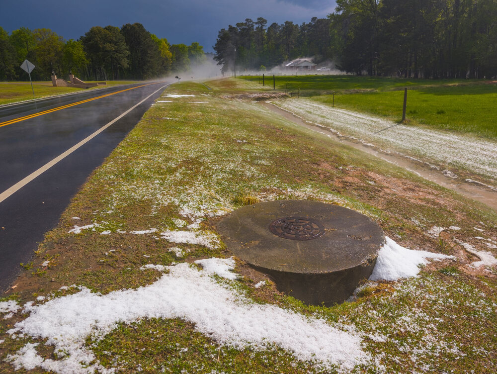
Hail video: https://bsky.app/profile/jeremywx.bsky.social/post/3lmmo7zcokc2zThat's more frozen precip than some winter weather events around here!
-
1
-
 1
1
-
 1
1
-
-
0.69 Thursday/Friday. 2.93 for the week. Grass looking much better.
-
Got down to 37.4. I wonder why the underperformance. I noticed some clouds int he sky this morning. Did some unexpected cloud cover develop?
-
What's the over/under on the RDU offset tonight? Will they get below 37?
-
1
-
-
2.24" here. Much needed.
-
The line split right over my house Got .09 from this mornings crumbs Better than nothing.
-
Ended up with 1.72 for the event
-
Best rain of the day here so far. 1.11" in the bucket
-
Got 0.92 in a short period.
-
Nasty looking squall line on the way
-
4 hours ago, psuhoffman said:
I’m not really in the mood but it’s likely going to be cold and miserable from March 15-April 1 so we might as well root for a fluke snow event. Even if it’s unlikely and probably just ends up some messy event that lets us down.
Aren't you going to be enjoying the frozen tundra of Northern Vermont during some of that time?
-
18 minutes ago, Interstate said:
Yeah... I do not know why you have to push your political opinion on people that come here for weather. I know he was posting it in banter... but I come here to get away from the real world...not to have someone push their political views on me.
Also, he didn't delete his account... so he will be back. You can look at his account, and see he logged in 50 minutes ago... more like a power type move that backfired.
His assertion is that there comes point where the "situation" becomes bad enough such that a desire get away from the real world is not ethically valid. Obviously whether or not a situation has reached that point is a subjective judgment. He judged that it had and acted accordingly. You can disagree with the premises but the logic itself seems valid. In any event he made his choice and i respect it.
-
2
-
 1
1
-
 1
1
-
-
I like every season in its time. I feel very fortunate to have had a real winter this year (by SE standards) and I'll enjoy spring.
-
11
-
-
I'm actually impressed at how hard the snow has been hanging on in the shady spots. That was a genuine winter interlude. Would love to see the same precip and temps happen in late December next year!!
-
13 minutes ago, Scarlet Pimpernel said:
Mimosas...served by Jesus! But I shouldn't bring religion in here (unless snow counts as a religion!).

Jesus would make a mean Mimosa out of a glass of water.
-
1
-
-
3 hours ago, StantonParkHoya said:

At that point I'm fine with it.
-
52 minutes ago, StantonParkHoya said:

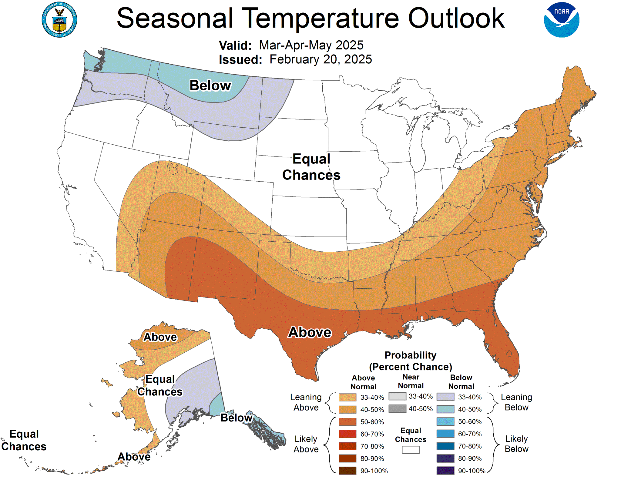
Meh that's stock Nino spring.


May 2025 Obs
in Southeastern States
Posted
0.13" today for a workman like 1.28" for the week and a workman-like 4.37" for the month. Got rain on 5 of 7 says this week but mostly just crumbs.
5/27 0.86"
5/28 0.02"
5/29 0.06"
5/30 0.21"
5/31 0.13"