It's Always Sunny
-
Posts
1,947 -
Joined
-
Last visited
Content Type
Profiles
Blogs
Forums
American Weather
Media Demo
Store
Gallery
Everything posted by It's Always Sunny
-
He gone.
-
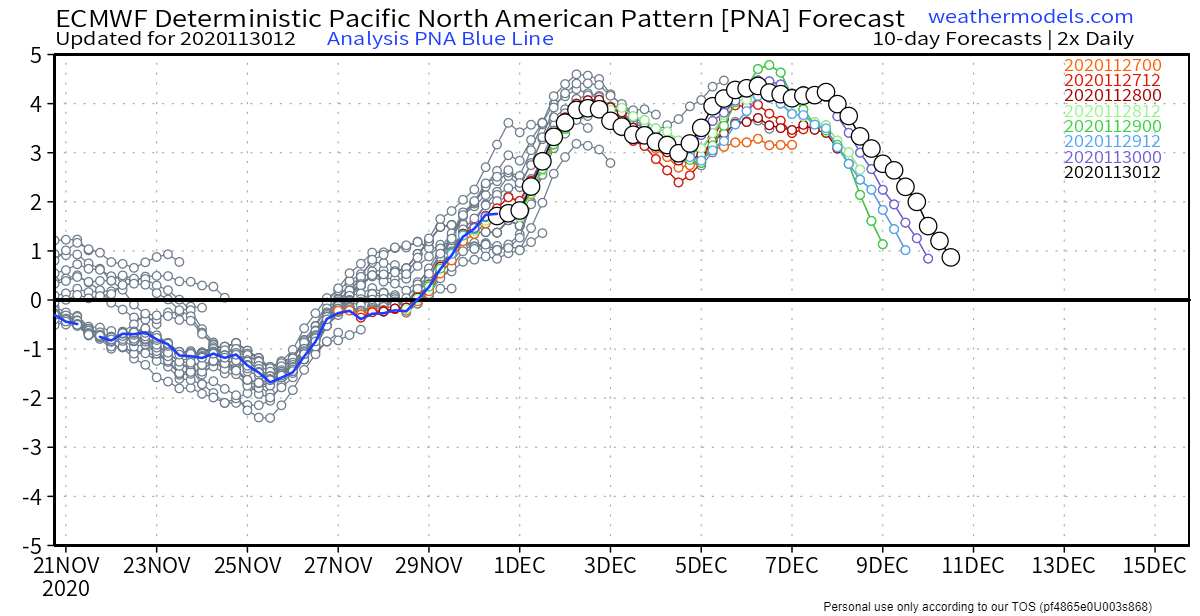
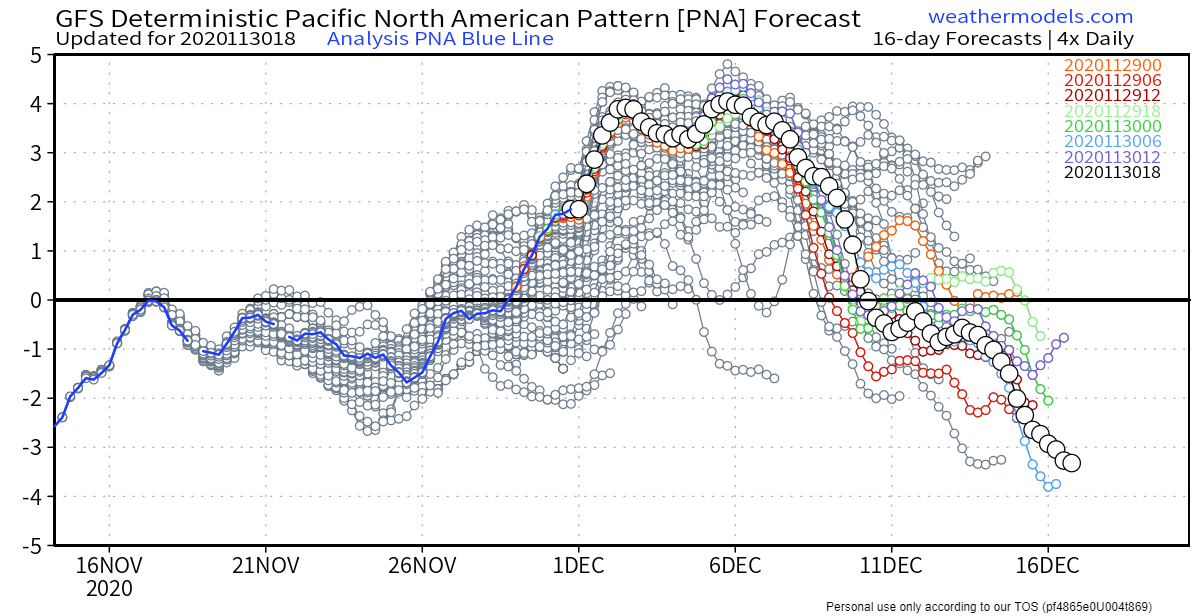
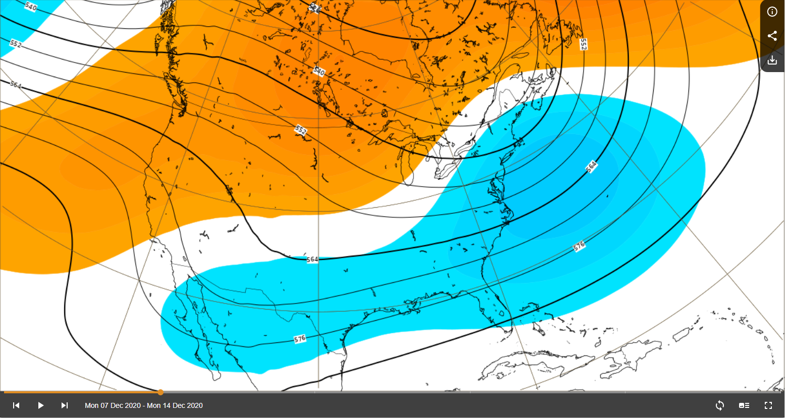
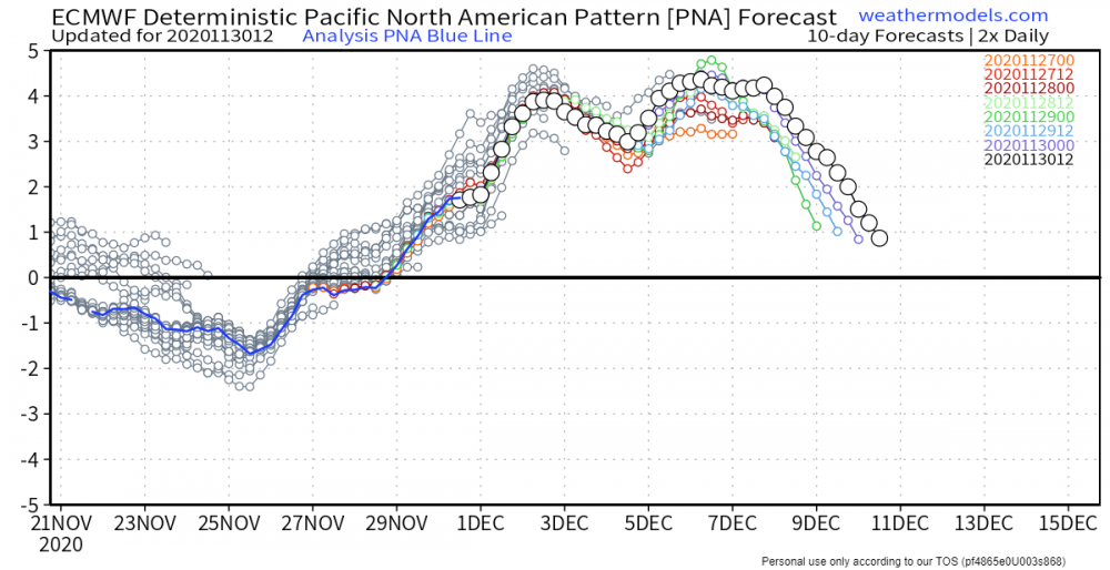
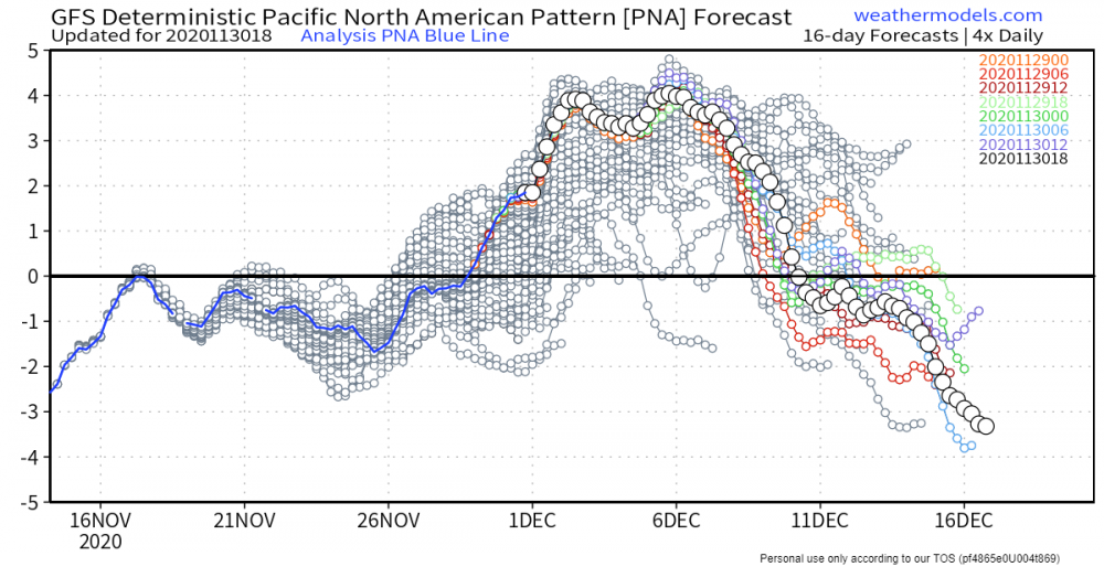
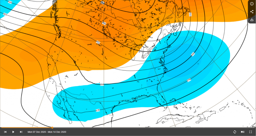
Absolute needle in chest PNA outlook through first couple weeks of December which bodes well. NAO also looks to continue its negative trend which is good.
-
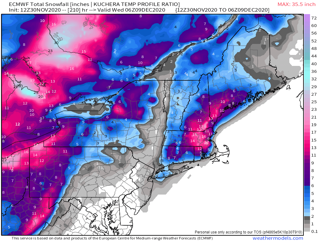
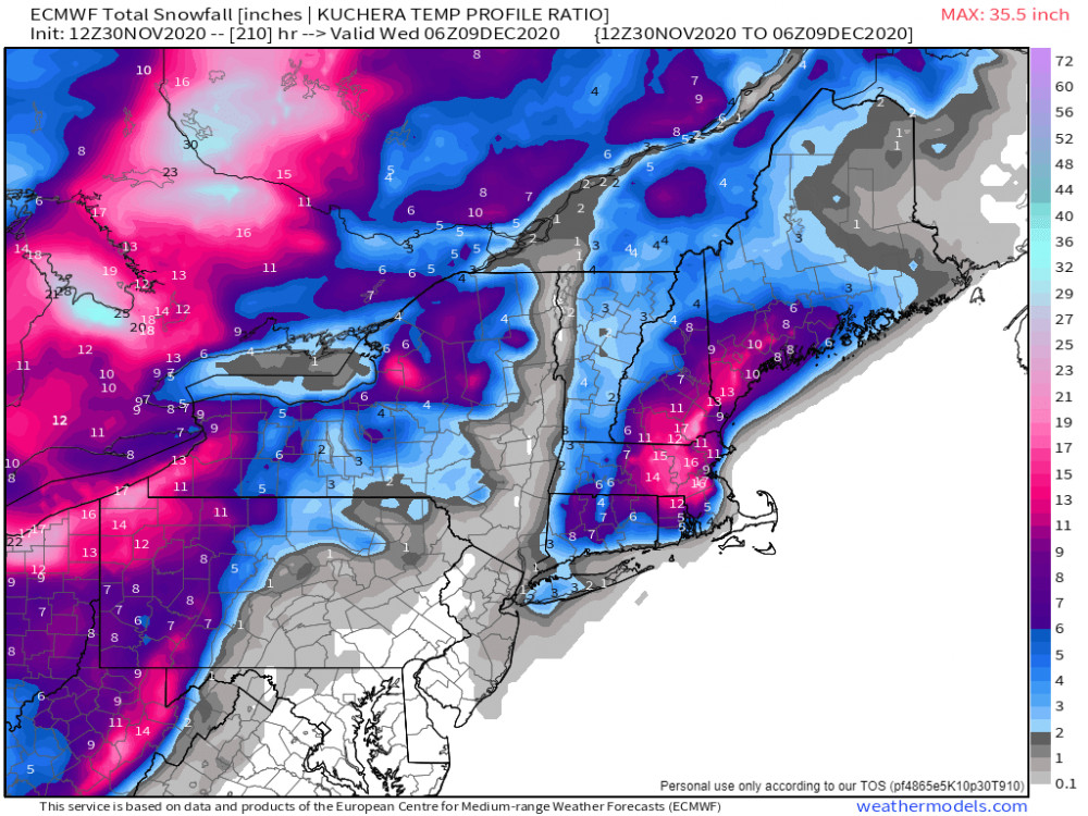
Really rooting for you guys up that way. Those along 495 & Worcester Hills have potential to do really well if this were to materialize. EPS members still have large spread so keeping expectations in check but synoptic pattern is there for sure.
-
Lock it in.
-
 Starting to see some pictures of likely tornadic damage there. Love Field was under a tornado warning for some time too but no tornado (thankfully).
 -
Curious to see the westward extent of that band. I think the NAM is on the high end but I think areas that do get banding could definitely see 5"+.
-
November 2020 General Discussion
It's Always Sunny replied to SchaumburgStormer's topic in Lakes/Ohio Valley
Just wow...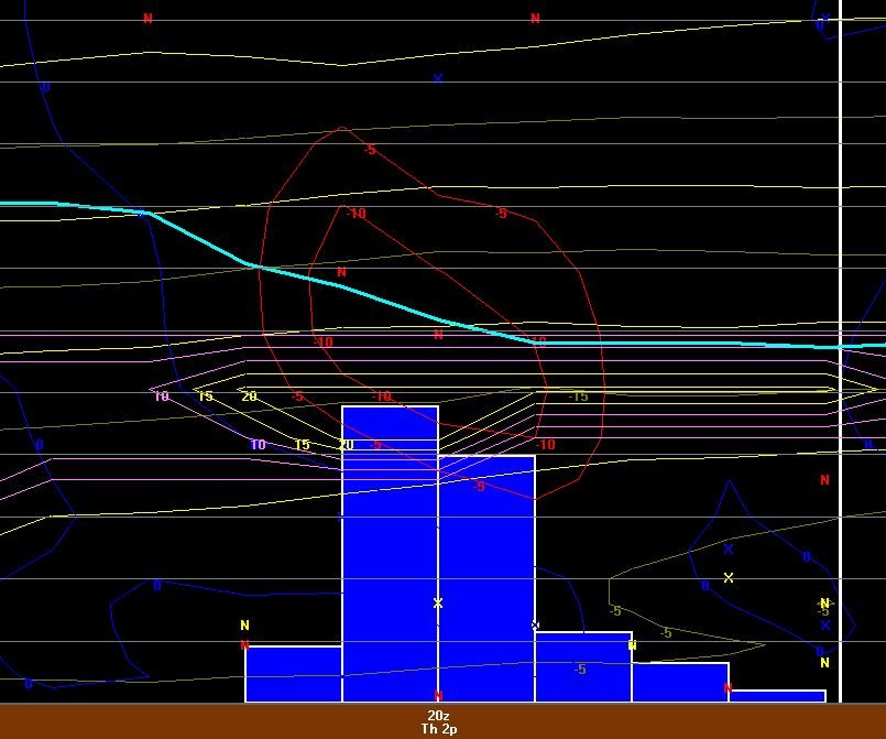
-
November 2020 General Discussion
It's Always Sunny replied to SchaumburgStormer's topic in Lakes/Ohio Valley
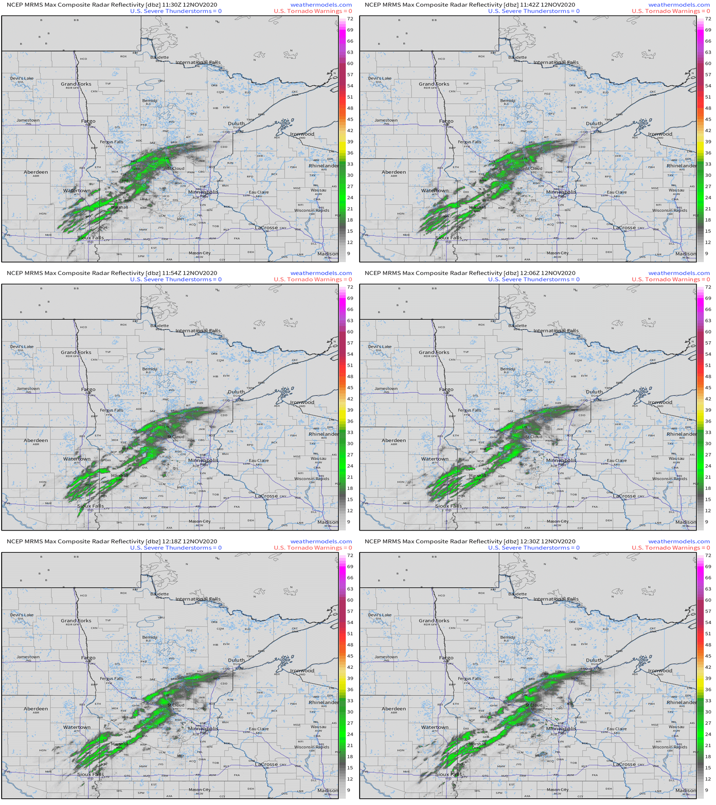
Buffalo, MN reporting 2.5". So cool! -
November 2020 General Discussion
It's Always Sunny replied to SchaumburgStormer's topic in Lakes/Ohio Valley
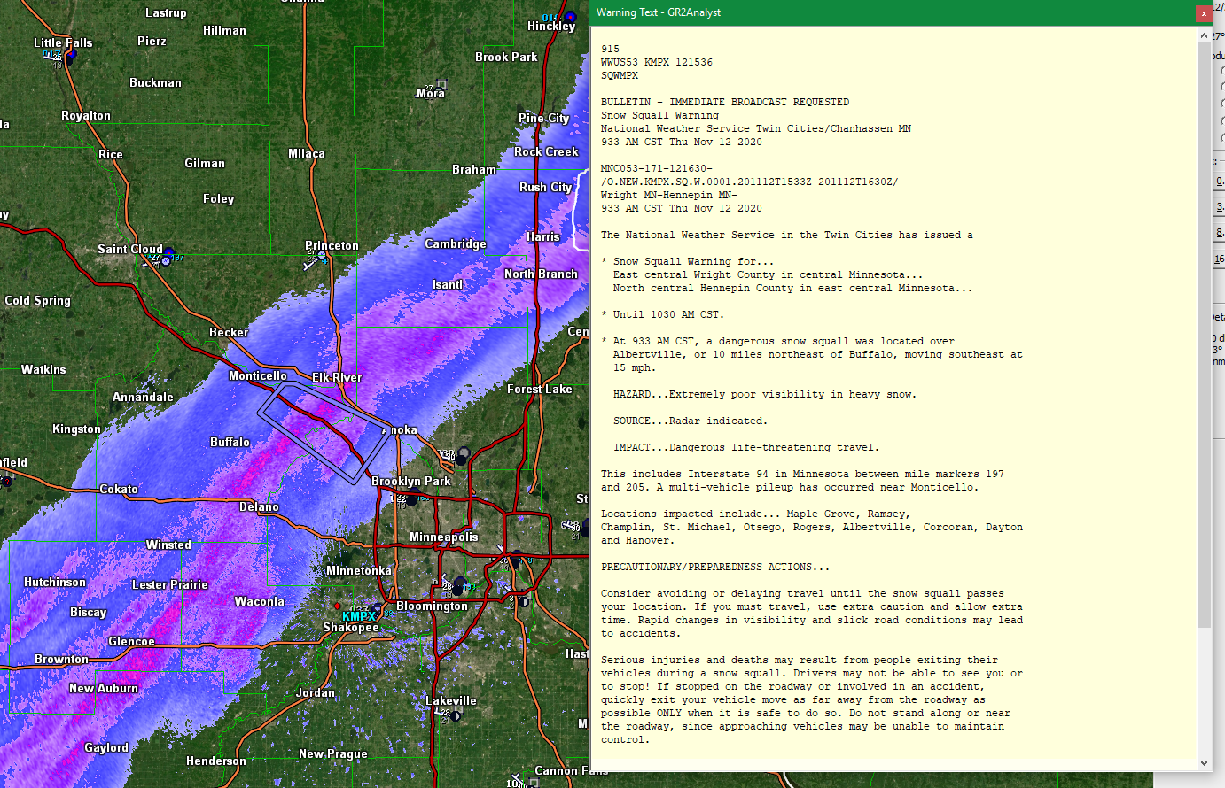
Snow squall warning currently out for parts of Wright/Hennepin counties. +SN on the way!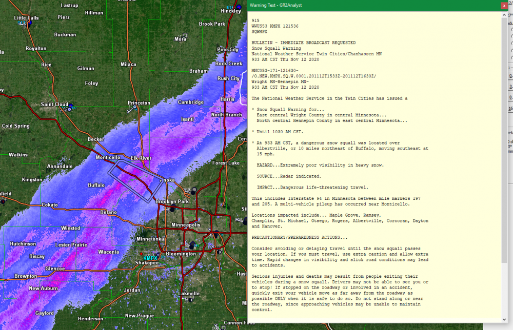
-
November 2020 General Discussion
It's Always Sunny replied to SchaumburgStormer's topic in Lakes/Ohio Valley
MSP could pick up a quick inch, maybe even two later this morning and afternoon with what (I think?) is an anafront (could be off on that). I think a brief period of moderate snow is in the cards.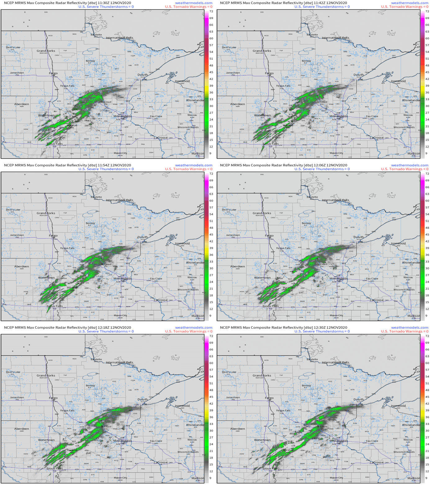
-
November 2020 General Discussion
It's Always Sunny replied to SchaumburgStormer's topic in Lakes/Ohio Valley
Agreed, and it had it linger for several hours as well before getting shunted north and east. Cute pup btw! -
November 2020 General Discussion
It's Always Sunny replied to SchaumburgStormer's topic in Lakes/Ohio Valley
Nice! That mid-level dry slot hung on once the warm nose eroded which allowed FZRA to continue into early evening. I don't recall the GFS having that but I think hi-res models did. MSP METAR had 0.23 liquid reported during that mixed precip phase so it's fair to assume that would've been around another 2-3 inches had that been snow. -
November 2020 General Discussion
It's Always Sunny replied to SchaumburgStormer's topic in Lakes/Ohio Valley
Looks like MSP got around 6". Personally I'm surprised given how much wintry mix they got earlier in the day. Banding did work considering MSP got ~0.2" more liquid than models had. -
November 2020 General Discussion
It's Always Sunny replied to SchaumburgStormer's topic in Lakes/Ohio Valley
Yeah it may teeter-tot a bit before it flips to all snow (hopefully) around 1-2pm CT. National Weather Service has it flipping to all FZRA at 2pm through 6pm but I'm just not seeing it. -
November 2020 General Discussion
It's Always Sunny replied to SchaumburgStormer's topic in Lakes/Ohio Valley
Pesky warm nose probably going to chip into what was once looking like decent snowfall for MSP: -
Fall Banter and General Discussion
It's Always Sunny replied to Baroclinic Zone's topic in New England
I'm okay with bringing him back. Red Sox needed some good news in 2020. I think he's a good manager despite the cheating scandal. It's like A-Rod using roids. Dude didn't need em he was good already just made a dumb decision. -
Fall Banter and General Discussion
It's Always Sunny replied to Baroclinic Zone's topic in New England
Well depending on the status of Covid I'll have to check out their location on the Cape next summer. The plan is to be up there in June for a week to see family . I've heard the microbrewery scene has really taken off over the past 3-4 years or so. -
Fall Banter and General Discussion
It's Always Sunny replied to Baroclinic Zone's topic in New England
I've heard this is a popular brewery up in MA. Near Sturbridge village? Now on the Cape? -
Fall Banter and General Discussion
It's Always Sunny replied to Baroclinic Zone's topic in New England
You nursing Organic Michelob Ultras now? -
I enjoy the rapid succession of the fronts as well mainly because it's a rinse & repeat pattern when moisture pools up here in N TX; a good way to reset. I enjoy the warm temperatures though so I probably won't be saying this a couple months from now, haha. From a meteorological standpoint they're fun to anticipate because if they don't bring something as simple as strong N/NW winds and a 10-30F temperature drop in a matter of hours they bring the chance of thunderstorms (potentially severe) or some sort of wintry surprise. When looking ahead at the long term pattern it's tough to pinpoint how often we'll see these, but as long as we have some sort of ridging in the Pacific we should be susceptible to these. Weekend should be good overall. Looks like a slight chance of thunderstorms late Sunday into Monday with another fropa but appears isolated and mainly east of DFW.
-
2020 Atlantic Hurricane Season
It's Always Sunny replied to Windspeed's topic in Tropical Headquarters
Yeah some PVS induced LP I wouldn't put any stock in that solution right now. GFS solution is more realistic. -
Delta now a Cat 1
-
I still think it's pretty on point. 12Z winds did really well so I buy into what it is selling. I am interested to see how much Delta is affected once it moves over the YP because that will set the baseline of how much/fast it can recover once it re-enters the GoM.
-
2019 ENSO
It's Always Sunny replied to AfewUniversesBelowNormal's topic in Weather Forecasting and Discussion
What I meant by record setting is top 10-15 I should've phrased that differently. 2003 had 543, 2004 had 509, 2008 had 462. May 2011 would be 9th most active May. May 2010 is actually 12th but still impressive in my opinion. -
2019 ENSO
It's Always Sunny replied to AfewUniversesBelowNormal's topic in Weather Forecasting and Discussion
I was just referring to how active they were. 2010 had record setting May (304) & June (324) numbers. 2011 had a whopping 758 tornados in April (highest ever on record) and May had 326 which was also amongst the highest. You're right about 2012 relatively speaking.