

Upstate Tiger
-
Posts
542 -
Joined
-
Last visited
Content Type
Profiles
Blogs
Forums
American Weather
Media Demo
Store
Gallery
Posts posted by Upstate Tiger
-
-
7 minutes ago, olafminesaw said:
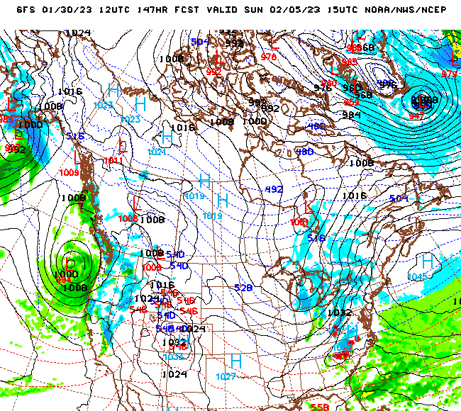
The trough that will become our ULL is currently pushing through New Mexico

Has it been sampled??
 . Not paying attention to any forecasts until the Chinese ballon samples it.
-
 6
6
-
-
1 minute ago, wncsnow said:
Here we go with the northern trend. Not going in the right direction
Yep, don't like that track. Hope Matt chimes in again...
-
Looks like the mountains and Tennessee about to get NAM'd.
-
I think the forecaster at KGSP said it best in this mornings AFD “we will likely have to go right to the eve of the event to determine precipitation types”. Complicated dynamics. Oh what I’d give for a 1038 over western NY.
-
 3
3
-
-
Nothing particularly concerning to me on the 18z. Track means everything here. We’re 4 days out.
-
1
-
-
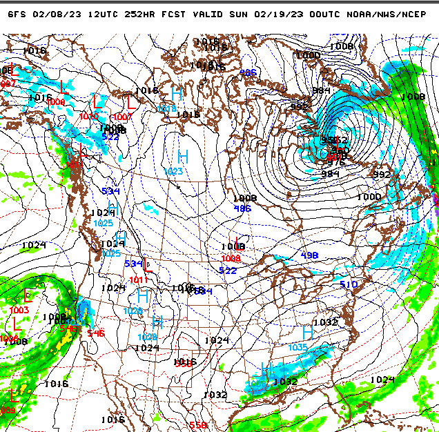
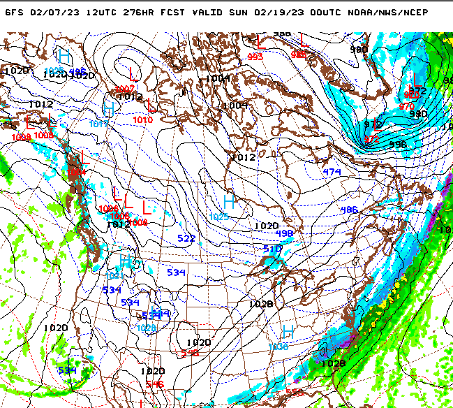
If the GFS is further west with a couple of runs, I’ll call it a trend. But since the others are catching up to what it has shown for days, I’m going to reserve judgment.
-
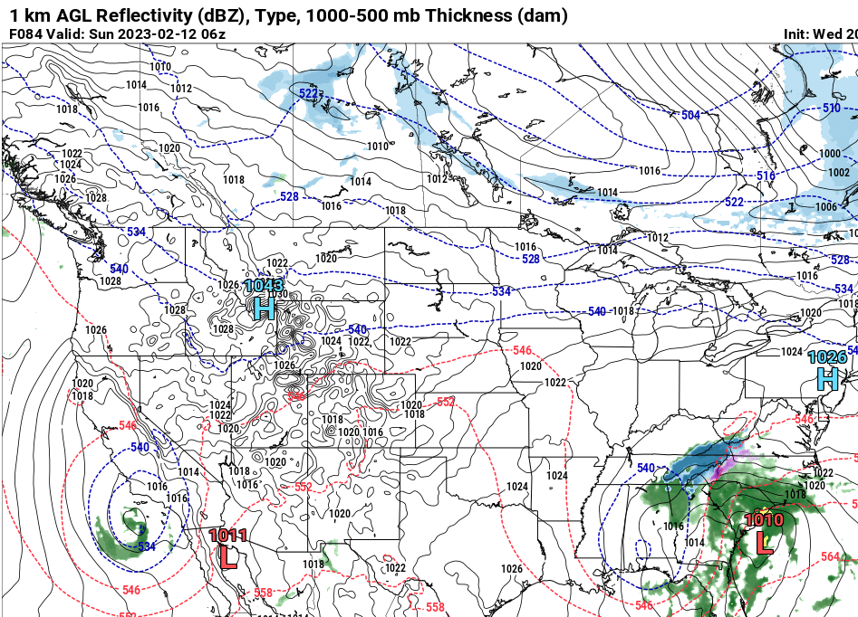
84 hour NAM
-
3 minutes ago, buckeyefan1 said:
For now, I'm saying middle of the road between the gfs and euro as we all know the euro loves to hold stuff back. Still plenty of time for it to go either way
")
About to write the same thing. That would be a smart play at this point. This is the best Euro operational run yet. Tomorrow afternoon should give us some sort of sense plus we start getting in NAM range.
-
2
-
-
You can hear the Euro groaning as it begrudgingly yields to the GFS
-
3
-
1
-
-
Not that I am hedging my bets or anything....
but still a signal for something to follow next weekend in case ya'll try and run me out of town this weekend.
-
3
-
2
-
-
OK. Added thread. Maybe Buckeye or someone can pin it...
-
2
-
-
Here you go! The last ULL I was in was March 2009. Hope this is repeat!
-
10
-
-
2 minutes ago, HWY316wx said:
Everyone from GA to NC will have to look at snow totals fast as temps climb quick as it exits stage right.

True, but I remember the Monday after the great Sunday President's Day Blizzard of 1979, temps climbed to 46 the next day.
-
2 minutes ago, olafminesaw said:
@Upstate Tiger posted the first map of this threat. He can take it home?
Sure! After all, this winter storm is looking more probable than us beating the Heels in Chapel Hill this weekend.
-
3
-
-
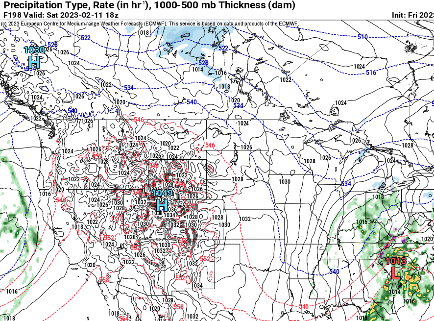
KGSP AFD for the weekend
.LONG TERM /FRIDAY NIGHT THROUGH TUESDAY/... As of 215 pm EST Tuesday: Considerable uncertainty remains over the handling of the upstream trough axis crossing the Mid-Mississippi River Valley Friday night. The 12Z GFS continues to feature a 500 mb low center cutting off and migrating over the Deep South on Saturday. The GEFS spread is quite large, however, and the NAM/CMC feature either a more northerly track of the low or an open wave. Until recently, the ECMWF runs have had a much more progressive, positive tilt, open wave moving through the Appalachians. Recent ECM trends, however, have been slightly toward the deeper and more dynamic operational GFS, and this has some implications for wintry weather potential over our area this weekend. For now, the forecast has been nudged slightly wetter through the Saturday night/Sunday morning period. This keeps mountain northwest flow snow showers solidly in the forecast Friday night through Saturday night, but also creates low end potential for a wintry mix east of the mountains through Sunday morning. Confidence remains very low on this and ensemble mean solutions still do not support much of any accumulating snow east of the mountains over the weekend. -
Euro trended better for sure. Still did not go full GFS.
-
1
-
-
11 minutes ago, NorthHillsWx said:
For posterity’s sake- the 12z CMC trended much better than previous runs. Much more neutral tilt and slower. Not as amped as GFS and obviously doesn’t get it done with the dynamic cooling (what this entire setup relies on) but it’s another model suite that actually looks very similar to GFS at upper levels than just a few runs ago
Yep. Curious to see the Euro shortly. It had this setup a couple of days ago but backed off.
-
1
-
-
2 Sundays in a row! I am ashamed that some of you people have already thrown in the towel!
-
3
-
-
6 minutes ago, eyewall said:
Lock it in!

I'll start a thread...The Great 2023 Valentines Weekend Blizzard
-
2
-
3
-
-
9 minutes ago, NorthHillsWx said:
Strangely a cool pool ULL snow event seems more plausible than snow by normal means in this sh*t pattern. We can’t do normal right so how bout we try the ‘exotic’ look? About a 1/100 chance of this happening as GFS is really the only model onboard but hey, that’s probably the closest to digital snow anyone in this forum has gotten this year!
GEFS has several members showing more southern solutions, btw. Still very, very low probability
Would love to see another March 2009 event. We got 8" of heavy wet snow in the upstate with very intense thundersnow. I was driving back from Columbia that Sunday evening and it was blinding. Thankfully I had 4WD. That was a ULL event.
-
2
-
-
Does next weekend have legs???....Probably more like a toenail but both GFS and Euro show something to watch at least.
-
3
-
1
-
-
38 minutes ago, strongwxnc said:
Its tough for sure...
We’ve had a lot of cold dreary days this winter. Very few golfing days since November and when we did, the course was very wet
-
58 minutes ago, GaWx said:
Fwiw, the 18Z GFS, like the 0Z, has what may be a real live major SSW on it late in the run fwiw. For those curious, check out the N Hemispheric maps at 10 mb late in the 18Z/0Z GFS runs to show what I'm seeing. They show a significantly displaced SPV along with massive Arctic strat warming. These are both bordering on a 60N wind direction reversal from W to E, especially the 18Z.
I swore this winter if I caught myself relying on SSW, I’d throw in the towel but here I am!
GW is that the reason we’re seeing those crazy HP readings in Canada on the GFS starting mid-month? I’m seeing highest I’ve seen all winter.
-
1
-
-
I know, I know, why keep torturing myself with hope?

February 11-12 ULL Winter Storm
in Southeastern States
Posted
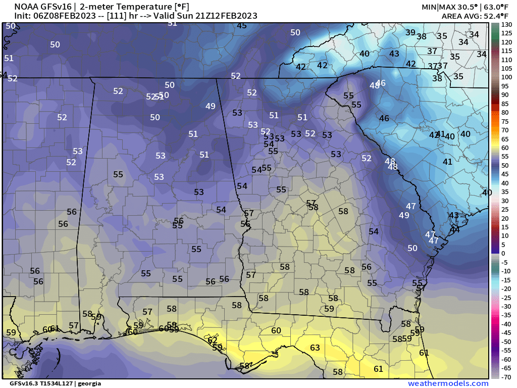
Just got a peak at the Euro. Hospital occasionally expects me to do some work. They're funny that way. I actually like that track and it's more in line with what Snowgoose was saying. I think anyone between I 75 and I 85 is still in play.