wxmeddler
-
Posts
6,872 -
Joined
-
Last visited
Content Type
Profiles
Blogs
Forums
American Weather
Media Demo
Store
Gallery
Everything posted by wxmeddler
-
In the places that got at least 2" of snow cover? Easily.
-
Sniffing the god*amn ozone tonight. My goodness.
-
Back from a weekend in NYC, and I've missed a 50+ page thread! Darn! Gonna be a cold one tonight! Hopefully the wind dies.
-
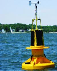
The snow depth sensor uses an echo-location ping (think bats/dolphins) to determine the depth. We've noticed that sometimes a big "spike" happens because the ping bounced off a snowflake(s) just below the sensor. This makes the sensor think that the snow top is right beneath the sensor. We have a few ideas of how we might remedy this, but we're pretty sure we're not going to be able to solve it completely. Humans with eyeballs are much more reliable!
-
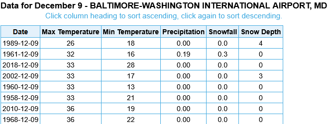
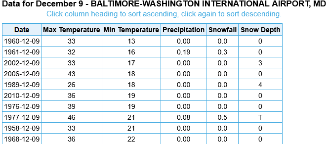
If BWI for the High stays at 32, it will be 2nd coldest high for 12/09 on record. Edit: Also 2nd Coldest Min Temperature with 14 this AM
-
Apparently there is no fun allowed in Harrisonburg.
-
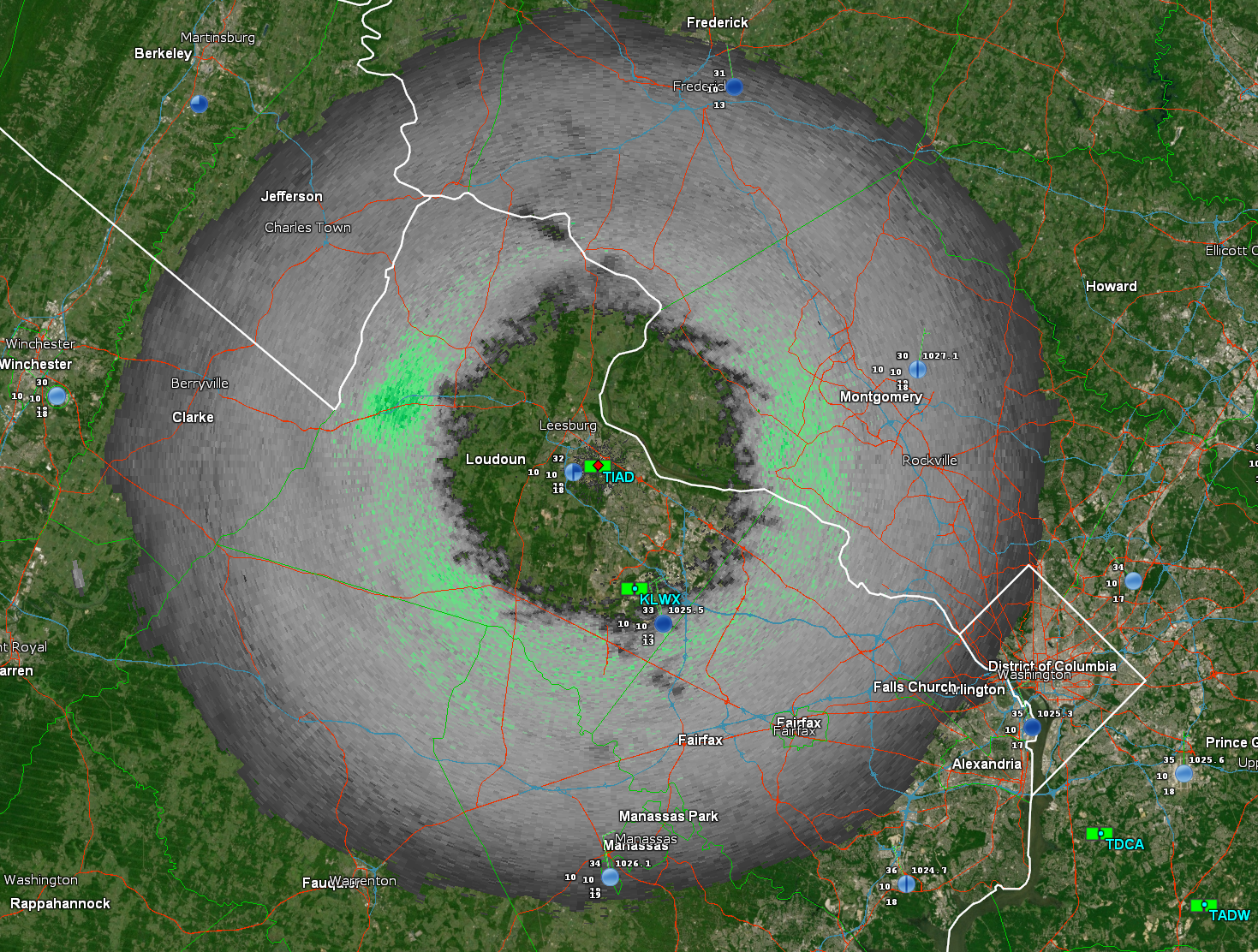
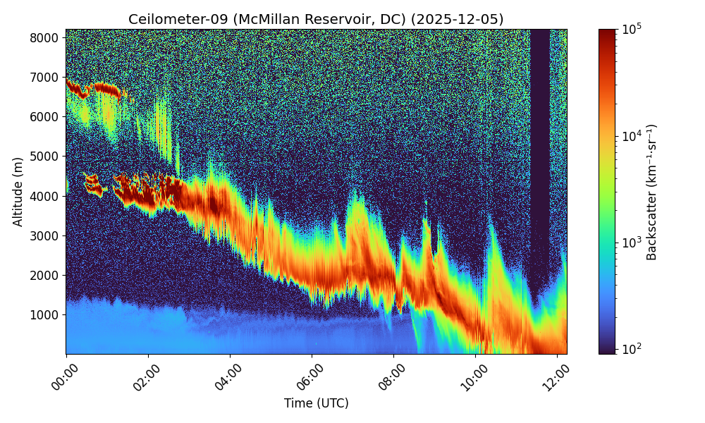
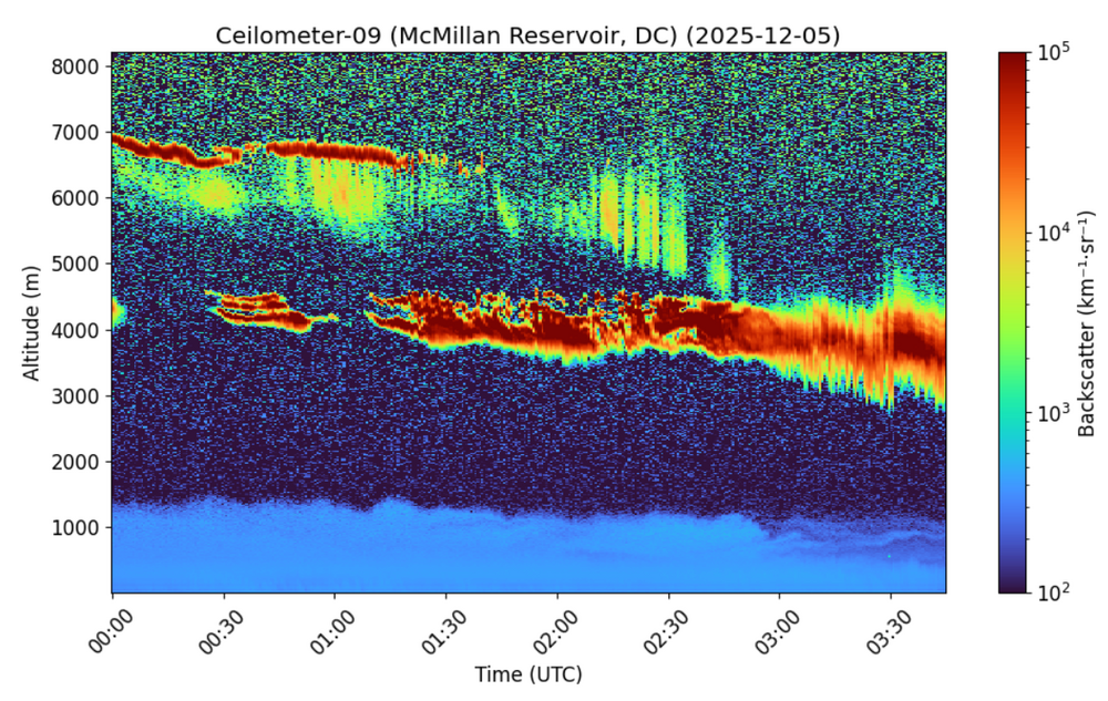
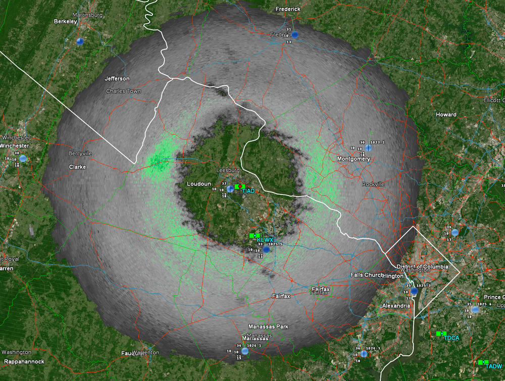
There was fairly steady contraction in the virga hole on the north side of KLWX which is upstream of even northern MoCo/HoCo. The signs were there that it was gonna do the thing.
-
December 5th Magic is back baby! Jebwalkin’ time.
-
It took 8 hours, but it got it done!
-
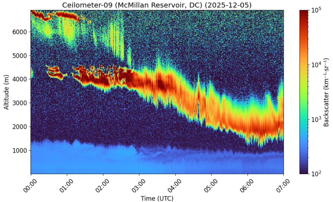
Woke up to check progress. Snow was getting steadily closer to the surface for the past 4 hours, but has stalled a bit in the last hour. It's trying to go through the really dry layer now.

-
Reading the METAR and watching the OVCxxx trend lower is the poor man's ceilometer.
-
Unless you got a radar I don't know about. The airport has a celiometer, but it just reports the first layer of strongest returns.
-
Randy, I'll have you know that I glaze my donuts them to perfection. No crust here.
-
So begins the painful watching of the dry air getting eroded.
-
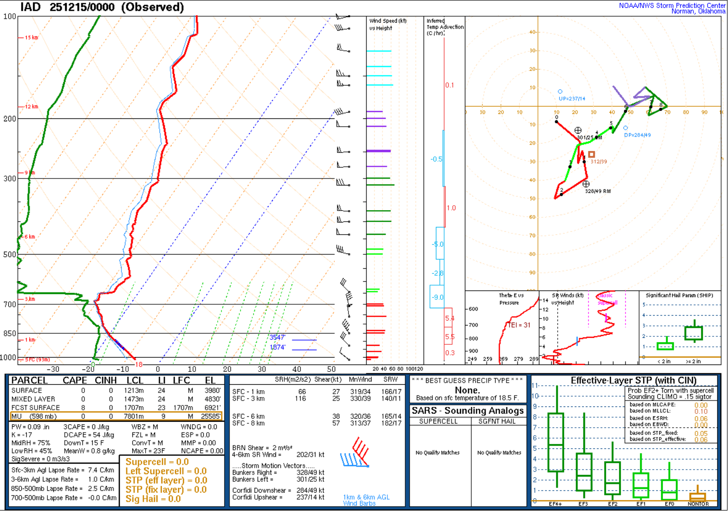
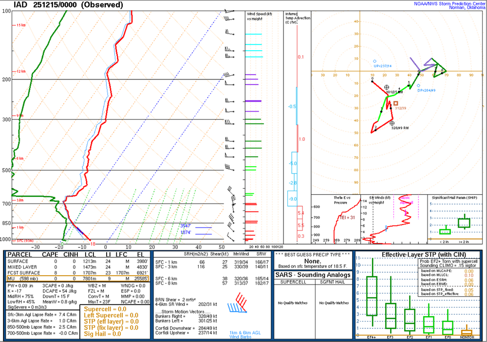
Birdie told me that the 00z LWX Balloon recorded a RH of 3.7% RH at 1300m AGL tonight.
-
s/w over central high plains is notably more pronounced in past few runs of GFS helping our poor flattened out s/w get slightly more ageostrophic winds overhead us. Now, that says nothing about the metric ton of dry air between 925 and 850 left behind by the passing subsidence/high. You can have all the lift at 500 in the world and still not get precipitation at the surface if your spread at 925 is -5/-30.
-
Welcome. Don't let the 's scare you. In the end it's just frozen water. The journey is sometimes more exciting than the event.
-
I may be a simple man, but I see this (Euro Ensemble) for a daytime event in the 1st week of December. I'm not complaining (edit: yet).

-
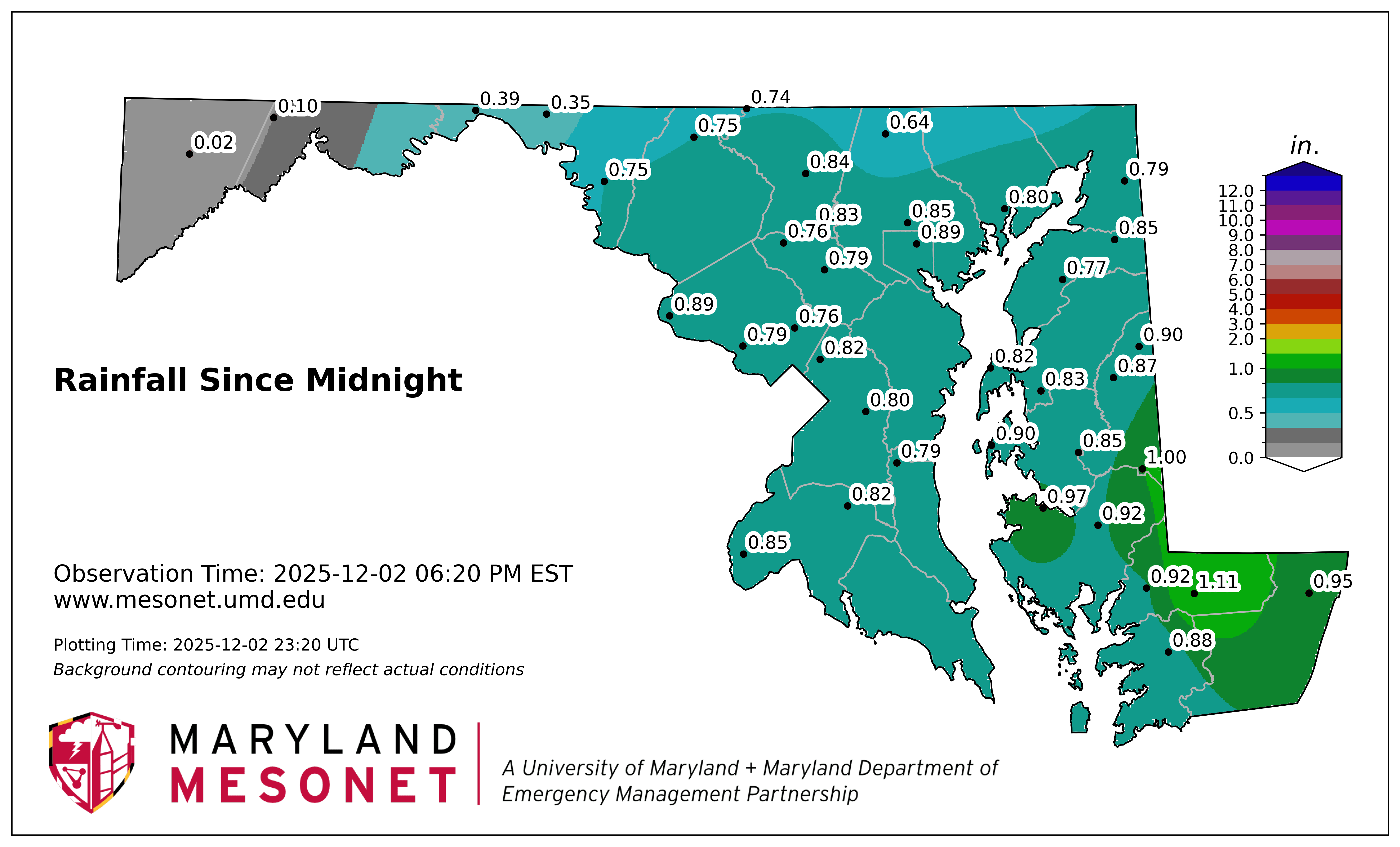
Totals for liquid might be a little low near the M/D line due not capturing snow/sleet.

-
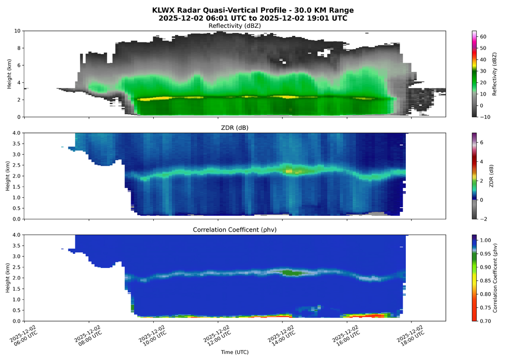
I've been working on this RD-QVP script for the last few weeks. I was hoping that this event could show off it's capabilities, but in the end it's just very sad. We had no chance.
-
All hail the Dec. 5th magic!
-
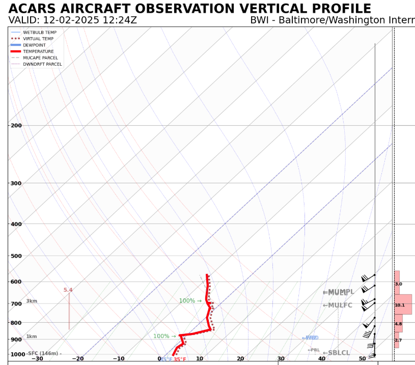
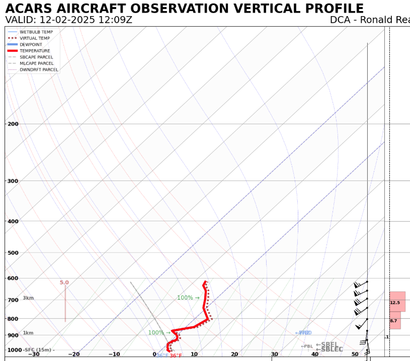
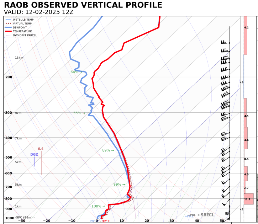
12:24z BWI 12:09z DCA: 12Z LWX (Balloon):
-
Profilers from MDE are wind only. I don’t know of any microwave radiometers in the area that would provide temperature. There might be a fortunately timed ACARS takeoff/landing at one of the big 3 airports but I’d have to look when I get into work.
-
My comment on 2hr delay was for the broader N/W of I-95 region in general. Places that are already under a WWA essentially. Mitch: Yes, and the snow crab is amazing
-
The radiational cooling is putting in work right now. If someone put a super-soaker to my head and made me call 2hr delay or not at this hour, I'd call 2hr delay. When the clouds move back in we'll likely rebound. This doesn't change what is going on upstairs though. If anything this just means higher chance of FZRA to start.