Met1985
-
Posts
16,018 -
Joined
-
Last visited
Content Type
Profiles
Blogs
Forums
American Weather
Media Demo
Store
Gallery
Everything posted by Met1985
-
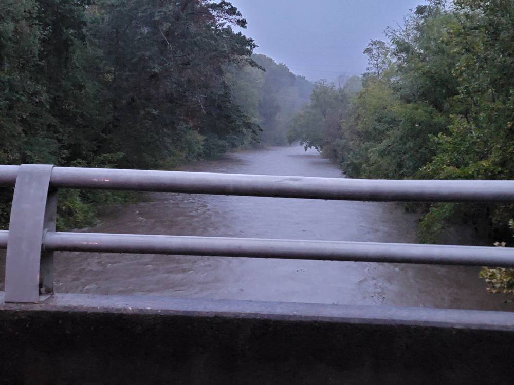
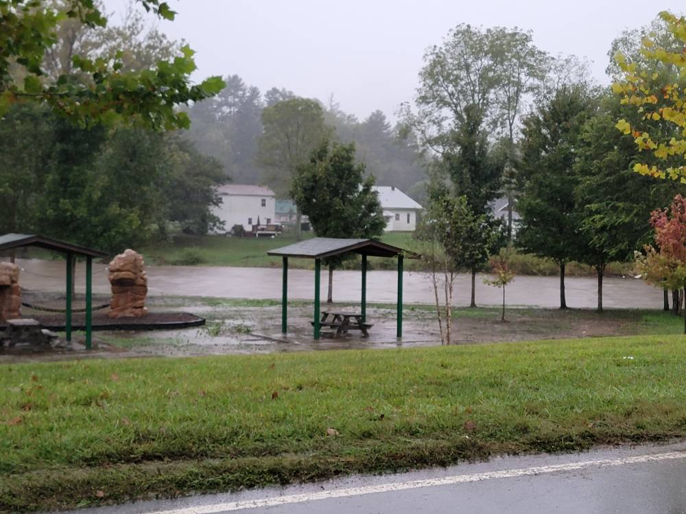
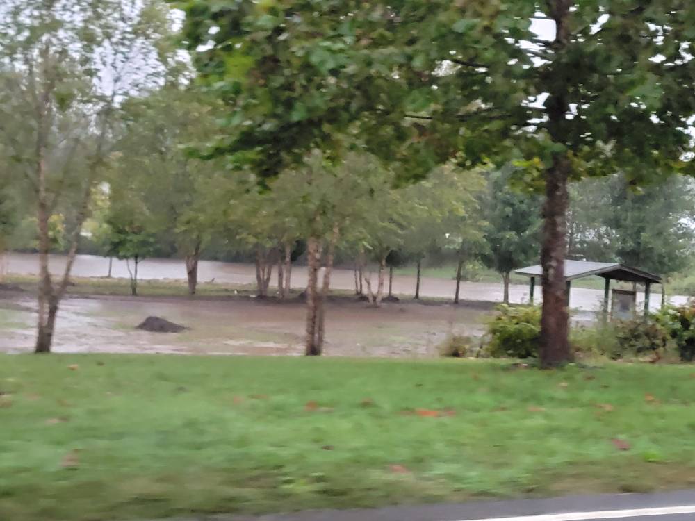
Got some evening pics from around Clyde and Canton. Sent from my SM-G998U using Tapatalk

-
No kidding!
-
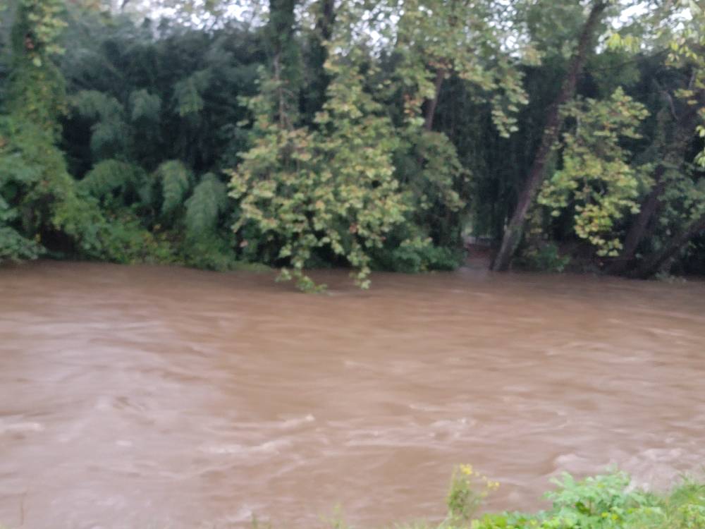
That's about as devastating as this thing has looked going over our area. I cannot stress the impact this will have across the region.
-
No not at all especially with Helene really taking off now.
-
This is not going to help things. Sent from my SM-G998U using Tapatalk
-
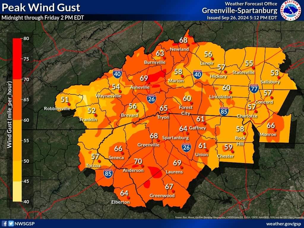
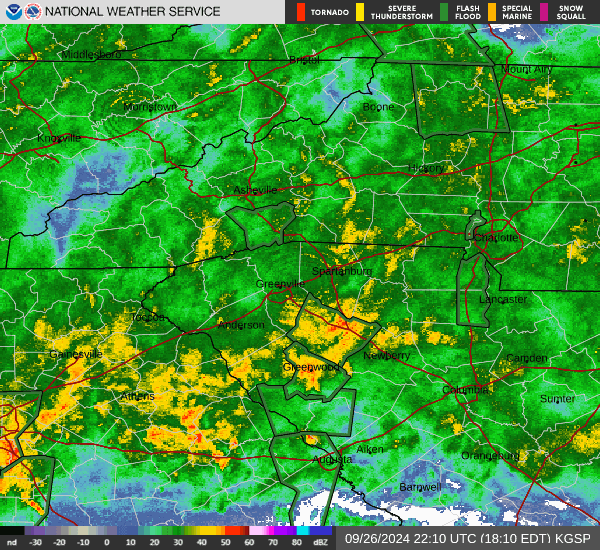
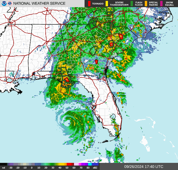
Forecasted wind gusts have increased to near hurricane strength as #HurricaneHelene approaches. Widespread power outages are likely tonight as well as the ongoing catastrophic flooding in the NC Mountains. Have multiple ways to receive a warning. #scwx #ncwx #gawx Sent from my SM-G998U using Tapatalk

-
Well it took a couple days but Helene is pissed and showing off now. Just a beautiful sight on the radar. This storm is freaking massive also.
-
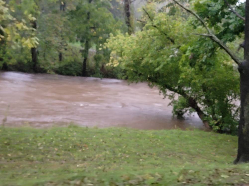
Looks like the French broad river is forecast to crest at 31 feet tomorrow at around 2pm. To put that in perspective that's 10 FEET above the record from 2004. This coming from the NWS...
-
Yeah winds at 125mph but pressure is steadily dropping. This is the best Helene has looked and right before landfall.
-
Another 1.25 inches in the rain guage. 5.07 total.
-
This is significant. Once it's wrapped it will strengthen pretty rapidly until landfall.
-
Head for cover!
-
I don't doubt it. That's going to be ground zero right there.
-
This came out of the NWS GSP office. It's on there Facebook page.
-
Just getting word from emergency management in Haywood that they are evacuating everyone in and around the Lake Logan area.
-
Thank you. We will be keeping everyone up to date in our SE thread but the NWS is saying this will be historical. Some very strong working out of NWS GSP today.
-
Thank you. We will definitely be on edge tonight through tomorrow. We have already seen a lot of flooding in various communities.
-
No it's definitely not hype at all here in WNC. We have families moving away from the rivers tonight and we are really worried about the saturated grounds and 60mph wind gusts.
-
Yeah we've been in moderate rainfall for over an hour now.
-
This looks really bad for us. Sent from my SM-G998U using Tapatalk
-
In my opinion this thing is so big that it's not a tight clustered system that goes off like a bomb all at once. This thing had been building into an absolute monster of a system so it takes time for things to come together and mix out the dry air. But the thing is the bigger this thing gets the harder it will be to slow her down... Just my opinion on the evolution of Helene currently.
-
This thing is getting it together.
-
I think that is a smart decision. Better safe than sorry man. Especially with you having a family.
-
That's what really worries me. The ground is saturated and we don't get winds like that here. That could cause some major problems.
-
Ah ok! Well good to know then.