

Met1985
-
Posts
16,909 -
Joined
-
Last visited
Content Type
Profiles
Blogs
Forums
American Weather
Media Demo
Store
Gallery
Everything posted by Met1985
-

2025 Spring/Summer Mountain Thread
Met1985 replied to Maggie Valley Steve's topic in Southeastern States
Finally some light rain moving through the area this afternoon. -
2025 Spring/Summer Mountain Thread
Met1985 replied to Maggie Valley Steve's topic in Southeastern States
The smoke here on Long Shoals rd has really thickened up and we have ash falling from the air. The air quality is absolutely horrendous. -
2025 Spring/Summer Mountain Thread
Met1985 replied to Maggie Valley Steve's topic in Southeastern States
Ended up getting down to 28 this morning. The fire on Cold mountain has grown to 400 to 500 acres overnight. This is very rugged and steep terrain. Not good at all. -
2025 Spring/Summer Mountain Thread
Met1985 replied to Maggie Valley Steve's topic in Southeastern States
Temp down to 29 this morning. -
2025 Spring/Summer Mountain Thread
Met1985 replied to Maggie Valley Steve's topic in Southeastern States
Temp down to 44 degrees already. -
2025 Spring/Summer Mountain Thread
Met1985 replied to Maggie Valley Steve's topic in Southeastern States
This early fire season is like nothing I've ever seen before for this time of the year. -
2025 Spring/Summer Mountain Thread
Met1985 replied to Maggie Valley Steve's topic in Southeastern States
Yeah the wind was blowing all night but it snowed all night also. -
Really? Have you not seen the Euro?
-
2025 Spring/Summer Mountain Thread
Met1985 replied to Maggie Valley Steve's topic in Southeastern States
Just dropped down to 23. -
2025 Spring/Summer Mountain Thread
Met1985 replied to Maggie Valley Steve's topic in Southeastern States
A nice snow overnight. The wind was ripping all night but I'd say an inch of snow and a low of 24 degrees. -
2025 Spring/Summer Mountain Thread
Met1985 replied to Maggie Valley Steve's topic in Southeastern States
29 degrees with moderate snow and everything is covered. -
2025 Spring/Summer Mountain Thread
Met1985 replied to Maggie Valley Steve's topic in Southeastern States
Yeah I'm hoping this overperforms. -
2025 Spring/Summer Mountain Thread
Met1985 replied to Maggie Valley Steve's topic in Southeastern States
Awesome! -
2025 Spring/Summer Mountain Thread
Met1985 replied to Maggie Valley Steve's topic in Southeastern States
Temp is 31 degrees with moderate snow. Everything is coveted at home now with this coming in waves -
2025 Spring/Summer Mountain Thread
Met1985 replied to Maggie Valley Steve's topic in Southeastern States
Not there. Up Wesley's creek Fines creek -
2025 Spring/Summer Mountain Thread
Met1985 replied to Maggie Valley Steve's topic in Southeastern States
This is almost like convective snow coming across the tops of the mountains and down into the valley. Just starting to lay around 4500' Sent from my SM-G998U using Tapatalk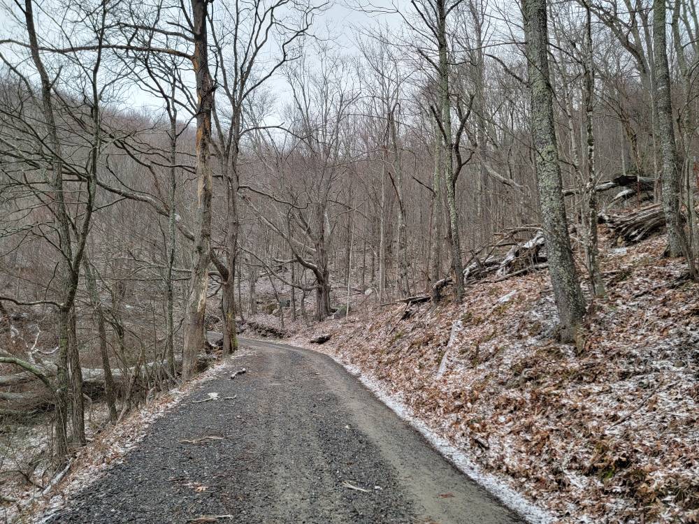
-
2025 Spring/Summer Mountain Thread
Met1985 replied to Maggie Valley Steve's topic in Southeastern States
Going to be a wild day today. Winds really picking up, temps crashing, and snow starting this afternoon. Literally spring to winter in about 8 hours today. -
2025 Spring/Summer Mountain Thread
Met1985 replied to Maggie Valley Steve's topic in Southeastern States
Flow snow looking great from tomorrow afternoon into Thursday night. Going to get freaking cold too. -
2025 Spring/Summer Mountain Thread
Met1985 replied to Maggie Valley Steve's topic in Southeastern States
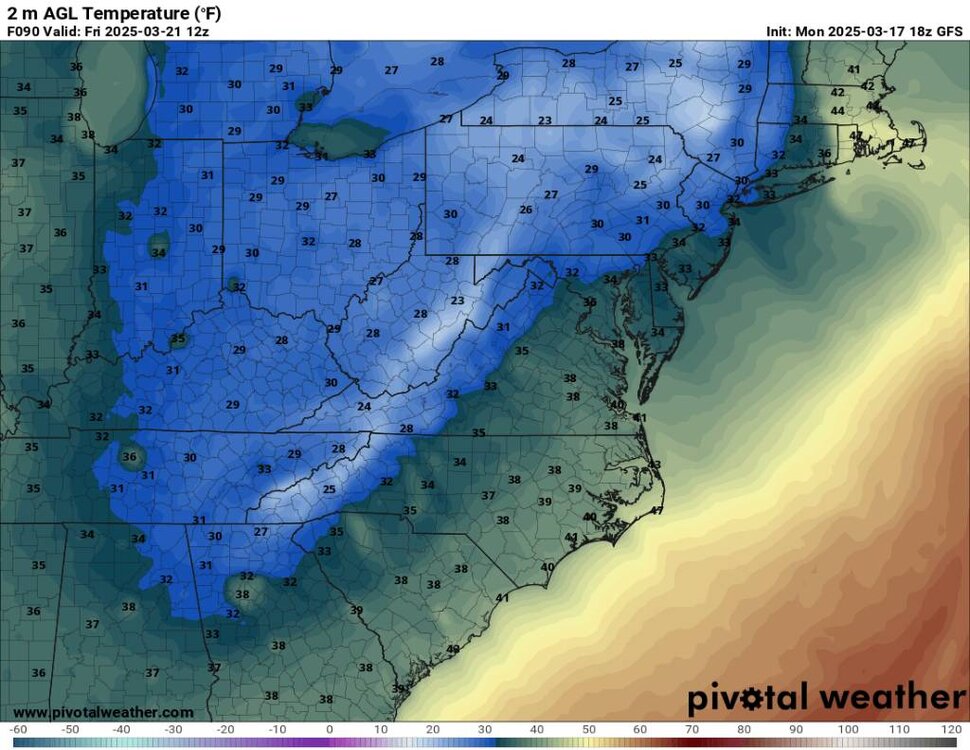
This looks good for the end of March. Sent from my SM-G998U using Tapatalk
-
2025 Spring/Summer Mountain Thread
Met1985 replied to Maggie Valley Steve's topic in Southeastern States
Today's 18z gfs looks great for flow snow. Sent from my SM-G998U using Tapatalk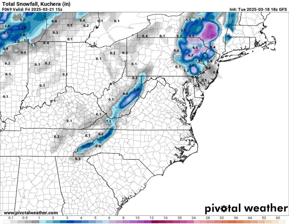
-
2025 Spring/Summer Mountain Thread
Met1985 replied to Maggie Valley Steve's topic in Southeastern States
Cold morning with a low of 25 and heavy frost. -
2025 Spring/Summer Mountain Thread
Met1985 replied to Maggie Valley Steve's topic in Southeastern States
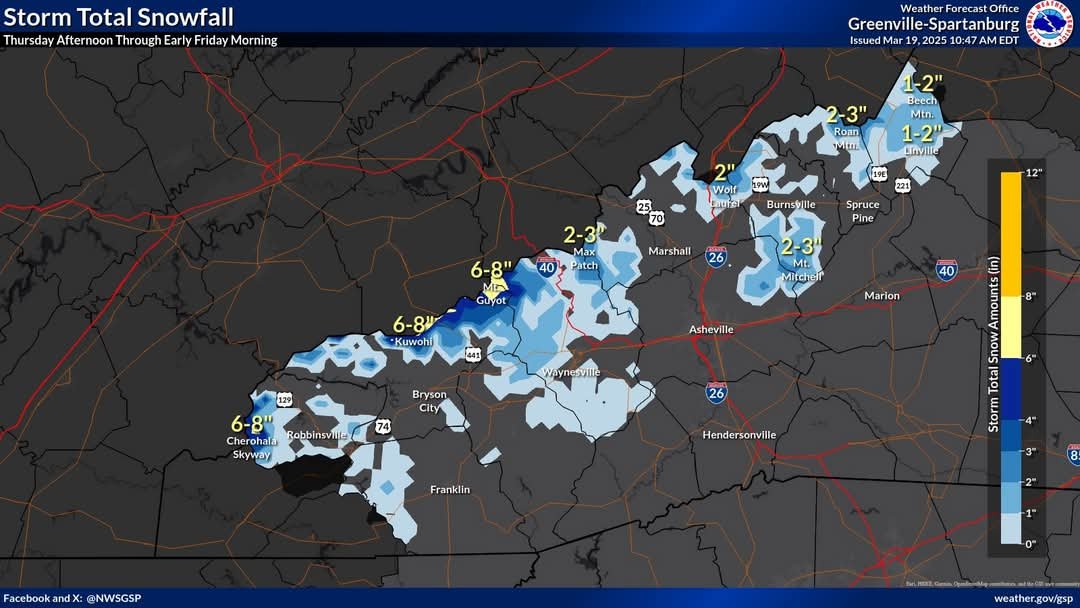
This next cold front means business. Looks like a great flow snow event for this time of the year and it is going to get cold. Probably will be teens for lows coming. Sent from my SM-G998U using Tapatalk.thumb.jpg.2f8b22590226e37891015307ec63d1d0.jpg)
-
2025 Spring/Summer Mountain Thread
Met1985 replied to Maggie Valley Steve's topic in Southeastern States
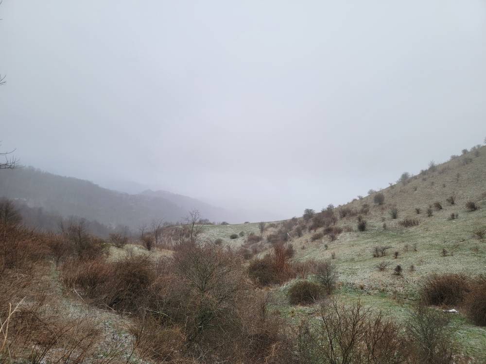
Winter has come back with a vengeance today. Had a low of 29 this morning. A high of only 47 and a current temp of 38 degrees. -
2025 Spring/Summer Mountain Thread
Met1985 replied to Maggie Valley Steve's topic in Southeastern States
30 degrees with flurries and the wind really ripping this morning. -
2025 Spring/Summer Mountain Thread
Met1985 replied to Maggie Valley Steve's topic in Southeastern States
36 degrees with light snow falling.


.jpg.e0dcaeef8f05615077200040cd83c4e4.jpg)

