

Met1985
-
Posts
13,951 -
Joined
-
Last visited
Content Type
Profiles
Blogs
Forums
American Weather
Media Demo
Store
Gallery
Posts posted by Met1985
-
-
Correction it's been sleeting here. We have a skiff in the deck.
-
 1
1
-
-
Nothing yet here but temp is 33 degrees.
-
Swain-Haywood-Graham-Northern Jackson-Macon-Southern Jackson-
Transylvania-
Including the cities of Rainbow Springs, Kyle, Highlands,
and Cashiers
451 AM EST Fri Mar 1 2024
...WINTER WEATHER ADVISORY REMAINS IN EFFECT UNTIL NOON EST TODAY
ABOVE 3500 FEET...
* WHAT...Mixed precipitation expected. Ice accumulation of up to
five hundredths of an inch, especially on elevated surfaces.
* WHERE...Elevations above 3500 feet in Swain, Haywood, Graham,
Jackson, Macon, and Transylvania Counties.
* WHEN...Until noon EST today.
* IMPACTS...Plan on slippery road conditions. The hazardous
conditions could impact the morning or evening commute.
-
11 hours ago, psuhoffman said:
The coldest high (not during a rainstorm) between April 15 and May 15 in 2019 was 62 degrees. Most days were in the 70s. I think the -NAO ruining our springs has been a bigger narrative than it has a reality.
Damn really? I guess our elevation here helps a lot especially when you live at 3500' or higher.
-
Temp down to 32 now.
-
Temp down to 36 already.
-
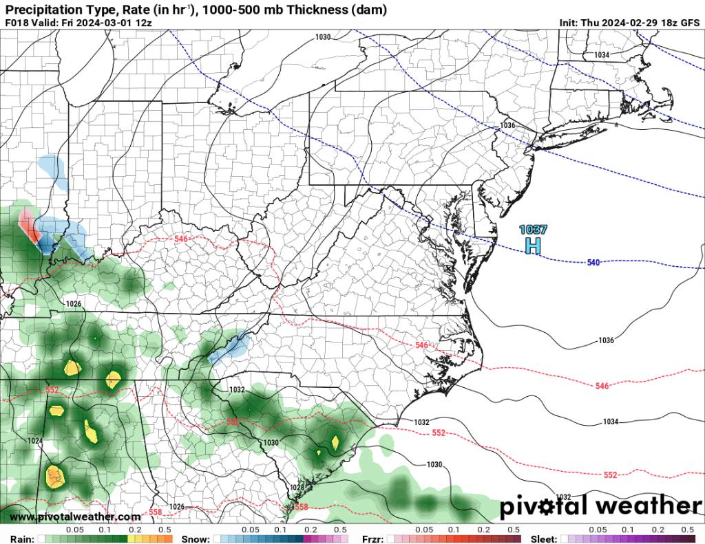
The Euro is just showing rain.
-
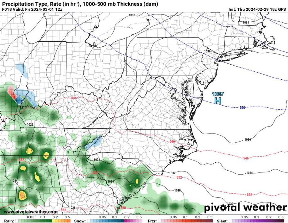
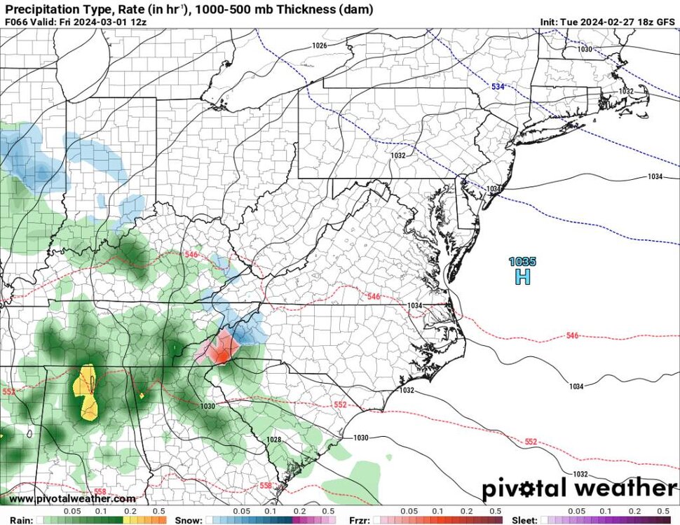
18z nam

Sent from my SM-G998U using Tapatalk -
Latest gfs run
.thumb.jpg.175a4e501fc27a63b959f8baea593aef.jpg)
Sent from my SM-G998U using Tapatalk -
Haywood-Buncombe-Northern Jackson-Southern Jackson-Transylvania-
Henderson-Caldwell Mountains-Burke Mountains-McDowell Mountains-
303 PM EST Thu Feb 29 2024
This Hazardous Weather Outlook is for western North Carolina.
.DAY ONE...This afternoon and tonight.
Hazardous weather is not expected at this time.
.DAYS TWO THROUGH SEVEN...Friday through Wednesday.
Precipitation will develop across the area Friday morning. Enough
cold air is expected to be in place for pockets of a wintry mix to
develop over the mountains, with freezing rain expected to be the
predominant type of winter precipitation. A light glaze of ice will
be possible, especially across high elevations and in sheltered
areas near the Blue Ridge escarpment. Warm road temperatures will
limit the potential for significant travel difficulties, but a few
slick spots could develop.
-
Watauga-
Including the city of Boone
242 PM EST Thu Feb 29 2024
...WINTER WEATHER ADVISORY IN EFFECT FROM 7 AM TO 7 PM EST
FRIDAY...
* WHAT...Mixed precipitation expected. Ice accumulations of up to
one tenth of an inch.
* WHERE...Watauga County.
* WHEN...From 7 AM to 7 PM EST Friday.
-
Yancey-Mitchell-
300 PM EST Thu Feb 29 2024
...WINTER WEATHER ADVISORY IN EFFECT FROM 7 AM TO 7 PM EST FRIDAY
ABOVE 3500 FEET...
* WHAT...Mixed precipitation expected. Ice accumulation of up to
five hundredths of an inch, with a dusting of snow also possible.
Winds gusting as high as 35 mph.
* WHERE...Elevations above 3500 feet in Yancey and Mitchell
Counties.
* WHEN...From 7 AM to 7 PM EST Friday.
-
Wind is cranking and temp down to 39 here.
-
1
-
-
1 hour ago, Buckethead said:
Down to 42.2 now at 4400' in Wolf.
Sent from my SM-S908U using Tapatalk
Down to 46 here. Wind has definitely picked up.
-
1
-
-
Impressive line coming through.
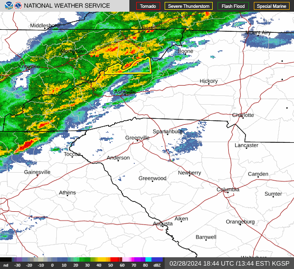
Sent from my SM-G998U using Tapatalk -
4 minutes ago, psuhoffman said:
You know I agree with the trend...but even if our climo has become Richmond's permanently now...even they used to get a big year from time to time, just much more rare.
Oh yeah for sure and I know. You're right the past 9 years have been extremely frustrating with snowfall. All along we are seeing a huge surge in snowpack out west. Literally they are calling for 8 to 12 feet out there this weekend. Maybe things will end up balancing out. I know I know. We are moving the goal posts as it is to climate and ever changing weather patterns.
-
2
-
-
Crazy!
Including the cities of Glenbrook, Incline Village, Truckee,
Stateline, South Lake Tahoe, Markleeville, and Tahoe City
1218 PM PST Tue Feb 27 2024
...BLIZZARD WARNING IN EFFECT FROM 10 AM THURSDAY TO 10 AM PST
SUNDAY...
* WHAT...Blizzard conditions likely, particularly from Friday
evening through Saturday morning. Snow accumulations between 2 and
4 feet for Lake Tahoe communities, with 4 to 8 feet above 7000
feet. Winds gusting to 60 mph in lower elevations and above 100
mph over Sierra ridges.
* WHERE...Greater Lake Tahoe Area.
-
1
-
-
4 minutes ago, psuhoffman said:
@Terpeast Referencing what I showed above...and the fact that has happened several times where opposite pacific longwave patterns lead to the same huge SER over the US...what are your thoughts that there is more going on here than just the PDO. I am just thinking out loud here...but is there any chance these 2 factors are also contributing...
1)systems are coming in off the pac more juiced up and amplify quicker which would tend to get them stuck in the inter-mountain west and amplify and cut off there not progress east....
2) the extreme warmth in the Gulf, Caribbean, Atlantic is contributing to the SER and the combination of these 2 is leading to a tendency for a crazy SER regardless of the PDO or pacific longwave pattern west of there....
I am NOT saying the PDO hasn't been a problem...and isn't contributing to this...but do you think these other 2 factors, which unfortunately wont be solved by a simple PDO flip, are part of the problem also?
A lot of question marks and not good answers for snow lovers. Our climate is changing for the worse. With all the warming a lot of us may never see big snows again.
-
Yep tomorrow night looks like we could see a few flakes then we could see a start of a mix to rain.

Sent from my SM-G998U using Tapatalk-
3
-
-
22 minutes ago, Jmoon said:
2 great years in a row for them.
Yeah I've been reading a ton on how all the lakes and reservoirs are at or near normal again which is amazing considering the absolute horrific drought they were in for several years. I read earlier this year that new rainfall wouldn't make a difference but wow has it.
-
1
-
-
40 minutes ago, Terpeast said:
The hottest SSTa of the marine heat wave is almost exactly where, and downstream of, Fukushima, the site from where they are dumping radioactive water.
I haven’t come across any research that this is the cause, but I can’t seriously believe that this is a mere coincidence.
This would be an amazing case study dealing with the weather pattern and the heat exchange from the ocean in that area to other areas. Very interesting for sure but what do you do?
-
1 hour ago, Buckethead said:
The resorts out there will be operating into early summer again!
Sent from my SM-S908U using Tapatalk
Yeah no kidding! All up and down the Mountain West. Man that house in Aspen is looking better and better.
-
2 minutes ago, Buckethead said:
The northern Sierra Nevada range has 10'+ in their forecast Thursday through Sunday. Just unreal. One of these days I'm gonna have to catch one of these events.
https://forecast.weather.gov/MapClick.php?w0=t&w1=td&w2=wc&w3=sfcwind&w3u=1&w4=sky&w5=pop&w6=rh&w7=rain&w8=thunder&w9=snow&w10=fzg&w11=sleet&w13u=0&w15u=1&AheadHour=0&FcstType=graphical&textField1=39.198&textField2=-120.2876&site=all&unit=0&dd=&bw=&AheadDay.x=84&AheadDay.y=5
Sent from my SM-S908U using Tapatalk
The next two weeks are going to be insane out there.
-
1
-
-
1 hour ago, GaWx said:
Since long term models are so accurate
") , I looked at them closely:
, I looked at them closely:
-Euro Weeklies warmest yet through 3/24
-Recent CFS ensemble runs about coldest yet for 3/10-17 along with AN precip.
-So, for 3/10-17, the Euro Weeklies have gone from cold a few days ago to NN now. That compares to recent CFS ens being BN to MBN.
-So, huge disagreement mid March. Whereas I’d love for the CFS to be right, I’m for now going for the Euro to be closer based on how this winter has gone. But I’m going to watch the forecasted strongest major SSW of the season that’s predicted ~Mar 3 along with the PNA/NAO/AO possibly going +/-/- by 3/10 to hopefully cause the Weeklies to bust too warm in mid March.
-Whereas Mar 3-9 is a high confidence period to average mild in the SE, Mar 10-17 is an extra low confidence period for whatever. And don’t forget that Mar 1 could have a bit of a wintry surprise for some of the CAD areas.
I have zero faith in the weeklies. I'm not sure what to believe other than we just had a minor SSW and we are going to have a strong one in a couple days. This pattern will break just in time for Spring to be delayed. My opinion this winter we saw more of a NINA pattern than anything else.
-
4
-
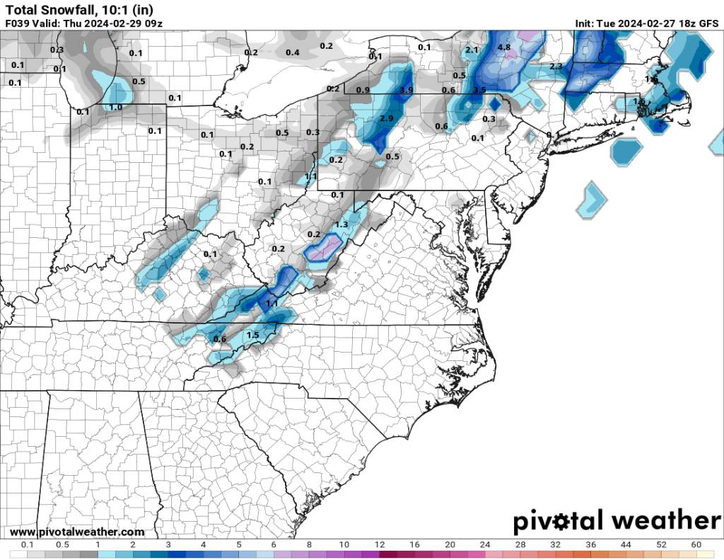
.jpg.93440510c6048d422db9d0900796ebd1.jpg)

2023-2024 Fall/Winter Mountain Thread
in Southeastern States
Posted
Mixture of sleet and snow currently.