

Met1985
-
Posts
13,940 -
Joined
-
Last visited
Content Type
Profiles
Blogs
Forums
American Weather
Media Demo
Store
Gallery
Posts posted by Met1985
-
-
27 minutes ago, Buckethead said:
35 and occasional flurries here in Wolf.
Sent from my SM-S908U using Tapatalk
Mostly clear with a temp of 38. Looks like the fun begins tomorrow morning.
-
20 minutes ago, NorthHillsWx said:
Upslope is so hard to forecast here. Gfs has looked and been steady. It's all about forcing with these things. Still doesn't help this has trended north a bit.
-
Springs already here! Screw the countdown. When we headed to the beach.
-
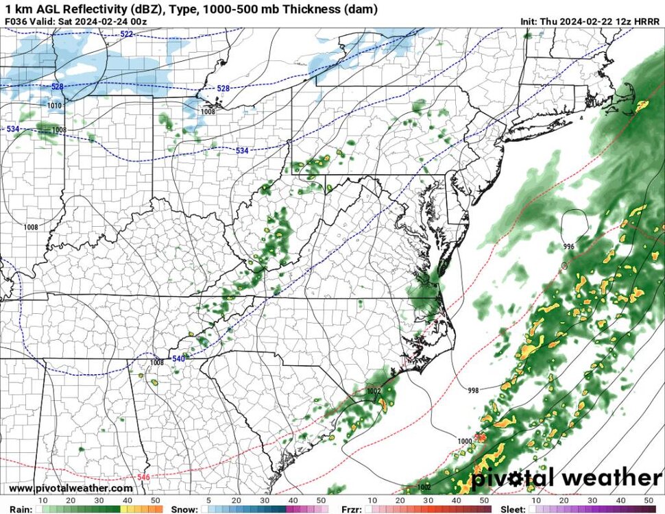
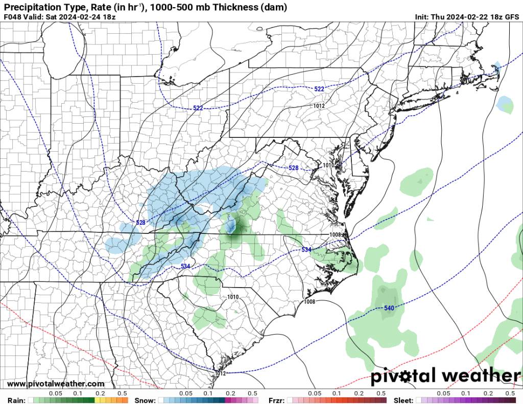
People who are following this, this isn't the main slug of moisture. This is basically going to bring in the colder air across the area. This has been modeled by the gfs and HRRR.
Sent from my SM-G998U using Tapatalk -
28 minutes ago, Buckethead said:
Currently 38.1 with clouds increasing. The convective look of the precip upstream makes me think someone may get some graupel before dark.
Sent from my SM-S908U using Tapatalk
I'm at 48 mostly cloudy and windy.
-
Avery-Madison-Yancey-Mitchell-Swain-Haywood-Graham-
407 AM EST Fri Feb 23 2024
This Hazardous Weather Outlook is for western North Carolina.
.DAY ONE...Today and tonight.
Hazardous weather is not expected at this time.
.DAYS TWO THROUGH SEVEN...Saturday through Thursday.
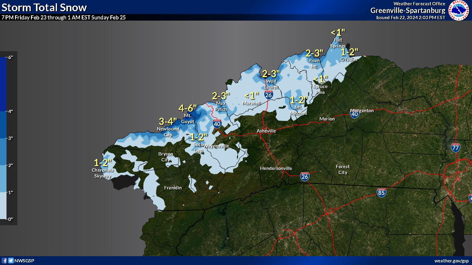
A fast moving system will bring a quick shot of snow across the high
elevations of the mountains, especially along the Tennessee border.
Generally 1-2" will be possible, but the highest elevations above
4000ft may see 2-4" with a swath of 4-6" possible across the Smokies
above 5000ft. Any high elevation roads may experience a few slick
spots.
-
 1
1
-
-
Cool moonrise.
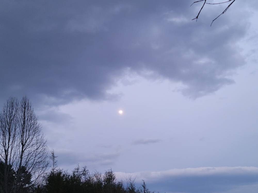
Sent from my SM-G998U using Tapatalk-
3
-
-
5 minutes ago, GaWx said:
Today’s Euro Weeklies are warmer for 3/11-18 and not as cold 3/18-25 vs yesterday’s run.

Well onto spring.
-
 1
1
-
-
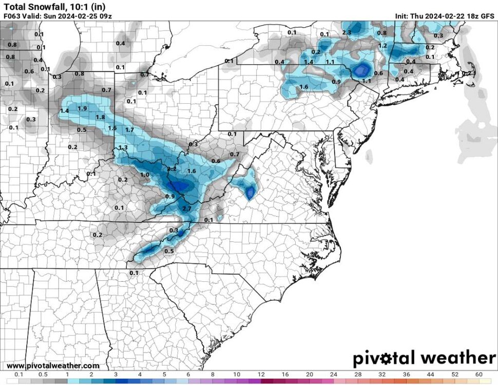
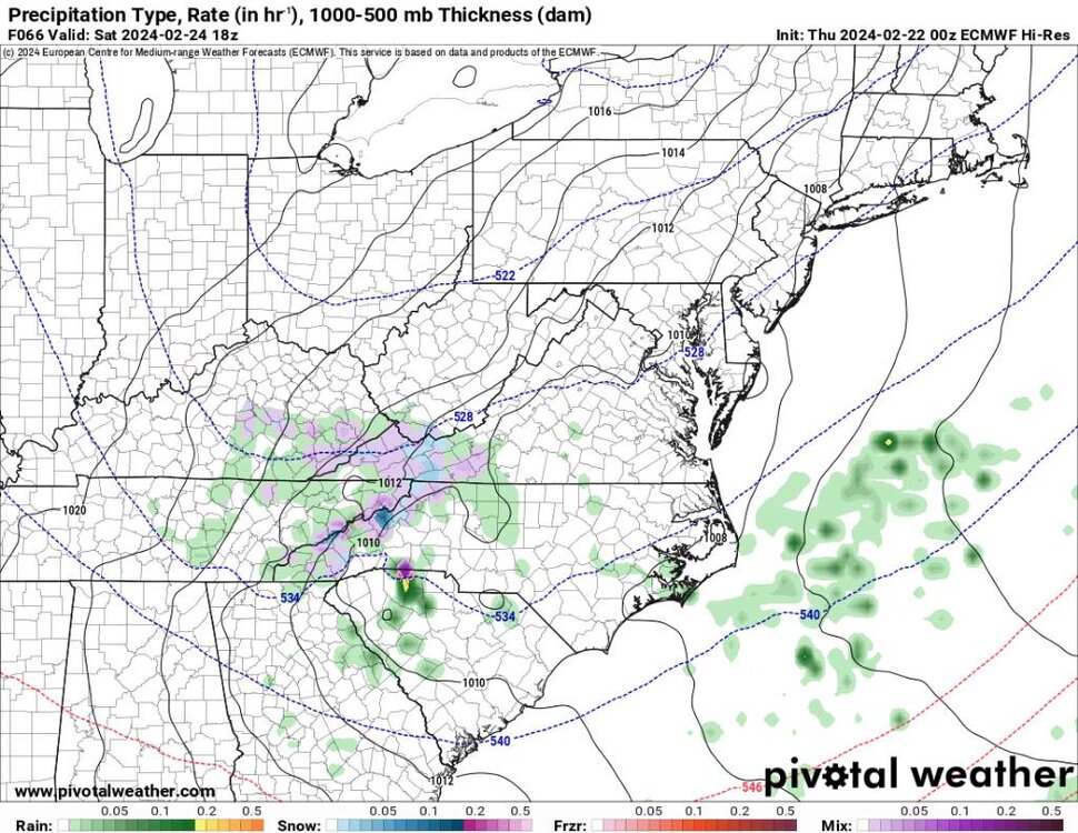
18z gfs looks good.

.thumb.jpg.777ff95a143f5a19bd2c8dde2fcb88d6.jpg)
.thumb.jpg.dafdb948b8ffc6bc73a00012adc001cc.jpg)
Sent from my SM-G998U using Tapatalk-
1
-
-
14 minutes ago, Maggie Valley Steve said:
I'll take it.

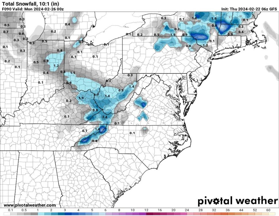
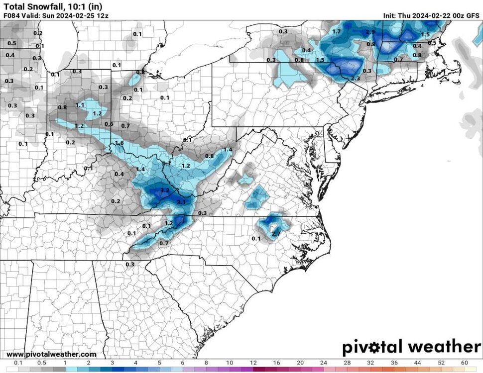
Yes sir! That is not a bad look at all. 4 to 6 right along the border with a general 1 to 2 inches. I'll take that during this torch.
-
2
-
-
23 minutes ago, UnionCountyNCWX said:
I was just thinking about the great lakes ice this morning. Am I wrong in thinking that 15-20 years ago it was normal for most of the lakes to be completely covered in ice? I feel like they used to talk about lake effect snow "until the lakes froze." But haven't heard of talk like that in a while. But maybe I'm remembering incorrectly.?
You are correct. Lake effect snow was early season or late season when the ice started to break up. I've read that even ski resorts in Montana have closed early this season because the lack of snow. Snowmobile trails in New England and the UP of Michigan have been closed because there isn't any snow pack. Seems like the only place that had had a good winter is Alaska. The SW and the inner mountains of California, Utah, New Mexico, Nevada, and Colorado have only recently gotten in on some big time snows because of the Atmospheric river screaming across the SW.
-
8 minutes ago, Daniel Boone said:
Yeah, shifted a bit North with main area.
Yeah but as we've seen this season there has been a late shift south the last 24 hours before an event so we will see. We could be shafted also lol.
-
1
-
-
Gfs and euro. Not as robust but workable.
.thumb.jpg.ef6bf3ab50ee7be2a6d72268d3dc901b.jpg)
Sent from my SM-G998U using Tapatalk-
1
-
-
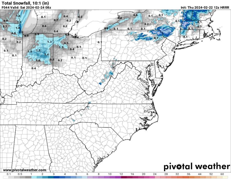
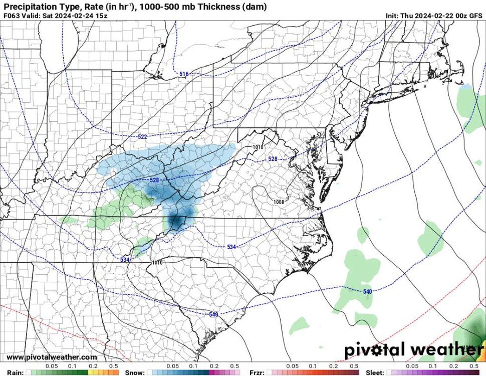
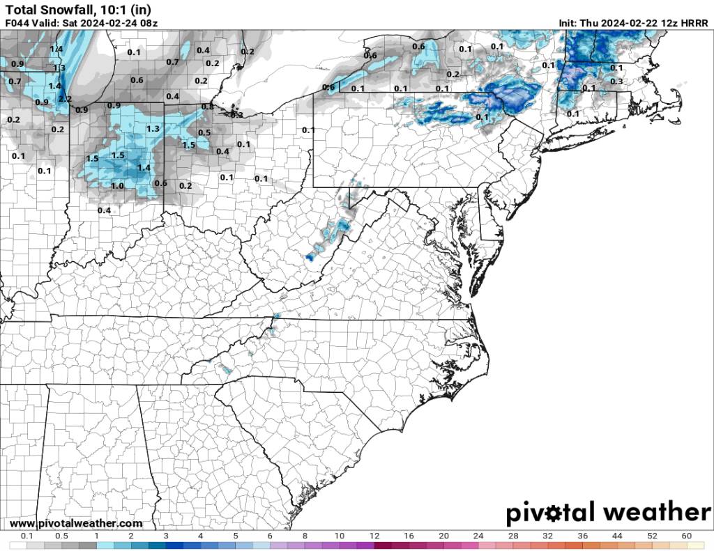
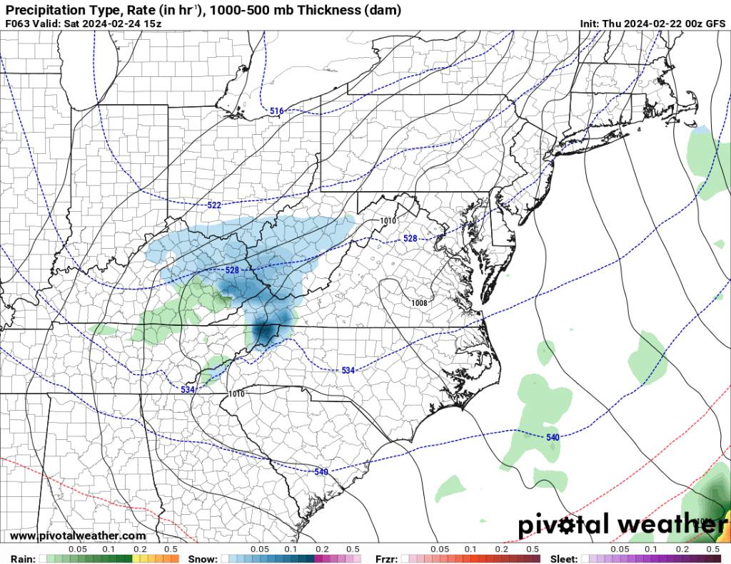
This has always been an interesting period right after the front passes. Might be a surprise period before the little clipper system. I think the HRRR has been the best short range model this season.
.thumb.jpg.aabf81cb0332269add0237754fb567ec.jpg)
.thumb.jpg.7e87efb42d93f5a4bd793afd440c7faf.jpg)
Sent from my SM-G998U using Tapatalk -
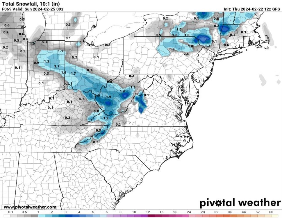
27 minutes ago, wncsnow said:
The energy is trending north on the short range models and GFS was north at 12Z
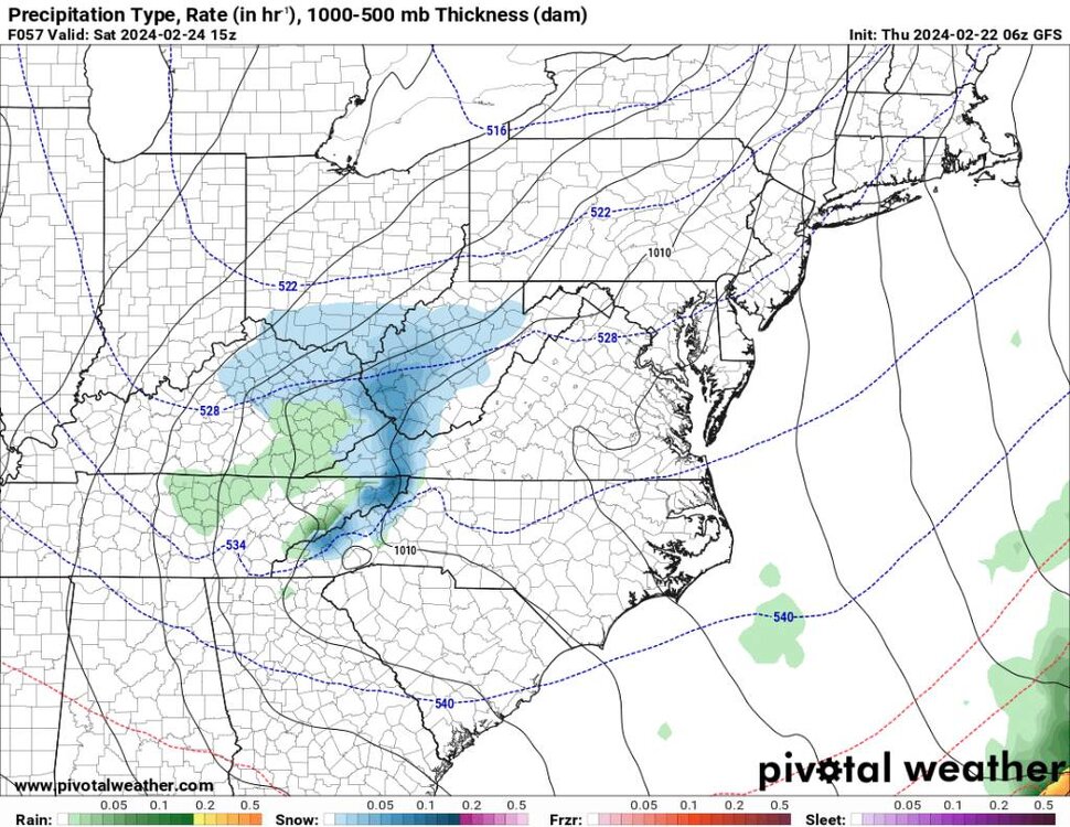
The energy has been north but we have less expansion of precipitation across our area with today's models. Any chance I think most will be happy about. I think this is going to be right along the border areas.
-
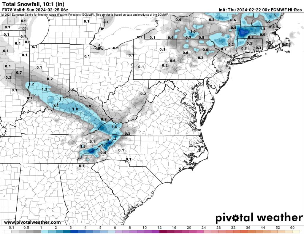
Yeah the 06z gfs looks really good.
.thumb.jpg.ecd1b38afda1cb9b37cb28f89d7f0f0c.jpg)
.thumb.jpg.49ef87ae5125c16f047b92c490f77f27.jpg)
Sent from my SM-G998U using Tapatalk-
1
-
-
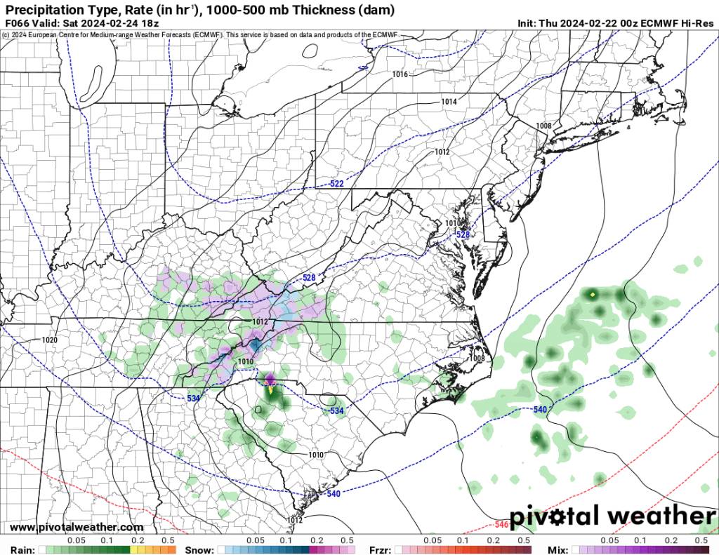
Euro still solid.

Sent from my SM-G998U using Tapatalk-
1
-
-
Might just be a bit of a surprise down east.
.thumb.jpg.e0c65266fdda5553b482543c93cec20f.jpg)
Sent from my SM-G998U using Tapatalk-
 1
1
-
-
Gfs steady as she goes.
.thumb.jpg.b9eb152a76b210ca1040bac6e40879d1.jpg)
.thumb.jpg.19979159e6333b124b04277ea244f66b.jpg)
Sent from my SM-G998U using Tapatalk -
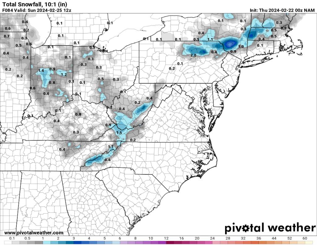
00z NAM. Not a bad look. I know it's not ground breaking but hey I'll take whatever I can get.

Sent from my SM-G998U using Tapatalk-
2
-
-
After a beautiful day temp down to 37 already.
-
1 hour ago, jaxjagman said:
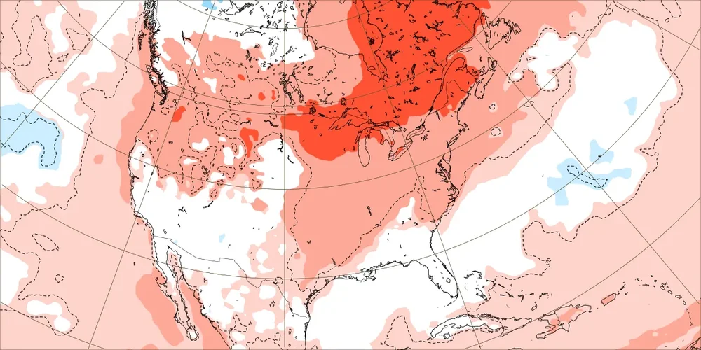
The mean has been aiming basically skipping the cold phases for the longest time and dont seem to be backing down
.png.269cd8b8acedb4216fa414b864494fa0.png)
This is probably correct.
-
1
-
-
4 minutes ago, GaWx said:
Indeed. The one exception this winter was in late Dec, when they were still predicting mainly mild for that mid Jan week that was then just over two weeks out and that turned out to be the coldest of the winter. What an odd curve ball that was. Some areas predicted on this map to be +5 for that week ended up -20 instead!
Yeah a lot of the country was in a down winter. I know it's all my back yard stuff but we've had record low snowfall across the entire country, record low snow-covered, and record low great lakes ice cover.
-
2
-
-
We are literally 3 days away from a little event and the NWS has nothing. We have the NAM, EURO, and gfs showing something. Strange but maybe they are jaded like us this winter lol.
-
2
-
.jpg.7d4e23f76fbf33a3945eb3653b926867.jpg)
.jpg.905ae6f4e3e530ca84665d8c4db51e0a.jpg)


.jpg.f2d40638f2558e8b8e6f1cc5be06ebdd.jpg)

.jpg.a34c17e3246df483b656e89c85223d61.jpg)
.jpg.19be4e6024d34a9eef38d71e32871d6d.jpg)

.jpg.cc1529fd5ccb044338179a3d56645f43.jpg)
.jpg.9b3d2382bd8cccaba614e300fa10f7ae.jpg)

.jpg.962813a1fad25b1b71e67f0c0fbf9c6f.jpg)
.jpg.d15e196abcd230f311734c931c0101ae.jpg)
.jpg.7978639ca0cc7c12641f8ff58f8b1fcf.jpg)


2023-2024 Fall/Winter Mountain Thread
in Southeastern States
Posted
00z NAM looks putrid.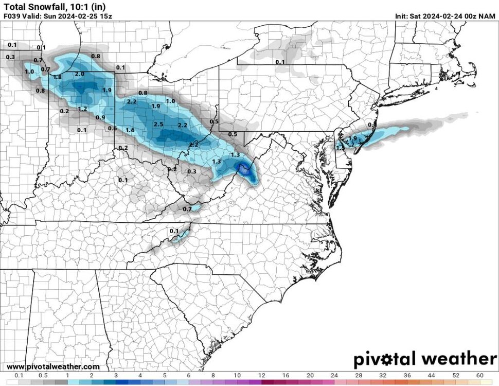
Sent from my SM-G998U using Tapatalk