Met1985
-
Posts
16,564 -
Joined
-
Last visited
Content Type
Profiles
Blogs
Forums
American Weather
Media Demo
Store
Gallery
Everything posted by Met1985
-
Going to be a raw week with highs in the 40s most of the week with rain. Also I still like our chances for high elevation snow towards the end of the week.
-
Heck yeah!
-
More realistic time frame. Sent from my SM-G998U using Tapatalk
-
Your using a 300 hour map? Interesting.
-
Probably not. It Probably doesn't make it in the short term or mid term with the way the indices are setting up.
-
Temp down to 43 degrees already.
-
What a great Fall day. Ended up making it down to 32 degrees with a high of 58 and a current temp back down to 53.
-
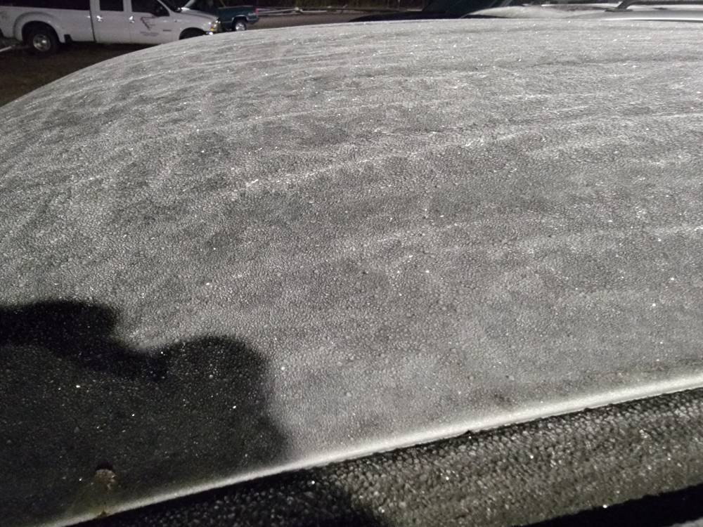
Temp down to 33 with a heavy frost so far. Temps just dropped like a snail here overnight.
-
Was a pleasant day today. Had a low of 36 before a breeze set in and the temp rose. Had a high today of 65 and a current temp of 57. Been a beeezy day today so the winds going to have to subside before we can really drop.
-
The rest of the mountains will get there's tomorrow night.
-
Avery-Yancey-Mitchell- Including the cities of Busick, Poplar, Celo, Newland, Spruce Pine, Burnsville, Ramseytown, Ingalls, Micaville, Banner Elk, and Swiss 153 PM EDT Wed Oct 22 2025 ...FREEZE WATCH IN EFFECT FROM LATE THURSDAY NIGHT THROUGH FRIDAY MORNING... * WHAT...Sub-freezing temperatures as low as 28 possible. * WHERE...The northern mountains of North Carolina. * WHEN...From late Thursday night through Friday
-
Going to be a cold one the next several nights. Today's high was 62 after a low of 41. Oh and um the pattern has changed.
-
Winds will also be gusty going into tonight with the next cold front passing through. Tomorrow will definitely feel like fall with several not making it out of the 50s.
-
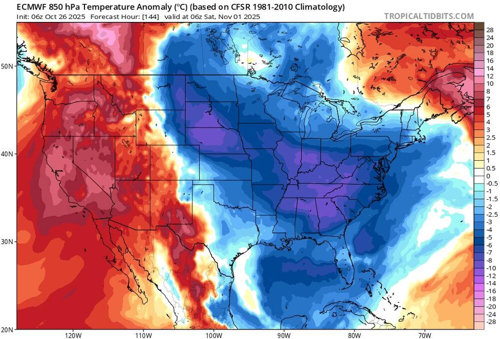
Euro is showing some persistent troughing in the East along with the GFS. This fits great with the indicies.
-
Bank it!
-
Down to 57 degrees and rain.
-
Just got home with heavy frost and a temp of 34 degrees.
-
Frosty morning in West Asheville with a temp of 36. Sent from my SM-G998U using Tapatalk
-
The demise of Fall has been greatly exaggerated.
-
39 here this morning with a bit of a breeze. Coldest of the season.
-
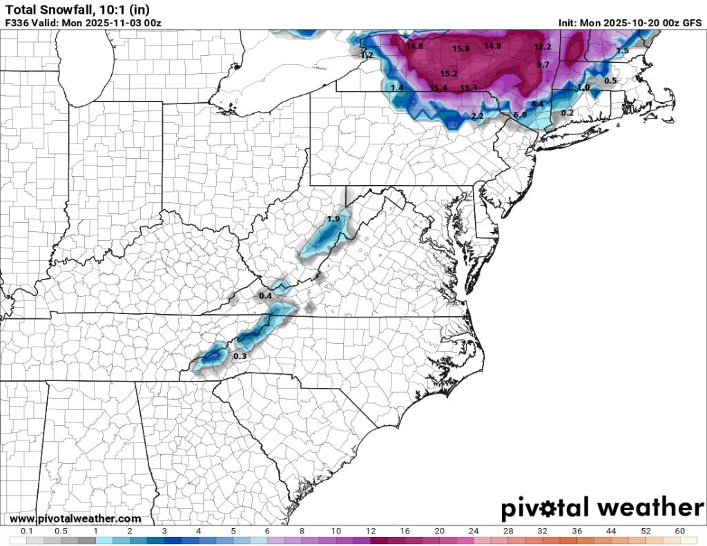
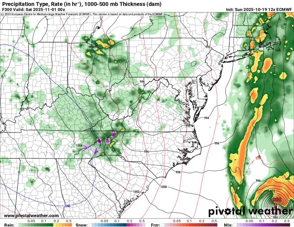
Entertainment only but the 00z gfs bringing the upslope snow. Sent from my SM-G998U using Tapatalk

-
Larry it definitely was a historical event to remember..im glad yall got nailed.
-
Yep! Sent from my SM-G998U using Tapatalk
-
Temp now down to 56..we've dropped about 10 degrees in an hour.
-
Front is here. Temp has dropped to 58 now.