

Met1985
-
Posts
16,671 -
Joined
-
Last visited
Content Type
Profiles
Blogs
Forums
American Weather
Media Demo
Store
Gallery
Everything posted by Met1985
-
Another day and more rainfall. Good it was getting too dry for the grass. It likes to grow an inch a day....
-
Dang looks like Asheville East is absolutely taking a beating this evening. Looks like a storm is just training there.
-
A beautiful sunset after all the rain. Sent from my SM-G998U using Tapatalk
-
Yep a steady to moderate rainfall all afternoon into early evening.
-
We've gotten multiple storms here today in Haywood. Over an inch of rainfall today. Was in Bryson city earlier before it let loose there.
-
Big time cells blowing up around our area.
-
Yep moderate to heavy rain currently.
-
Rain will be moving in this morning.
-
Yeah this has been horrible..
-
Looks like we are going to see some severe storms possible this weekend. A little early fireworks before the 4th.
-
Absolutely hammering with pea size hail.
-
Lighting and thunder are already popping.
-
Severe Thunderstorm Warning for... Western Madison County in western North Carolina... Haywood County in western North Carolina... Northwestern Buncombe County in western North Carolina... * Until 415 AM EDT. * At 309 AM EDT, severe thunderstorms were located along a line extending from 13 miles south of Greeneville to 14 miles east of Gatlinburg in Tennessee, moving southeast at 45 mph. HAZARD...60 mph wind gusts and penny size hail.
-
Yeah much more impressive and knocking on the door. Severe thunderstorm warning for just over the border.
-
It was a washout here this afternoon. Some gusty winds and more rain.
-
Yeah that blob keeps on looking more and more impressive.
-
Yeah if that holds together that would bring a lot of rainfall and some heavy storms into the region.
-
Still way below average. 3 pm at the end of June and it's 65 degrees.
-
Great info calculus1. I did know about the state park but not about Buncombe. It makes a lot of sense but crazy to think about.
-
That is crazy. Seems like everyone around them had 4 plus inches of rainfall this week... Thanks for the totals brother.
-
Wlos is only reporting that the airport received 1.61 inches of rainfall this month. Can anyone in or around Buncombe verify there total rainfall this week? That seems very very underreported.
-
Rain has been relentless this late afternoon through the evening.
-
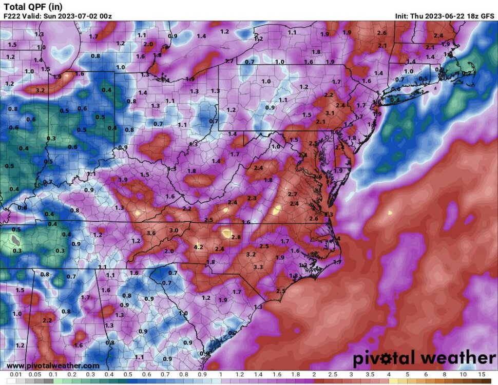
12z euro.... Remains wet.. I think any inkling of a drought here has been washed away.... No pun intended. Sent from my SM-G998U using Tapatalk
.thumb.jpg.1f191d5cf9fa4dd6dcd96fe368b6bce2.jpg)
-
Literally rain almost every day in the forecast. Sent from my SM-G998U using Tapatalk
-
Amazing for the second day of summer.


.jpg.26102c3855ff04fe471f32718271a8f0.jpg)
