franklin NCwx
-
Posts
9,106 -
Joined
-
Last visited
Content Type
Profiles
Blogs
Forums
American Weather
Media Demo
Store
Gallery
Everything posted by franklin NCwx
-
It's most likely a track in between the two. Similar to the euro
-
2021-2022 Fall/Winter Mountains Thread
franklin NCwx replied to BlueRidgeFolklore's topic in Southeastern States
It actually turns into a big rainstorm for them. Thus baby runs up I-95. It's almost a scaled down version of 93 -
2021-2022 Fall/Winter Mountains Thread
franklin NCwx replied to BlueRidgeFolklore's topic in Southeastern States
Paste bomb! Get the generator ready -
2021-2022 Fall/Winter Mountains Thread
franklin NCwx replied to BlueRidgeFolklore's topic in Southeastern States
Few more jogs north early on and we rain. -
I agree, you can tell it's "tugging" it north on every model run.
-
2021-2022 Fall/Winter Mountains Thread
franklin NCwx replied to BlueRidgeFolklore's topic in Southeastern States
I can ask. The train goes past their house too on the way to Nantahala -
2021-2022 Fall/Winter Mountains Thread
franklin NCwx replied to BlueRidgeFolklore's topic in Southeastern States
Bets on the euro? I bet it comes in between the ukie and gfs/cmc -
2021-2022 Fall/Winter Mountains Thread
franklin NCwx replied to BlueRidgeFolklore's topic in Southeastern States
You need one here in fontana lake estates so we can see the park
-
2021-2022 Fall/Winter Mountains Thread
franklin NCwx replied to BlueRidgeFolklore's topic in Southeastern States
Ukie is south -
2021-2022 Fall/Winter Mountains Thread
franklin NCwx replied to BlueRidgeFolklore's topic in Southeastern States

-

-
Should be a good run
-
Ensemble mean is usually like that.
-
2021-2022 Fall/Winter Mountains Thread
franklin NCwx replied to BlueRidgeFolklore's topic in Southeastern States
Lol...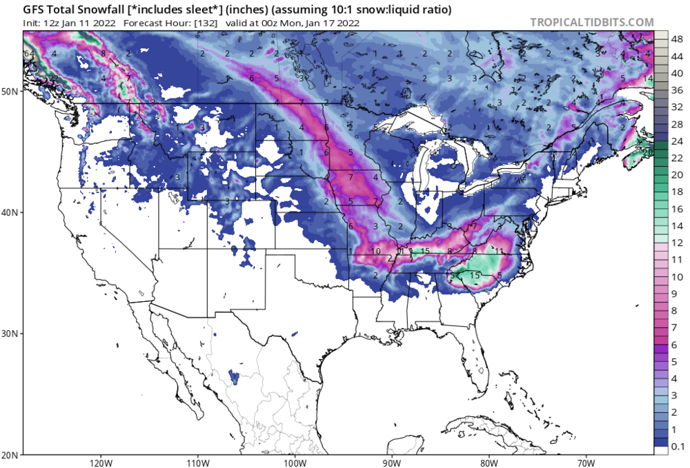
-
2021-2022 Fall/Winter Mountains Thread
franklin NCwx replied to BlueRidgeFolklore's topic in Southeastern States
Should be a good run for the mtns -
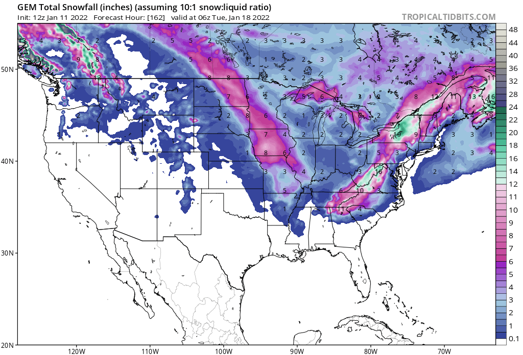
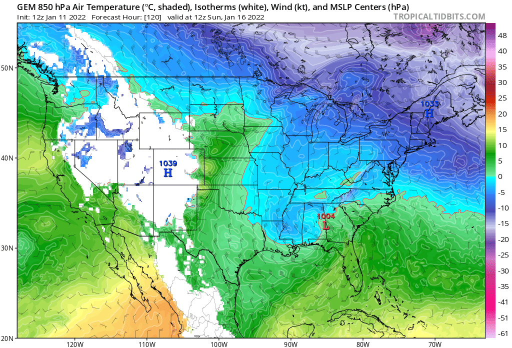
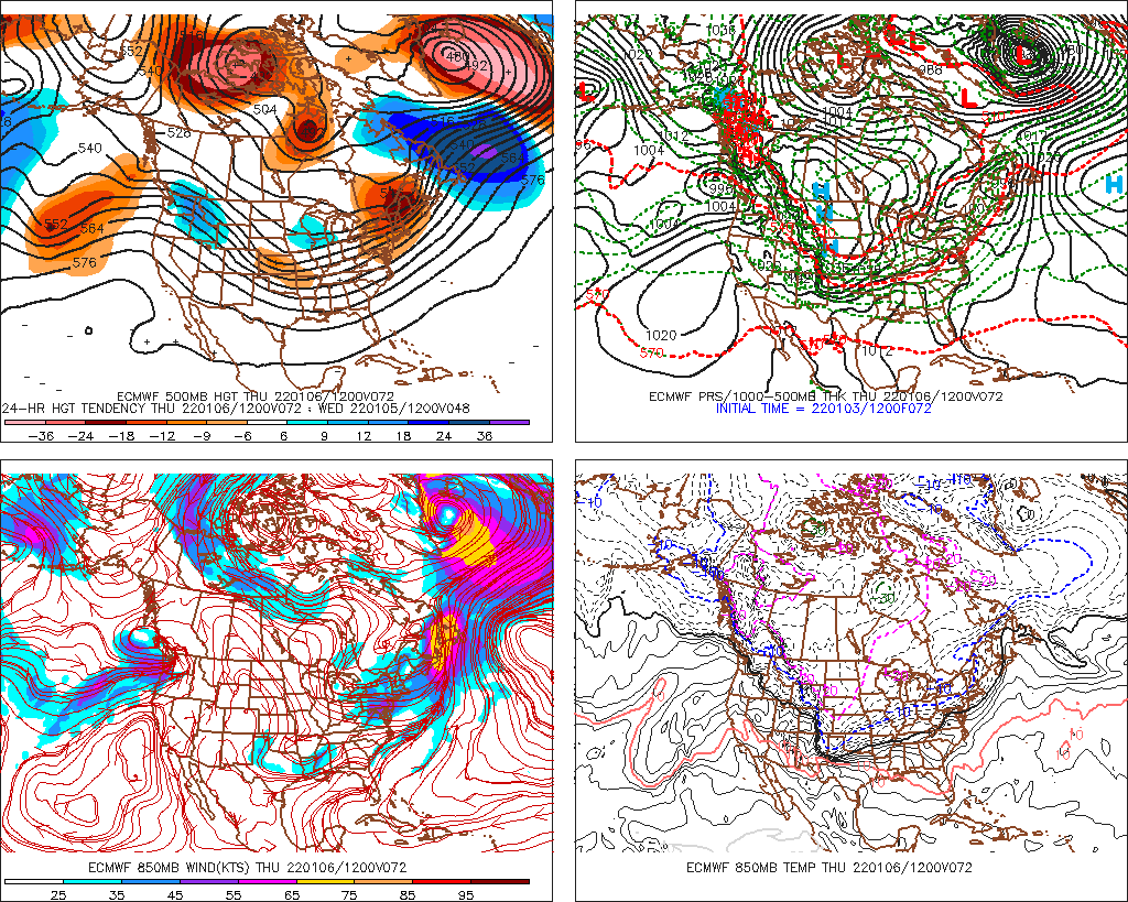
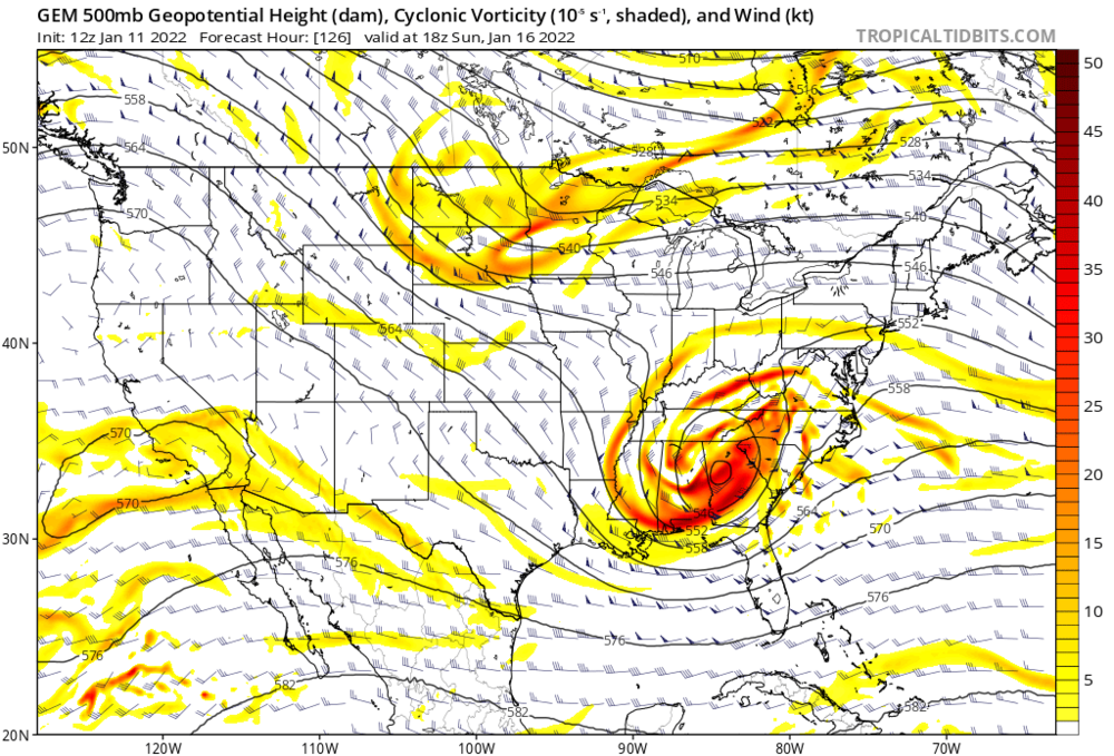
Looks stronger and more consolidated compared to 6z. At hour 90 heights are a little higher across the SE.
-
-
2021-2022 Fall/Winter Mountains Thread
franklin NCwx replied to BlueRidgeFolklore's topic in Southeastern States
Same. When I went to bed last night it was 28, when I got up at 5 it was 40, then 50 by 10am. -
Mid to Long Range Discussion ~ 2022
franklin NCwx replied to buckeyefan1's topic in Southeastern States
Dude. Your area averages about 6" a year. You just remember the good years and not the bad one's. I remember several in the 90's and even 80's that sucked In the mtns. -
2021-2022 Fall/Winter Mountains Thread
franklin NCwx replied to BlueRidgeFolklore's topic in Southeastern States
Rain at 3k feet too with that track. Congrats Eastern KY and WV -
Mid to Long Range Discussion ~ 2022
franklin NCwx replied to buckeyefan1's topic in Southeastern States
Several factors but this ridge out west needs to amplify more to allow the sw to dig.
-
Mid to Long Range Discussion ~ 2022
franklin NCwx replied to buckeyefan1's topic in Southeastern States
Just lack of ridge out west -
2021-2022 Fall/Winter Mountains Thread
franklin NCwx replied to BlueRidgeFolklore's topic in Southeastern States
You're I'm a good spot. Should see 6+ -
Amazing for a place that averages 14" a year they seem to get a lot of big storms every year
-
2021-2022 Fall/Winter Mountains Thread
franklin NCwx replied to BlueRidgeFolklore's topic in Southeastern States
This is like 8 years now that the euro has been folding to the gfs