-
Posts
3,925 -
Joined
Content Type
Profiles
Blogs
Forums
American Weather
Media Demo
Store
Gallery
Posts posted by Snowstorms
-
-
Visibility was down to 0.5 miles around 3 am at YYZ with an intense squall moving through. Got less than an inch in my neck of the woods with an inch near YYZ.
-
00Z CMC isn't much different than the 12z run. Sfc low cuts just south of Chicago. Rain for most of us except eastern Iowa and Wisconsin.
-
3 minutes ago, Hoosier said:
Yeah, but they are kind of inferior.

Just saying. If I had to bet on whether the Euro would shift north or south of the 12z on future runs, I'd probably lean south. I'll admit some seasonal bias could be affecting my thoughts as well.
History tells us its usually rare for a storm to come back south again after all models shift NW simultaneously lol. But as mentioned before, there's still a lot of room for error.
-
Onto the next storm then.
-
 1
1
-
-
12z CMC is a rainer for most of us.
-
14 minutes ago, snowstormcanuck said:
LMAO, you haven't changed one bit.
You know we're at ~22" for the season, which either at or slightly above normal?
Going to Aruba tomorrow for a week;
 enjoy this nonsense.
Haha. More than half that came from Nov and the Dec 2nd event. It's been pretty uneventful since. Anyways, good to have you back.
Enjoy your vacation! Aruba is on my list too.

-
4 minutes ago, buckeye said:
Which depending on geography, wasn't necessarily saying much. I still have nightmares of that Feb'07 storm... 12" of snow predicted the morning of = .3" of sleet by nightfall.
That winter was hot garbage outside of that one storm.
-
2 minutes ago, buckeye said:
...which was preceeded by the hostile December pattern when talk of the New Year's turn around was all the chatter amongst the weenie class.
It's almost like 06-07 where 80% of that winter happened in February lol.
-
 1
1
-
-
If the 12z NAM were to be extrapolated, it would be rain for all of us.
-
2020-21 will be rockin'
-
 1
1
-
 1
1
-
-
2 minutes ago, Chicago Storm said:
The pattern really isn’t all that great, so it wouldn’t be surprising.
.Once that trough out west moves further east, and it will eventually, it'll suppress every storm. So yeah, terrible pattern both ways.
-
 1
1
-
-
If this storm ends up being a rainer, nothing can save this winter. I'd punt it. That's just ridiculous.
-
 1
1
-
 1
1
-
-
9 minutes ago, michsnowfreak said:
Beavis' doppelganger lol? The winter you describe sounds more like an average Kentucky winter than a Chicago winter. The midwest has some of the most changeable weather in north America. Edit - you must be south of Chicago if last 6"+ storm was 2015
We've nickel and dimed our way up to average the last few winters. No exceptional storms outside of some over performing clippers or overrunning events. We haven't had a phased storm in years. ChiTown's frustration is understandable.
-
 1
1
-
 1
1
-
-
The initial low won't make it to the coast till tom night and the main event till Thurs night. So we likely won't have an accurate picture until Wed 00z and Thurs 12Z, respectively. Can't write it off just yet.
-
 2
2
-
-
2 minutes ago, Hoosier said:
That is some nice ridging in the east/southeast. I am uncommitted for now like Chi Storm but do feel like this has a real chance of ending up farther north.
There's also a strong HP that undercuts the departing LP in Northern Ontario. If the southern stream slows down a bit, we can gain some help from it.
-
 1
1
-
-
It's been a couple years since we've had a proper storm. Therefore, trends would favour a weaker storm lol.
-
9 minutes ago, nwohweather said:
Ahh looks like a classic Panhandle Hook on the horizon. I'd be pretty happy if I were in Chicago or Milwaukee, other points east are going to be in a much stickier ball game.
Also the PWAT's on this look absolutely insane, the moisture rush out of the gulf could lead to an epic ice storm in the battleground. Definitely has the look of a big dog storm
Pretty nice subtropical jet stream influence. If this storm pans out, it'll be a decent storm for some. Been a while since we've seen a storm like this.
-
3 minutes ago, Hoosier said:
If we get as wide of a snow zone as the Euro portrays, take it and run.
"And keep running". - Hoosier.
-
 1
1
-
-
The EURO has a three punch storm. The third is further south than the GFS and CMC.
Edit: That strong HP near Hudson Bay plays a major role IMO on how far north the storm comes and where the gradient sets up with a cold NE wind.
-
 1
1
-
-
23 minutes ago, buckeye said:
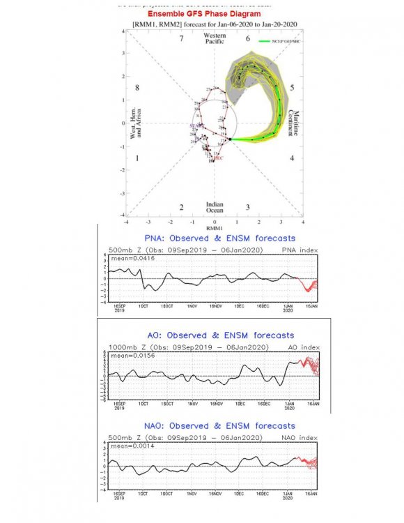
Half of February 08 was spent in unfavourable phases (3-4-5-6) along with a +NAO/AO pattern. We can get lucky depending on where NPAC ridge sets up and how it impacts the gradient. A bit further east into the EPO domain could allow for a slightly suppressed SE ridge.
-
 1
1
-
-
Massive sleet storm on the CMC... yeah no thanks.
-
Light snow has begun. Looks like 2.0" is a safe bet for tonight. Local amounts may approach 3.0" in Toronto.
-
15 minutes ago, Hoosier said:
We are having one for the weekend by God. I don't care if it's a pencil thin band.
LOL. Feb 1-3 GHD part 3. Book it.
-
 2
2
-
-
I was bored so I began watching a radar loop lol. The winter of 2004-05 was a fairly interesting and active winter for most of us. Got around 65.0" locally.
Back when phased storms were a thing lol.
-
 1
1
-


January 10th-12th Winter Storm Potential
in Lakes/Ohio Valley
Posted
NAM trying to do a repeat of the 2013 ice storm in my neck of the woods.