turtlehurricane
-
Posts
5,005 -
Joined
-
Last visited
Content Type
Profiles
Blogs
Forums
American Weather
Media Demo
Store
Gallery
Everything posted by turtlehurricane
-
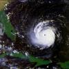
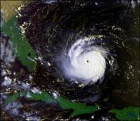
Still deep in the cone here in SouthEast Florida. This is definitely a hard approach angle for anything big to happen here though. Usually the Greater Antilles will suck a storm like this right into the mountains. Could easily see a decent tropical storm impact though, with lots of juicy rain bands.
-
I’m in the cone!!!!
-
I'm loving the weather. Last night we had summer-style rain squalls coming off the ocean. It's the first sign of hurricane season. I went all the way up north on my road trip. Coldest temps I felt were 12 F in Rhode Island with a -8 F wind chill. It was outright painful. On the upside I saw some snow flurries and it was exciting. I've had enough cold weather now, and I'm glad summer is setting in.
-
I finally went on that road trip up north. When I left my house it was around 80 F. It was already getting cooler out by the time I got to Vero Beach, and in St. Augustine it was a chilly 54 F, 20 degrees colder than at my home at the same time. I made it all the way up to coastal southern Georgia so far, where it is a frigid 41 F right now, which is equivalent to the coldest temps I've experienced all winter, and 33 degrees colder than where I live. Heading up the east coast much further today. It looks to be a relatively balmy day today in the Southeast US, but I'm driving so far north that I'll be experiencing the first 30s of the year by tonight, and then eventually 20s by early next week since I'm going all the way to Rhode Island.
-
The whole country has been freezing, but we're in a sealed off tropical biosphere over here. I was at the beach yesterday and the air temp was 85 F, and the water was warm and everyone was swimming. Gotta love it. However, this probably means we are going to have an extreme hurricane season. I've never seen water temps this warm this time of year. This is supposed to be the climatological minimum for ocean temps, and the ocean should be freezing. P.S. Lots of thunderstorm activity over the past day. It's feeling pretty much like summer. Although a cold front is projected to come through later this week and drop highs down to 70 F and lows into the 50s.
-
The rain has gotten extremely heavy, the street I live on has become a river. I planted hundreds of seeds for Tu Bi'Shvat, the Jewish New Year for Trees, and now they will probably all sprout at once.
-
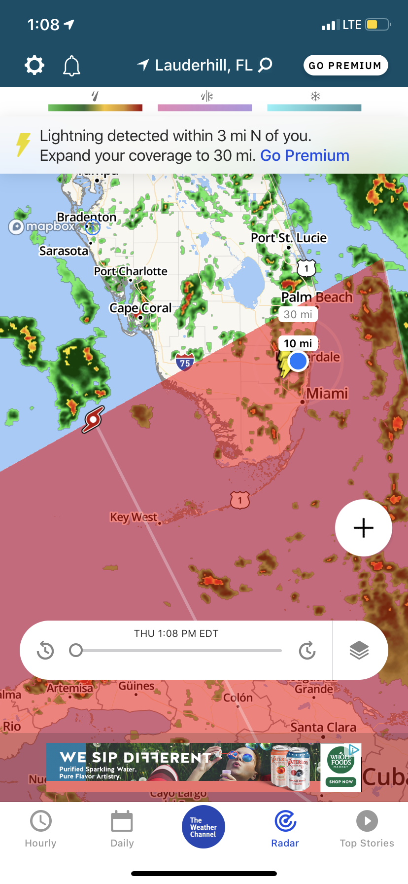
Getting tropical downpours in the middle of the night, temp hovering in low 70s. The frontal boundary literally stalled directly over me, and now starting to be pushed back north. In-fact, wind shift occurred as far south as northern Broward. GFS shows zero FROPAs for at least the next week, just a constantly flow of tropical air from the Caribbean. We might even see Seabreeze season begin. EDIT: It's really pouring, maybe getting an inch or two of rain. Feels like the beginning of wet season, hasn't rained like this in a long time.
-
Simultaneous with the severe weather further up the peninsula, Caribbean air has finally come back here thanks to the strong southerly inflow. It's moist and hot, temp hovering around 85 F. Lows for the entire next week expected to be 70 F. Seems like winter is coming to an end. Still potential to get more spring time cold shots later on, especially when polar vortex breaks down as hemisphere transitions towards summer. Even when that happens tho, the sun angle is rapidly increasing and it will be very hard for cold air to stick around here.
-
Only a day after hitting the low-mid 40s, which was frigid cold for me, it is already up to 75 F and undoubtedly heading to 80 F today. That's the beauty of South Florida winter. It might get cold sometimes, but it doesn't last long. Ultimately I did not go drive up north due to covid restrictions and such. And honestly, I don't think I could've handled the cold up there anyways. I have not felt sub-freezing temps in over 8 years.
-
Powerful FROPA today, been extremely windy and cool even in the heat of the day, and now it's quickly dropped to 60 F, and we're on our ways to the upper 40s tonight. Very strong CAA will make highs struggle to hit 65 F tomorrow. Notably, I am about to be driving north, all the way to New York eventually, so about to really experience winter for the first time in a long time. Looks like by the time I even get north of Lake Okeechobee it will be freezing cold, with highs below 60 F. If I make it all the way up to Georgia tomorrow highs will be around 50 F and lows below freezing. This is really the most extreme time of year to drive north, so I'm excited. Looks like polar vortex will be over New York by the time I get there too, maybe temps near 0 F.
-
Was a nice and chilly 52 F this morning. Highs should be in upper 60s today. Beautiful weather. Still no serious cold shots on GFS though, I guess it's because there's been no nor'easters and no nor'easters coming. Takes an East Coast Blizzard to get temps really cold here.
-
Cloudy and cold this morning with passing showers, feels like New York. GFS shows several cold fronts coming in over the next week so it'll stay fairly cold. Nothing major coming though.
-
Got pretty cold last night, felt really nice. Lows in the upper 40s. GFS has been trending weaker on the cold front later this week. Only about 1-2 months of 'winter' left here, and then the freeze chances will dry up.
-
GFS shows a fantasy freeze out towards 400 hours. In general hinting at an increasingly colder pattern as the month progresses. In the meantime pretty strong cold front coming this weekend, highs in the 60s and lows in the 40s expected.
-
Wow! Yeah this airmass has been cooler than anticipated by a bit, likely due to the fact that it's the optimal time of the year for cold weather. Looks like many more days like this ahead due to upper trough sitting still over the eastern half of the country. No serious cold shots coming though.
-
It's been quite warm here for awhile now, with highs in the 80s and lows in the 70s, but cold front pushing through South Florida tonight should drop our low temps down into the 50s starting tomorrow night and continuing for an entire week, with highs in the low-mid 70s during the same period of time. Basically, some perfect Florida 'winter' weather on the way. I'm excited.
-
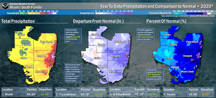
P.S. NWS Miami made an excellent yearly rainfall graphic for South Florida. We got like 100 inches of rain here, which is basically two years worth of rain in one year. For most of the Summer the street I live on was a river, with waves, currents, and aquatic life. I think that's mostly due to the abundance of tropical cyclones this year. We had so many tropical cyclones effect us this year I can't even remember them all off the top of my head.
-
Temps got into the low-mid 40s that night in the SE FL metro area, and it felt frigid cold. First time I saw my breath in a long time. A station in the interior of Palm Beach County hit 35, and Venus, FL, at the far NW corner of South Florida, hit 34. The Panhandle and Northern Florida went deep into the 20s. The lowest I can find after a brief analysis is 22 F. Back to regular Florida winter weather here, 75 F right now. Still really nice compared to the Summer where it's usually 90-95 F. Doesn't look like any potent cold fronts in the next week, but that's typical, cold weather comes in cycles where it's like 2 weeks on and 2 weeks off. So I'd expect in mid January we will see more serious cold fronts.
-
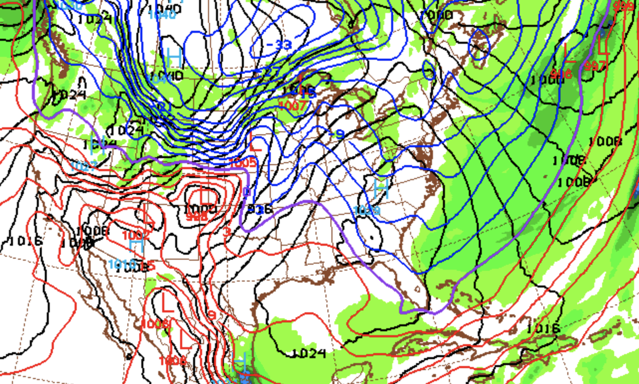
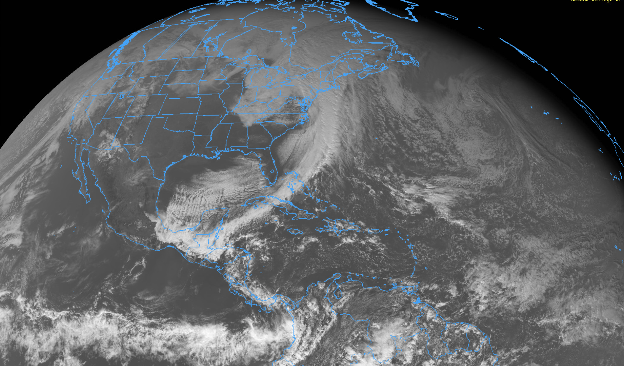
GOES from earlier today. This cold front is by far the dominant feature in the hemisphere. Winds already slackening off big time even tho sun hasn't even set. Only a bit of upper level clouds and they are moving out. Could end up being an ideal radiational cooling setup, with just the slightest flow of winds from the NW which enhances the cooling potential as it blows in boundary layer air from the interior. Notably, very little temp gradient across Florida right now. 53 F here on the SE FL coast, and simultaneously it's 53 F in Orlando. 47 F in Tallahassee, 48 F Jacksonville.

-
Still freezing cold out there, has not gotten warmer all day, at least subjectively. High at FLL today was 59 F, and now temp is steadily declining, so we indeed did not get out of the 50s today! Been a long time since that has happened. Same story down in Miami, they got no higher than 58 F. Dewpoints here are the same as in the Lake Okeechobee region, hovering in the mid 30s. We could end up going into the 30s tonight, especially since a light breeze will be advecting in the colder air from the Everglades.
-
Just past solar noon, so the peak heating of the day has come and gone, and that heating has only managed to get us up to 54 F. Incredible CAA, and once again, we are much colder than forecast by roughly 10 F. I think it has a lot to do with much stronger northerly winds than originally forecast. It's been really ripping out there. NWS forecasting a low of 47 F tonight. If it's 54 F at the peak heating of the day, it makes no sense that we'd only be able to achieve a low 7 F cooler than this under clear skies and continued CAA at night. We could be at 47 F by the time the sun sets at this rate...
-
Wow, definitely colder than forecasted here!!! Was 50 F at 10 am, and now 53 F. A coastal site near me just dropped to 49 F. We could easily fail to get out of the 50s today.
-
I stayed up all night working with my boss, and right around 1 am tremendous blasts of wind rattled the house. Easily gusted to 50 mph. Indeed, many sites on SE FL coast recorded 40+ mph. I was scared a tree was gonna come down on my car. Now sun is rising and temp has crashed to 53 F, and it's still dropping. Literally was 75 F only 6 hours ago at 1 am, dramatic FROPA. About to step out into the winter air to do my morning prayers EDIT: Back from prayers, this is seriously some Wisconsin air!!! It's incredibly refreshing.
-
That sounds nice to me, at least for a day lol. I guess I like South Florida winter so much cause it can get real cold and then it's gone in a couple days. Cold front just entering South Florida, it's passed through Fort Meyers. Squall line died, since cold front outran the convection and cutoff the instability, but front is very well-defined by a band of light/moderate rain, which is interesting to watch on radar. It's moving really quick.
-
The sun is setting now. Although cooler air has made its way across the entire Panhandle, with temps already in the low 40s in the Western Panhandle, the entire peninsula is still immersed in humid tropical air with 70s and 80s. That will drastically change tonight! Also, FROPA will be much more dramatic due to it coming at night time versus the day time. Also, a band of rain/storms has setup south-north along the SE FL coast, its been raining on and off here. The main squall line is getting ready to broadside the entire peninsula over the next several hours.