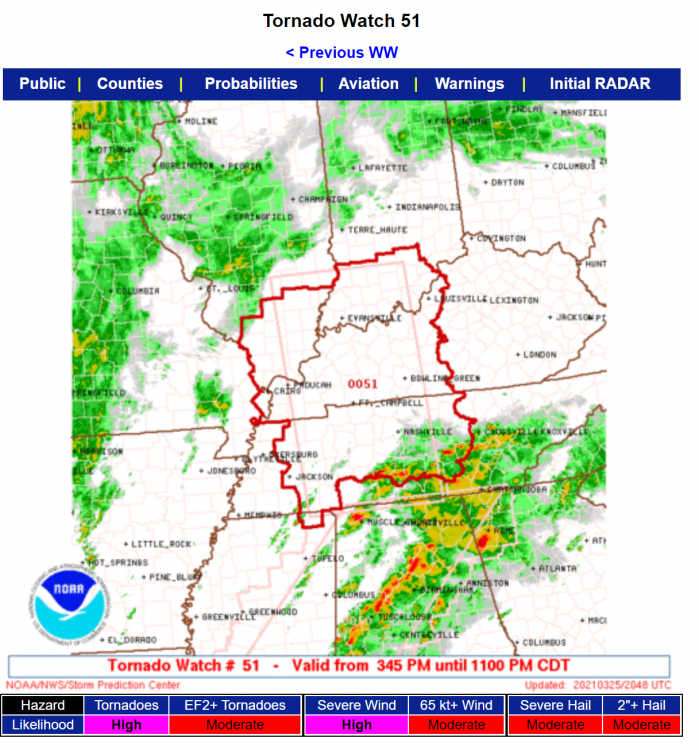
Tornado Watch Number 51
NWS Storm Prediction Center Norman OK
345 PM CDT Thu Mar 25 2021
The NWS Storm Prediction Center has issued a
* Tornado Watch for portions of
Southern Illinois
Southern Indiana
Western and Central Kentucky
Southeast Missouri
Northeast Mississippi
Western and Middle Tennessee
* Effective this Thursday afternoon and evening from 345 PM until
1100 PM CDT.
* Primary threats include...
A few tornadoes and a couple intense tornadoes likely
Scattered damaging winds and isolated significant gusts to 75
mph likely
Scattered large hail likely with isolated very large hail events
to 2 inches in diameter possible
SUMMARY...Thunderstorms are expected to intensify this afternoon
from southern Illinois southward into west Tennessee and track
across the watch area. Rapidly strengthening winds aloft will
increase the risk of damaging winds, large hail, and a few
tornadoes.