Radtechwxman
-
Posts
2,099 -
Joined
-
Last visited
Content Type
Profiles
Blogs
Forums
American Weather
Media Demo
Store
Gallery
Everything posted by Radtechwxman
-
That's what I was thinking. Tight couplet. Thanks
-
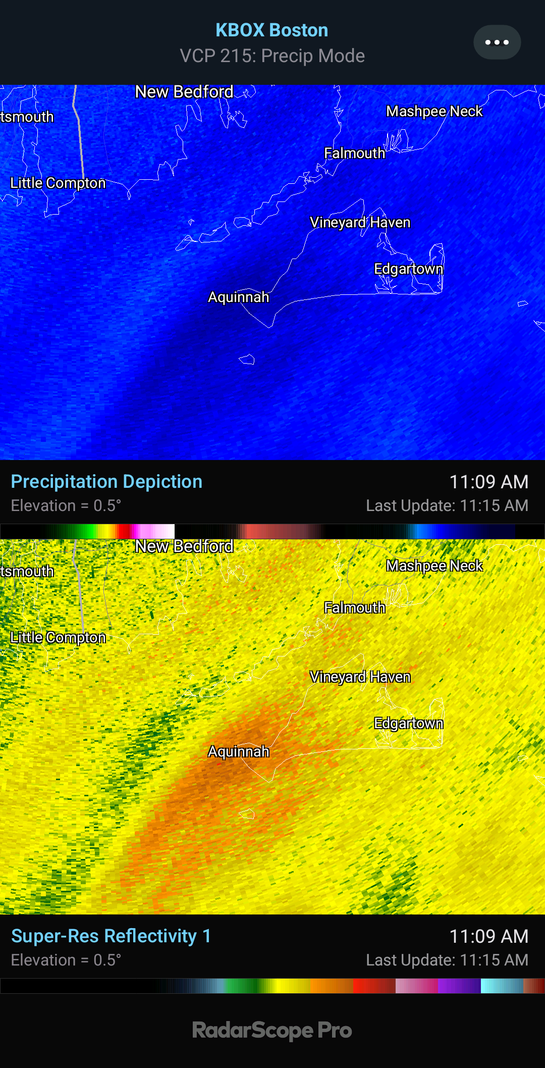
Do you know which storm that's on?
-
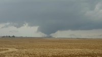
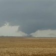
Huge debris fallout. Wow. That likely inflicted a good amount of damage in town.
-
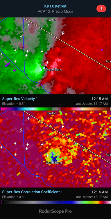
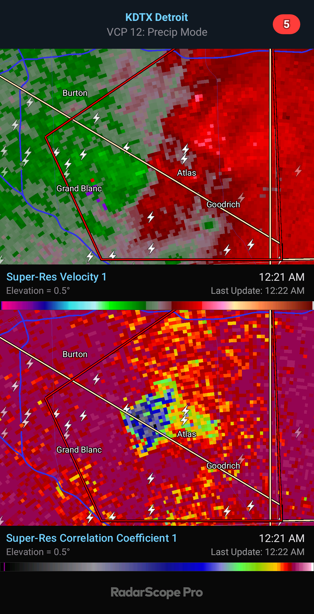
Damaging tornado about to come into Grand Blanc. Wrapped up fast
.thumb.png.2d93c32e08d6ebdfe334b946687feaa6.png)
-
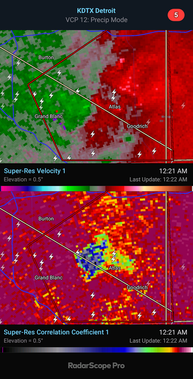
You're pushing it just a bit man. Far from a violent tornado signature. But definitely a damaging tornado at night which is still dangerous regardless.
-
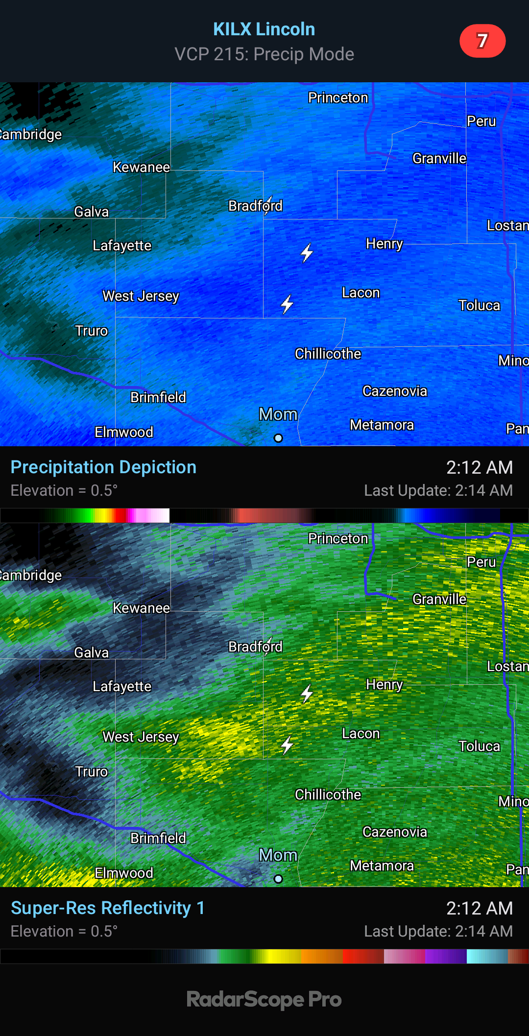
There's no confirmation and no current debris signature. Impressive cell though with strong rotation.
-
Totally agree 100%. Last second moisture return esp in cold season always is a concern. Afraid moisture may be too shallow and can mix out easily like you said. It's too bad all winter we avoided big scouring cf's in Gulf overall but now that severe wx is upon us we are getting them. Ha. But as you said lapse rates will really help. Hodos have great low level curvature so wouldn't take much to produce tornadoes if storm mode avoids being too linear. I feel like wf will be very in play for your area.
-
Euro definitely the most ominous solution of all the models. Lapse rates are good esp for this north and this time of year thanks to that EML. This def bears some similarities to 2-28-17 though for that event we had a well defined wf up this way. I like that sfc winds are south to even slightly backed. Shear isn't crazy but definitely sufficient with that cape profile. Definitely am still worried about cap holding till cf moves in. That dewpoint depression and/or dryline feature could help fire storms ahead of cf if there's enough convergence on it and cap can break. Good thing is storms would likely be discrete. Sfc low is strong but wish it was more compact and not stretched out. Definitely not a perfect setup but definitely one worth chasing.
-
 You're not lying. Insane
 -
Probably from warm antecedent conditions and the wet nature of the snow but if your rates keep up it should overcome it
-
That's insane. Kind of what I figured. Big ol' fatties. Easily getting 2-3in/hr rates there now if not more.
-
Yeah that's a massive epic fail by nws. I understand the downgrade overnight because of model trends but it was clear this morning models are performing poorly and this was a overperformer esp for areas further north.
-
Surprised they didn't get upgraded to a WSW after radar trends this morning. That's pretty bad for being in a WWA.
-
Would love to see a report or video from here. CC shows that it should be mostly snow with minimal mixing. Probably some large aggregates.
-
Did Someone Say Clipper(Hybrid)!?! 1/18-1/19
Radtechwxman replied to Frog Town's topic in Lakes/Ohio Valley
The best banding for this definitely ended up pretty south. Some areas south of the wwa's may overperform. -
Did Someone Say Clipper(Hybrid)!?! 1/18-1/19
Radtechwxman replied to Frog Town's topic in Lakes/Ohio Valley
Sounds about right. Lol. We had an uptrend in models now followed by a downtrend. By the looks of this, I was thinking it could be an overperformer. Guess not, ha. #2024 -
Did Someone Say Clipper(Hybrid)!?! 1/18-1/19
Radtechwxman replied to Frog Town's topic in Lakes/Ohio Valley
Yeah 0z runs no beuno. Lol. Of course better I80 north. Shocker. They get the front wing of precip and just a glancing blow here. Was looking solid for 2-4in here but now probably an 1-1.5in at best. Is it Spring yet? -
I'm glad last night overperformed here because I look to get little if any snow based on latest hrrr/rap guidance on back side
-
You're really in the thick of it now. Mesoscale band parked right over you.
-
Hrrr nailed the waa snow tonight. Nam/rap only clipped me briefly with it. It's been snowing here since midnight with some impressive periods of moderate to heavy snow. Wind pretty intense in these mesoscale bursts. Looks like it's about to end here. Sadly that will start my warm up and set stage for rain or mix through afternoon before changeover. Hoping it doesn't all melt what fell tonight. Looks like a good 2-3in outside but hard to say cuz it's really blowing around.
-
Thundersnow starting to get active!
-
I know. I'm impatient. Probably because this is the "main event" for me. Precip blossoming in MO and a nice convective feed into this band up north.
-
I'm sure that will be me here soon. I don't buy the hrrr output
-
I hope more precip blossoms south of this initial waa band like hrrr suggests. Otherwise not going to get much at all.
-
I was about to post this and say the almighty snow bosoms. RIP


.png.c2d7312adbec4991c0f41c159527c7cd.png)