scope1
-
Posts
135 -
Joined
-
Last visited
Content Type
Profiles
Blogs
Forums
American Weather
Media Demo
Store
Gallery
Everything posted by scope1
-
Switched over to sleet
-
Flurries in McLean!!! First flakes of the season!
-
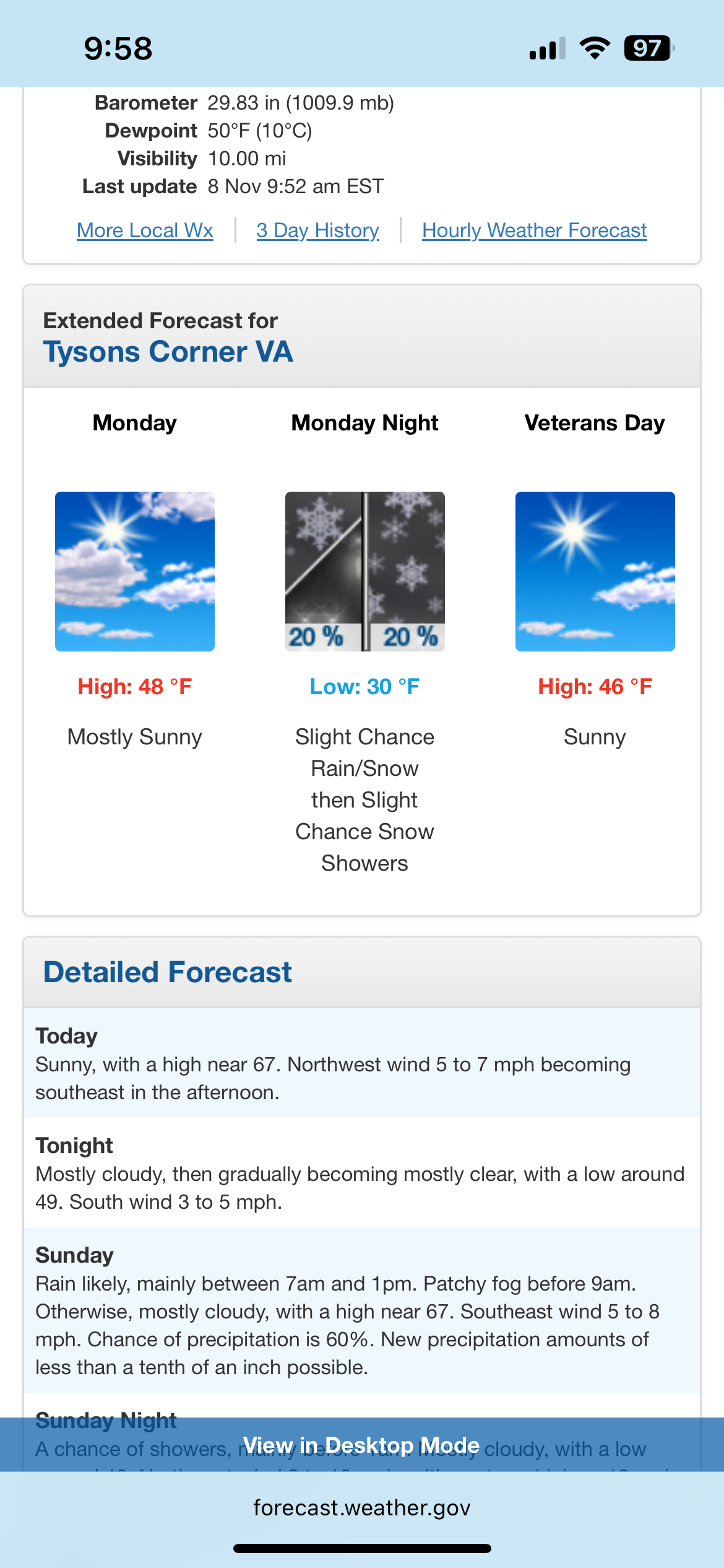
South trend came 12z GFS but now it’s too far south and all rain central/southern VA
-
FWIW
-
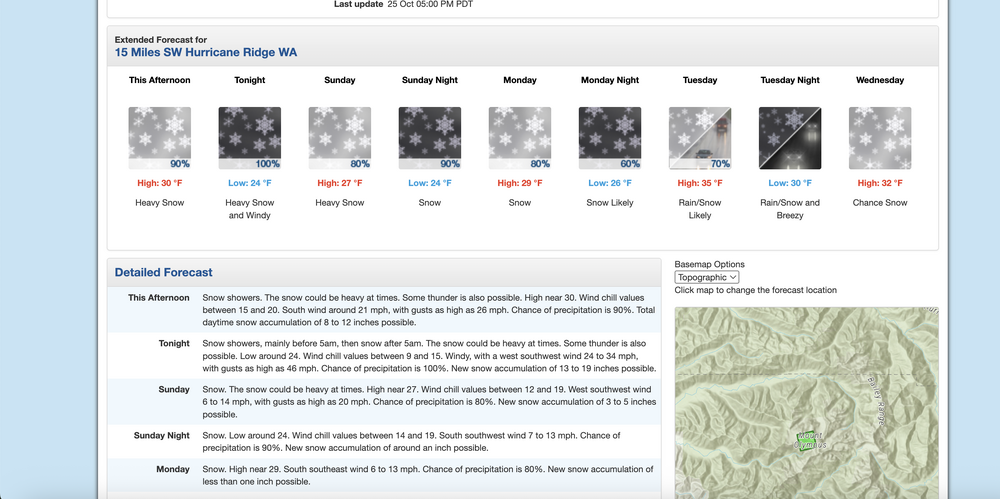
Should be a fun night in the mountains of Washington State. Perhaps they will get more snow tonight and tomorrow than what we will see in 2+ years. I remember being up there in September a few years ago near Leavenworth, WA and there was snow/sleet with accumulation at some higher elevations.
-
Light rain in mclean
-
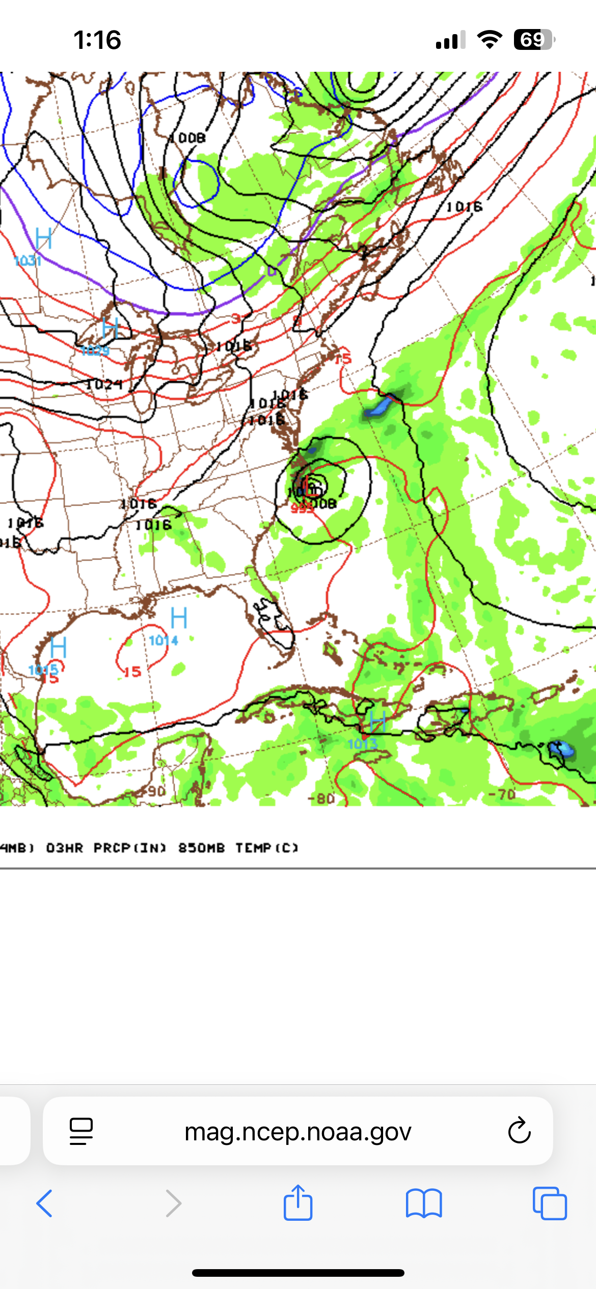
Hour 177 is interesting. 6z GFS had the storm much closer to the DC area but still something to watch.
-
Light rain has started in mclean
-
Been sitting in the sweet spot constant thunder lightning and rain. Flash flood warning for my house.
-
Looks like I could have a round 2 for thunderstorms here from the storms near Dulles airport which were severe warned earlier. Just heard thunder.
-
Thunderstorm in McLean. Lots of thunder lightning heavy rain and a little wind at times.
-
Heavy downpour in McLean but no thunder/lightning.
-
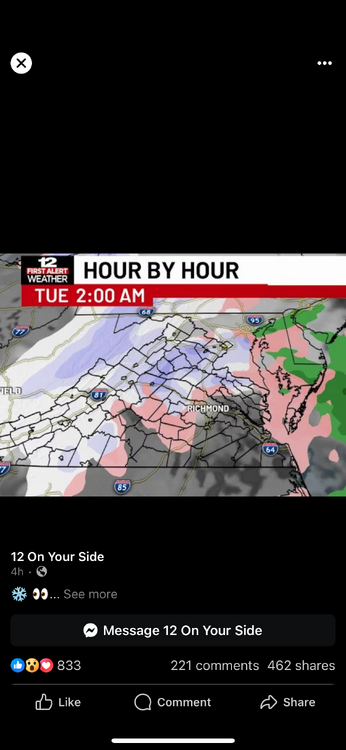
Only a few drops of rain at the house but went for a quick drive earlier and there was a downpour only a few minutes drive away especially towards downtown McLean. Also was in Richmond yesterday and they were getting rocked, very heavy rain and tons of lightning/loud thunder. Some flooding on roadways out that way, a flash flood warning was issued.
-
Had very loud thunder and plenty of lightning earlier. Still some activity going on but nothing like an hour ago. Enjoyed it.
-
Rain shower here from the outermost band of Chantal. Pretty cool.
-
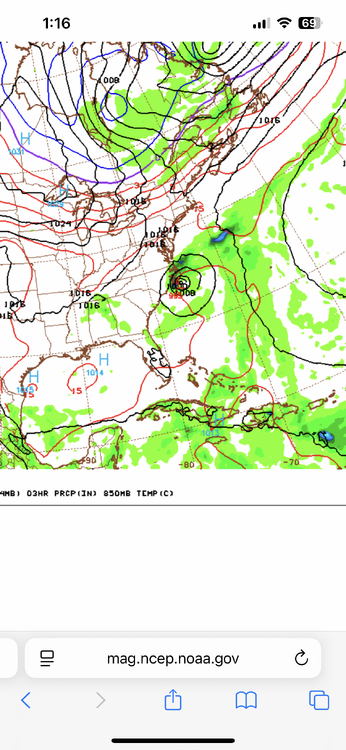
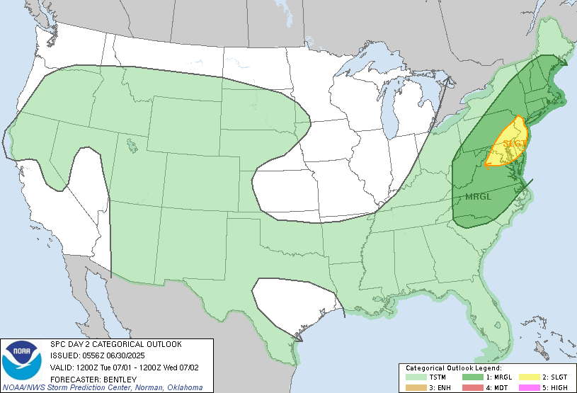
Slight risked for tomorrow.
-
Yep lightning was extremely bright and vivid around here last night. Very loud thunder as well.
-
Rain has commenced.
-
Flurries
-
About 45 min ago briefly had heavy wind swept rain with small hail.
-
Sleet
-
Steady snow for the past hour. Deck has a coating and grass is starting to whiten.
-
There was a snow/sleet mix earlier but lasted only about an hour. Watching the precip in west Virginia entering Virginia for later.
-
Seeing some very light flurries just now.