-
Posts
8,488 -
Joined
-
Last visited
Content Type
Profiles
Blogs
Forums
American Weather
Media Demo
Store
Gallery
Posts posted by LongBeachSurfFreak
-
-
3 minutes ago, MJO812 said:
Good things are going to happen when you have a sub 980 low southeast of LI.
Not with a crap airmass. You need it to pound to scour out the urban heat island. This is going to come down to rates or you’re going to waste allot of snow. Outside the city and the immediate coast, not as big a concern.
-
 1
1
-
-
1 hour ago, donsutherland1 said:
It should be noted that the low temperature during the storm is 34 on the 18z HRRR. NYC has never had a 10”+ snowfall with such temperatures. The NAM briefly dips below freezing, so its solution is more defensible based on its own numbers. Until the other guidance suggests colder readings than 34-36, it’s difficult to buy these more aggressive solutions for NYC, JFK, and LGA.
During heavy snow you can force the temp quickly down to 32. We have seen this in many late season events (which this basically mirrors do to the ascendant airmass)
So for the city and coast if we can get heavy rates there’s a definite upside. If all we can manage is moderate, then it’s a slushy grass and car topper. Any elevation, even a couple hundred feet could be key here. Having done snow removal for a decade on the uws, I have seen multiple events like this were we have several inches up there and CPK and midtown struggle to accumulate. Being at 150’ and just north of the main heat island helps.
-
 1
1
-
-
1 hour ago, Allsnow said:
Probably never see this again…
One of my favorite storms. I was in college just north of Baltimore and had a 30” pack after the storm. No classes for a week, party after party. Drunk sledding on campus. Good times.
-
 1
1
-
-
Just now, MJO812 said:
I think this surprises. Cold air is not fleeting. If we get a good track with a bombing low then we will do well.
Think mid March storm. Urban nyc is really going to struggle with temps. To me this is a 3” in the NW Bronx and zip in midtown type scenario.
We are really going to be relying on heavy banding as the low is pulling away for anything meaningful closer to the coast. Is it possible of course. But could easily be white rain. -
2 minutes ago, jm1220 said:
Very preliminary I’d say 1-3” for the north shore away from the city, maybe an inch if lucky in the city and south shore. 3-6” north of the Tappan Zee and 6-12” near I-84.
Sounds about right, I’m going for 1-2” here on the far uws, where we usually do far better then the south shore in this type of setup. So based on that, a coating or zip on the south shore.
-
 1
1
-
-
-
1 hour ago, Yanksfan said:
Holy crap. 2005 redux in the making!
Yeah. This really isn’t a stretch. Pretty much everything you want to see for a busy season lining up. Does that mean we get hit? Of course not, but it does mean a prolific swell season for area beaches regardless of tracks.
-
3 minutes ago, the_other_guy said:
Whiteface is hands down the best ski area in the region. if you could ski that, you could ski anything. On a good day it is spectacular. On a bad day it presents some of those most challenging skiing around at a marked trail resort
I have been about a dozen times over the years. It’s amazing on a fresh snow day, but holds up its rep when the wind is howling and it hasn’t snowed. Most vertical in the east by far and if you add the chutes the most challenging terrain.
-
9 minutes ago, MJO812 said:
That's good enough for snow
Storm track dependent yes. It’s still prime snow climo. Luckily we aren’t seeing this a month later or for sure we would be in trouble.
-
 1
1
-
-
8 hours ago, CPcantmeasuresnow said:
Why is it that everyone in New York always seems to look to New England as the snow paradise when we have the entire Adirondack region with higher peaks, cold as or colder winters and as much snow if not more so? Not a skier so curious why that seems to be the case.
The Adirondacks aren’t ideally situated for snow. The orientation doesn’t produce upslope like the greens. The western portion which does get enhanced lake effect is nearly unpopulated. And the largest ski resort whiteface has the reputation as ice face do to it being a nearly stand alone peak. That means it’s extremely wind prone and doesn’t produce upslope well.
Personally I love it up there.-
 1
1
-
-
1 hour ago, brooklynwx99 said:
Baked Alaska let’s goooooooo. Bring the cold, keep it long enough in a nino and something will eventually work out. It’s not going to be cold and dry for three straight weeks.
-
 2
2
-
 1
1
-
-
1 hour ago, North and West said:
Yeah you gotta watch the Oliver stone doc on nuclear, incredible. Some amazing safe small scale tech now exists. But unfortunately country’s like Germany are shutting down their remaining reactors, in favor of so called green tech like burning trees. Which they import without hesitation from all over the world.
The real fix will come when we have viable fusion, that’s the game changer.
-
10 minutes ago, donsutherland1 said:
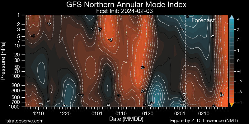
At least for now, the 12z GFS is an outlier. The GEFS is colder and the EPS is even more aggressive with the cold. The weeklies continue to show the cold. Moreover, the forecast EPO-/AO-/PNA+ is also consistent with a colder outlook.
That triple combo is a lock to produce mid to late February if it occurs. We just need all those pieces to finish the puzzle. We did extremely well in 13/14 14/15 with that combo.
-
 3
3
-
-
Brutal out today. Nothing worse than cold rain over preforming. It’s been raining moderately for hours on the uws. To think, at the top of the Nordstrom tower flat roof 1550’ it’s probably snowing or close to it.
-
 1
1
-
-
-
1 minute ago, LibertyBell said:
I hope so too, hey we got a 6" snowstorm in late February in 2008, so it's definitely possible even in a mostly mild winter-- that was another brutal winter and that was the only snowfall of note that winter (that was also the winter when we had that horrible "Heavy Snow Warning" non event in January.)
That was on of the worst forecasts from the nws post 2000. I vividly remember watching the street light all night waiting for the change over that never happened. There was a slushy coating from about the northern state north however.
I wouldn’t be surprised if we somehow strike out again for the rest of the winter and have a cold damp April, just to rub it in. But I’ll stick to my guns right now with a mid/late February at least advisory level event.-
 1
1
-
-
3 minutes ago, LibertyBell said:
We discussed the origin and fate of the universe, mass extinctions, organic farming and climate change lol. "Only in New York (subforum)" would you get such a diversity of discussion lol -- especially when the sun hasn't been out in about a week and there hasn't been any significant snow in over 2 years.
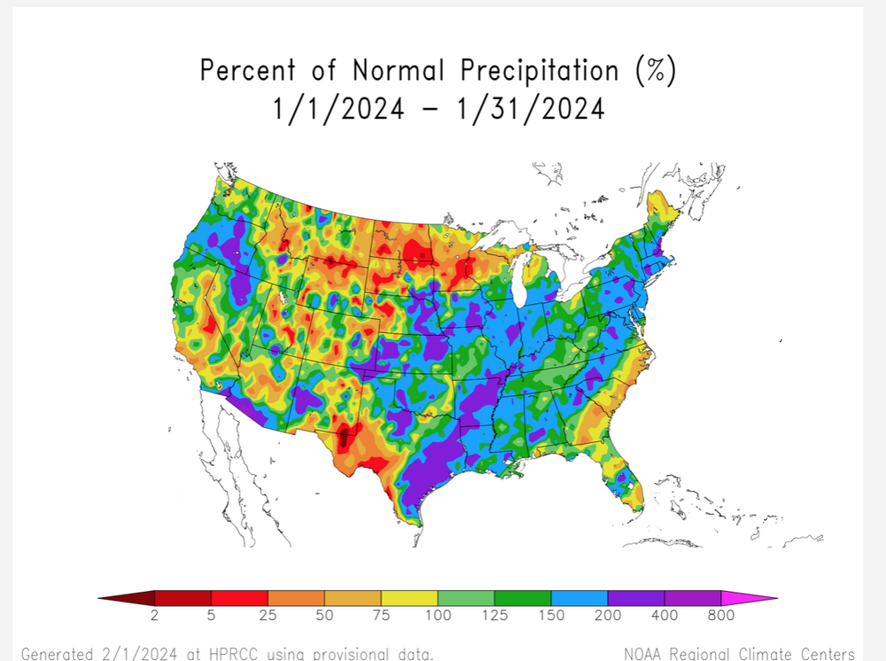
Yeah. What a brutal stretch. Right on the south shore it’s been even longer, 3 winters in a row now. I do have faith in the my original call made at the beginning of the winter that February will produce our first warning level event right to the coast however. It was based mostly on nino climo and the tendency of our winters to be backloaded.
-
 1
1
-
-
44 minutes ago, forkyfork said:
how can anyone be a denier anymore lol
Politics. Still clinging to its “just natural variability” the oil industry has allot of money and allot of PR firms.
-
 2
2
-
-
6 hours ago, LibertyBell said:
I saw a total of 0.5 inch at Mt Pocono, I guess that's the most we can expect from this.
My uncles place mid way between Scranton and Binghamton at 1900’ got 6”. So you just missed out on good banding. It was a lack of precip issue. I’ll be there this weekend.
-
 1
1
-
-
Had some ice on my car the way into work from lynbrook. So it was either melted snow that froze or freezing drizzle. Currently on the uws everything just wet.
-
 1
1
-
-
34 minutes ago, psv88 said:
When Alaska is cold we are warm and the reverse is true as well
That’s been my rule of thumb, obviously there are exceptions but it’s almost always the case. I believe during the record February 15 NE snows Alaska was like +30
-
 2
2
-
-
15 hours ago, Volcanic Winter said:
This is a spectacular summary of the Chicxulub impact and what we know about it. I’ve read through this several times and still always come back to it. Keep clicking through to each page as you get to the bottom (the formatting is a little not obvious).
https://www.lpi.usra.edu/science/kring/Chicxulub/regional-effects/
I have been following this Australian guy on YouTube who has some great research on some recent large impacts. One in the Indian Ocean that produced a huge tsunami that affected the topography of southern Australia and another possible one in the Mediterranean that affected the Sahara. So large impacts may be more common than previously thought.
-
 2
2
-
-
On 1/24/2024 at 9:55 AM, LibertyBell said:
speaking of podunk LOL
You would be surprised how much money there is around the top ski resorts out west. If you’re really rich you don’t go to New England to go skiing.
-
 1
1
-
-
33 minutes ago, LibertyBell said:
Even when there's no precip it still seems to be mostly cloudy. If there's no storm around where exactly are all these clouds coming from? For example, after today it's supposed to be mostly cloudy for the rest of the week, but there are no storm systems around. Is this because we don't have any strong fronts to clear us out?
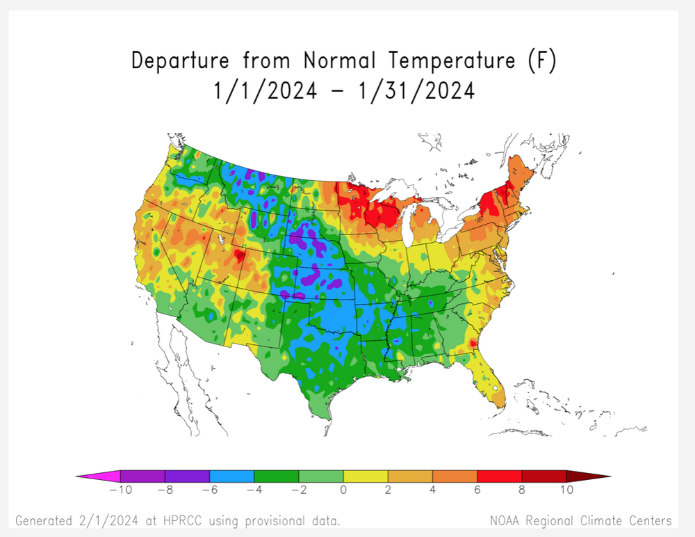
It’s called El Niño, amped up pac jet and allot of onshore flow. We haven’t had your normal winter polar/arctic highs which bring days of brilliant sunshine.
-
 1
1
-


2/13 Significant/Major Winter Storm Discussion & Observations
in New York City Metro
Posted
I have to admit I did not see this one coming. I still think your going to see the highest totals just outside the urban heat island and the immediate coast do to the marginal airmass at the start. But anyone even urban areas, that gets into the ccb with 2”+ hour rates will have no problem accumulating. I’m thinking big giant flakes. This is going to be a pure snow globe event. Hopefully minimal tree damage and power outages.