-
Posts
26,462 -
Joined
-
Last visited
Content Type
Profiles
Blogs
Forums
American Weather
Media Demo
Store
Gallery
Everything posted by Allsnow
-
Yeah, all the ensembles agree of a long stretch of below normal weather starting on the 13th
-
Really nice ensemble runs overnight. All have that classic look with the block decaying as it moves southwest popping the pna.
-
Snow droughts happen
-
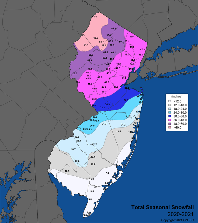
I don’t disagree that the winters have been warmer the past 9 years. What I disagree with is your assumption that we would need a major volcanic eruption for over 50 inches again in nyc. Just two years ago areas very close to NYC had over 50. We have also had very poor pna the last few winters contributing to the warmer winters. You’re forecasting persistence over a 9 year sample size…
-
A favorable Pacific for more then a week
-
“Absent of some type of major volcanic eruption”
-
You obviously didn’t read the entire post…
-
That’s not what he said
-
I’m not denying the winters have been warmer but to say we need volcanic eruptions for 50 inch winter in nyc is ridiculous
-
A small sample size considering areas close to NYC have had over 50 inches of snow in one season over the last 4 winters.
-
I had over .50 here last Thursday
-
CMC agrees
-
Big rain storm on the euro for the 12th, so much for the dry weather
-

It was a Flop... February 2024 Disco. Thread
Allsnow replied to Prismshine Productions's topic in New England
Might be time to call it? -
This is a ridiculous post…
-
Don’t feel bad, they had close to 100 last winter
-
@bluewave no snow in nyc until March? I think we get something before that with the pattern depicted
-

It was a Flop... February 2024 Disco. Thread
Allsnow replied to Prismshine Productions's topic in New England
Repeat of the January storm for @40/70 Benchmark


