SchaumburgStormer
-
Posts
5,911 -
Joined
-
Last visited
Content Type
Profiles
Blogs
Forums
American Weather
Media Demo
Store
Gallery
Everything posted by SchaumburgStormer
-
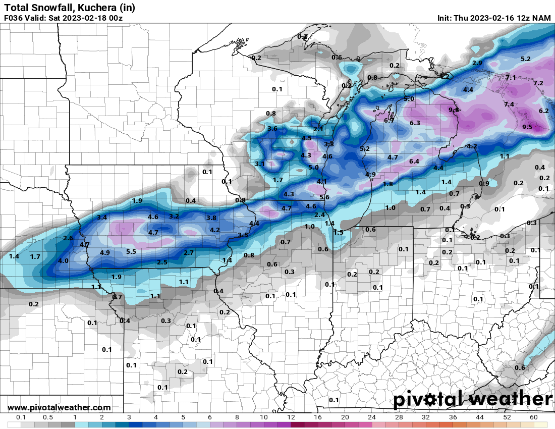
NAM well north with the cold stuff
-
I thought my pc froze
-
Waiting for model weakening and qpf lowering, as is tradition
-

Winter 2022/23 Banter Hangout
SchaumburgStormer replied to Chicago Storm's topic in Lakes/Ohio Valley
In St Louis over the weekend, took the kids to the park yesterday and already headed for a balmy mid-60’s today. MSP can have this big winter storm as long as they promise to take all of them in late march and April -
The band is spicy, but relatively transient. Either way it’s a top winter event for someone along the lakeshore
-
South… weaker….
-
So you did reel it in… you just didn’t tell us your were reeling north
-
Continues to be lame as the band weakens
-
P lame under the start of the defo
-
Light snow now, with the layer of sleet and freezing rain, should make roads a treat.
-
Sleet and occasional freezing rain continues, although on CC it’s starting to look like the snow line may be moving.
-
And now some light freezing rain.
-
Kitchen sink continues, now sleet with graupel
-
The back and forth sleet to snow has made roads miserable around here.
-
Looks like I-88 is roughly the transition line currently. It’s pounding now, 1/2 mile vis.
-
Back and forth now here, sleet under lighter returns with snow/snow mix under the heavier.
-
Sleetfest in sycamore.
-
Been chilling with a nothing-burger all morning, but it looks like something may finally be filling in SW
-
Both the HRRR and the RAP want to drop decent snow imby, with the NAM/GFS pushing the mix line to right above my head. Expecting the kitchen sink today, but what a dicey forecast.
-
RC’s comments notwithstanding, GFS/NAM seemed to have ticked back north while the high res is south. Going to be one of the more “nowcast” types of storms that we have had in awhile.
-
Winter 2022/23 Medium/Long Range Discussion
SchaumburgStormer replied to Chicago Storm's topic in Lakes/Ohio Valley
-
I folded long ago, so kudos to those who are staying to see the flop.
-
LOT: "There are other factors, though, that could play a role in limiting how much snow we`ll get compared to what most model guidance is currently advertising, including the aforementioned dry slot preventing complete saturation of the dendritic growth zone (resulting in poorer quality snowflakes and lower snow-to- liquid ratios) and the possibility of convection to our south limiting much moisture will reach our latitude. Also worth noting is that setups similar to this one featuring a positively-tilted trough and a not overly deep low have also underperformed here in the past when other mitigating factors such as dry slots and moisture robbing have been involved."
-
GFS has slipped a bit south, but is still a north outlier. Euro is south in and represents a good blend of the GFS & HRRR. 12Z NAM having its issues with snowfall depiction, but looking in line with the Euro. Baum really working this one back to $$