CoolHandMike
-
Posts
1,652 -
Joined
-
Last visited
Content Type
Profiles
Blogs
Forums
American Weather
Media Demo
Store
Gallery
Everything posted by CoolHandMike
-

E PA/NJ/DE Winter 2020/2021 OBS Thread
CoolHandMike replied to Rtd208's topic in Philadelphia Region
It's gusty with the occasional shower passing though just north of Reading. Sounds like a minor squall just went through, but no significant rain up here just yet. Seems like everything is passing to the south of us. -
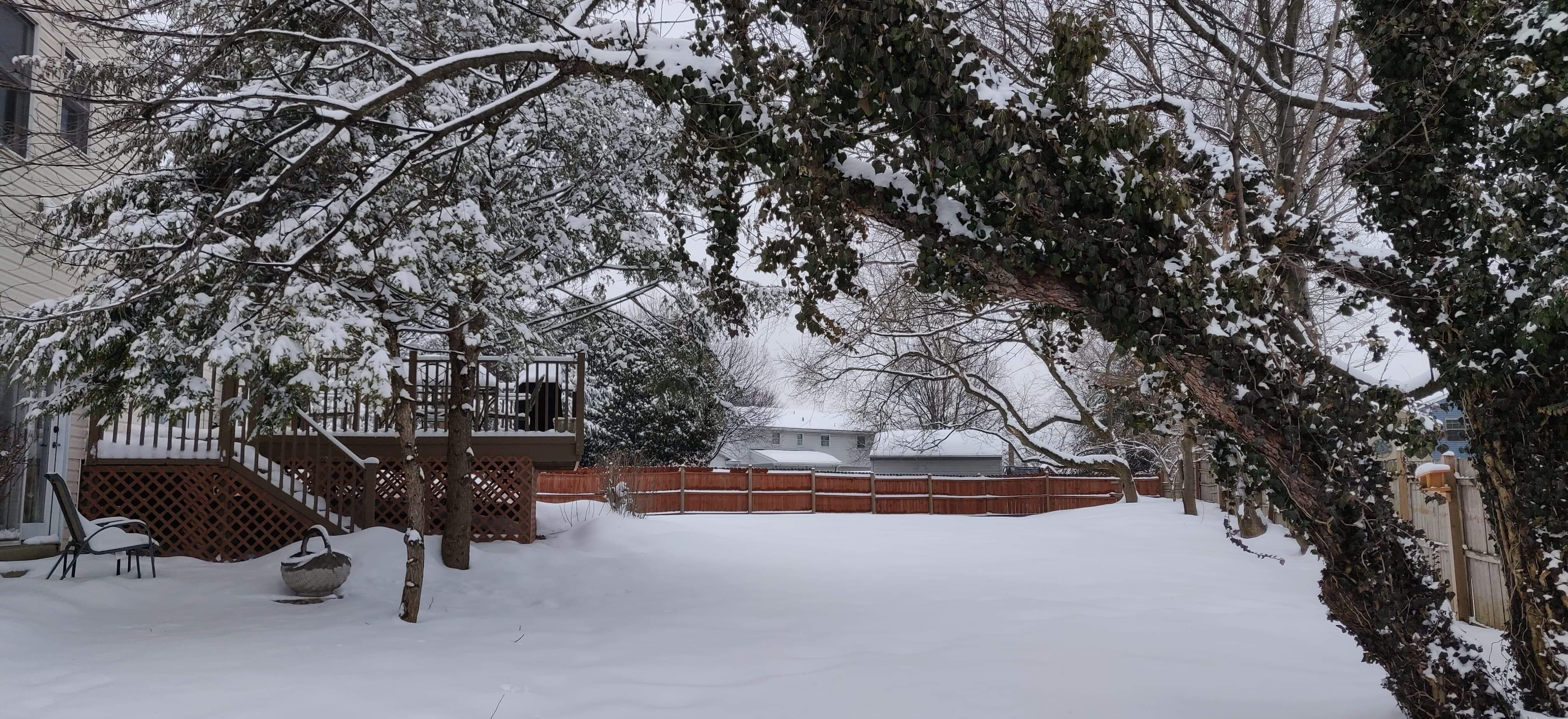
Got about 6" here just north of Reading. Lucky for me, the previous owners of my new house left 2 non-working snowblowers behind. I was able to get one of them working, so this was my first snowfall where I got to use one. The only thing I had to shovel was the front steps. That was awesome!
-
Holding at 22.6°F for the past hour. Initially I am dissapoint with the precip results, but upon further reflection, this has turned out to be a really good little event for this early in the year. Sure, I would have liked for the forecasted 2' of snow to have materialized, but I'll take my 4-6", grass-hiding, sleet-topped, La Nina anomaly, especially in our climate. So, somewhat bummed, but also somewhat thankful. Looking forward to taking pictures of my new house covered in snow tomorrow. Also, no way in heck I'm driving to work in southern NJ tomorrow at 4 in the morning, so that's also a plus. I'll take any kind of snow day I can.
-
22.8°F and light sleet. ~4" on the front steps, ~6" in the back yard (measured depth to ground). Wondering if we will get any colder or if we're bottoming out right now.
-
Anyone want to hazard a guess as to why all the models and predictions turned out to be so wrong with this storm? Two days ago we were supposed to get almost 2' of snow, then yesterday they backed it off to 13", and now I have barely 4" with sleet coming down much further north than predicted, with not much else seemingly incoming. I mean, I want to be happy for the first major snowfall in a long, long while, but why the huge bust this time?
-
I do believe I'm getting dry-slotted at the moment. Huh. Where's the rest of the storm?
-
Occasional sleet starting to mix in. It's really sporadic, but definitely there.
-
Only have ~3.5 inches of really fine, dry stuff here north of Reading. Temp down to 23.5°F and getting windy. Grass finally completely covered.
-
December 16-17, 2020 Winter Storm
CoolHandMike replied to Ralph Wiggum's topic in Philadelphia Region
Temp dropped to 25.2°F and still light, steady snow here just north of Reading. -
December 16-17, 2020 Winter Storm
CoolHandMike replied to Ralph Wiggum's topic in Philadelphia Region
My wife bought me Radarscope as an early Xmas gift. How do I get to the "precipitation depiction" pane? Is this a mobile-only type thing? I'm using Windows 10... -
December 16-17, 2020 Winter Storm
CoolHandMike replied to Ralph Wiggum's topic in Philadelphia Region
I've got 26.8°F and steady light snow just north of Reading. Already coated the roads and sidewalks. I officially have snow on snow (some remnants of Monday's little event)! -
December 16-17, 2020 Winter Storm
CoolHandMike replied to Ralph Wiggum's topic in Philadelphia Region
Seconded. This is a place to celebrate and sympathize with fellow weather nerds. -
E PA/NJ/DE Winter 2020/2021 OBS Thread
CoolHandMike replied to Rtd208's topic in Philadelphia Region
So I got one of the snow blowers working. I had to kludge together a linkage for engaging the auger, which then immediately broke. The only thing I could find last minute was a lawnmower throttle cable, but the actual lever is made of the cheapest plastic known to man and almost immediately shattered under load. Oh well. Ordered some correct replacement parts, and with any luck they'll be here on Tuesday... We shall see. But I was really happy to get it running after sitting neglected for who know how long. It's a 1996 Craftsman, FWIW. -
E PA/NJ/DE Winter 2020/2021 OBS Thread
CoolHandMike replied to Rtd208's topic in Philadelphia Region
Truth. Planning on doing it today while smoking a pork shoulder. -
E PA/NJ/DE Winter 2020/2021 OBS Thread
CoolHandMike replied to Rtd208's topic in Philadelphia Region
Welp, one of my neighbors fired up his snowblower yesterday... I think I might have to see if I can get one of mine working since I won't have any free time between this evening and Wednesday. As much as I'd like to be superstitious and not jinx anything, it's looking like a pretty credible event is going to happen at this point. Not sure what I'm going to do about work though. I have a 1.5 hour commute to southern NJ all this week, for which I leave at 4AM. I know they're not gonna be happy if I call out Wednesday morning, but I don't want to get there and then be stuck down there on Wednesday. My wife certainly would not appreciate it. -
E PA/NJ/DE Winter 2020/2021 OBS Thread
CoolHandMike replied to Rtd208's topic in Philadelphia Region
Oh, I'm fairly comfortable with small engine repair. I just haven't had the time yet, what with all the other new house stuff that's been needing doing. I told my wife that if it does end up dumping on us, that's when I'll try to get one of them working. -
E PA/NJ/DE Winter 2020/2021 OBS Thread
CoolHandMike replied to Rtd208's topic in Philadelphia Region
I tell you guys what. My wife and I bought our first house this past October, and it came with not one, but TWO non-working snowblowers, one from the 80's and one of a much newer vintage. (Dunno why. The previous owners were a riddle wrapped in a mystery inside an enigma.) I've been itching to get either or both of these bad boys up and running, but with the colder weather fast approaching, my wife recently turned to me and said "don't you dare". She's superstitious like that. So there they sit, in my shed, in all their un-working glory. It would be awesome if our first major storm dumps enough to warrant the operation of such a machine, and I would not complain one bit having to shovel it all out by hand. The first time, at least. So there you go. I'm doing my part, everyone. -
So when's this rain supposed to start? 1-2" that wunderground is calling for seems a little far-fetched imho...
-
I remember there was a massive, pitched snowball battle on main campus. I also remember all the cars being completely buried. It was epic.
-
March 2, 2019 Snow Event Discussion
CoolHandMike replied to Ralph Wiggum's topic in Philadelphia Region
turned out to be kind of a dud here. Mostly sleet, and it never really got below freezing at the surface. Saw very little in the way of actual snow.


