rochesterdave
-
Posts
6,707 -
Joined
-
Last visited
Content Type
Profiles
Blogs
Forums
American Weather
Media Demo
Store
Gallery
Posts posted by rochesterdave
-
-
Pretty heavy stuff in Irondequoit for last 2 hours. Looking at about 3” in the grass. All new. Really picking up now.
Looks like it Finally got cold enough to jump start Ontario.
-
6 minutes ago, CNY-WXFREAK said:
Looks good on its approach but as it gets closer it pretty much disappears. The flake size was forecasted well by most guidance when I looked at the soundings from KFZY yesterday. Snow growth didn't look good at all for pretty much the whole event but I figured with abundant synoptic moisture pretty much up tp 300MB so I didn't think it would be a big deal, but it always is, lol. Definitely not gonna radar watch all night thats for sure, but ill check the cell periodically and also check in here once in a while.
Since I've lived here, every time an event was forecasted such as this one, with a stacked LP over VT and NH that just sits and spins for 48hrs,, was forecasted, it never under-performed, never, but there's a first time for everything I supose, lol!.
But is it underperforming on qpf?
Im in complete agreement. This setup is usually gold. Maybe give it a few more hours.
-
Rochester has had nada. Light snow and 34. Frustrating. Lol
-
1 minute ago, CNY-WXFREAK said:
Those NWS maps are the worst product they produce I think cause they are never, and I mean, NEVER right, lol!
They start super high and then chip away.
-
8 minutes ago, wolfie09 said:
Hopefully the Hrrr is on to something..
Every degree matters..
Would obviously accumulate more efficient..

That would be plenty cold rnough to get LES going with efficient accumulating
-
This is the time when I usually get real anxious and call the storm off. Gonna stay strong this time. We always get it on the backside.
This is a good setup.
-
NWS has no handle on this. It’s gonna be what you see is what you get. 34 and snow in ROC. Actually a bit cooler than I expected at this time.
Its a solid set up for ROC and SYR. We will know by midnight.
-
 1
1
-
-
Look at those yellows and oranges on the ridge. Ouch
-
Looking like it might be a tick cooler than originally feared. I’m starting to like this one. Not much rain is depicted on the 12z’s.
-
You can already see precip backing in on radar. It’s a classic sign of a strong, well developed LP to our east. Cool
-
NWS still hanging onto the thought that this is an east based LES event. QPF has been shown along the western south shore for 5 model cycles now. Ridiculous. They haven’t even hoisted advisories for Orleans or Niagara Counties:
Late this afternoon and into tonight, the combination of the loss of
daytime heating and temperatures in the lower levels cooling a
degree or two will allow for a little more widespread snow
accumulation. Moisture continuing to wrap around the upper level low
will maintain light synoptic snows across much of the region.

There will be areas of enhanced snow within the light synoptic
snows. First, on a northwest flow over Lake Ontario and temperatures
becoming marginally cold enough for lake effect snow, a band of snow
is likely to form near an inverted surface trough on the southeast
side of Lake Ontario. This band may form as early as the mid
afternoon hours. As winds veer some tonight, this area of enhanced
snow may back as far westward as Monroe County. While weak lake
instability, there could be several inches of snow falling in a few
hours. Additionally not only the higher terrain of WNY, and the Tug
Hill...but areas such as the Buffalo Southtowns, and the Bristol
Hills could receive 3 to 5 inches of snow on an upslope flow.
-
I couldn’t agree more. Maybe higher rates will help the cooling? IDK

-
1 minute ago, CNY-WXFREAK said:
00Z WRF is juiced too!
.png.9f07c11178fec7f9d8c94ad45f16fca9.png)
Look at the difference between the Chataqua Ridge and the Valleys in the Finger Lakes. Wow!
-
-
Yeah. Canadian came in a bit cooler. It’s a pretty solid model. It’d be great if everyone could get in on this. Especially BUF.
-
5 minutes ago, MAIDEsNow said:
House looks to be in a really good spot.
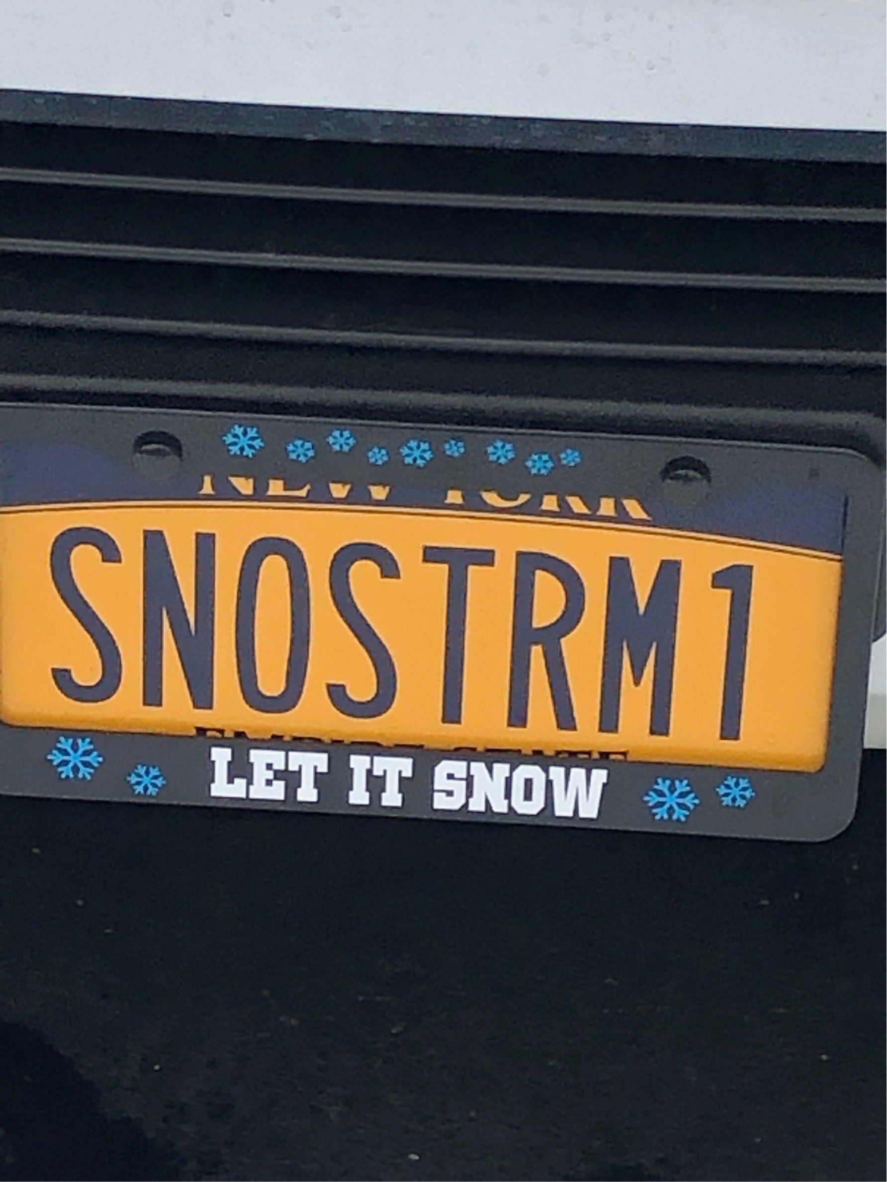
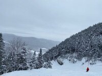
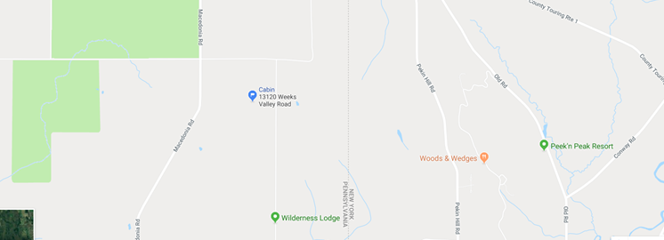
The cabin appears to be locked and loaded for a pretty big snow. Will definitely be out there Tues and Weds night. May go tonight. Will take some photos and provide updates from the western end of the chautauqua ridge (just west of Peek Peak and just north of the Wilderness Lodge resorts)
Awesome! Enjoy
-
The Erie lakeshore proper won’t see those totals, but they do have better thermal profiles than the immediate Ontario shoreline. The big snows will be inland up on the ridge. Erie lake shore is forecast for 3-4” at Dunkirk by NWS.
-
18z NAM is warm. One run.
Did EURO look ok Wolfie?
-
-
It’s more surface temps I think. Ratios. 700 looks ok. 850 marginal. 2 meter is rough.
-
NWS going all in. I’m on the fence- surprise! If Syracuse gets a watch and they’ve coordinated, I bet Monroe and Wayne do to. But then again, SUR has a tiny bit of elevation. Don’t they?
Its nearly a perfect setup for the south shore except for the marginal temps. I’m gonna have to get under the hood and start watching the 700 temps. Ugh. Looking at snowfall outputs is so much easier.
-
You can see each mole hill on the WRF

-
Do we have any posters who live on the Chattaqua Ridge?
-
This is acting like such a spring event. The high res models are showing every oragraphic blip in the region. If you live above 600’ you’re looking good. Areas along the Ontario shore and plain look to do very poorly.
This could easily change. We’re talking temp profile changes of 2-3F and everyone snows OR everyone rains.
This low would be a lock for south shore if it was just a tad cooler. Honestly, this is the golden setup for KROC with a retro LP hanging near the dacks! Copious moisture! It’s gonna snow hard for 36 hrs and we might accumulate 2”.
Anyone with elevation gets it. Anyone on the lake plain- nobody really knows.
-
1
-


Upstate/Eastern New York
in Upstate New York/Pennsylvania
Posted
I know it’s obs time but ARW came in strong. Might have a ways to go.