rochesterdave
-
Posts
6,707 -
Joined
-
Last visited
Content Type
Profiles
Blogs
Forums
American Weather
Media Demo
Store
Gallery
Posts posted by rochesterdave
-
-
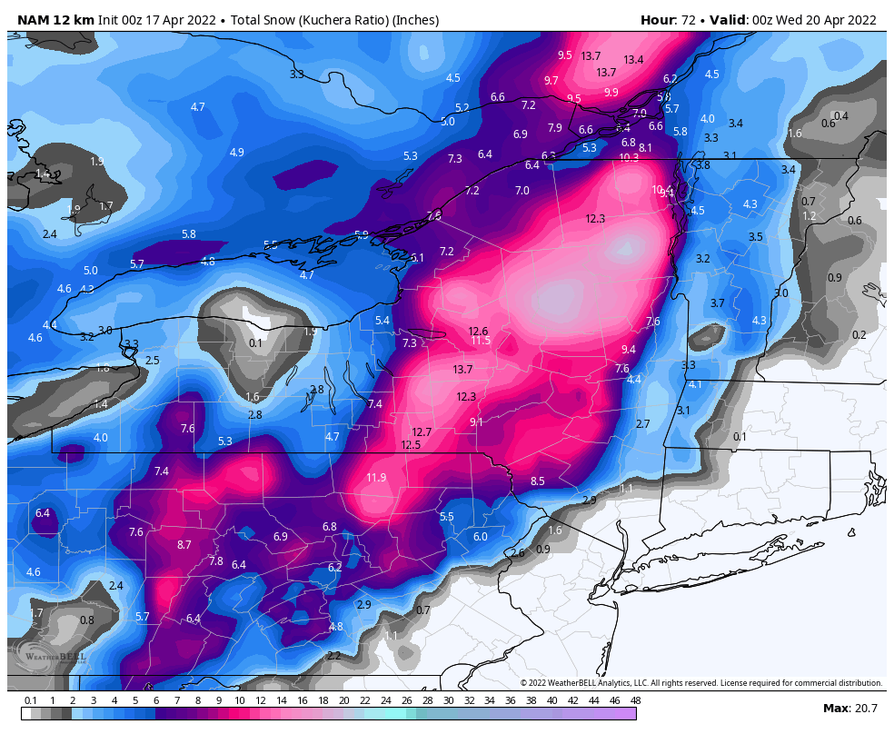
13 minutes ago, BGM Blizzard said:
Large part of CNY and ENY got Nam'd on 0z. Probably overdone and a bit too far W but most of the models are showing some really heavy banding potential. Folks in the Catskills and ADK better make sure their generators are in working order @Flying MXZ. Probably going to see some WSW issued by either tonight or following 12z runs tomorrow.
Big jump west. I’d hold of on watches- too many limiting factors/ variables. But you’re right, could be a heavy wet snow. Nothing has leafed out here yet.
-
1 hour ago, SouthBuffaloSteve said:
I still can't get over this map... Legend runs 0-96" but I've got to separate 4 shades of blue for amounts under 3"?
Stupidest map. They’ve got to redo it.
-
The fantasy storms have vanished. About right. I believe that’s a wrap. I loved all our interactions this winter. I’ll see ya next chance of snow. Peace and love.
-
 1
1
-
-
1 hour ago, BuffaloWeather said:
It’s really sad. It looked hopeful in December but that went to shit.
-
 1
1
-
-
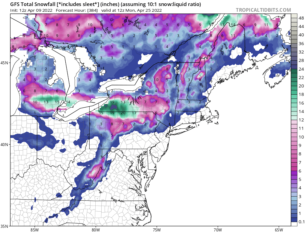
17 minutes ago, vortmax said:
All of these fantasy charts are 384hrs, not really believing anything outside of 5 days. My guess the above snowfall comes 10+ days out.
Bingo! But it’s still fun to watch. Active, cold pattern. The chance is there. I wouldn’t rule out a final snow storm.
-
1
-
-
Haha. They don’t give up
-
35 minutes ago, Ericjcrash said:
The front range and Dakotas have amazing springs as well as falls... awesome shorts and T-shirt days to blizzards in the 10's and 20's with no worries of an extended period of shitty 40° rain and overcast.
Super windy. Very hot in the summer. Very cold in the winter. Very little average snowfall. Flat. Otherwise it’s awesome.
-
 1
1
-
-
58 minutes ago, BuffaloWeather said:
gross
I finally agree with you. It’s generally too late for anything interesting and I’m tired of mud. That being said, it would be lovely to get some 60’s instead of the traditional slam into 88 and humid.
-
2
-
-
2 hours ago, TugHillMatt said:
Lol. Indeed! I actually lived in the snowbelt of Ontario, Canada for two winters. The people there were dumbfounded when, after a brutal winter, I was still happily shoveling snow during a snowstorm at the end of April. Hah!
I always get asked, “You must love to ski”, which I now answer, “I do but it has nothing to do with it. I just love snow”
-
1
-
-
-
45 minutes ago, wolfie09 said:
Yeah definitely, wasn't expecting much Imby but I'd still take it over rain lol Starting to slush up on the deck which is probably the best we'll do..
flipping back and forth in Pittsford. 38. Raw.
-
1
-
-
1 hour ago, DeltaT13 said:
Pretty nice satellite showing the highly localized lake snows from the past few days. Quite the strip through wayne county with an impressive drop off just to the NorthEast! The wispyness of the snow cover East of Huron is also pretty interesting.
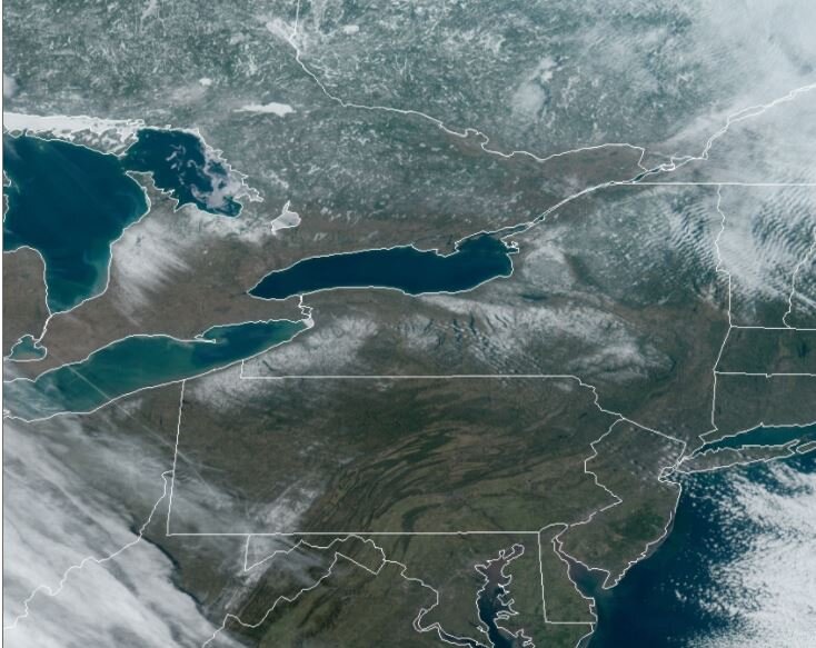
Valley near Lowville very evident for its lack of snow cover
-
1
-
-
4 hours ago, DeltaT13 said:
That first car in the video has the dumbest driver I've ever seen. Just hanging out and chilling as if its not an ongoing super dangerous situation. He then goes from the dumbest person to the luckiest guy in the world at 42 seconds. If you are ever in a situation like this, get out of your car and get the **** up and off the highway ASAP!Total, 100% lack of situational awareness! I’ve seen it in almost every scenario like this. It makes you just wonder how these morons even breath. He almost died for his stupidity.
You need to stay in your car and wait for a window and then RUN into the woods to get behind the biggest trees you can find.
I hate sharing the road with people like that. -
30 minutes ago, LakeEffectKing said:
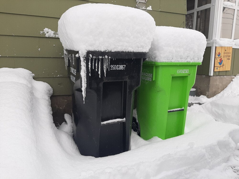
3 more inches during day...20" for the event. Still poundtown.
Astounding
-
2
-
-
2 hours ago, LakeEffectKing said:
Snow has pretty much stopped ended up with about 14" overnight.
Amazing! So cool. Only caught caught 2” here in Irondequoit. 0” in Pittsford. So pretty much a bust.
I’ve been really impressed with the Caz microclimate! Is it a nice place to live?-
2
-
-
Love to see the Montague radar
-
30 minutes ago, vortmax said:
This band is legit. Jeb walk time.
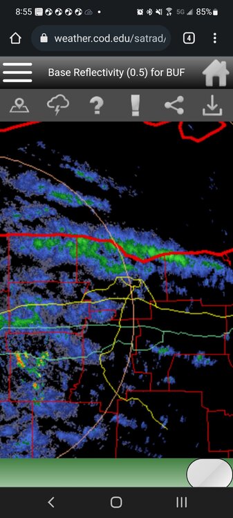
It’s a real banger
-
Check that. Extremely heavy snow in Irondequoit. Like listen for thunder stuff.
-
2
-
-
1 hour ago, vortmax said:
Win.
No snow in Pittsford but my cams show heavy snow in Irondequoit with maybe a couple inches already.
-
16 minutes ago, wolfie09 said:
The flow is out of the NW..We get that wind direction a lot in the winter, obviously..I feel like"majority" of big events (feet) happen east of the lake but you probably see more consistent snow SE of the lake with the constant northerly flows..They obviously have some elevation as well.. The tug can upslope from various wind direction which is why they have it made lol
It always astounds me when the tug can cash in on a NW flow. It makes no sense. Lol
-
1
-
-
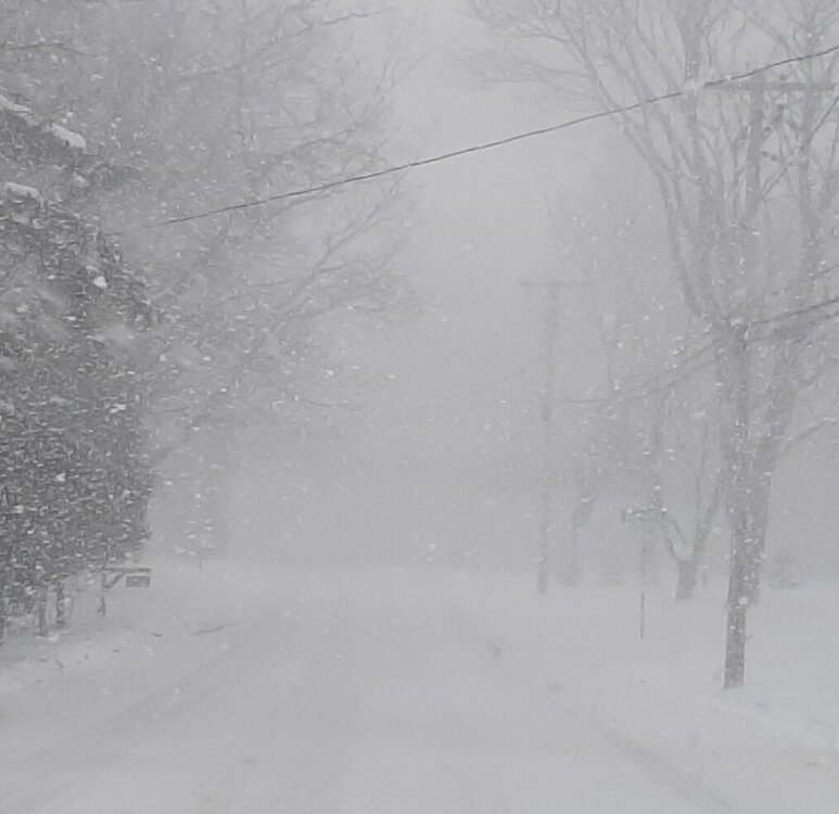
Very wet snow with some rain drops in Pittsford. Going back and forth. Obviously not accumulating.
-
It’s unbelievable
-
2
-
-
Looks like it’s starting to come down on the ridge. Any good cams?
-
8 minutes ago, Leelee said:
It's not expensive in Cattaraugus County. I assume it's because of the terrain that it's not more developed, and even driving around there in summer can be hair raising, I'm not nearly brave enough to try there in winter. I'm excited for my yearly summer trip through Amish country in Chautauqua... Cherry Creek to Clymer. Beautiful area and a way of living I admire.
I saw a lot of Amish driving in their buggies. Apparently LED lights are permissible.
You gotta get some snow tires bro

Historic Lake Effect Event?! 11/17-11/21
in Upstate New York/Pennsylvania
Posted
Nice package.
If anyone is wondering where everyone has gone. We are now at Discord. Ask for an invite.
.