rochesterdave
-
Posts
6,707 -
Joined
-
Last visited
Content Type
Profiles
Blogs
Forums
American Weather
Media Demo
Store
Gallery
Posts posted by rochesterdave
-
-
All the regulars getting it good. Fun time to in Springville or Dayton. Boston Hill Blizzard
-
For the synoptic event, pretty much all the models are consistent in showing a warm layer holding firm over Monroe and Wayne. I think , with that track, it snows; but, at some point I’ve gotta stop arguing with the model consistency.
-
I’m a bit surprised nobody is chasing that Erie band. It being Saturday and all.
-
Lots of consistency with the models for the Tuesday storm. It’s a perfect track for W and Central NY. The models always overdo the lake plain warming. If that track holds I’d expect a heavy, wet snow with accumulations in the 6-10” range from BUF to Rome. No exceptions.
Hope it comes at nighttime. It’s gonna be a fun one!
-
The BUF lake effect feels like it’s just about on time. Don’t you guys always get one or two in November?
ROC will have to wait for the synoptic help.
-
I hate to rain on anyone’s parade, but this aforementioned cold air looks very typical for November.
It will be moderate and west based. The LES should be mostly at the east ends.
The only way this gets interesting is if we see a storm develop along the EC or just inland. Climo would suggest inland runner ie: Great Lakes Cutter but the cold is pushing just a bit east for that so we will have to watch. Might be intriguing.
Im starting early with the vague hogwash and climo. Can we please keep politics off this site?
-
I hate to rain on anyone’s parade, but this aforementioned cold air looks very typical for November.
It will be moderate and west based. The LES should be mostly at the east ends.
The only way this gets interesting is if we see a storm develop along the EC or just inland. Climo would suggest inland runner ie: Great Lakes Cutter but the cold is pushing just a bit east for that.
Im starting early with the vague hogwash and climo nonsense. Peace!
-
On 10/27/2018 at 9:16 AM, wolfie09 said:30 minutes ago, OSUmetstud said:
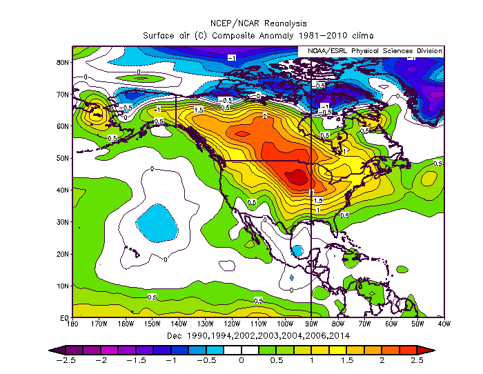
This isn't exactly true. Sometimes in El Nino years the PAC flow can invade AK and Canada so that theres warmth across much of the northern tier. November and December wave lengths are shorter than Jan Feb and March. This is my analog set for December, for example:
Considerable improvement in Jan through March as the north PAC low sinks south towards Hawaii.
.png.f6286855c5b00a568aeeaf53e1aa4f42.png)
It seems winter just comes later now a days. Everyone all excited for El Niño but my first experiences with it were devastating. I recal some early 1980’s winters that were absolutely soul crushing.
-
2 hours ago, wolfie09 said:
Next in the line of storms to keep an eye on..


Yeah. That one kinda came out of nowhere! I’ll be watching to see if other models get ahold of it.
-
I’m not writing off some snow Saturday night. It’s early but it’s a fine line between 40 and rain and 34 with pasty snow. Wait and see. I’ll bet we all see some flakes mixing.
As for winter, 02-03 was a killer along the south shore. Huge amounts of lake effect that was often under forecast.
Glad to be back!
-
On 9/1/2018 at 9:01 PM, TugHillMatt said:
Ha! The next door neighbor (half mile down the road) has an Air B&B. I have always wanted to own a Bed and Breakfast.
The past couple weekends have been insane with all these city slickers coming up here. I am assured by locals things will quiet down..and then pick up during the winter. The weeks are soooo much quieter than the weekends.
The past couple days, the temperature has been awesome. Upper 60s/70 for a high. Went to the Redfield Old Homes Day Parade this evening (picture below). Can tell fall is on the way...hopefully for good after this hot spell this week.

Good to know there’s an Air BB up there. I’m just about ready to buy a 4Runner and will hopefully make a trek or two up there during ‘the weather’.
Get ready and welcome aboard!
-
 2
2
-
-
-
3 hours ago, Syrmax said:
I'm just hoping we can scrape together 1.7" of snow the rest of the month at KSYR to get into 2nd place for highest March snowfalls. Looks like it's gonna be like pulling teeth despite ample cold air. Next 2 systems look to be crushed south and/or 99 lb weaklings.
Nah, you get that easy
-
NW shifts have begun. DC never looked right. Probably not gonna make it this far NW with no ULL to pull precip back. But it’s gonna get interesting for CNY and perhaps southern tier.
-
We are going for gold.
-
Suppression city. Ugh
-
I missed some banter. Yeah, I was wrong trying to sign off a week ago. Real wrong.
Suppression is still the concern. I like the set up. It might be a PA thing but I can’t see it being a DC snowstorm. I think we need the NAO to break down (no?) it’s not my area of strength or interest.
Looks like we’ve attracted a few new contributing members. I hope they stick around.
-
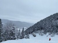
An oldie! But goodie. This one was huge in Northern Monroe County. I recall two feet.

-
2
-
-
4 hours ago, Syrmax said:
Looks like the whole Thursday 12z model suite takes next weeks system well south of us, including Euro. Unless I'm missing something.
You’re not missing anything. But (prepare to cringe) climo would argue against a track that far south. I mentioned suppression as a worry but I’m thinking more like N Pa- NOT DC.
IDK. One run. Lots of time. Several moving parts.
-
2
-
-
At first glance, it looks like a solid set up. Miller B. Good for 8”+ across the board. Lots can change. Biggest concern is suppression. Also, these can feed a slug of warmth up with the precip. Might prove a bit problematic this late in the season?

-
6 minutes ago, MAIDEsNow said:
Was a factor for sure. Pondered a home purchase just north of Sherman about a year ago, but the commute and substantial extra bite out of each paycheck quashed that.
Cabin looks great. Lucky dog. You are our new observation guy for that part of the snowbelt.
-
It was fun to watch. I’ll bet there’s a hilltop south of Cayuga with 20”.
-
My 6” woulda been 12”+ easy if it weren’t for the March sun angle. Tough to overcome with these light to moderate rates. Tough to measure. 6” on top of the old snow. 3” on driveway (generous).
-
Gotta give Bing credit for picking up on warning amts in this region!


Upstate/Eastern New York
in Upstate New York/Pennsylvania
Posted
Hey all. Every year I get some sort of access to euro snow maps. Last year it was free for a while. I can’t find any free access- every year I forget a lot of my most used sources.
Any good recommendations?
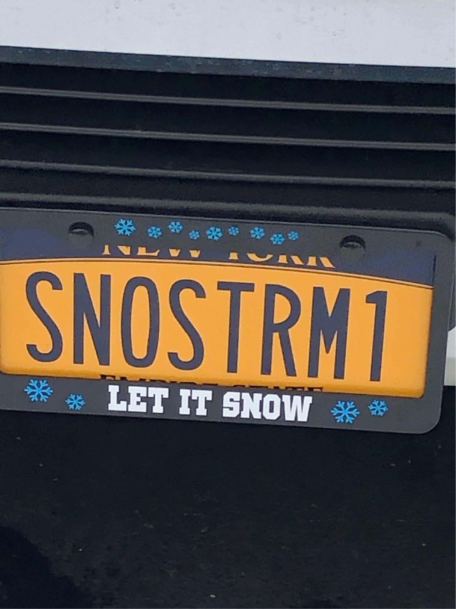
First good storm I’ll change the avatar! Not until then! Lol