KAOS
-
Posts
1,536 -
Joined
-
Last visited
Content Type
Profiles
Blogs
Forums
American Weather
Media Demo
Store
Gallery
Everything posted by KAOS
-
Narrowly escaped the jaws of death with this frontal passage. Fortunately, I prepared and did nothing. That was a close call.
-
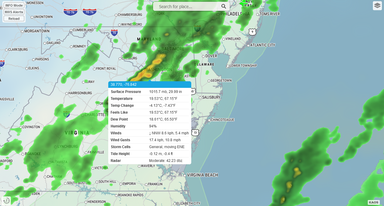
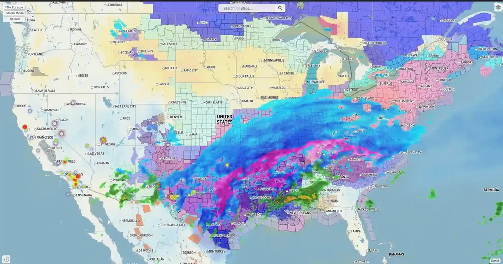
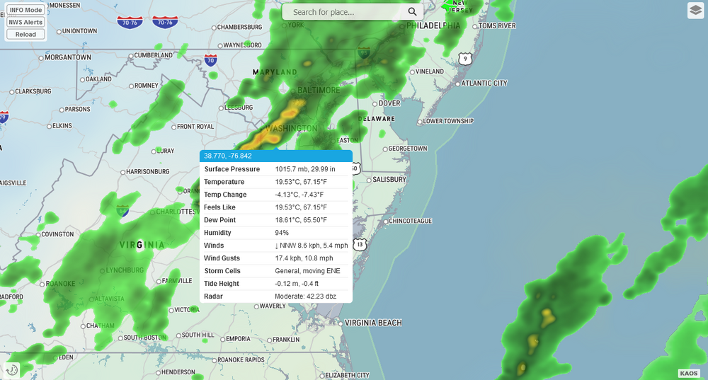
NAM https://kaosfactory.github.io/wxblox/fmap2.html?lat=39.1184384,-76.5231104
-
GFS https://kaosfactory.github.io/wxblox/fmap.html?lat=39.1184384,-76.5231104

-
While watching everyone else getting daisy duked.
-
You just described my yard.
-
Cold smoke/powder... check Ridiculous rates/amounts of sleet/ice/snow beads... check Blue snow/sleet... check ZR/Glacier... check Super Weather Friends Bonus Level Unlocked. 100,000,000 Weenie Points Awarded.
-
-
Thinking this seems like a jeb nightmare. How do you even shovel heavy freezing rain?
-
Seek Counseling. 18F Cloudy
-
January 24-26: Miracle or Mirage JV/Banter Thread!
KAOS replied to SnowenOutThere's topic in Mid Atlantic
I'm here for the radio show and waiting to fire up the bus. -
prolonged deluge
-
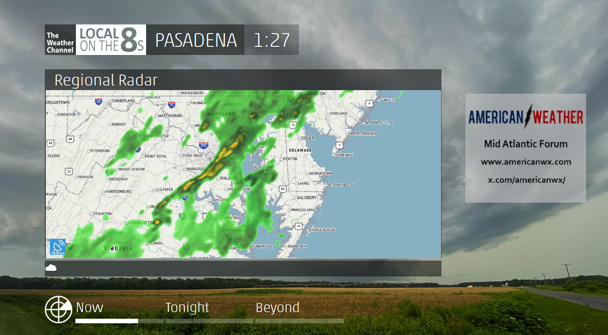
Perhaps... after taking a closer look I see they do not emulate my version of IntelliStar. The most "advanced" version of IntelliStar. https://www.twcarchive.com/wiki/IntelliStar_2_XD https://kaosfactory.github.io/desktopX1.html I also have this... https://kaosfactory.github.io/wxblox/geo.html But this is really good work... https://xl.weatherstar.dev/ Still kinda jealous.
-
Very cool. Though I am a little disappointed. I have been outdone.
-
Special links for my weather frens.
-
https://kaosfactory.github.io/WX_APP_standalone.html
-
GL map test...
-
That concludes this test of the inteliistar emulator.... https://kaosfactory.github.io/desktopX1.html
-
This is a test of the intellistar emulator... this is only test.

-
The cold air is coming...
-
Second day of drizzle/mist. I just want to cut the lawn!!! FFS.
-
Split
-
5 rain drops and living in a tropical rain forest tonight.
-
Seriously?
-
Bring on 2026... it is going to be great.