Rjay
-
Posts
28,400 -
Joined
-
Last visited
Content Type
Profiles
Blogs
Forums
American Weather
Media Demo
Store
Gallery
Everything posted by Rjay
-
Don't you live in Central Jersey, Warlock?
-
5 months til you start tracking a 70 degree Christmas
-
78/74. Enjoy your awful weather.
-
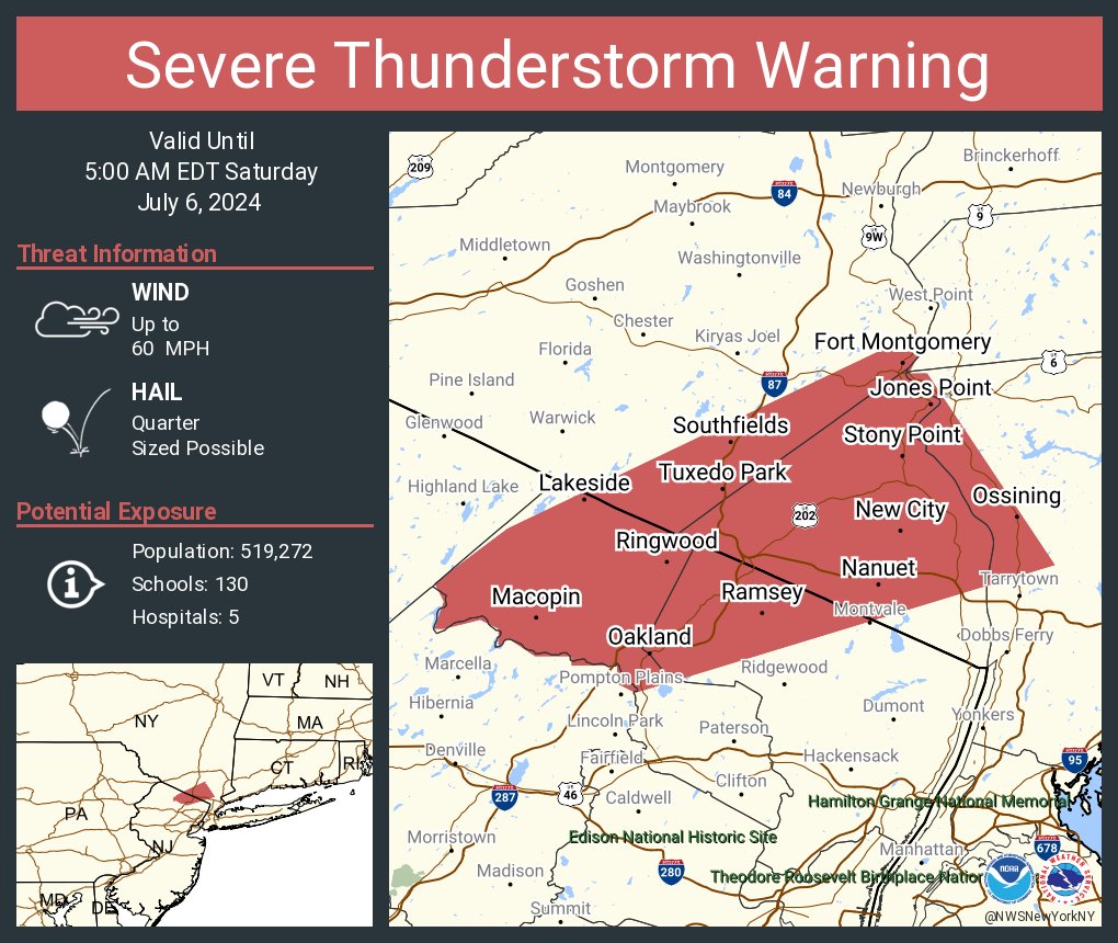
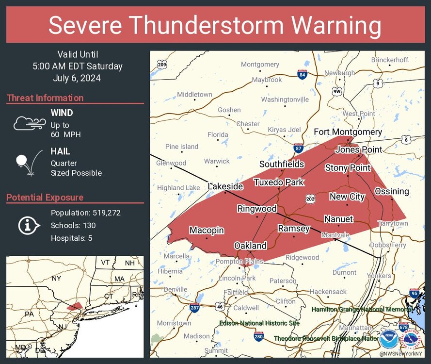
This just expired
-
0.02"
-
Canceled
-
Happens a couple times a year I think. Long Island is way more rare.
-
July 2024 temperature forecast contest
Rjay replied to Roger Smith's topic in Weather Forecasting and Discussion
DCA: +3.7 NYC: +3.7 BOS: +3.7 ORD: +3.7 ATL: +3.7 IAH: +3..5 DEN: +3.5 PHX: +2.7 SEA: +1.0 -
0.01
-
But seriously, what about all the other stations in northeast NJ or the boroughs, particularly the urban ones? Are they all wrong too? I still disagree with that assertion. I don't see it. Newark is usually in line with Sommerville and a couple other stations in NJ and with the more urban stations in Queens.
-
Just like their temps
-
Hartford and Manchester under the gun with tornado warnings.
-
Lots of tornado warnings in New England
-
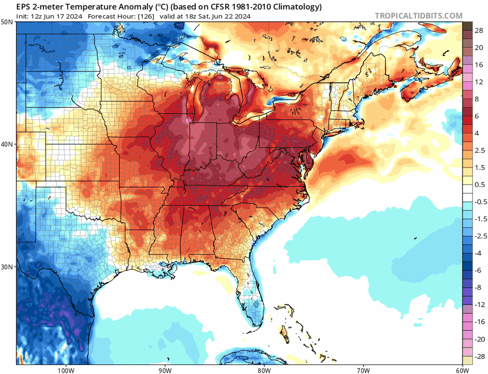
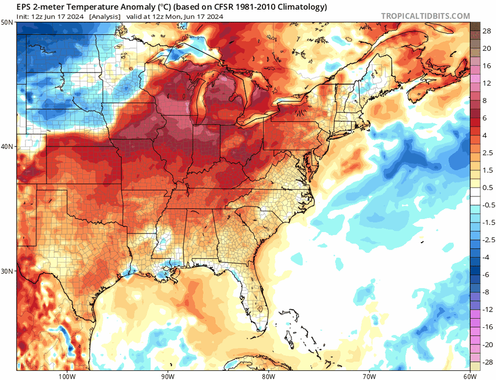
Hr 126-360
-
EPS looks warm for the entire run Hr 0-120
-
JM spent years in Austin
-
Extended summer stormlover74 future snow hole banter thread 23
Rjay replied to BxEngine's topic in New York City Metro
Lies -
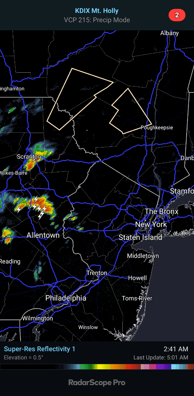
Cycled 3 times in the last 30 frames on radar. Looks like a new tornado is on the ground now with this storm.
-
DCA: +2.0. 100 NYC: +2.0. 98 BOS: +2.0. 100 ORD: +2.0. 100 ATL: +2.0. 101 IAH: +2.0. 105 DEN: +2.0. 100 PHX: +2.0. 119 SEA: +2.0. 95
-
Extended summer stormlover74 future snow hole banter thread 23
Rjay replied to BxEngine's topic in New York City Metro
It's really annoying. Idk how to fix that. -
Extended summer stormlover74 future snow hole banter thread 23
Rjay replied to BxEngine's topic in New York City Metro
It does work. -
Nice downpour