Rjay
-
Posts
28,401 -
Joined
-
Last visited
Content Type
Profiles
Blogs
Forums
American Weather
Media Demo
Store
Gallery
Everything posted by Rjay
-
A few flurries
-
I literally have no choice but to go to work due to the nature of my job. Should be a fun drive to and from...
-
What time is work? How far from your home? When do you get off?
-
Oh boy WINTER STORM WARNING REMAINS IN EFFECT FROM MIDNIGHT TONIGHT TO 6 AM EST TUESDAY... * WHAT...Heavy snow expected. Total snow accumulations of 12 to 20 inches. Winds gusting as high as 50 mph. * WHERE...Southwestern Suffolk, Southern Nassau, Northern Nassau and Northwestern Suffolk Counties.
- 2,426 replies
-
- 2
-

-
- heavy snow
- ice pellets
- (and 3 more)
-
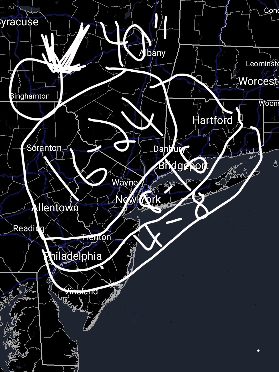
10-16"+
-
Cloudy 22 degrees in Holbrook
-
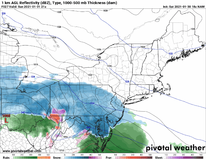
Lol. I hate kuchera maps but that one is worth a weenie or 2.
-
Every model tn has 15"+ even out here lol
-
Use this site. Choose a model, pick an hour and click on your location. https://home.pivotalweather.com/
- 2,426 replies
-
- 1
-
-
- heavy snow
- ice pellets
- (and 3 more)
-
I would go 8-14" for LI and less for the twin forks.
-
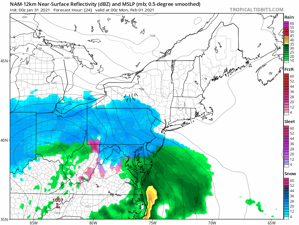
Don't worry about the 18z nam. It was LI weenie porn.
- 2,426 replies
-
- 4
-
-

-
- heavy snow
- ice pellets
- (and 3 more)


.png.dfd7b272a8488e19194f10319597da14.png)