Rjay
-
Posts
28,400 -
Joined
-
Last visited
Content Type
Profiles
Blogs
Forums
American Weather
Media Demo
Store
Gallery
Everything posted by Rjay
-
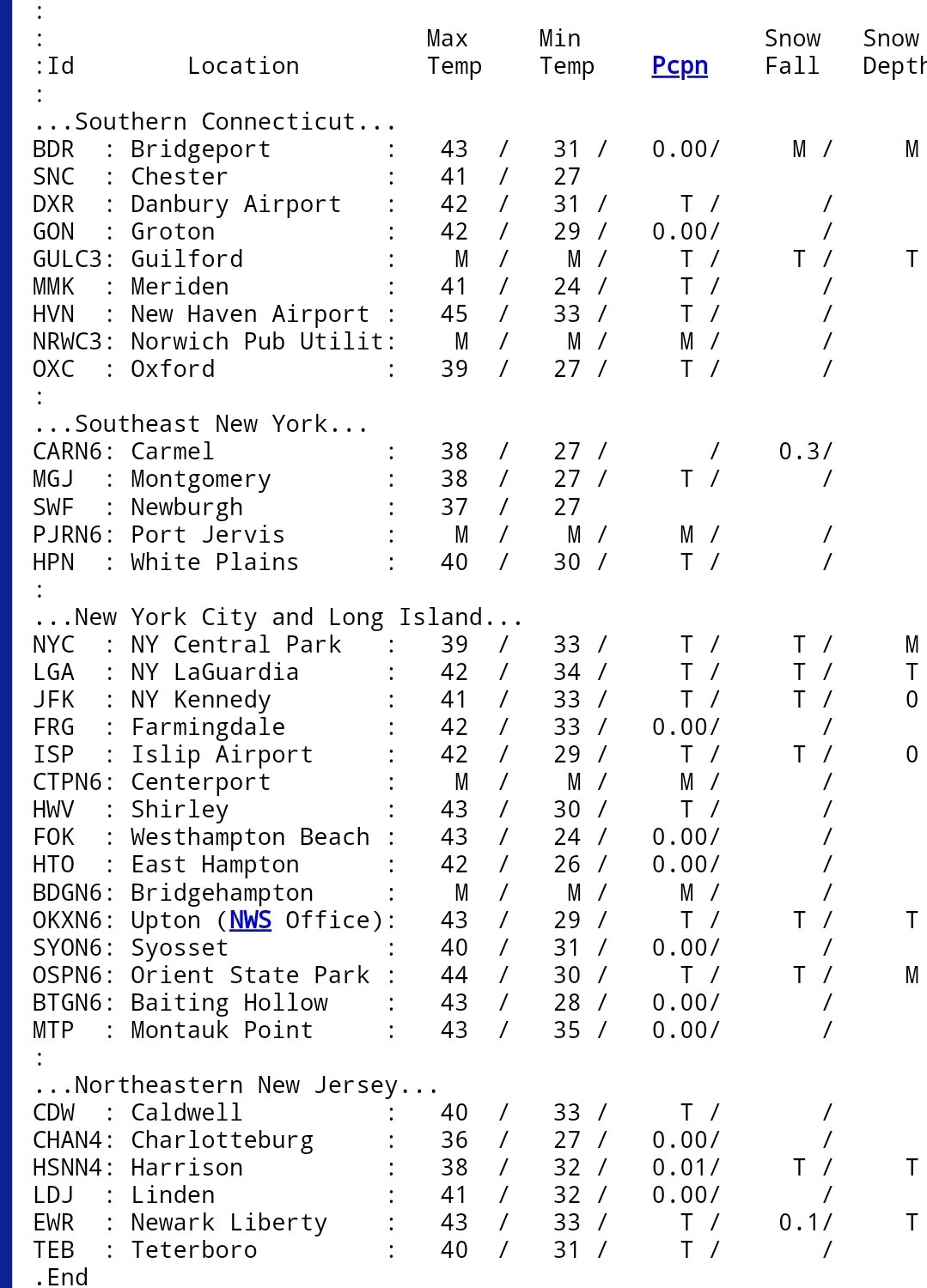
LGA, JFK and ISP as well.
-
Had my first flakes
-
I'll hold you to that, Tony.
-
Why is Corona Queens the same as Newark? No airport there.
-
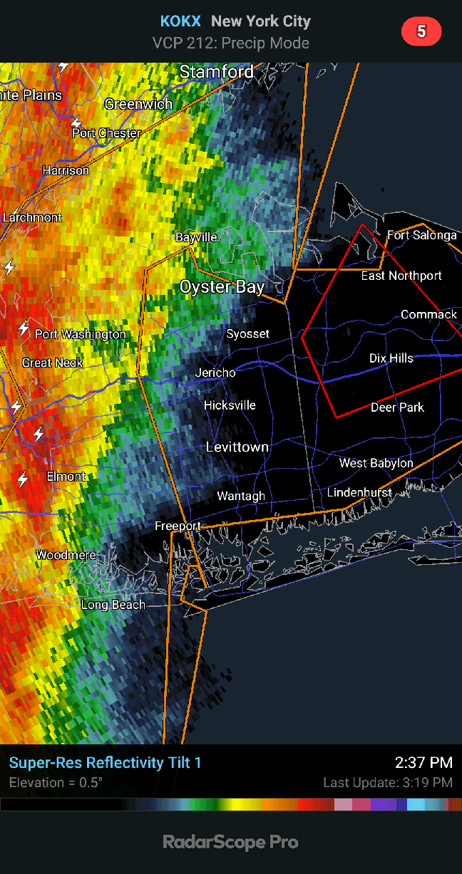
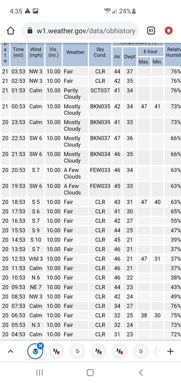
The other night was multiple wind direction changes. With very warm water off the coast we saw some crazy temp jumps when winds switched around to the south. Last night clouds moved in so temps rose. Then the clouds moved out and temps dropped, before the clouds came back around daybreak.
-
46 at LGA lol
-
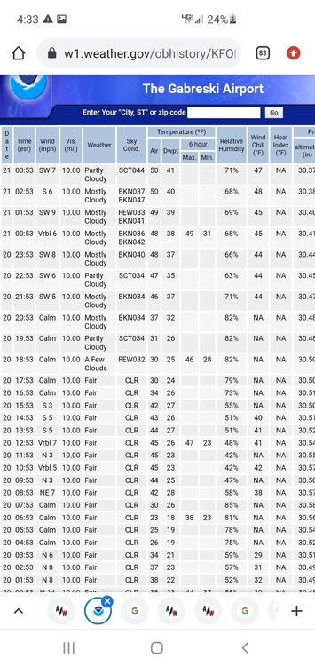
Pretty damn cold in the NW surbs. Already in the 20s at POU.
-
36 here 36 ISP 39 FRG
-
I was locked in at $2.06 and it expired November 1st. No point in locking in now.
-
38 with a cold breeze. Oil prices are too high for this. If it's going to be cold it better snow.
-
You're arguing against a point no one made though.
-
Psst. *Whispers* it's wpo....
-
36-45-38-50-40
-
My November forecast isn't looking too bad as of now for KNYC
-
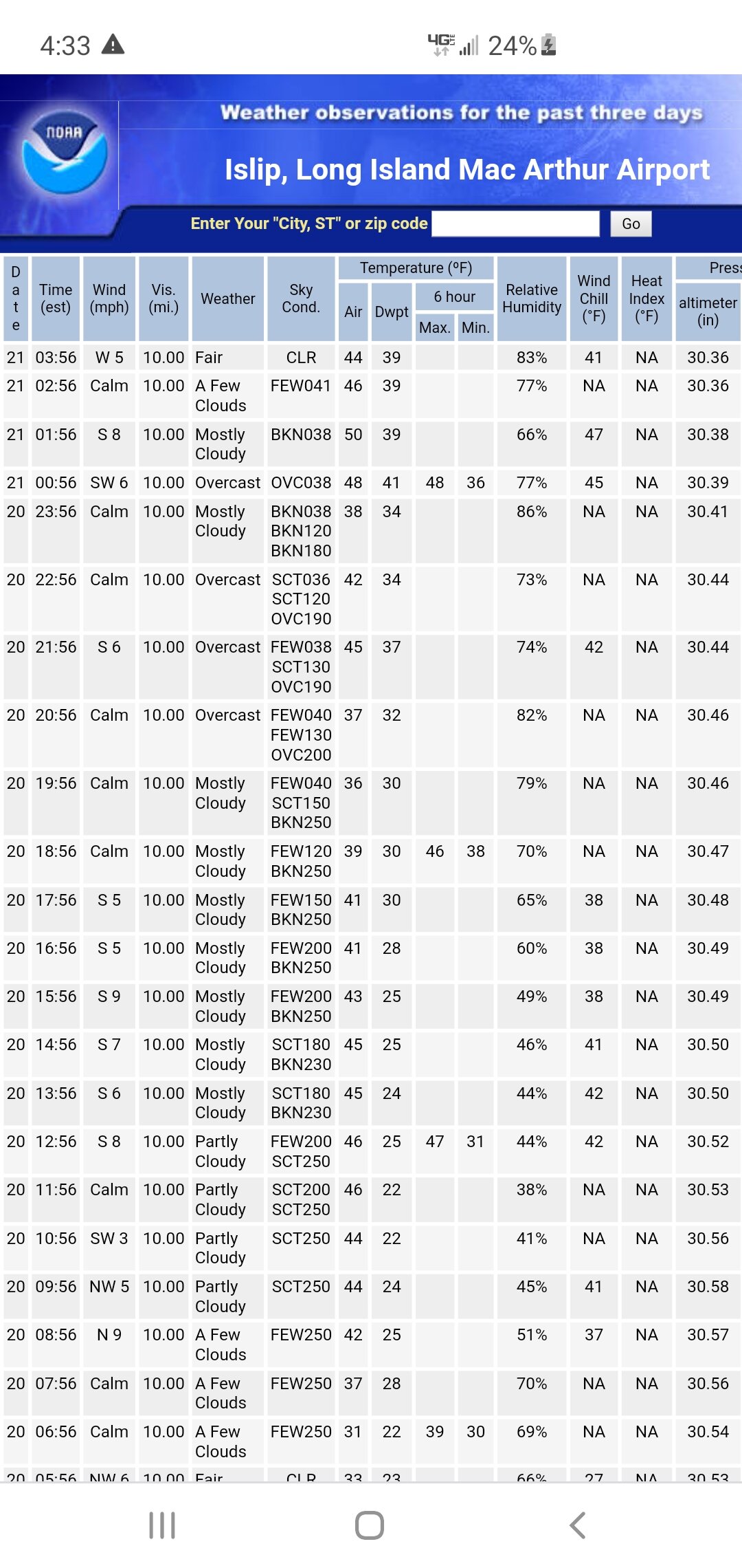
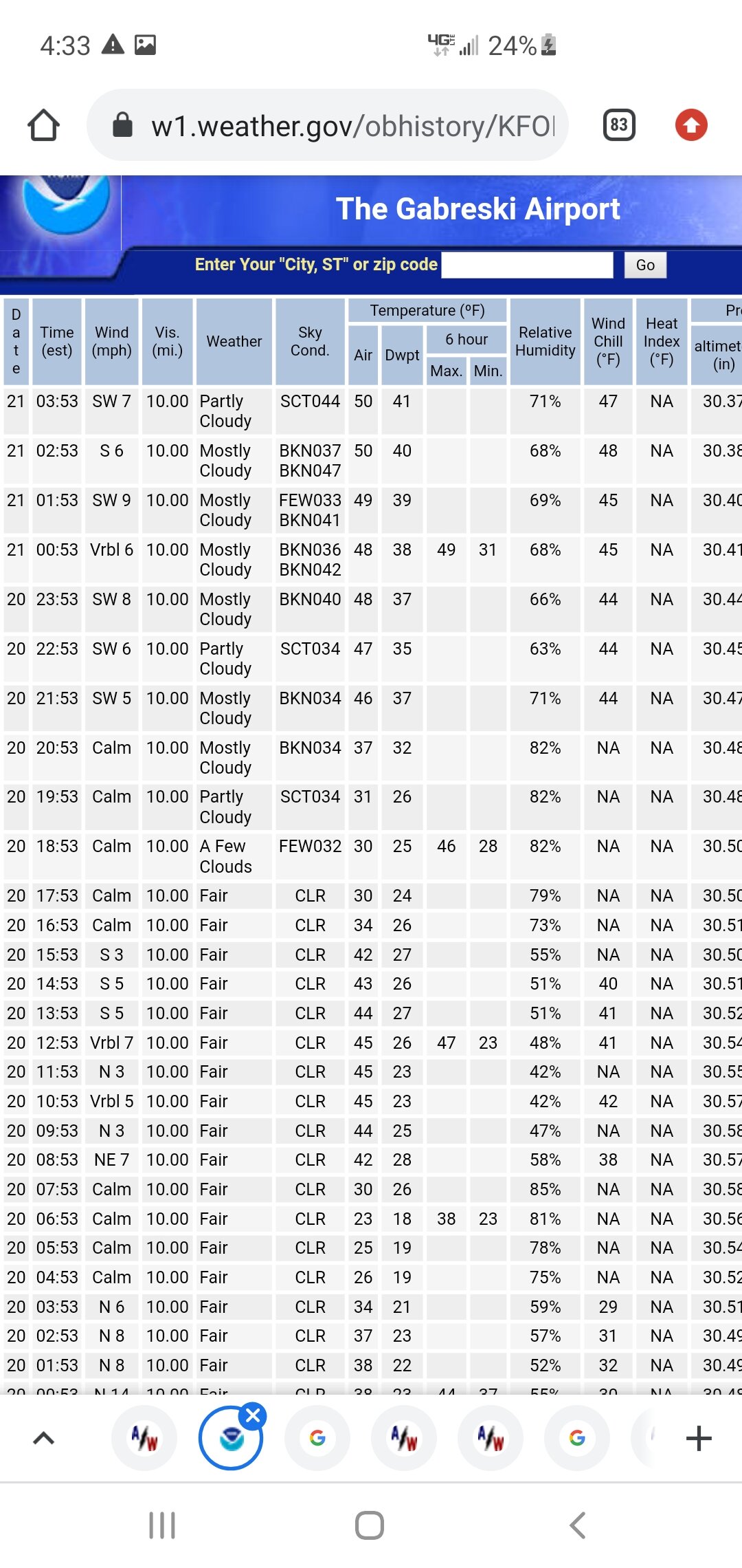
Islip's temps last night were bouncing all over the place.
-
Interesting night on the island. Wind direction and warm waters do their thing.

-
All i have is Nassau unfortunately