WxUSAF
-
Posts
28,347 -
Joined
-
Last visited
Content Type
Profiles
Blogs
Forums
American Weather
Media Demo
Store
Gallery
Everything posted by WxUSAF
-
Nothing on radar but some drizzle and even light rain on my way to work and back home (forgot my ID card) and back again
-
0.06” overnight
-
The simple answer is we’ve been in a long -ENSO/-PDO cycle. Northern stream dominant with a weak subtropical jet.
-
Midnight high for MBY.
-
3k NAM is really rainy for tonight and tomorrow. FV3 hires and hrrr less so, more for eastern shore.
-
Line reforms after passing. Classic. 0.03”
-
NE MD pummeled yet again
-
MoCo literally stealing HoCo's thunder
-
3k NAM says tomorrow is a midnight high with midday highs of upper 60s/low 70s. Euro is near 80/low 80s. GFS upper 70s, GGEM low 70s.
-
Immabout to detonate a pumpkin spice nuke
-
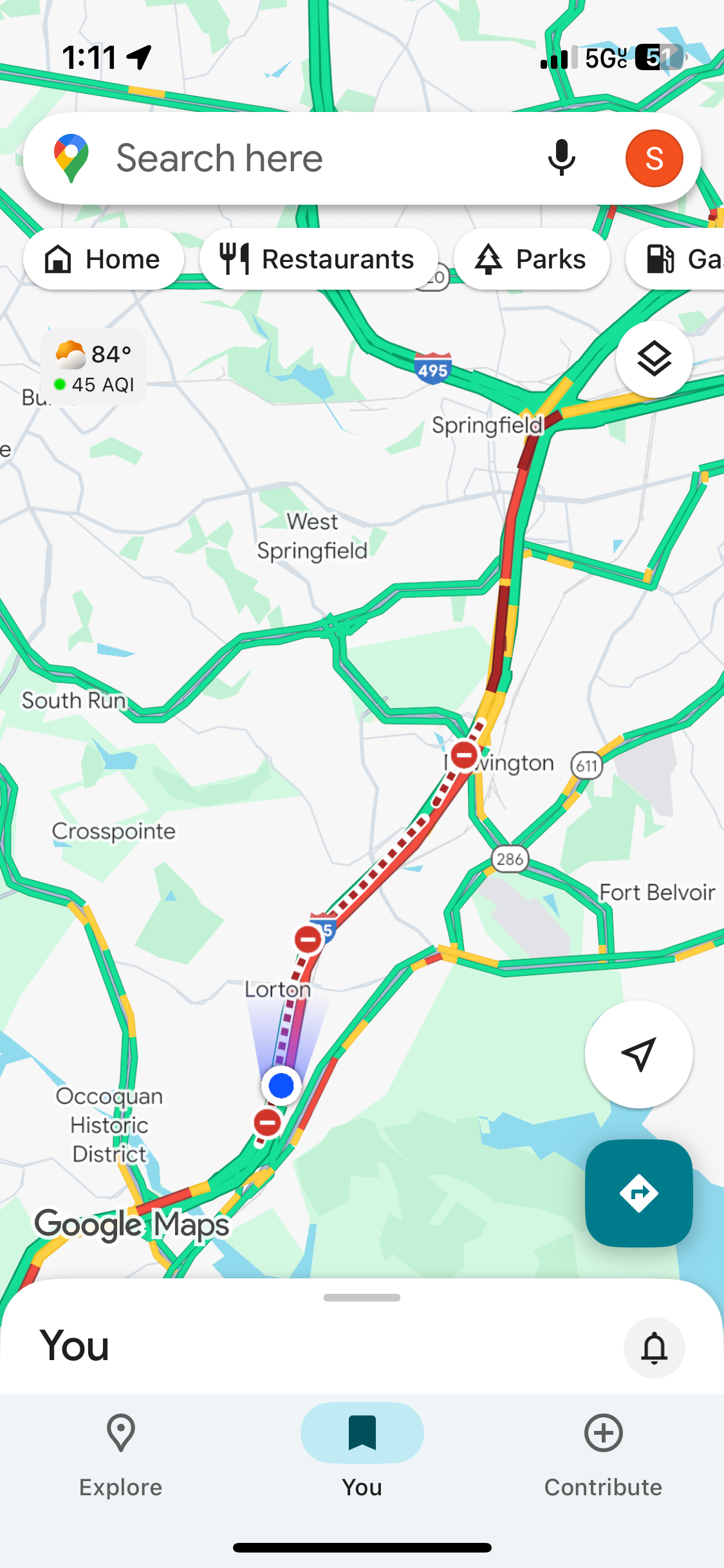
Confirmed. We’re passing it now. Accident in the southbound express.
-
Another beautiful Saturday in northern VA
-
Got sorta skipped but about 0.25”
-
Swing and a miss
-
Yup. Looks like a MD split unless something changes in a hurry.
-
-
Come to papa
-
Hi SE friends. I’m in OBX this next week for my first ever visit. 76 with a lovely breeze right now.
-
Basallo is fine to stay in Norfolk. He still hasn’t caught that much. But 2 weeks could make a big difference for Beavers if it included regular playing time. Every single O’s prospect has required 100+ ABs at the MLB level to start getting into any sort of rhythm.
-
Trade seems to be early fall cold front with gorgeous weather or cat 5 up the Bay
-
Beavers isn’t even a top 100 prospect right now. So this roster manipulation bullshit is all for the vanishingly small chance that he gets added to those lists at the end of the season and then wins RotY in 2026. The big deal is that management is prioritizing this microscopic chance of an extra 2027 draft pick over the CURRENT FAN EXPERIENCE. They’re raising ticket prices and forcing fans to watch an outfield of Greg Allen (who??), Dylan Carlson, and Ryan Noda. If you had a healthy high-performing outfield this conversation would be moot. But it’s not. Your outfield is decimated and you have someone who’s knocking the cover off the ball at AAA.
-
Total bullshit