Tyler Penland
-
Posts
2,522 -
Joined
-
Last visited
Content Type
Profiles
Blogs
Forums
American Weather
Media Demo
Store
Gallery
Everything posted by Tyler Penland
-

2021-2022 Fall/Winter Mountains Thread
Tyler Penland replied to BlueRidgeFolklore's topic in Southeastern States
Not the NAM. -
2021-2022 Fall/Winter Mountains Thread
Tyler Penland replied to BlueRidgeFolklore's topic in Southeastern States
December 18 is what I remember. Biggest snow I've seen in my life at 16". Completely shut down Boone for 2 days which is unheard of. Sent from my Pixel 5 using Tapatalk -
2021-2022 Fall/Winter Mountains Thread
Tyler Penland replied to BlueRidgeFolklore's topic in Southeastern States
The 3km/12km NAM is pretty dry with it as well. -
2021-2022 Fall/Winter Mountains Thread
Tyler Penland replied to BlueRidgeFolklore's topic in Southeastern States
Wind whipping out there this morning. Woke me up. Temp up 9 degrees in the last hour. Sent from my Pixel 5 using Tapatalk -
2021-2022 Fall/Winter Mountains Thread
Tyler Penland replied to BlueRidgeFolklore's topic in Southeastern States
That's what the NW trend is for. Sent from my Pixel 5 using Tapatalk -
2021-2022 Fall/Winter Mountains Thread
Tyler Penland replied to BlueRidgeFolklore's topic in Southeastern States
Only managed 13. Temp stalled out there most of the night. Feels like a sauna outside now compared to yesterday. Sent from my Pixel 5 using Tapatalk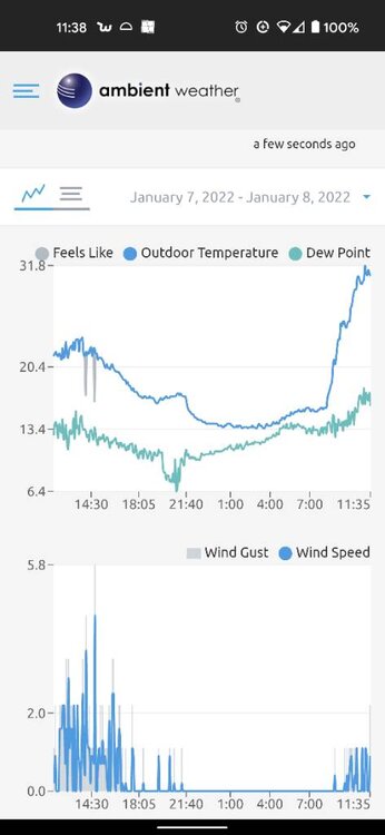
-
2021-2022 Fall/Winter Mountains Thread
Tyler Penland replied to BlueRidgeFolklore's topic in Southeastern States
Low of 15 and a high of 23 today. Already down to 17.1 looks like we'll see single digits tonight. Did a little hiking along the Parkway around Blowing Rock today. Not a particularly photogenic day with the wind knocking everything off the trees but definitely a fun day to hike. Windy and 16. Hoping to tackle Grandfather after a snow later this winter. Sent from my Pixel 5 using Tapatalk -
2021-2022 Fall/Winter Mountains Thread
Tyler Penland replied to BlueRidgeFolklore's topic in Southeastern States
Managed another inch overnight. Pretty good for us in a NWFS scenario. Sent from my Pixel 5 using Tapatalk -
2021-2022 Fall/Winter Mountains Thread
Tyler Penland replied to BlueRidgeFolklore's topic in Southeastern States
Finally snowing here in Blowing Rock. Actually coming down decent. Won't last long though. Sent from my Pixel 5 using Tapatalk -
2021-2022 Fall/Winter Mountains Thread
Tyler Penland replied to BlueRidgeFolklore's topic in Southeastern States
Still fighting off the mid level dry air here. Looks ominous outside and temp has dropped about 5 degrees so far though. Sent from my Pixel 5 using Tapatalk -
2021-2022 Fall/Winter Mountains Thread
Tyler Penland replied to BlueRidgeFolklore's topic in Southeastern States
Nothing reaching the ground here in Blowing Rock. Yay dry slots! Sent from my Pixel 5 using Tapatalk -
2021-2022 Fall/Winter Mountains Thread
Tyler Penland replied to BlueRidgeFolklore's topic in Southeastern States
I believe NAM stands for "Not Accurate Much". At least that's what I've read on countless weenie threads. -
2021-2022 Fall/Winter Mountains Thread
Tyler Penland replied to BlueRidgeFolklore's topic in Southeastern States
Run was an improvement IMBY. Shows about 4-5" over most of Watauga. Sent from my Pixel 5 using Tapatalk -
2021-2022 Fall/Winter Mountains Thread
Tyler Penland replied to BlueRidgeFolklore's topic in Southeastern States
6z HRRR was a massive improvement in the border counties. Big qpf increase. Sent from my Pixel 5 using Tapatalk.thumb.jpg.717250d4c773b6664a2ec2948f1eb560.jpg)
-
2021-2022 Fall/Winter Mountains Thread
Tyler Penland replied to BlueRidgeFolklore's topic in Southeastern States
*looks at timestamp* Ah another day 10 map. I'll believe it when I see it. I've already had more than I had expected to get out of this 2nd straight Nina winter. I guess if you set your bar low enough you're good with anything. -
2021-2022 Fall/Winter Mountains Thread
Tyler Penland replied to BlueRidgeFolklore's topic in Southeastern States
Yep little improvements one at a time. I'm good to get another 3-4" IMBY. If I can't get a foot all at once I'll gladly take it in 2 doses 4 days apart. Also I'm off Friday so a great day to hit the trails. Sent from my Pixel 5 using Tapatalk -
2021-2022 Fall/Winter Mountains Thread
Tyler Penland replied to BlueRidgeFolklore's topic in Southeastern States
New NAM is a step up for the Thursday night system. Trend has been towards more moisture. Sent from my Pixel 5 using Tapatalk -
2021-2022 Fall/Winter Mountains Thread
Tyler Penland replied to BlueRidgeFolklore's topic in Southeastern States
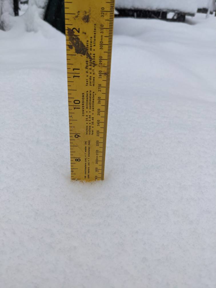
8" in 3.5 hours (7" in 2.5hrs) and tapering off. Storm for the record books IMBY rate-wise. Sent from my Pixel 5 using Tapatalk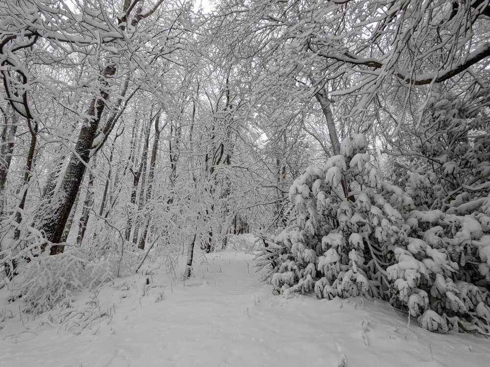

-
2021-2022 Fall/Winter Mountains Thread
Tyler Penland replied to BlueRidgeFolklore's topic in Southeastern States
We're supposed to be opening the outlet mall at 12. Hopefully they get the roads improved by then. No clue why they didn't just punt instead of opening for 6 hours. Sent from my Pixel 5 using Tapatalk -
2021-2022 Fall/Winter Mountains Thread
Tyler Penland replied to BlueRidgeFolklore's topic in Southeastern States
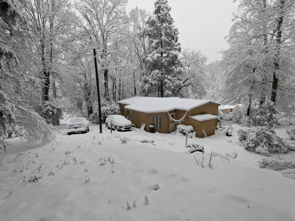
7" so far and still dumping. Another hour and we'll hit double digits. Worth noting almost no wind here at the house so it's not blowing around any. We're tucked into a holler and it's been almost dead calm the whole time. Sent from my Pixel 5 using Tapatalk
-
2021-2022 Fall/Winter Mountains Thread
Tyler Penland replied to BlueRidgeFolklore's topic in Southeastern States
THUNDER!!!! Sent from my Pixel 5 using Tapatalk -
2021-2022 Fall/Winter Mountains Thread
Tyler Penland replied to BlueRidgeFolklore's topic in Southeastern States
First measurement at 3.5". Had a dusting at 6AM so roughly 3" in the last hour. Amazing. Sent from my Pixel 5 using Tapatalk -
2021-2022 Fall/Winter Mountains Thread
Tyler Penland replied to BlueRidgeFolklore's topic in Southeastern States
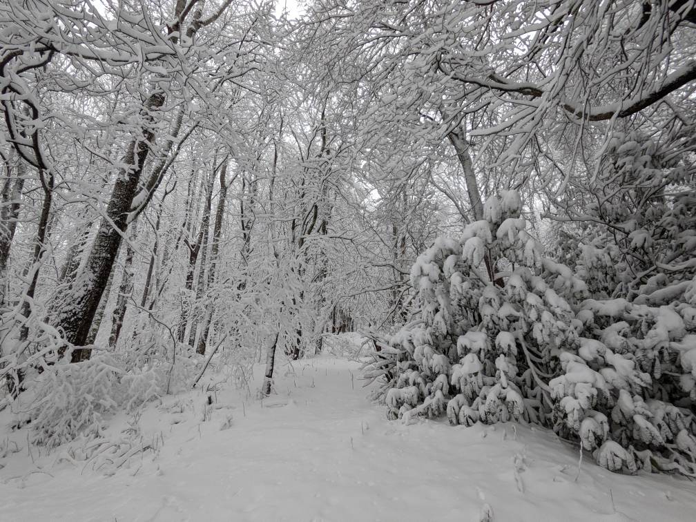
Absolutely ripping now and just dropped below freezing. Everything covered. Sent from my Pixel 5 using Tapatalk -
2021-2022 Fall/Winter Mountains Thread
Tyler Penland replied to BlueRidgeFolklore's topic in Southeastern States
New MD covers the NW corner of the state. Another MD just a hundred miles east for a severe watch possibility. Mesoscale Discussion 0028 NWS Storm Prediction Center Norman OK 0413 AM CST Mon Jan 03 2022 Areas affected...Parts of southwest through northern Virginia and central Maryland Concerning...Heavy snow Valid 031013Z - 031415Z SUMMARY...Heavy snow rates around 1-2 inches per hour and occasionally greater appear increasingly possible along and to the east of the Virginia Blue Ridge Mountains, into the Greater Washington D.C. and Baltimore Metropolitan areas, through 7-10 AM EST. DISCUSSION...Precipitation rates have increased along a frontal zone north through north-northeast of a deepening surface cyclone center across the South Carolina Piedmont. Although temperatures near the surface and in layers aloft are generally still warm to the east of the Appalachians, across much of the southern Mid Atlantic, a combination of strengthening mid/upper forcing for ascent and gradual low-level cold advection on northerly surface flow is likely to contribute to profiles increasingly conducive to snow. Surface temperatures are already approaching freezing across much of the Greater Baltimore and Washington D.C. metro areas into the immediate lee of the Blue Ridge, where strengthening mid-level frontogenetic forcing for ascent appears likely to become focused, beneath an intensifying divergent flow field between coupled upper jets. Forecast soundings suggest that lift will become increasingly maximized within the dendritic growth layer through 12-15Z, in the presence of seasonably high moisture content (including precipitable water on the order of .75-1.0 inches) supportive of 1-2 inch per hour snow rates, and perhaps occasionally heavier. -
2021-2022 Fall/Winter Mountains Thread
Tyler Penland replied to BlueRidgeFolklore's topic in Southeastern States
Welcome to our tiny town! Down to 34 with cars starting to turn white. Flakes IMBY still kinda slushy but we're usually last to change locally tucked up in this warm-air-holding valley.


.jpg.2ae78be5b9d08560709d90d6635cb786.jpg)