

Tyler Penland
-
Posts
2,388 -
Joined
-
Last visited
Content Type
Profiles
Blogs
Forums
American Weather
Media Demo
Store
Gallery
Posts posted by Tyler Penland
-
-
82.5 here at the house today. Felt like the Wicked Witch of the West screaming "I'm Melting".
GFS is wildly close to a snow event next Saturday night into Sunday morning. If a little more moisture gets kicked back west it could get interesting. The Euro is much further off the coast with the developing low and overall a bit warmer.
-
 1
1
-
-
14 hours ago, Met1985 said:
Gfs finally caught onto the second low and cold front dropping down around the 11th that gives us a prolonged flow snow event that would be significant for this time of the year.
NASCAR is coming to Bristol that weekend. You can pretty much bet on either the spring Martinsville or the spring Bristol race being absolutely freezing. Martinsville was straight up hot this year so.....
-
Wound up with right at an inch and a low of 25 this morning.
Marks my first measurable snowfall since 2/20 (just had a half a dusting on 3/6). 21.1" on the season so just a couple inches below average. If we end here I'll call it a win.-
5
-
-
May see some flurries up high tonight.
The more wraparound potential on Thursday. Winter definitely not done.-
2
-
-
Tylertown/Bassfield area getting hit by two big ones. Tylertown storms separated by a couple miles at most, big CC drop on both cells.
-
1
-
-
Watch text:
"SUMMARY...MULTIPLE SUPERCELLS ARE EXPECTED LATE THIS MORNING THROUGH
EARLY EVENING FROM EASTERN LOUISIANA INTO MUCH OF MISSISSIPPI. WITH
A VERY FAVORABLE ENVIRONMENT IN PLACE, NUMEROUS TORNADOES ARE
EXPECTED, INCLUDING THE POTENTIAL FOR MULTIPLE INTENSE TO VIOLENT
TORNADOES (EF3-4+). SCATTERED LARGE HAIL UP TO 1.5-2.5 INCHES IN
DIAMETER AND DAMAGING WINDS OF 60-75 MPH WILL ALSO BE A THREAT AS
THESE THUNDERSTORMS MOVE NORTHEASTWARD. "Starting to really take off now. Storm motion still pretty N/S, gonna have a hard time getting the storms spaced out for long unless they get a more E/W component to them.
-
17 minutes ago, NorthArlington101 said:
WaPo says we’re up to 10 - which isn’t terrible from a PDS Warning : Fatality ratio. We’ll see how the numbers settle out.
13 now.
That new MD is spine-chilling.
-
31 minutes ago, olafminesaw said:
My bad, I misremembered. I do feel though they are a world a way climate-wise. Would be nice to have more posters from those states
That area really flocks to TalkWeather in my experience. They have a nearly 200 page thread over there already about this event. It looks a lot like the winter weather threads on this subforum IMO. LOL
-
3
-
-
Large PDS watch for western TN/KY and North MS. Gonna be a long night, long day and long night tomorrow.
-
1
-
-
Here's a graphic I made with the times for the site I work for.

-
1
-
-
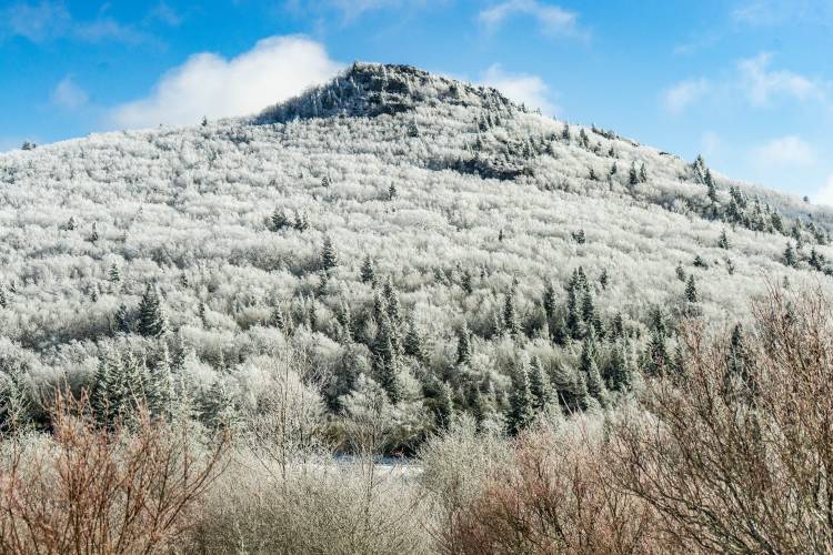
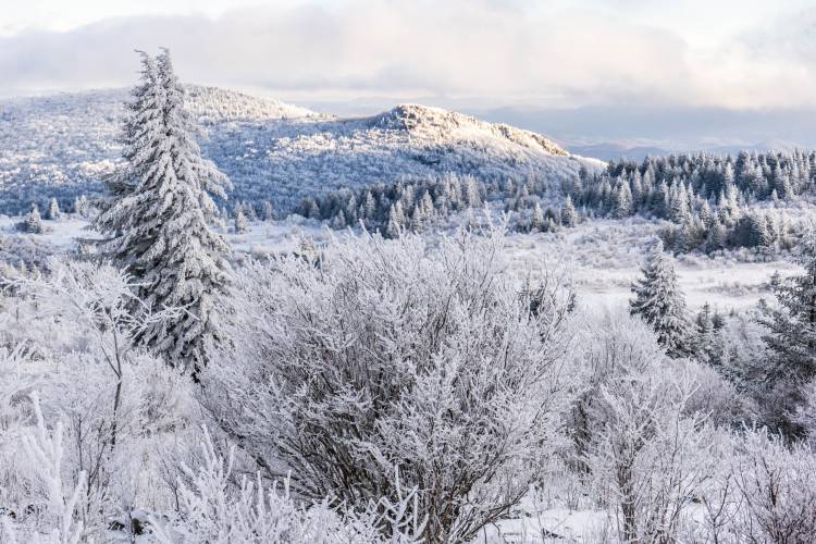
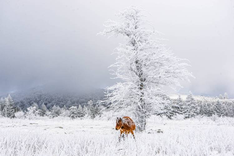
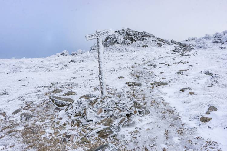
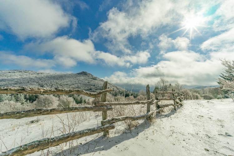
Did a few miles up around Grayson Highlands yesterday. Temps were 15-20 with winds gusting at "I needed a pole to hang onto" (50-60). Was pleasantly surprised to catch the ponies out in the open.
-
12
-
-
Getting downsloped pretty bad right now. Flow must be coming right over Beech (roughly WNW of me). Temp still just above freezing at 33. Wind has really picked up, though.
-
2
-
-
Finally switched over to snow.

-
2
-
-
Still 43 here with sprinkles. Planning to head to Grayson Highlands tomorrow. Hoping for some good rime ice on the trees and a few inches on the ground. Wind gusts of 60+ expected, gotta remember to pack lead for my shoes LOL
-
2
-
-
Definitely a solid west flow right this second. Currently warmer here than it is at my parents house in North GA.
-
2.57" of rain overnight and the wind woke me up a couple times.
Quite a bit more rain than I was expecting, got the little creek beside the house roaring good.-
3
-
-
Even the HRRR has a solid NWF event and it usually lacks.
It also has Boone getting wind gusts to 75-80mph Thursday morning so maybe take it with a grain of salt lol-
2
-
-
Looks like we could get a bit of a lakes connection set up Wednesday night. Gonna be WINDY too.
-
4
-
-
NWF looking solid Thursday.
GFS with a little hit from a gulf system next Saturday night. Euro has had something similar at times. Not gonna lie after this week I think I'll be done with the cold. Trying to get a chicken coop built but between the flu and bad weather its coming along slow.
-
4
-
-
1.5" overnight. Dumped on and off all day at the store in Blowing Rock but didn't add up to much with the wind. Saw quite a few snownados.
Currently 12. Pretty nice day.-
3
-
-
Currently webcams showing nothing on the ground in Banner Elk. Currently foggy with flurries here in Blowing Rock.
What is this winter?-
2
-
-
Not sure what happened to the NW trend but it seems to have taken a vacation lately.
We did get 1.5" overnight which was very nice.-
2
-
-
Been dumping flakes here at times. Windy even in the hole here at the house. Down to 33 after a high of 55 this morning.
-
1
-
-
Cold front is here. Big wind gusts behind that last area of showers and temp down 4 degrees in 5 minutes.
-
4
-

2025 Spring/Summer Mountain Thread
in Southeastern States
Posted
Absolutely beautiful day yesterday and today. Loving the lower dewpoints.