wxmanmitch
-
Posts
2,087 -
Joined
-
Last visited
Content Type
Profiles
Blogs
Forums
American Weather
Media Demo
Store
Gallery
Everything posted by wxmanmitch
-

February 12th-14 Redeveloper Nowcast/Obs
wxmanmitch replied to Baroclinic Zone's topic in New England
Transition to sleet occurring, so yes, I ping before BOS. Around 4" or so. Winds gusting to at least 30 MPH. 12.4° F. -
February 12th-14 Redeveloper Nowcast/Obs
wxmanmitch replied to Baroclinic Zone's topic in New England
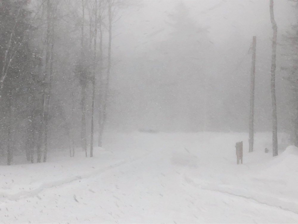
Still snow for now, but pingers are encroaching from the W and S per the dual pol. The wind is really cranking with gusts into the 30 MPH range out of the ESE, which is blowing this fine snow all over the place. I wonder if I can generate some low level snow beneath the inversion once the sleet moves in. I've seen it before here and ESE wind is perpendicular to the mountains. -
February 12th-14 Redeveloper Nowcast/Obs
wxmanmitch replied to Baroclinic Zone's topic in New England
2.5" and heavy snow. Typical SWFE meager snow growth. Super cold at 10° F though. -
Winter Re-Awakening - February 12-14th Redeveloper
wxmanmitch replied to Baroclinic Zone's topic in New England
I like the look of the Euro and GFS, but I'm always nervous when the meso models show so much warming aloft. I know this event is still a bit beyond the NAM's wheelhouse, but it can't be discounted, especially the way so many storms have gone this winter. Besides it's pretty common for SWFE to trend warmer as we get closer. -
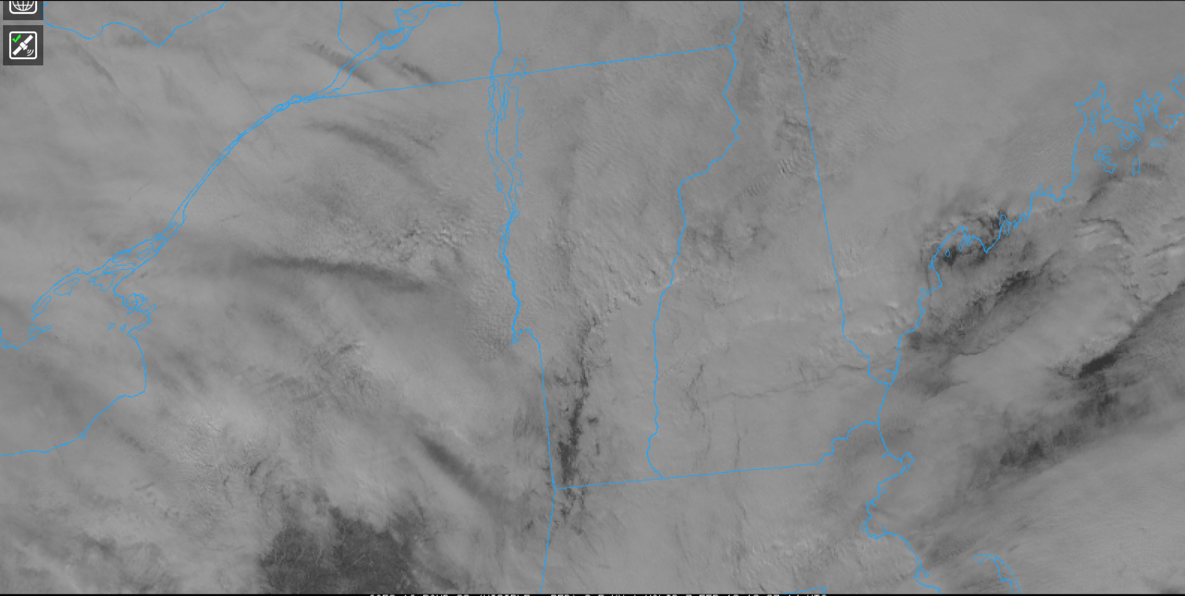
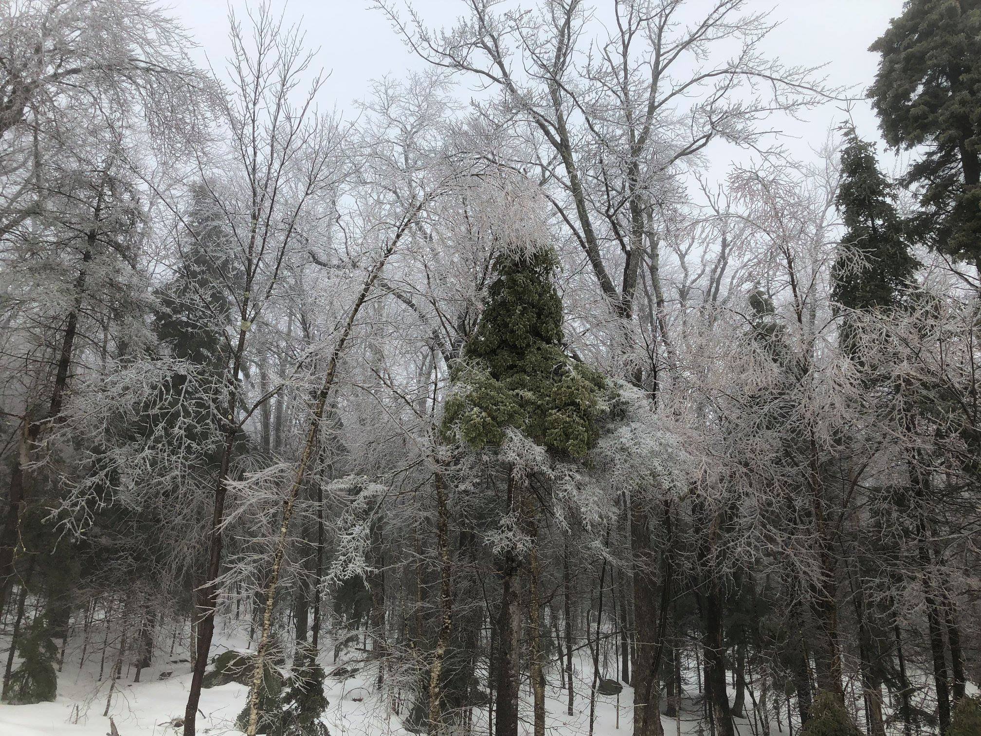
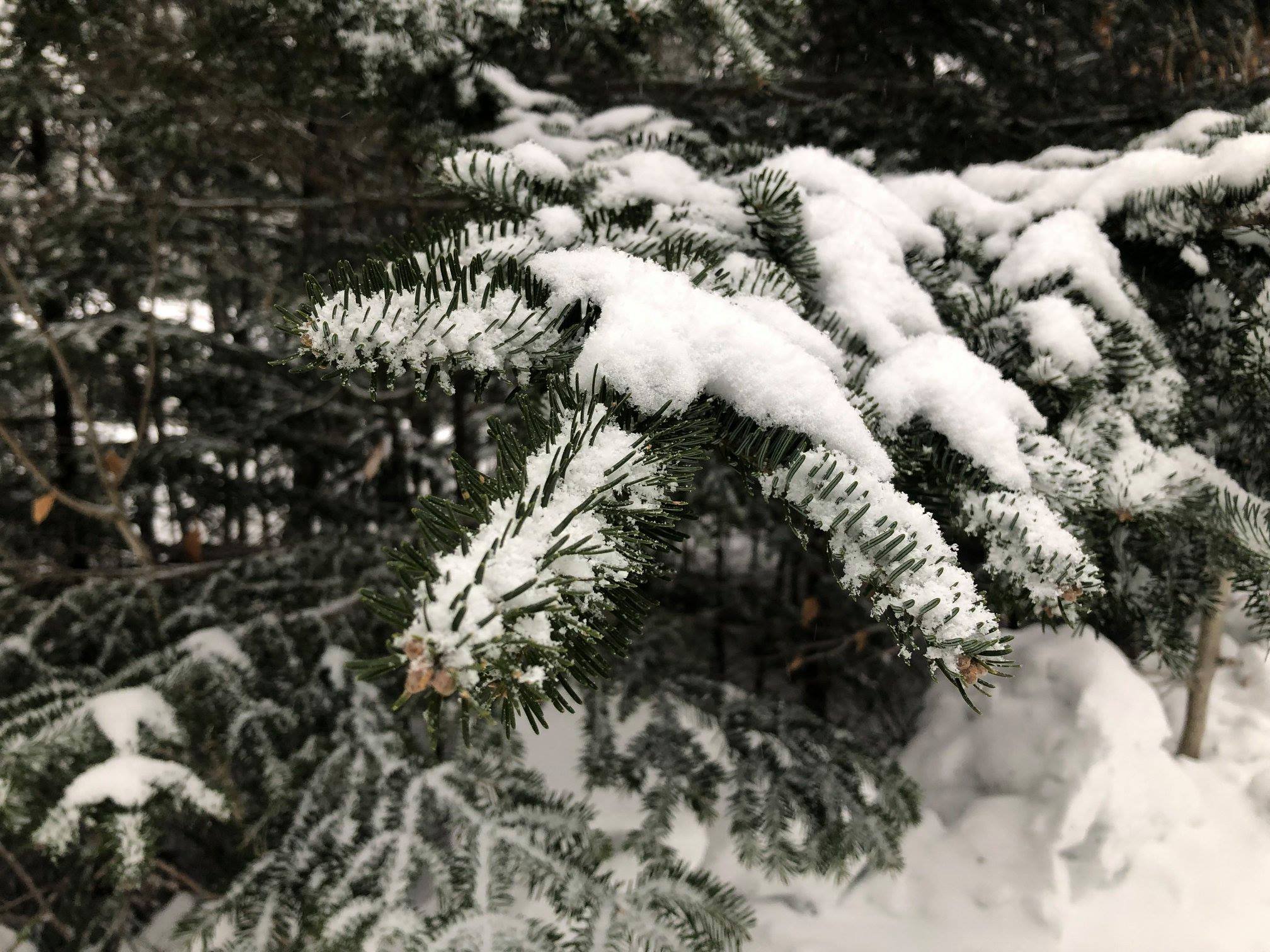
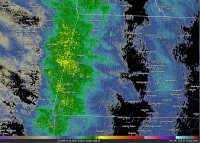
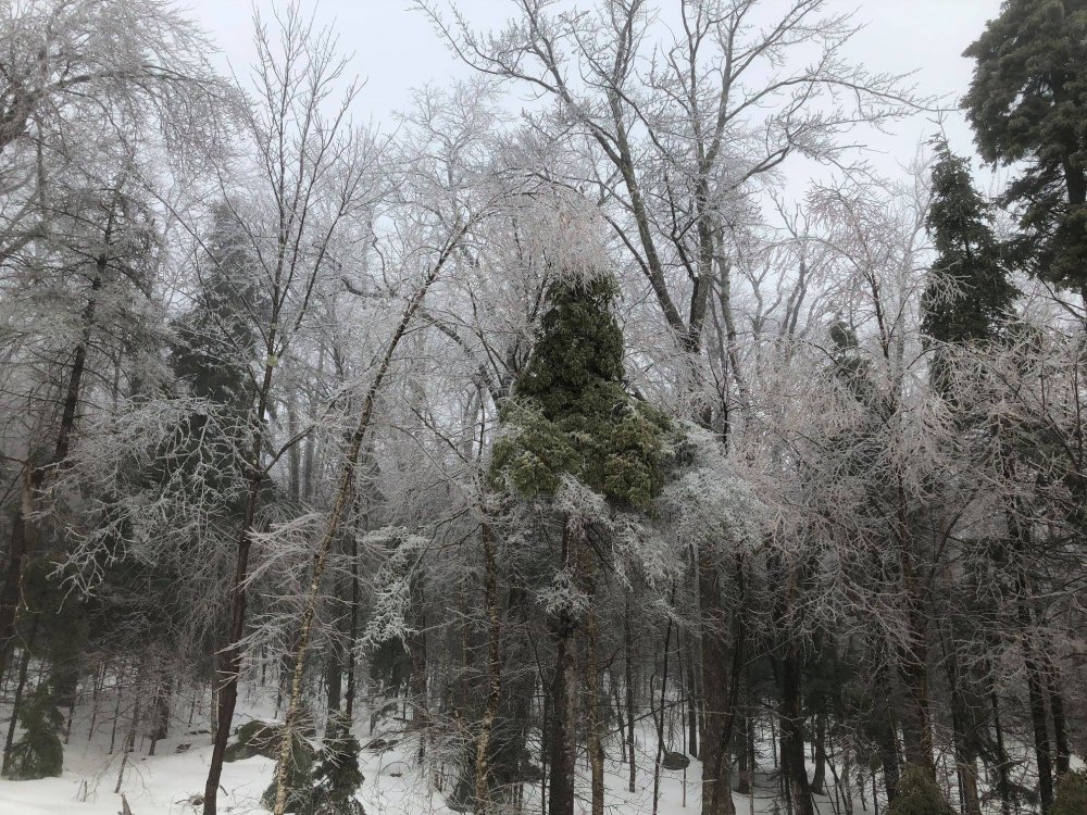
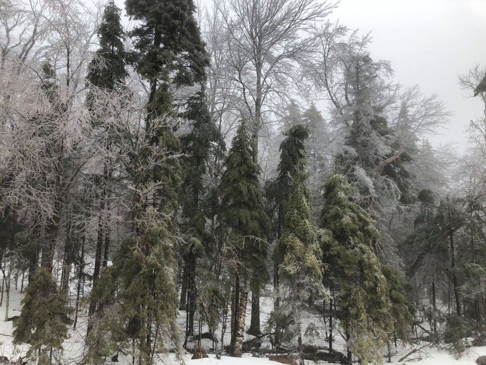
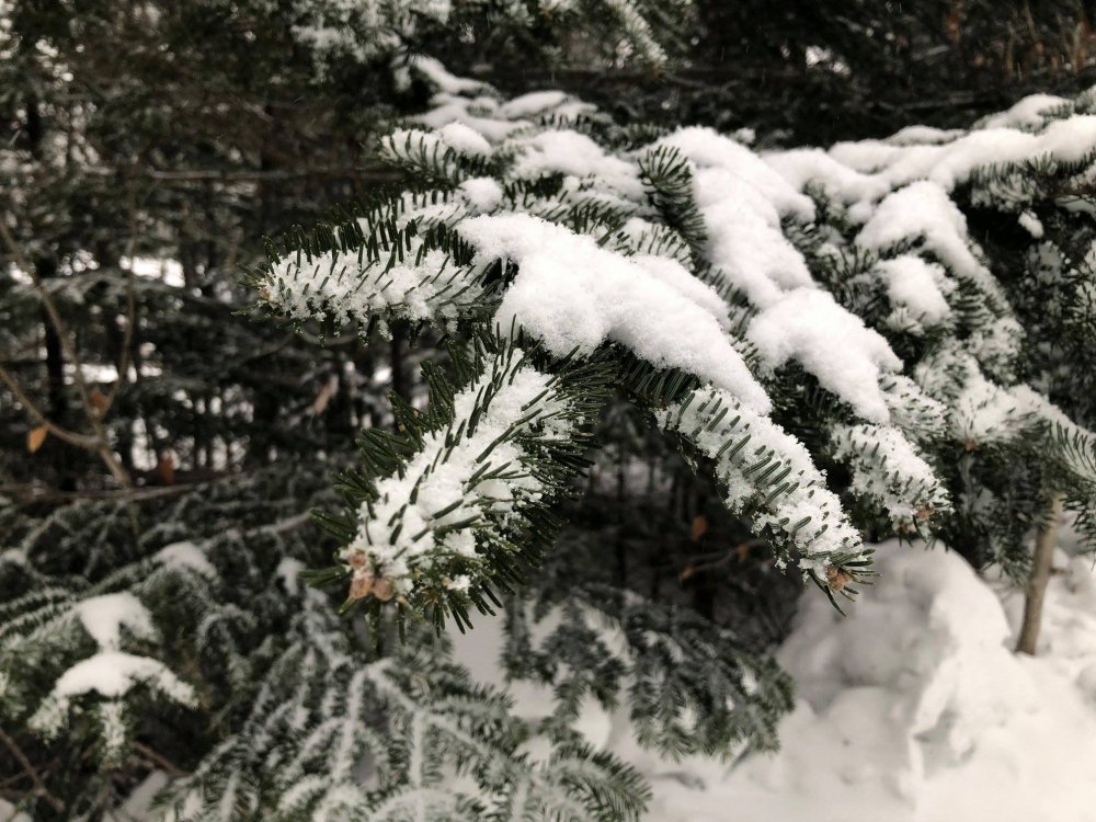
I had about 1/4 to 1/3" of glaze here. Just below damage threshold, but the birches and evergreens were sagging and bending a bit. I put a couple of pics up in the other thread. I've been rotting at 32-33° F all day and foggy while the west slope has been 45-50° F and partly cloudy. Even Woodford has been flirting with 40° F. Incredible difference over such as short distance! The mesoscale nuances here in the Green Mountains never cease to amaze me. You can actually see the downslope clearing on the GOES 16 image today. Pretty neat.

-
I rot at 33° F and fog while Bennington on the other side of the mountain is 45°+ F with partly cloudy skies! What a drastic difference! It has tried to clear with the silhouette of the sun poking through the fog at times, but it has not succeeded. Even Woodford has been flirting with 40° F. There's still some residual glaze left on the trees, but it warmed up just enough to get most of it off. There was about 1/4 to 1/3" of accretion, which was enough for the tree branches to sag, but not any damage. A couple of photos from earlier.
-
30.8° F with light freezing rain. It was pouring earlier at 31.2° F. There's definitely some accretion going on, but it doesn't seem too efficient with the heavier rain as it tends to drip off the trees before freezing. There is some sagging on the birches, spruces, and firs, but it doesn't seem too bad yet. The lighter rain and drizzle accretes much more efficiently, plus with less latent heat release from heavier rain, temperatures may drop back a little. This is why we will likely accrete more overnight.
-
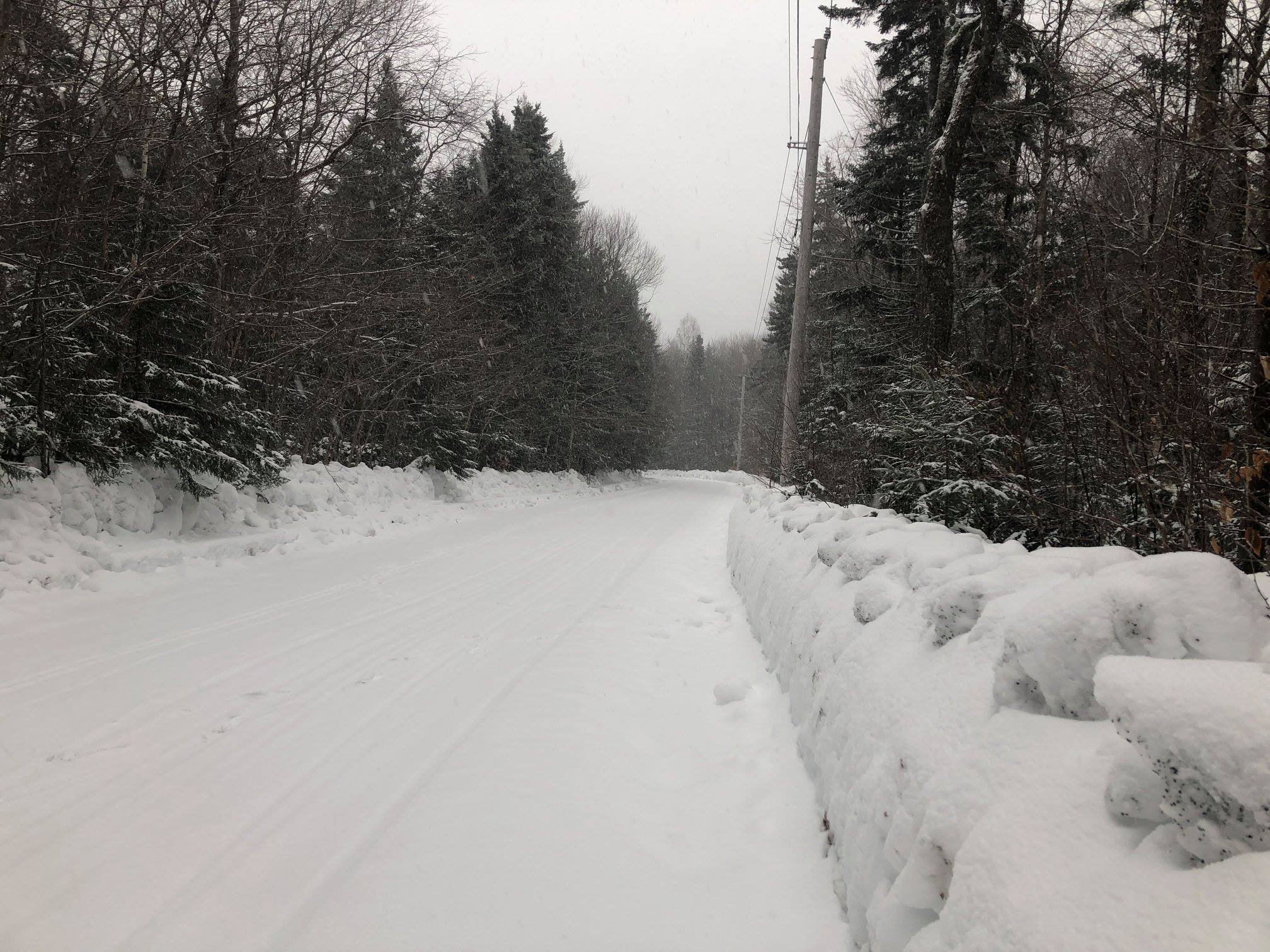
31.7° F/22° F as the first spits of freezing rain arrive. The 22" snow pack will have a nice shiny veneer on it by tomorrow AM.
-
2018/19 Winter Banter and General Discussion - We winter of YORE
wxmanmitch replied to Baroclinic Zone's topic in New England
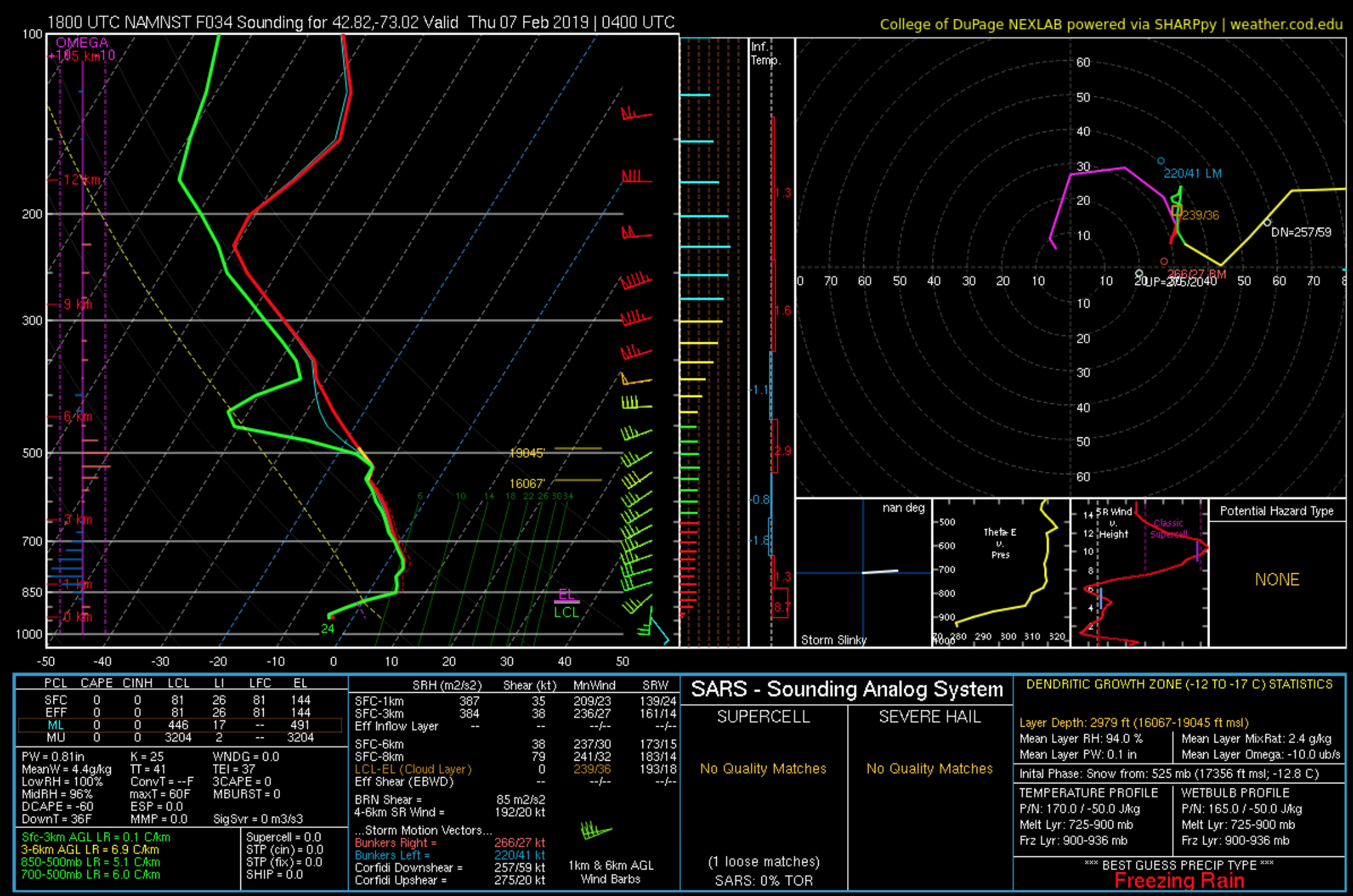
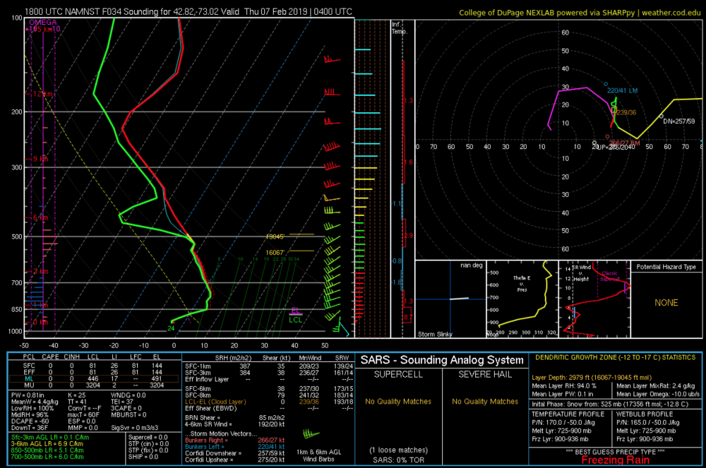
49.2° F for yesterday's high, 44.7° F today. Disaster averted, but there was a net loss of several inches. The rivers stayed mostly frozen without there being any rain, so no flooding issues. Depth is probably around 22-24", but I'll measure tomorrow. Now if we can avoid the worst of the freezing rain around here. Soundings look hideous... -
Yikes! Not liking the looks of the soundings around here tomorrow night. It's still rotting at 32° F here at hour 60 as the cutter comes in Thursday night. Euro has it icing into Friday AM too. My elevation puts me right smack dab in the midst of the cold layer with too much warmth above for sleet. Usually the base of the > 0° C layer needs to be above 800-825 mb for sleet here, unless it's super cold and/or warm layer is thin. 925 mb charts work quite well for my spot. While usually 925 mb is up closer to the 3K, there are cases when 925 mb is below me during stronger storms.
-
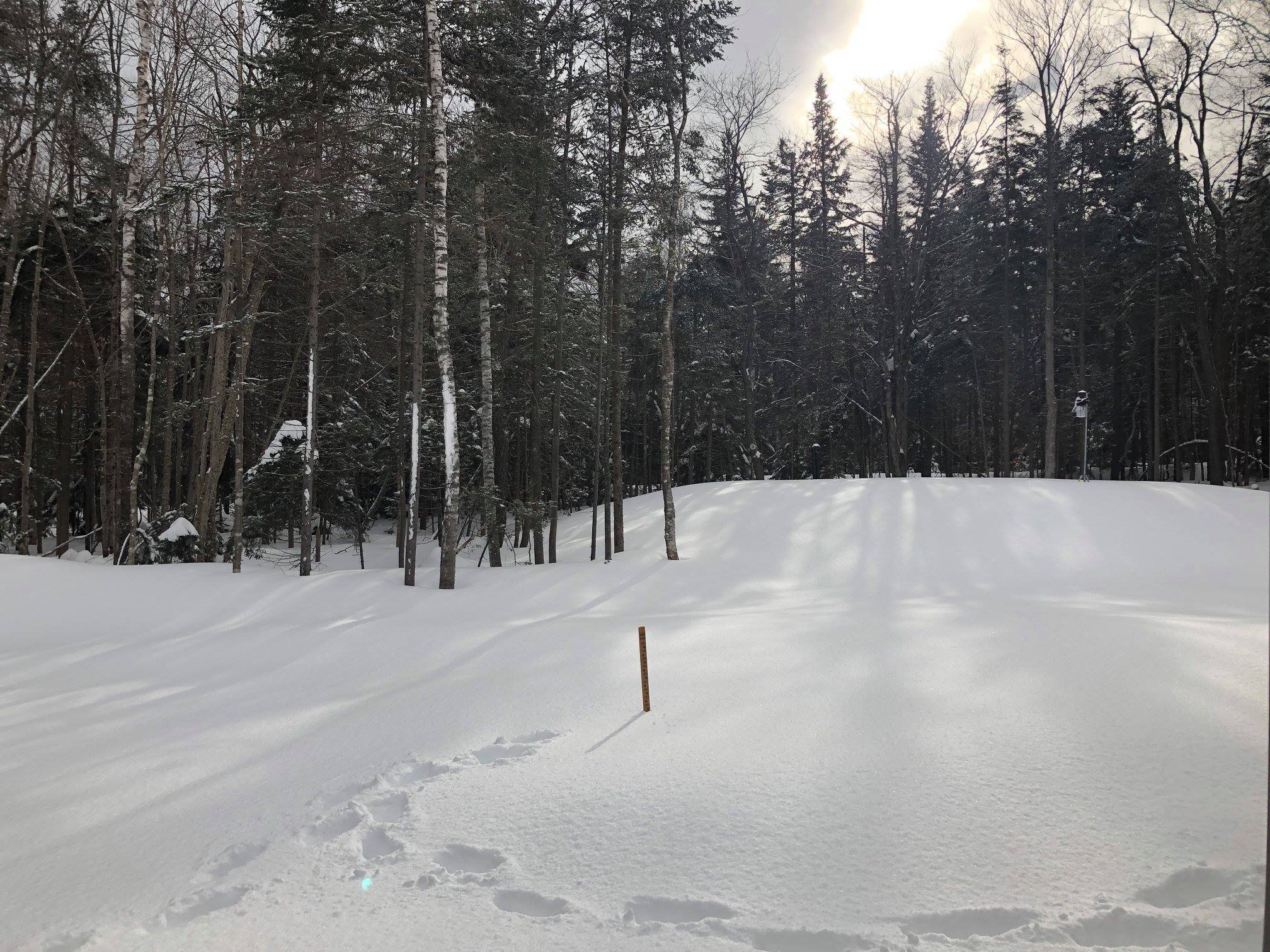
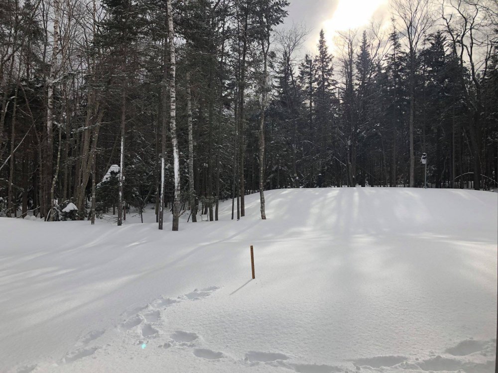
At 90.3" so far for the season, 40.5" in Novie, 11.3" in December, and 38.5" in January. Seasonal total is probably a bit above average to date, but probably not too much. I have no idea what this location averages, and it'll take time to establish an average. My guess is 120-130", but it could be higher, possibly 150". The 38.5" for January is probably about average for the month. January was a meh month here, nothing too exciting, but not terrible by any means either. I could've done without the rainy cutters though. All that said, I'm likely ahead of where I was at this point last winter and we finished with over 200" thanks to getting 90" in the first two weeks of last March.
-
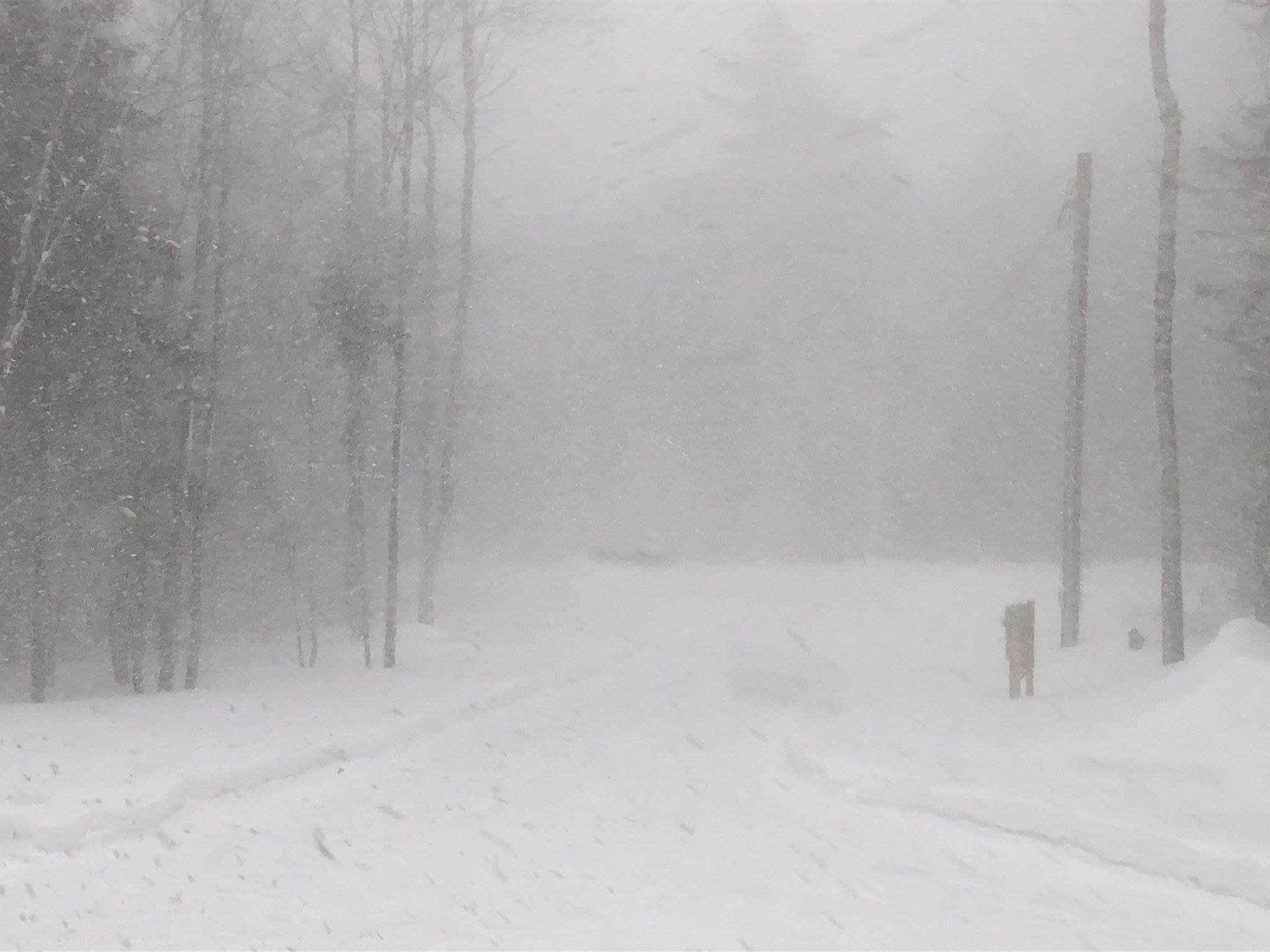
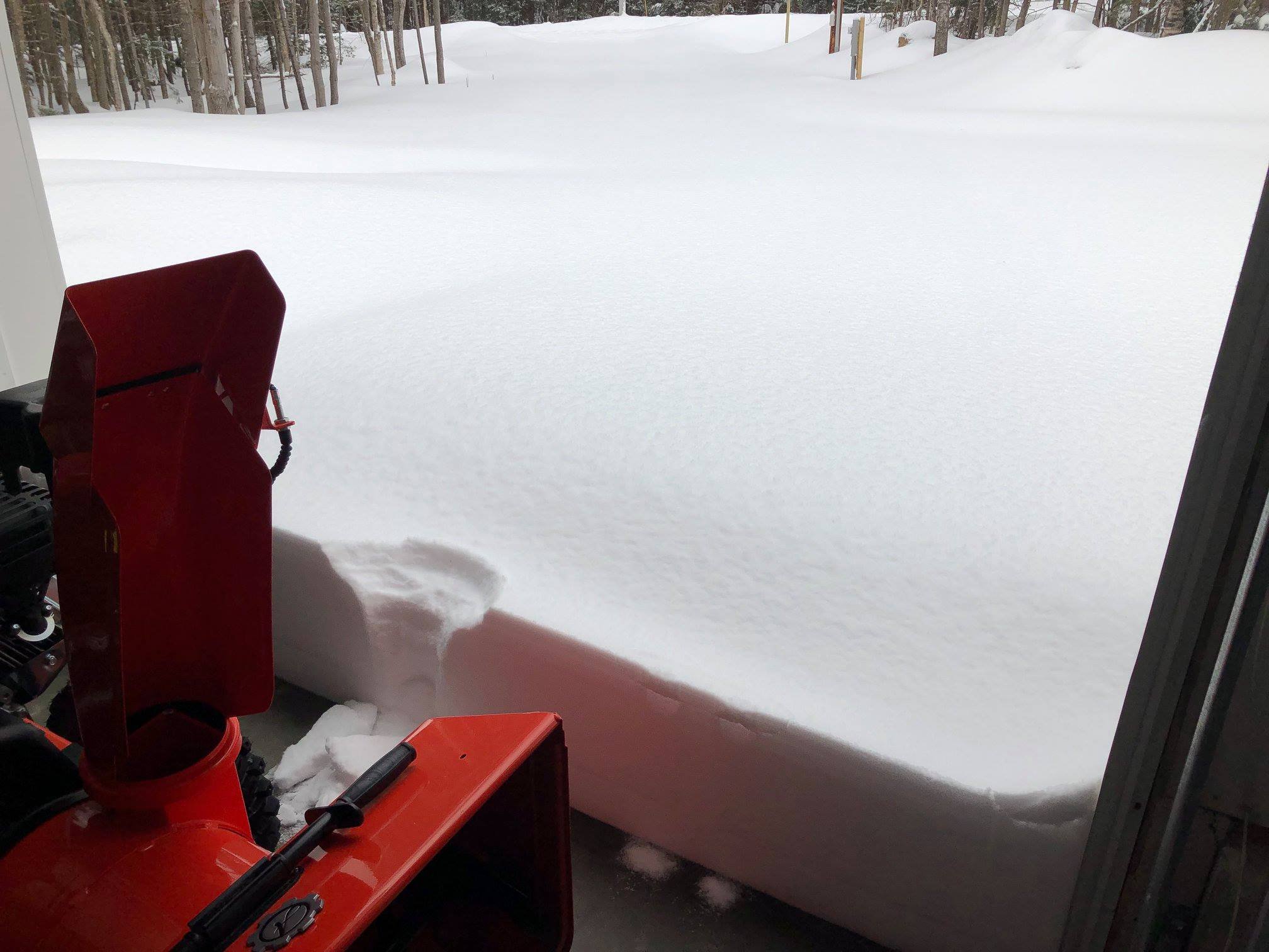
That was nuts!!! I had at least 20 minutes of near zero visibility +SN and wind. Now getting a moderate arctic dust from upslope. There's probably about an inch of new snow, but it's pretty much impossible to measure due to blowing. BTW, last night was a dud. I sat under weak 15-20 dBZ returns pretty much the whole time and only mustered 4.0". I kept expecting the heavier echoes to move in from the S and SW except they never did. I'm not sure what happened, but I may have been screwed by the energy transfer somehow. I missed the southerly flow upslope that brought some impressive totals in the southern Adirondacks, which was a result of the primary and heavier totals to my S and SW from the secondary.
-
A little over an inch of the freshies so far. 28° F. It's a little foggy too and I'm getting some light riming on the trees. It seems to happen here a lot with S or SE flow. Hoping to get another 1-2" from the squalls this evening. Total depth is around 24". We winter...

-
I did my Synoptic II case study paper on that storm. Started out as a light freezing rain in Plymouth, NH and then went to one of the most intense wind whipped blizzards I can recall. We got 6" or so, but it was super intense. Anyway, I like where I stand for this upcoming event. It doesn't look like a big ticket event, but I think a decent moderate event is in order the way it stands now.
-
Massive Sou'easter could bring damaging winds to Eastern MA
wxmanmitch replied to USCAPEWEATHERAF's topic in New England
It doesn't look like much on radar, but it is really dumping right now. A very fine snow, probably 1-1.5" new since the changeover occurred. 28° F. -
Not bad at all actually. This pack really is absorbing it like a sponge and I don't think I lost more than 6". Last year's thaw on 1/12 was far worse in terms of flooding around here for whatever reason. We had about a 2 foot pack prior to that event, but it nearly got wiped out unlike this event where it's held up comparatively well. Pretty much over to all snow now, albeit wet.
-
Massive Sou'easter could bring damaging winds to Eastern MA
wxmanmitch replied to USCAPEWEATHERAF's topic in New England
Rain is beginning to mix with snow here. 35.7° F off a high of 47.5° F. 2.60" of rain for the event. Pack took a hit, but it still looks like at least 18". Maybe I put a couple of it back over the next few hours... -
2018/19 Winter Banter and General Discussion - We winter of YORE
wxmanmitch replied to Baroclinic Zone's topic in New England
Back down to -9.5° F after a high of -7.8° F and a low of -16.1° F. A most impressive cold day. The great pixie dust blizzard of 2019 is winding down now, finally after nearly 24 hours. With the wind it's impossible to tell how much it accumulated though as it blew off the snow board. My other board that I use for the snow depth had a 0.6" gain though. -
2018/19 Winter Banter and General Discussion - We winter of YORE
wxmanmitch replied to Baroclinic Zone's topic in New England
-16° F with light snow this morning...the coldest I've ever experienced! It's a fine pixie dust that appears more like haze. -
-16.1° F this morning with light upslope snow. It's likely the coldest snow I've ever experienced; a fine pixie dust that appears more like haze.
-
Posted this in the obs thread, but I had 11.3" total. Quite a bit of sleet contamination, but fortunately no freezing rain, so snow blowing was easy. Season total is up to 81.2" with about 28-29" snow depth.
-
Updated measurement of 11.3". 81.2" for the season so far.
-
10.5" of new snow and sleet as of 2 PM when I went out to snow blow, but we've had some off and on light wrap around and upslope snow showers so we may have gotten another 1/2" or so. There was an 18" drift in front of the garage door when I opened it, but snow blower went right through it. Dry, but dense snow. Down to 4.4° F after a high of 19.5° F. I'll likely have a subzero max tomorrow and then rain midweek. Euro says bring out Noah's Ark, awful...

-
Back over to all snow now, maybe I get another quick 1/2-1". Albany looks like they had a N wind overnight, so maybe they had some upslope enhancement with the Catskills off the S and SW of them? They only had one observation at 7 AM that looked like sleet and they ripped all night.
-
Sleet is beginning to slowly transition back to snow here. Weird snowfall distribution around E NY and W NE per the PNSs from ALY and BOX. There's actually more snow in the valleys out by Albany and down by Greenfield, MA than in the mountains, which has me scratching my head. No sure what could've caused this...cold air drain from the north down the valleys? But that was only in the low levels, not aloft where winds were southwesterly.