bearman
-
Posts
713 -
Joined
-
Last visited
Content Type
Profiles
Blogs
Forums
American Weather
Media Demo
Store
Gallery
Everything posted by bearman
-
Went up to the cumberland state park in Crossville. It has just started snowing again after a bout of rain. It is going from lite to moderate.
-
38 here in Knoxville. Not as confident as I was yesterday but we will see how long it takes to get this Low to our east and what energy is left over.
-
Forcast has the change over @ 4pm if that is the case we are goiing to end up with very little snow. I hate the waiting and watching all the wasted moisture. It is dumping right now. If this keeps up flooding is going to be a problem.
-
Good old rain here in Knoxville. Not sure when the change over is suppose to take place. It seems to be slowly creeping into the valley. Maybe.
-
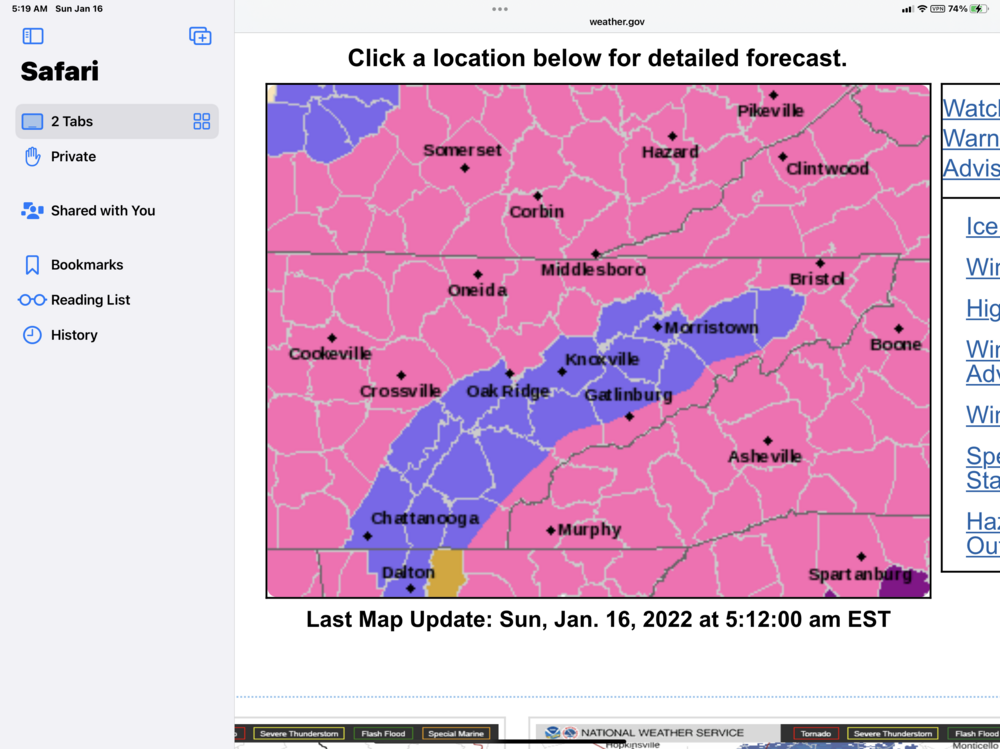
Can you post that graphic.
-
MRX has now put the entire valley under warning or winter weather advisory.
-
I going all in on this one, might be wrong but I have a good feeling. Been watching these setups for 40 years. I think areas around Chatt might even have a chance. Athens North I think have a fair chance up the valley. See how I hedged everything.
-
Am I being to cynical to say the best and the brightest putting your tax dollars at work?
-
I Would not be suprised to see Knox get screwed. I once, in another lifetime lived in Etowah and we would regularly get more snowfall in an area wide event than did Knoxville.
-
There are going to be crazy cutoffs in wild places with heavy and light areas. One neighborhoodwill get crushed and the next will accuse his freinds across town of lying about the snowfall totals.
-
Here in Knoxville we have been socked in with thick clouds all day long and temps are well below forcasted highs
-
With all the different micro-climates and downsloping we have in the valley, I have made out a little map of the Knox county. I have plotted out snow totals over the years. When you get 3 to 6 inches in your area I will most likely get half of your totals in the Cedar bluff area. This is not always the case but in a system like this it happens often enough I consider it a pattern.
-
Peachtree just put 2 northwest Ga counties under a winter storm warning for tonight and sunday morning. I supose they are on the plateau?
-
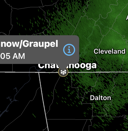
Looks like lookout has some snow at the moment.
-
It is always curious to me how MRX makes their decision to issue winter weather warning products. They always err on the side of caution when it comes to severe weather events like tornadoes and issure many warnings that never pan out. It seems like this can cause people to often disregard these warnings but with winter events they seem much more hesitant to pull the trigger. Maybe it is an issue of scale of impact?
-
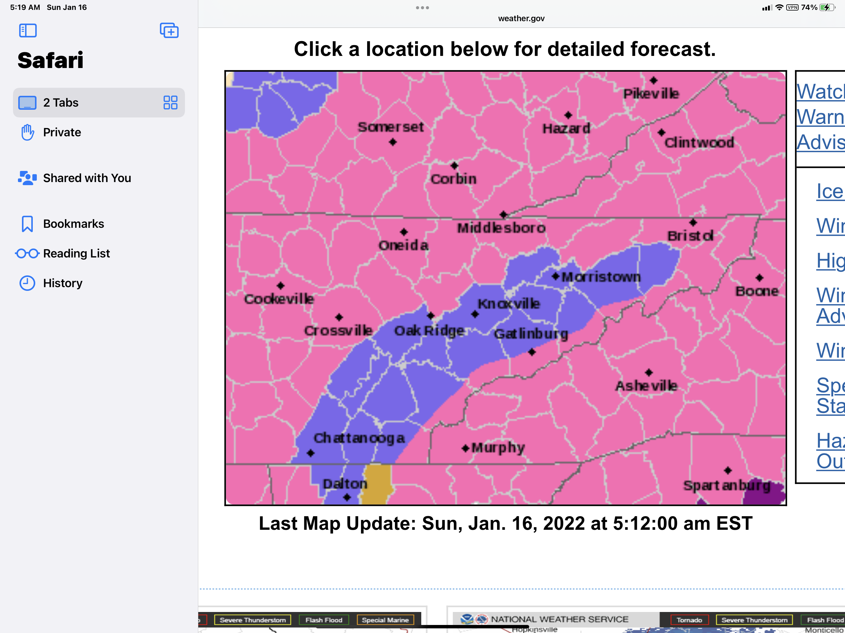
I see MRX did not put the valley under any advisorys except for the extream northern counties. That gives the rest of the valley a fighting chance. Right on queue Latest GFS 6.5 for TYS and 13.3 for Etowah.
-
Just as I predicted earlier. The valley is totally surrounded with wsw. LOL.
-
The way you look at it is if models dont change it is going to be a dud for the valley but when do models not change in 48 hours with snow in the forecast.
-
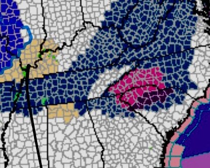
THIS MAP NEEDS TO GO DOWN AS A CLASSIC FOR THE VALLEY AND HISTORIC FOR A STORM. GOOD OLD TN VALLEY IN ALL ITS GLORY. ALL WE NEED IS FOR THE WSW TO BE FILLED IN BELOW US.

-
Forming up over my area in west knox good bit coming down again.
-
Great jump in when ever you wish glad to have you.
-
That band just south west of Nashville just might hold together. If it does it will lay down some snow on the roads.
-
Hello
-
Dont look now but another line is coming in to Knoxville.
-
And as soon as they did my road turned white in west Knoxville. it was the last hurrah but it did turn everything white including the road.