

moneypitmike
-
Posts
29,869 -
Joined
-
Last visited
Content Type
Profiles
Blogs
Forums
American Weather
Media Demo
Store
Gallery
Posts posted by moneypitmike
-
-
23 minutes ago, Hoth said:
Eyeballing 1/4" since we started at 2 a.m.
That's one helluva rate.
")
Snow's just started here; strong winds.
31*
-
32 minutes ago, Baroclinic Zone said:
Stuff has some meat to it. Beautiful band setting up shop. You can see the ML band out west as well. Watch out in between for the subsidence.
Nice to see that narrow weenie band on the Pit. Hopefully the heavy stuff from Scooter through RI can inch back to Gynx and Kevin. Looks like Pawcatuc through SRI is taking it on the chin.
27.4* at the Pit--should be dry there.
14 minutes ago, tunafish said:32/31, overcast.
Go big or go home...

I can live with that. The probabiliies table looks to have me maxing out between 21-25".
Looks like the flakes should be starting here in an hour or so. Winds cranking. I'm expecting very little snow to measure here. This will be blown up the road.
-
Patiently awaiting first flakes. Look to be about another 1.5-2 hours away.
Meanwhile, the wind is already cranking here at Pit2. It's nice to have a blizzard warning--something we're not too accustomed to in GC.
Warm. 32*
-
5 minutes ago, Lava Rock said:
Storm delayed? My forcst called for 1-3" last night and we've only got high cirrus
Sent from my Pixel 2 using Tapatalk
No models were showing that for last night. Yesterday's 12z and 18z runs were showing start times around 6-7 here at Pit2. They've slowed a little bit--I don't think I'll see flakes here until 8:00 or later.
-
Nice to wake up to a blizzard warning.
Today
Snow, mainly after 8am. The snow could be heavy at times. High near 34. Breezy, with a north wind 15 to 25 mph, with gusts as high as 40 mph. Chance of precipitation is 100%. Total daytime snow accumulation of 5 to 9 inches possible.TonightSnow. The snow could be heavy at times. Low around 31. Blustery, with a north wind 15 to 20 mph decreasing to 10 to 15 mph after midnight. Winds could gust as high as 35 mph. Chance of precipitation is 100%. New snow accumulation of 7 to 11 inches possible.WednesdaySnow before 11am, then rain and snow between 11am and 1pm, then rain after 1pm. High near 38. West wind 10 to 15 mph. Chance of precipitation is 90%. New snow accumulation of 1 to 3 inches possible-
 2
2
-
-
3 hours ago, snowwors2 said:
Enjoy folks....(so jealous!!)
one of these days my wife will let me buy that little cottage on the Penobscott in Bayview ME

Everyone should enjoy a Pit2.
-
1
-
-
Things a bit slower on the NAM. Looks like first flakes don't make it up here before 8:00.
-
Just got up to Pit2--hoping for the best. Looks like I'll be waking just in time for the first flakes.
-
1 hour ago, HIPPYVALLEY said:
According to this forum every model sucks and even the euro " ain't what it used to be".

lol. Hopefully this only helps the Maine crew.
-
3km showing over 20" at Pit2 at 42; hasn't stopped yet.
-
5 minutes ago, Ginx snewx said:
I really like what the hot Swiss Model is depicting as a possible final

Do you have a NNE pic as well?
-
11 minutes ago, CoastalWx said:
I just have this nagging feeling in the back of my head. But, I can afford to wait until 12z stuff rolls in to add confidence. Just not sold a wide area of 12-18+ like some have.
Cautiously optismistic......but I'll keep it in check until 12z rolls through.
-
1 minute ago, STILL N OF PIKE said:
Its a truck stop in E.B.F Maine. Tap twice at stall 4. Bring lube and a diet coke
LOL. I'm off the diet Coke. Polar seltzer is the drink du jour. Coffee is welcome, too.
-
1
-
-
4 minutes ago, sbos_wx said:
Mike where's Pitt 2?
Bath, ME.
43.9N/69.8W
-
24 minutes ago, sbos_wx said:
Nothing better than a peaking blizzard during the day time. Nothing.
Agree. That said, the potential in Maine is for a lot to continue during the night as well. But I'll take whatever I can get in the daytime!
5 minutes ago, HIPPYVALLEY said:My area may be trapped in the exhaust zone between epic bands for the 2nd time in a week.
You should hitch a ride to Pit2.
-
3 minutes ago, CoastalWx said:
They are useless to the real world. People want to know what will happen, not what has a 10% chance of happening.
That same logic should then be applied to the highest amounts maps; those have a 10% chance of happening as well. Those all get celebrated.
-
Walking a fine line between good and great per GYX.
The snowfall forecast is definitely not a final answer, but more the most likely outcome based on the current guidance available. Definitely expect to have to make some shifts to account for track variation, andmesoscale banding. One question still definitely not resolved is whether banding features with extreme snowfall rates will remain off shore or pivot into coastal Maine and New Hampshire. At this point there`s no clear answer to the question. Will have to wait for the storm to take better shape and give mesocale models a better chance to resolve these features. -
Pit2 or bust. The maps give me a range of 7-23". The 'most likely' has me at 16" --and about the entire GYX CWA between 13-17".
Tonight
Cloudy. Snow after midnight. Snow accumulation around an inch. Lows in the upper 20s. Northeast winds 10 to 15 mph. Chance of snow 80 percent.TuesdaySnow. Additional snow accumulation of 8 to 12 inches. Highs in the lower 30s. North winds 15 to 20 mph with gusts up to 30 mph. Chance of snow near 100 percent.Tuesday NightSnow. Additional heavy snow accumulation. Lows in the upper 20s. North winds 15 to 20 mph with gusts up to 30 mph, becoming northwest around 10 mph with gusts up to 20 mph after midnight. Chance of snow near 100 percent. -
-
16 minutes ago, HullMA said:
Looks like its gonna double down. Surprised over here if it does. Thought it was gonna cave.
It has three more runs to cave. Why rush it?
-
26 minutes ago, dryslot said:

Kind of reminds me of sam's maps..................

LOL--indeed it does.
Very little talk of wind with this.....non-factor?
-
12 minutes ago, Ginx snewx said:
Lol the model runs will be there when you wake up.
That's become my take of late.
5 minutes ago, weathafella said:In the dark-sitting or standing?
LOL--TMI.
2 minutes ago, dryslot said:I mentioned your name the other day that your snow maps use to give rise to many..................
I lived for those maps. In fact, I think the last time I managed to jackpot was when you were making those!
-
1 hour ago, 40/70 Benchmark said:
Here is my interpretation of the 12z EURO.

Great to see the love.
4 minutes ago, Ginx snewx said:At this point I am really hoping for just an old fashioned 6 to 12 with dry snow moderate winds
Let 'em crank.
-
10 minutes ago, dryslot said:
18z Extended Reggie

Over an inch for much of NNE.
3 minutes ago, WintersComing said:Everyone jumping off the cliff already?
.Jump or cling to the NAM. your choice.

.png.5d5119693667c9eaaea6dbe0148519b3.png)

March 12/13/14 Blizzard/Winter Storm/WWA etc
in New England
Posted
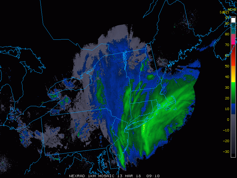
IT's been ripping here for about 2 hours with the wind howling. Deck, car and street are all blown free of snow. I hope people can measure someplace to see what actually comes down. No measurements will work here.
Looks like Pit1 and Hippy are doing great in this.
SN+ and 29* at Pit2