snywx
-
Posts
10,484 -
Joined
-
Last visited
Content Type
Profiles
Blogs
Forums
American Weather
Media Demo
Store
Gallery
Everything posted by snywx
-
9/1 right now 4” of snow cover 23.3” ytd. awesome start to this winter season
-
Roads are a mess up here
-
About 1” new otg here 23 w/ flurries
-
On & off flurries this morning 25°
-
How much survived ? We have about 3” here. 100% coverage
-
Temp is up to 43 here Winds already gusting to 35mph
-
33° here as well. Snowpack should make it through the day here. A general 4-5" depth with 100% coverage
-
@The 4 Seasons 5.7” 22.3” ytd
-
5.7” 22.3” ytd
-
5.4” otg temp 19
-
Temp 19 very lgt snow falling 5.4” otg
-
Same here.. Measured 4.8" about an hour ago.
-
4.8” otg temp 15 A few flakes flying right now
-
Keep those obs coming.. if you start to taint that might be bad news for me as it progresses north. 16 here
-
snow 16/11
-
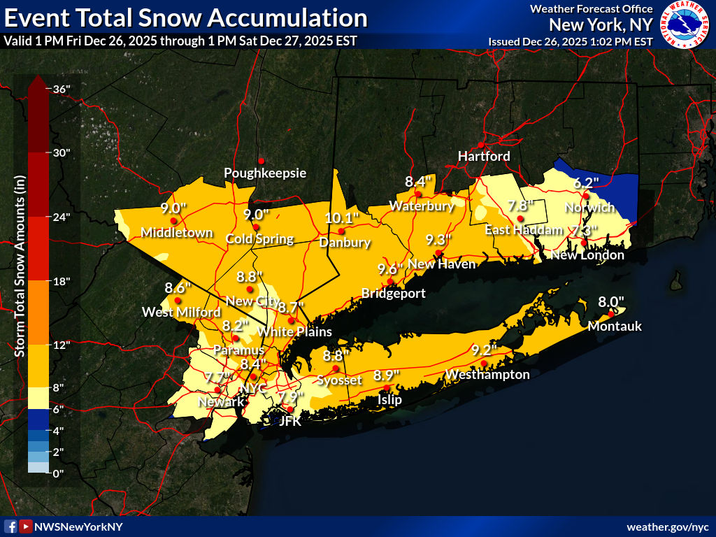
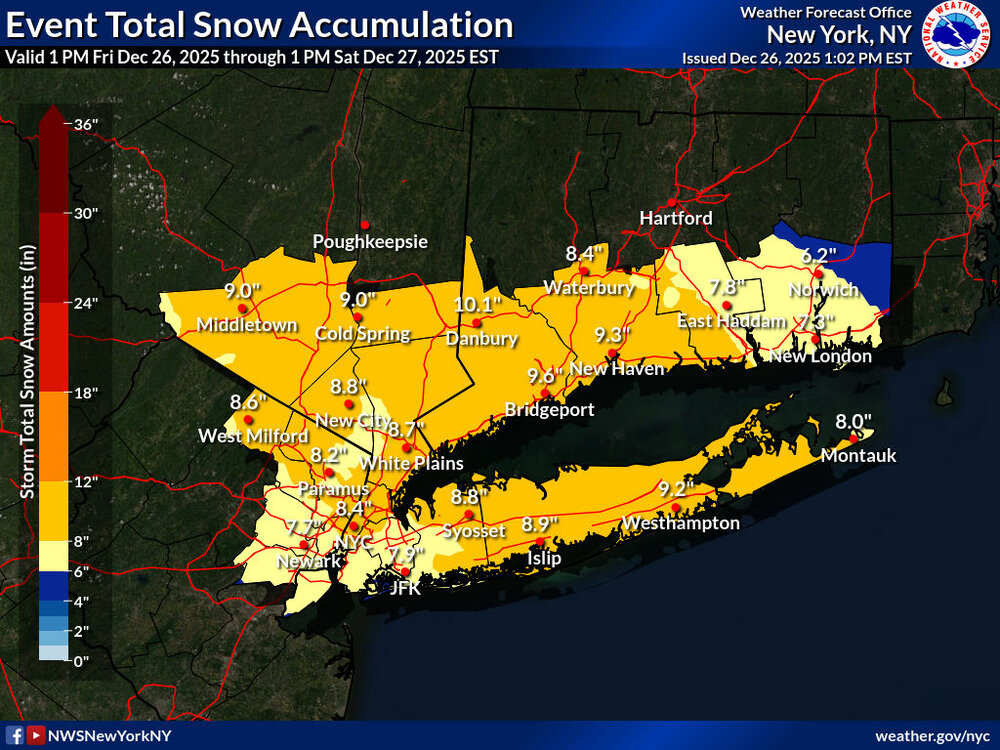
I think there will be a widespread 8-12” in the I-84 corridor w/ Danbury prob having the highest probability.
-
-
15/4 deep deep cold
-
14/5 expecting 8-10” here
-
The NAM sniffing out those warm mid level temps this late in the game scares me a bit. Seeing the RGEM hold serve for the most part is def a good sign for an all snow event
-
24/8 here general 2” of snow cover remain
-
I got around 13” for that event. Eastern side of the county doubled our amounts
-
02-03 was amazing up here. Dec 5 I beleive had a 20 piece and quite a few of the favored locations up here finished that season 100+
-
We can potentially close December with 25”+ up this way. Can’t remember the last time that happened
-
Merry Christmas! another white Christmas on this side of the county. 8-12” coming Friday night. Can’t remember the last time we had a December like this